Edmonton’s district planning is in the final stage of consultation. District planning will define the borders of “nodes and corridors” where site-specific rezonings for higher density are likely to be supported. While I generally disagree with the approach that concentrates higher density along higher-trafficked roads, that is the scope and compromise of the initiative.
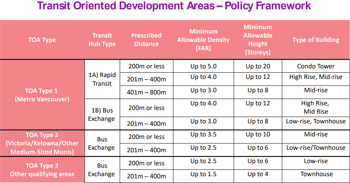
However, even within the nodes and corridors approach, the city is missing an opportunity for transit-oriented development around some of its LRT stations in secondary corridors. This comes at the same time as the BC provincial government just announced a huge upzoning around every rapid transit station and even bus exchanges.
As an example, let’s take a closer look at McKernan/Belgravia Station, built recently in 2009 and the least-used station on the entire LRT network. But first, a primer on corridors in district planning. If you’re already familiar with district planning, skip straight to Section 3 for a look at population and housing growth over the past 20 years using census data. Lastly, Section 4 maps out what district planning actually means around McKernan/Belgravia station and compares it to the new BC legislation.
Tl;dr
McKernan/Belgravia Station area has not grown much from 2001-2021. The two major drivers of the small growth it has seen is the construction of a few apartment buildings along the University Ave car sewer and a couple redevelopments of low-rise apartments into slightly higher-density low-rise apartments along 76 Ave. District planning is an improvement over what’s currently supported in the area redevelopment plan, but falls short of what should be expected around a major transit station, especially considering the new bar set by BC.
Nodes and corridors primer
The City Plan and draft district policy define primary corridors as:
dense and vibrant urban areas along prominent streets that serve residents from multiple Districts. They connect to Nodes, feature diverse travel modes and may evolve as more commercial or residential. Over time, they should redevelop and grow along their entire length.
and secondary corridors as:
areas along prominent residential and commercial streets that serve as a local destination for surrounding Neighbourhoods. They connect to Nodes, feature diverse travel modes and may evolve as more commercial or residential over time.
Primary corridors will support:
Mid-rise (5-8 storeys) development throughout the corridor.
High-rise (9-20 storeys) along main streets within 200m of a rapid transit station or within 200m of an intersection of two larger streets.
Tall high-rise (>21 storeys) at sites that meet the same criteria as high rise, but where the context allows for “appropriate transition to the surrounding development”.
Secondary corridors will support low-rise (up to 4 storeys) throughout and mid-rise along the main streets. Transition to lower density will be supported along the edges of secondary corridors. There are no provisions for additional density within secondary corridors near rapid transit stations or around rapid transit stations that are not within a node or corridor.
Major nodes will support mid-rise throughout the area, high-rise (up to 21 storeys) along main roads and tall high rise (21+) where context allows for transition.
Two decades of little growth
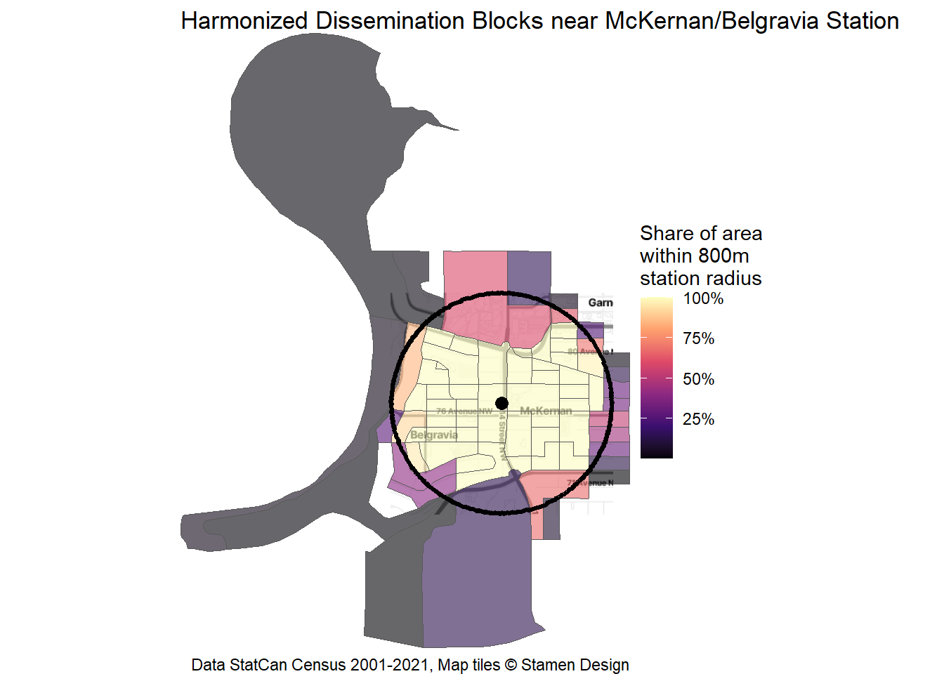
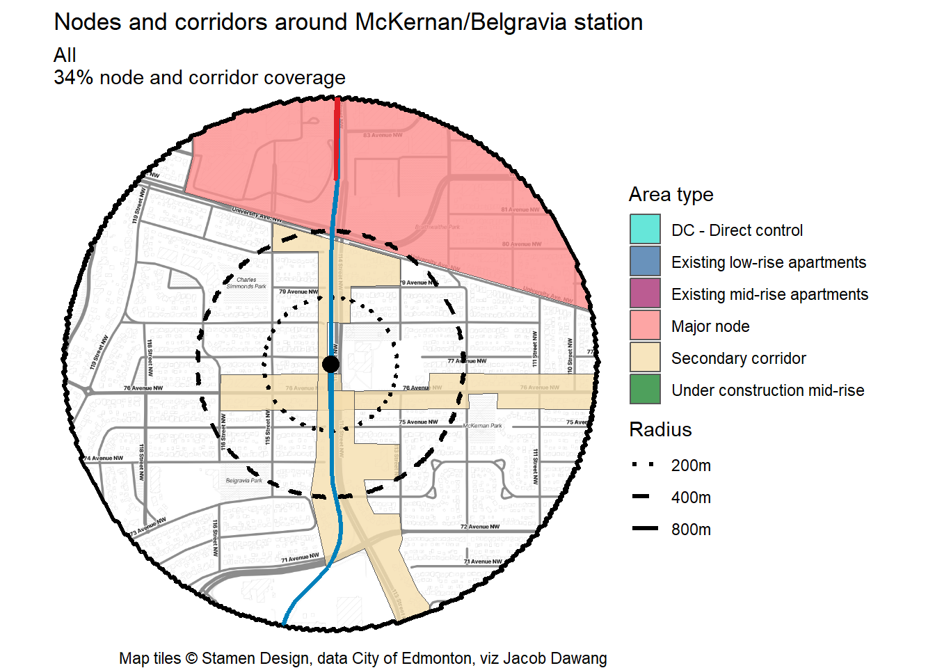
Let’s take a look at how the area around McKernan/Belgravia Station area has grown over the past 20 years. To start off, I’ve defined the station area as extending 800m from the platform at 76 Ave and 114 St. This aligns with the largest radius of BC’s new TOD policy and is generally a 10-15 minute walk away.
This section is inspired and much of the code is copied from Jens von Bergmann’s blog post on Nanaimo Station in Vancouver.
Census data has what we need, but census dissemination blocks (DBs) don’t perfectly line up with the 800m radius and their borders change from census to census. First, I harmonized the 2001-2021 DBs to a common geography using the TongFen library. Then, I selected the DBs that are more than 50% within the station area, shown in Figure 2.
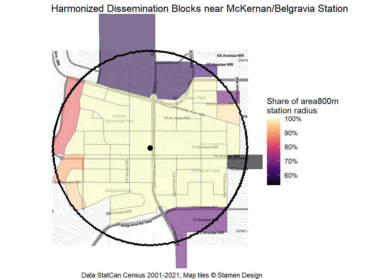
Figure 3 shows only the DBs considered to be within McKernan/Belgravia Station area by the simple 50% inclusion rule. These DBs form the “census station area” that will be used from here on.
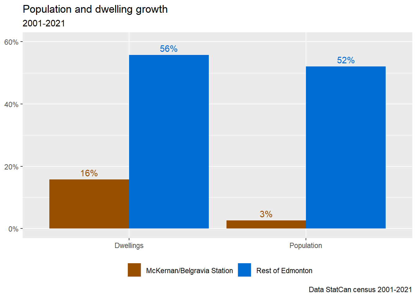
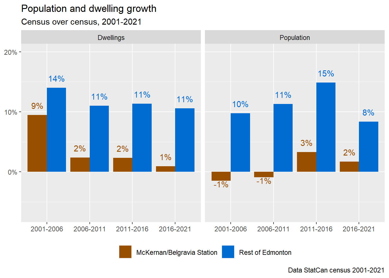
Now that the census station area is well-defined, we can divide Edmonton into the McKernan/Belgravia Station area and the Rest of Edmonton. As shown in Figure 4, the station area trailed the rest of the city by a lot in both dwellings growth and population growth over the past two decades. This is not a novel fact: it is well-known that the vast majority of Edmonton’s growth has come from greenfield sprawl while the mature neighbourhoods have largely remained static. But, most of the Rest of Edmonton doesn’t have a major transit station within walking distance.
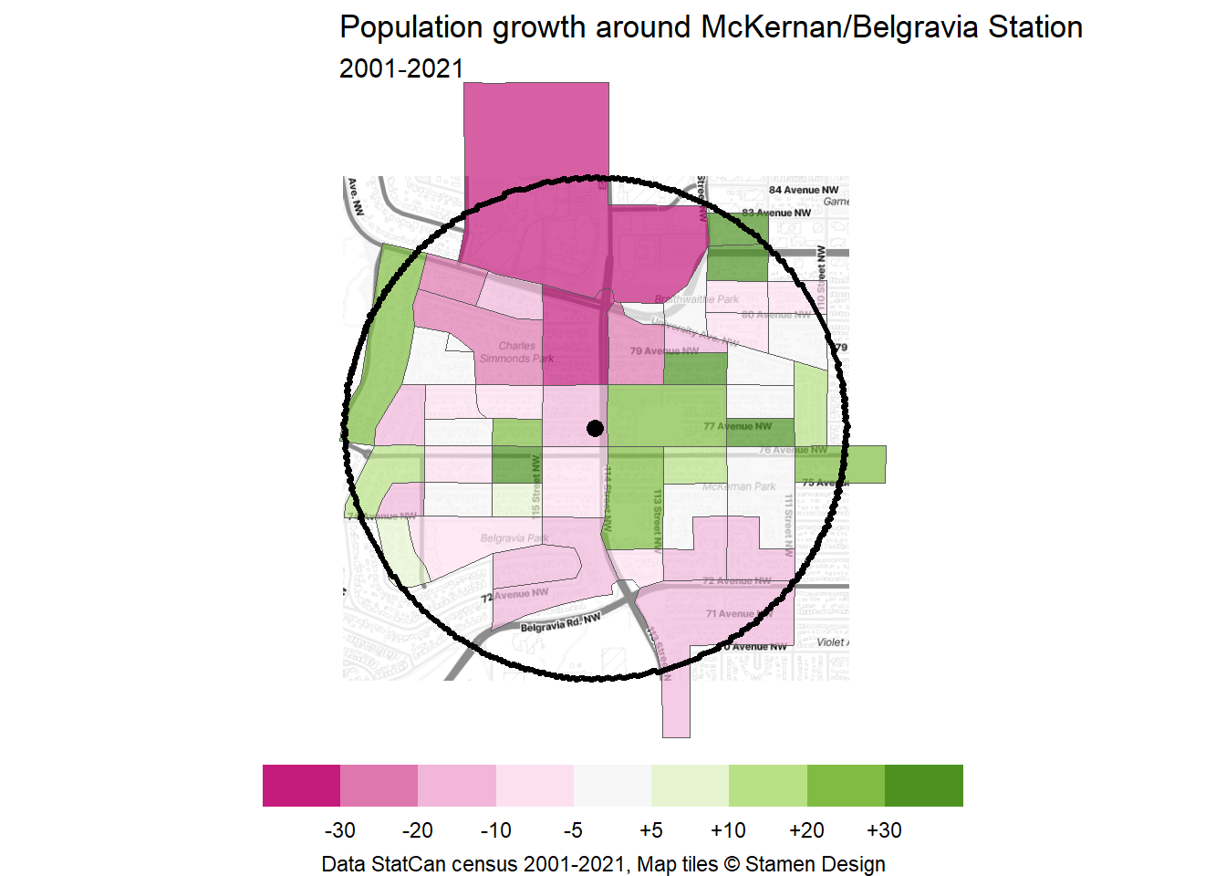
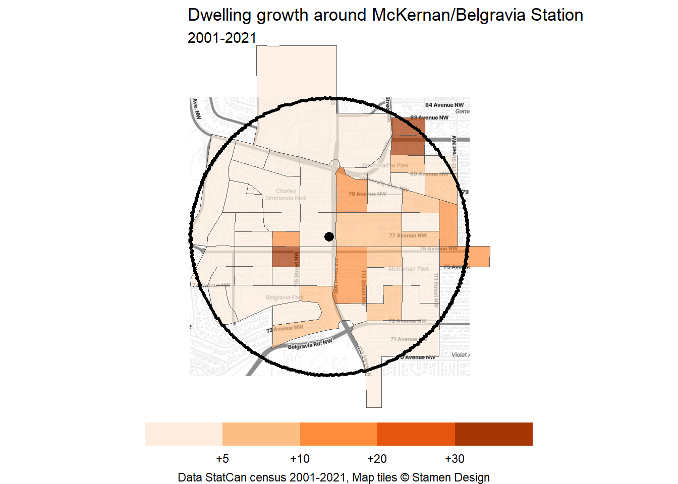
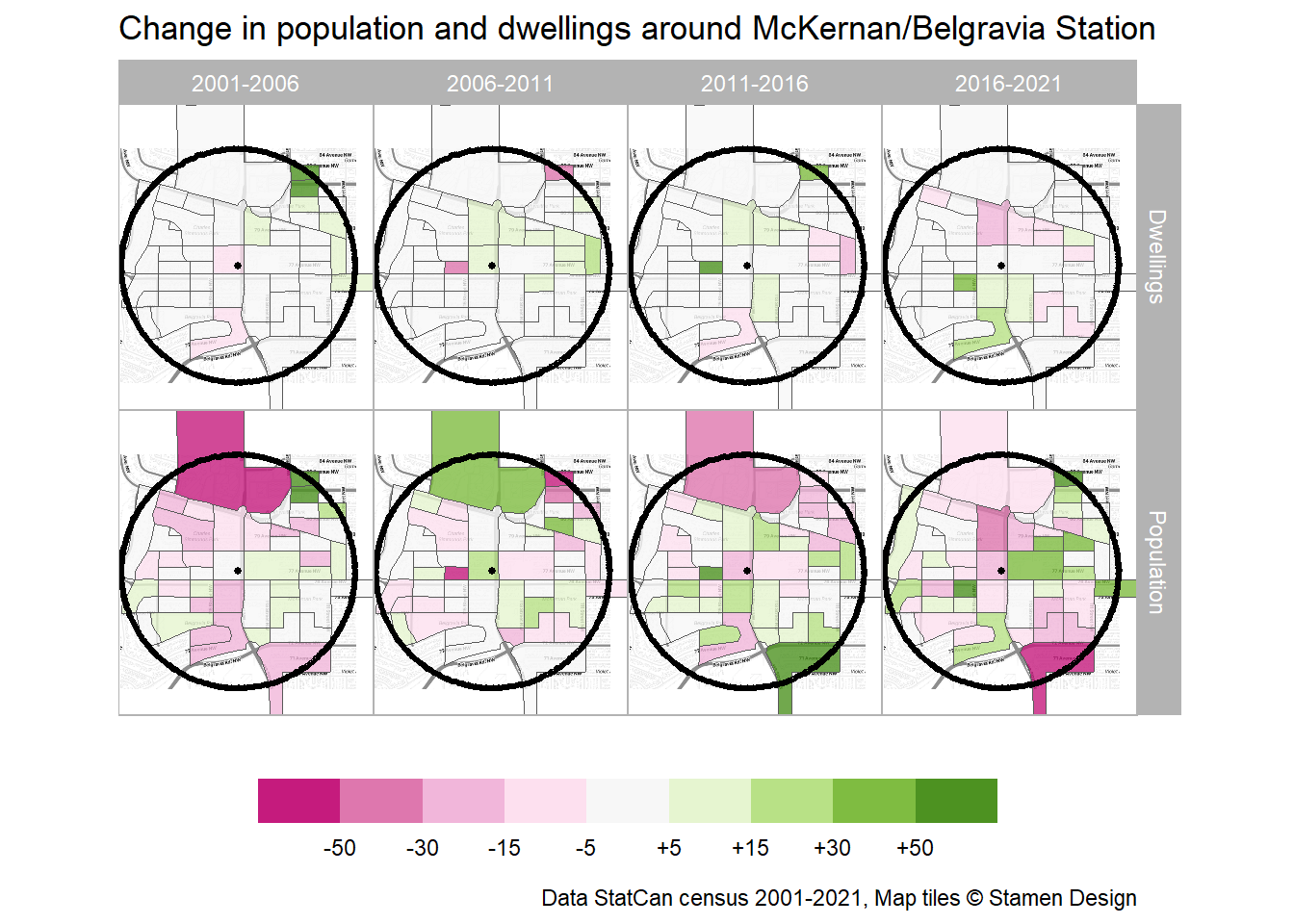
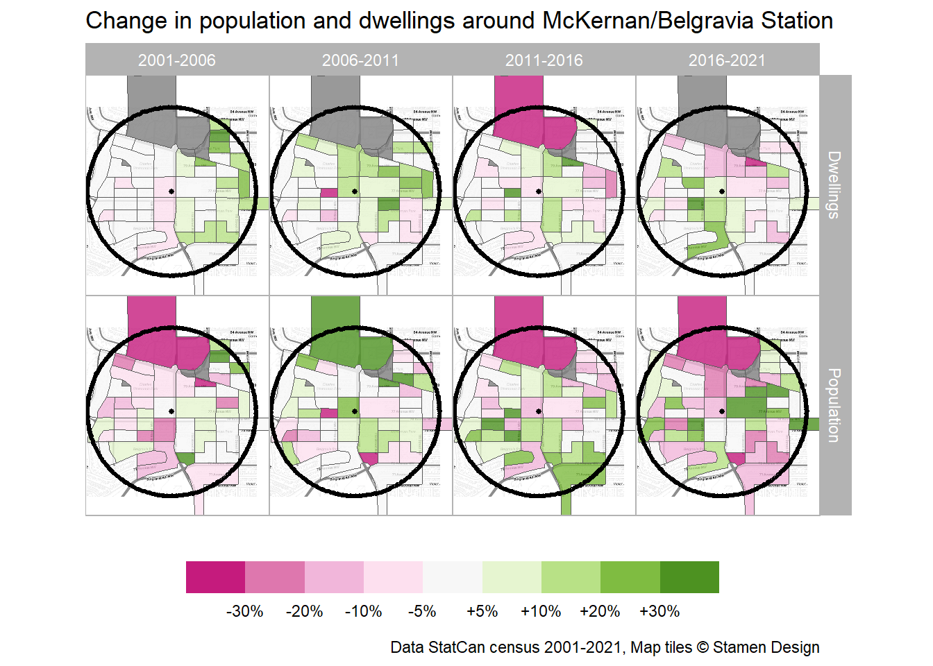
Since we have data on a DB level, we can also look at population and dwelling growth spatially in Figure 5 and Figure 6. Dwelling and population growth has mostly occurred in two places:
- On the east side of 114 St and the LRT line in McKernan.
- Two DBs in Belgravia on either side of 76 Ave where low-rise apartments were redeveloped into higher density low-rise apartments, as can be seen on streetview.
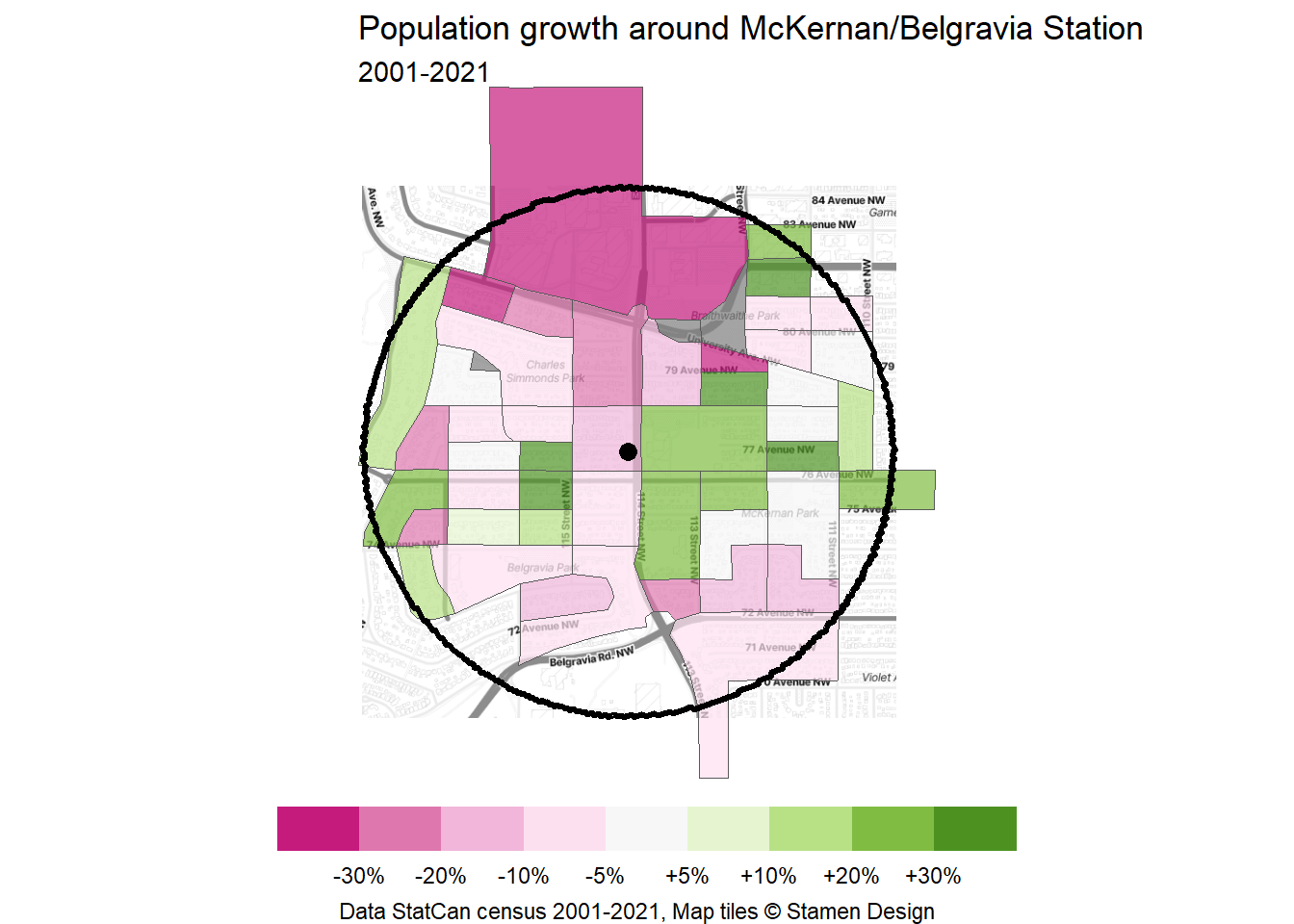
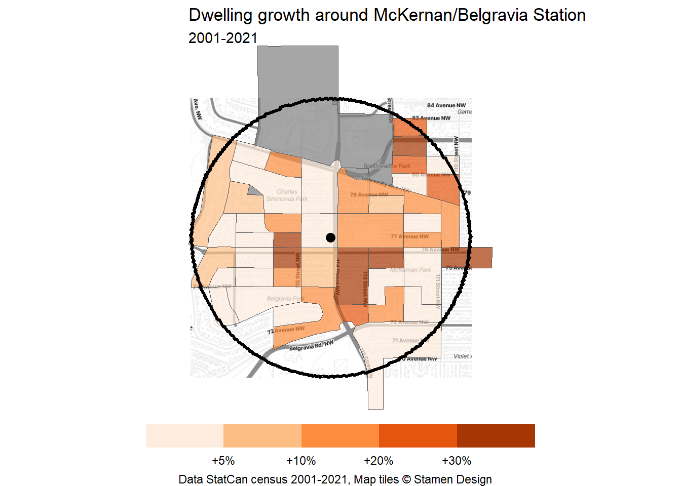
Since we have data from multiple censuses, we can also track change census-over-census, every five years from 2001 in Figure 7. McKernan/Belgravia trailed the Rest of Edmonton in every census period. The station area really only grew in dwellings and population substantially in 2011-2016.
Once again, we can break down the census-over-census change by DB, as shown in Figure 8 and Figure 9. We can see the driver of the increase in dwellings in 2011-2016 being the demolition (seen in 2006-2011) and subsequent replacement of the aforementioned low-rise apartments on 76 Ave west of the station. We can also see the second demolition and replacement of low-rise apartments happen across the street in 2016-2021. More recently, we can see the demolition of mostly single-family homes north of the station along University Ave with under construction (at the time) mid-rise apartments that should increase dwellings and population in those blocks in the upcoming census. Most other blocks have largely intensified very gently or remained static.
To sum up:
McKernan/Belgravia Station area has not seen much growth over the past twenty years, especially compared to the rest of Edmonton.
The first major driver of growth seems to be demolition and replacement of low-rise apartments with slightly higher density. This means that there was more displacement through demolition than if the surrounding detached homes were replaced with apartments.
The second major driver of growth seems to be construction of new mid-rise apartments on the University Ave car sewer. As others have argued, it is profoundly unequal to confine apartments to busy roads.
District plans need more transit-oriented development
While the census shows what happened in the past, zoning and district plans together show what we can expect for the future. Data for the new zoning is not yet available, so I pieced it together using the City’s interactive map and the equivalences listed in the new zoning bylaw. Data for the nodes and corridors of district planning is also not available so I have drawn these borders manually based on the images in the Scona district plan.
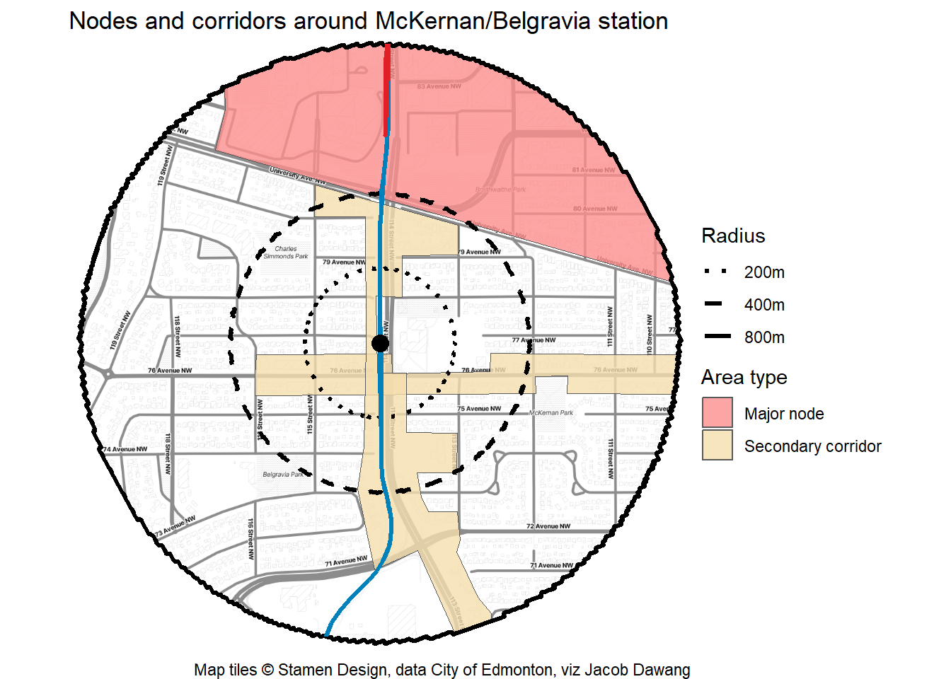
Figure 10 shows the zoning (as of January 1, 2024) and proposed nodes and corridors within the station area. I have also overlaid smaller radii to compare Edmonton’s plan with BC’s new transit-oriented development legislation that will permit 20 storeys within 200m, 12 storeys within 400m and 8 storeys within the full 800m.
While the vast majority of McKernan/Belgravia station area is RS zoned, this is a slight improvement over the previous bylaw. Looking at the nodes and corridors map, we can see that the secondary corridor only extends at most one block in each direction, except for the University Ave and 114 St intersection. In fact, using the unamended district planning borders, only 34% of the station area will be covered by the nodes and corridors. The rest of the area is planned for low-rise only.
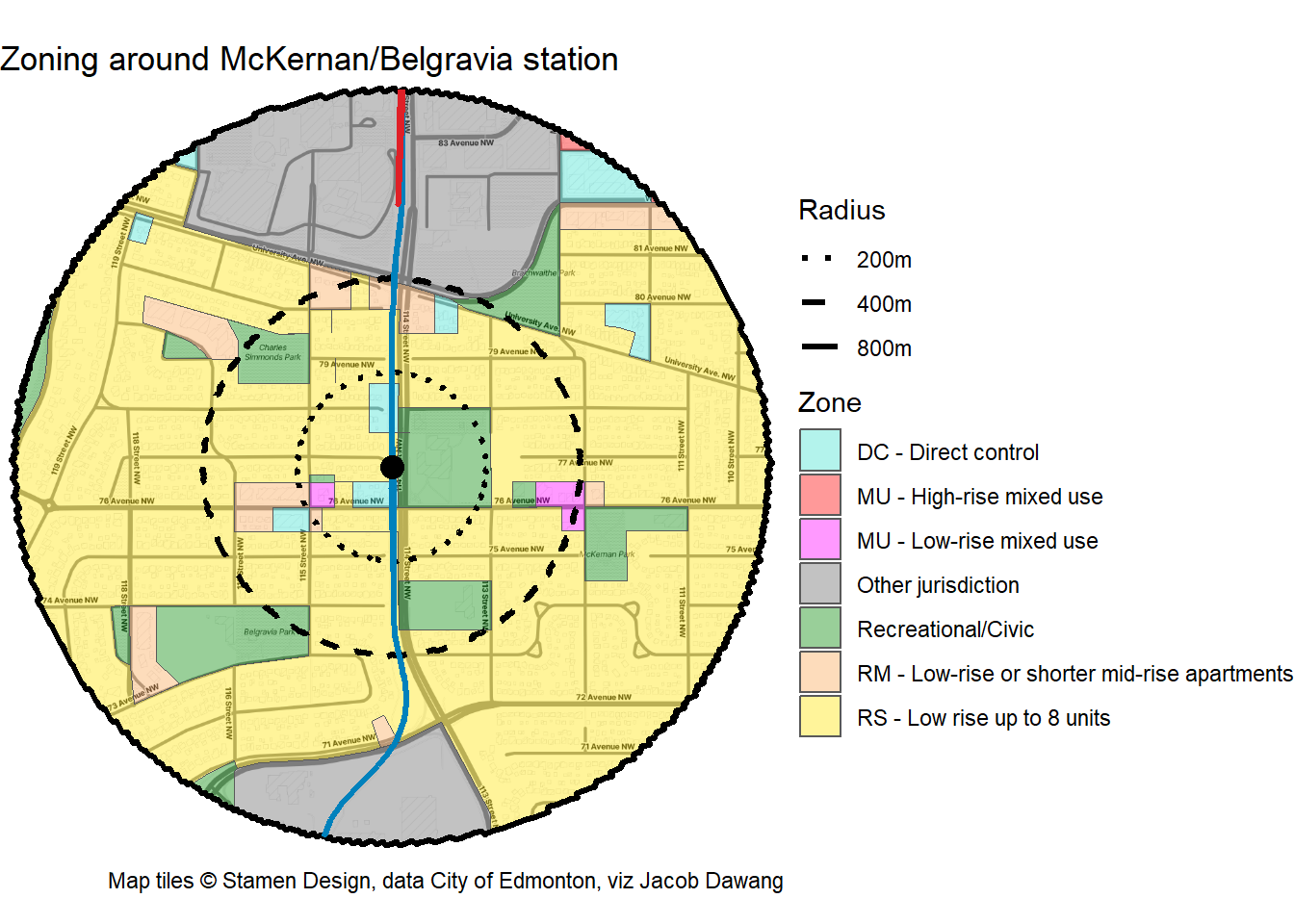
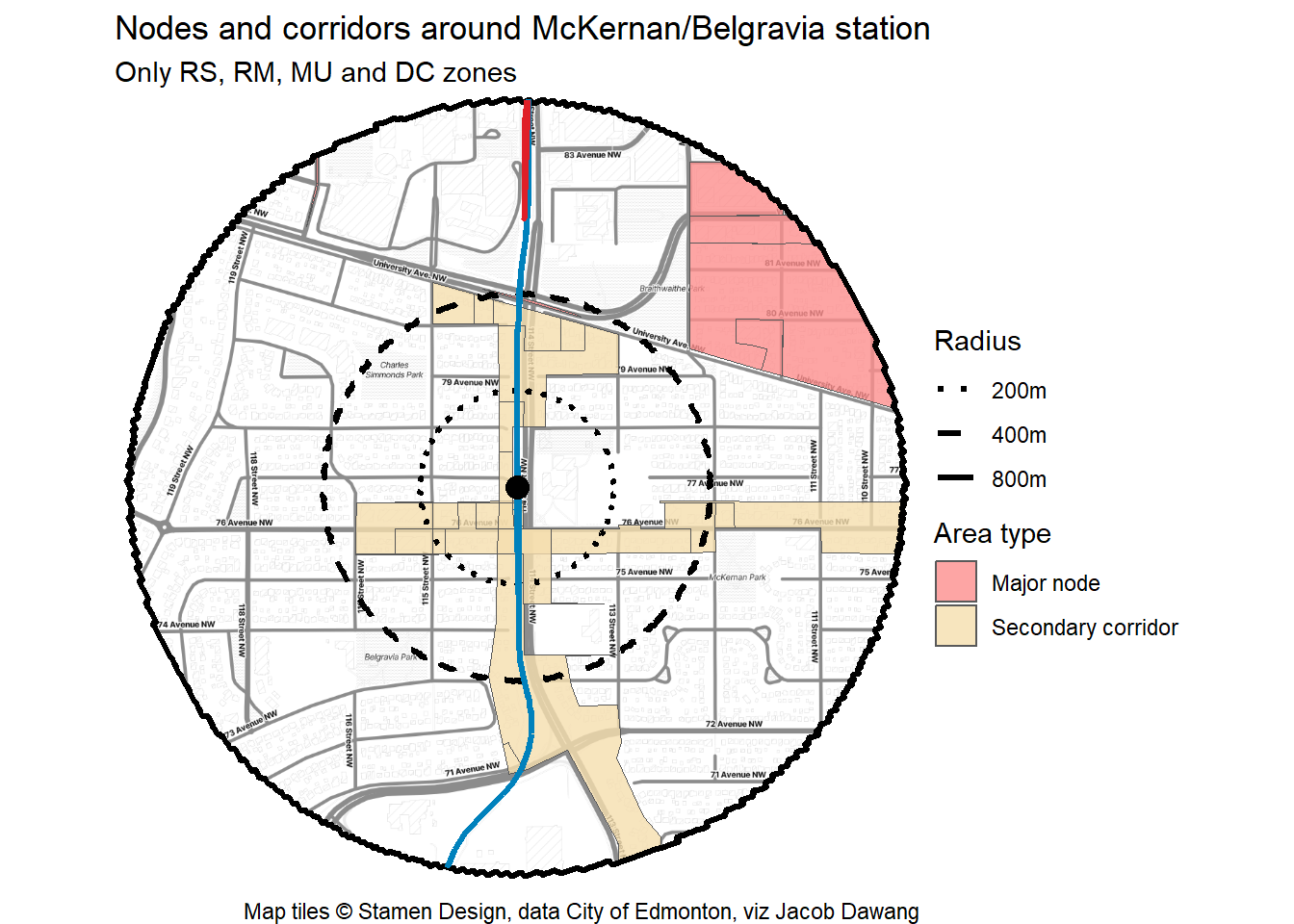
But, that doesn’t tell the whole story, as some plots are zoned for parks, fire halls and other jurisdictions, where housing is unlikely to be built, even through a rezoning. Figure 11 shows the coverage of nodes and corridors when we exclude these zones. The major node to the north at the University of Alberta plays a much smaller rolein the McKernan/Belgravia Station area. Using this map, only 18% of the station area is covered by the secondary corridors and major node.
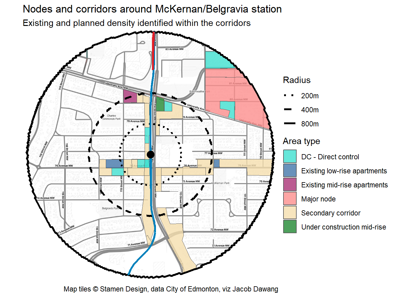
Why stop there? Through DC zoning, local knowledge and some streetview, I identified some sites within the secondary corridor that are either existing, under construction or planned low to mid-rise apartments, shown in Figure 12. I have also excluded the wide 114 St/LRT right-of-way. While arguably one of the older low-rise apartments on the site furthest east along 76 Ave could see an increase in permissions and redevelop, the rest of the sites identified are relatively new and are unlikely to benefit from the secondary corridor permissions. When we remove these sites and the right-of-way, only 13% of the station area remains covered by secondary corridors and the major node.
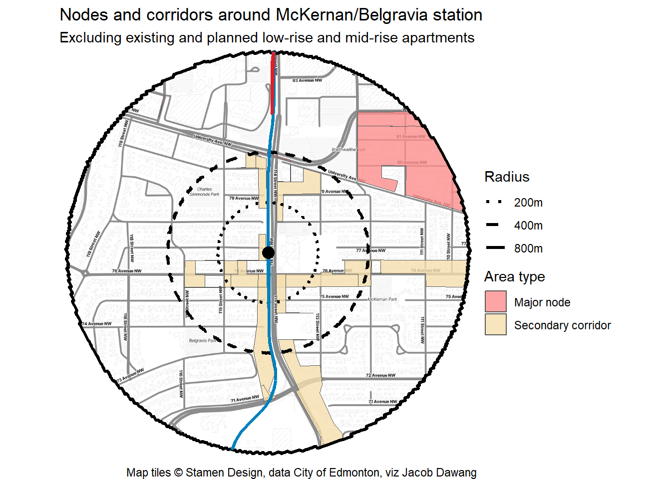
I’ve stitched all of this together in an animation below in Figure 13, to show the progression as we remove more and more sites that probably won’t see higher density than today under the proposed district plan. Remember that BC’s new legislation applied to McKernan/Belgravia Station would support 8 storeys over 100% of the station area (minus parks, fire halls, etc) and even taller buildings within the 400m and 200m radii. So even the generous 34% node and corridor area coverage using the raw data is conservative in comparison.
Conclusion and how to move forward
The Scona district plan is certainly an improvement on the area redevelopment plan, allowing higher densities along 76 Ave and 114 St. However, we need to fully leverage every one of the few rapid transit stations in Edmonton to avoid a spreading Canadian housing crisis, dial back sprawl and achieve the city’s target of 50% infill development. This especially applies to the least used station on the LRT network, one that is also a short walk away from the University of Alberta.
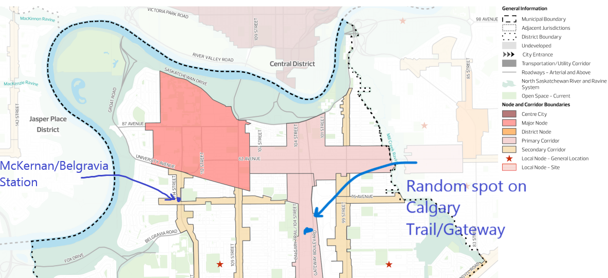
BC’s government has set a new bar in Canada for transit-oriented development and that’s where we should start. There is no good reason why a random spot between the twin four-lane stroads of Calgary Trail and Gateway should be designated for high density, but a site that’s a five minute walk from McKernan/Belgravia Station should only be designated for low density. This is essentially relegating high-density apartment dwellers, who tend to be less wealthy and more reliant on transit, to live in a truly horrendous area with high levels of air pollution, noise and traffic, while throttling how many people are allowed to enjoy a desirable neighbourhood that’s well-served by rapid transit. I’m not saying that Calgary Trail/Gateway should not have high density permissions, but people who can only afford to live in high-density apartments should have the choice to have good access to the LRT. In this case, it means that we need to allow higher density housing throughout the McKernan/Belgravia Station area than what is currently planned.
Higher density permissions around major transit stations should be written into the district plans. It shouldn’t matter whether rapid transit stations are within a primary corridor, secondary corridor, major node or none of them. This can happen before the final draft district policy and plans are brought back to council in 2024 or in subsequent amendments by council. If you agree with me, please take a few minutes to tell City Planning this in their district policy survey and as always, sign up for the Grow Together Edmonton mailing list to stay up-to-date on Edmonton housing news.
Are there any other LRT stations I should do? Did I get anything wrong? Let me know in the comments.