Last year, I deputed at Edmonton City Council’s Urban Planning Committee for district planning, urging them to have more consideration of density around transit. I used my previous posts on McKernan Belgravia and Avonmore as examples of planning to underbuild around billion-dollar rapid transit investments. Administration said that Avonmore was an outlier, so I thought I’d check that out.
In this post, I’ve profiled every current and funded Edmonton LRT station area using:
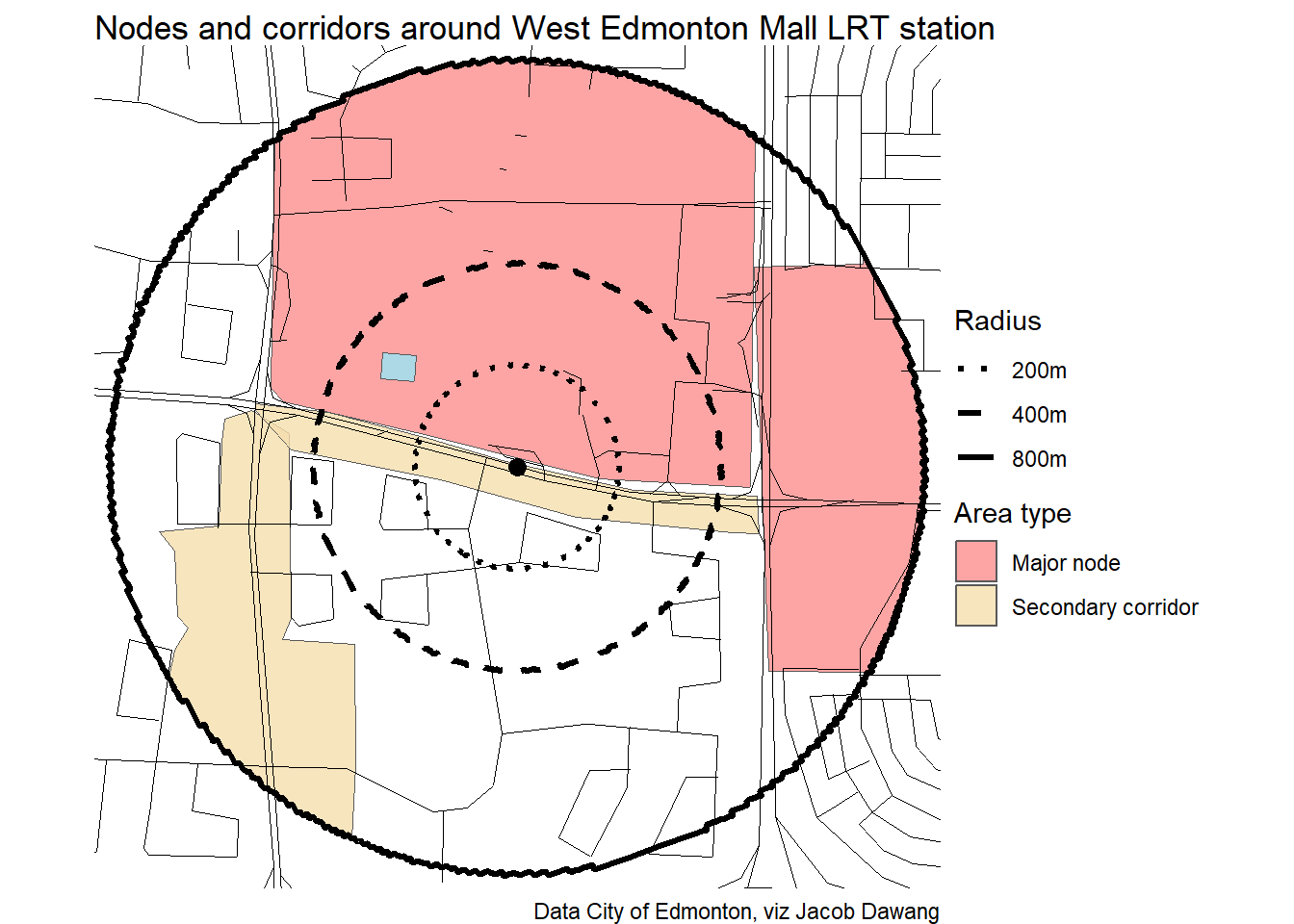
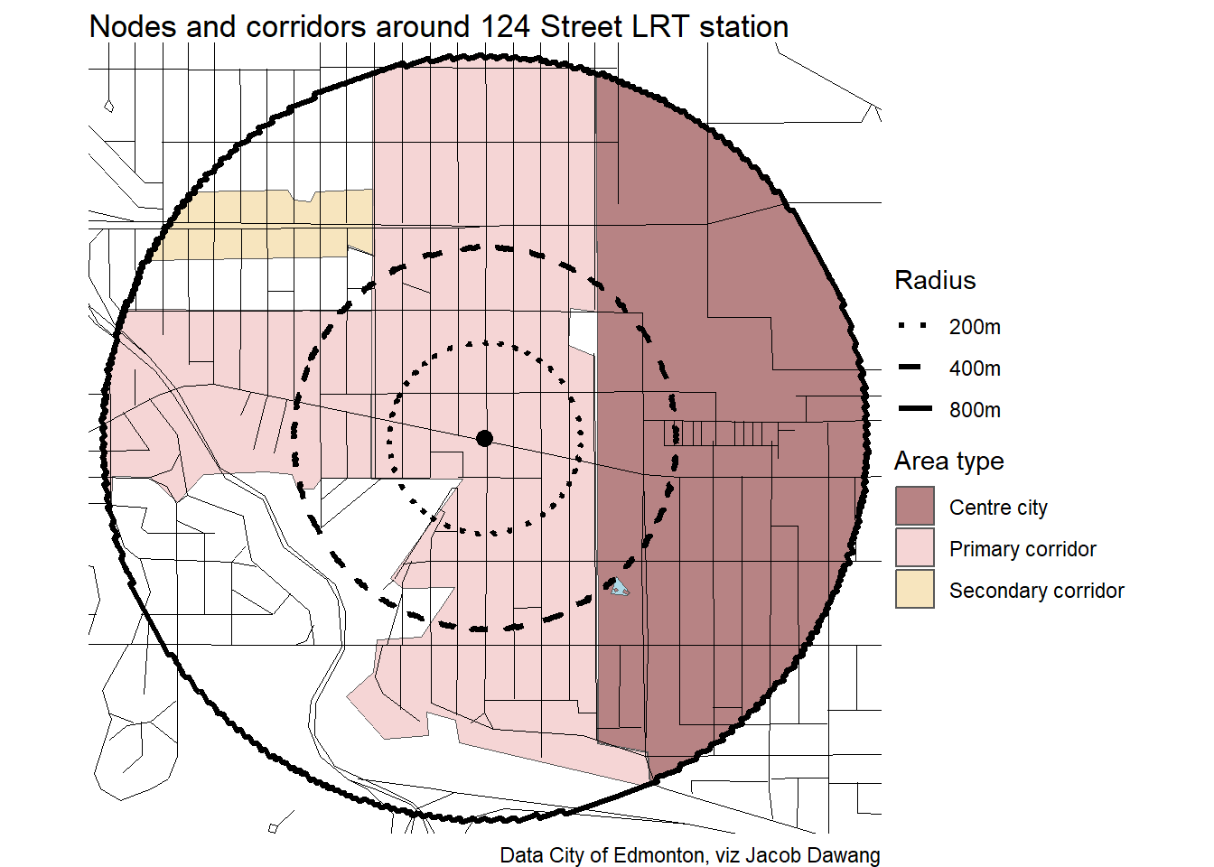
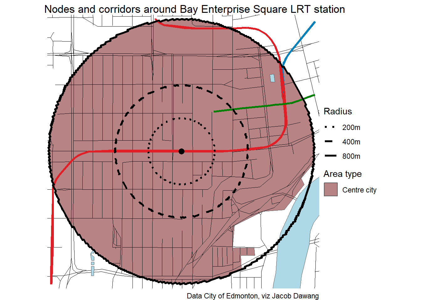
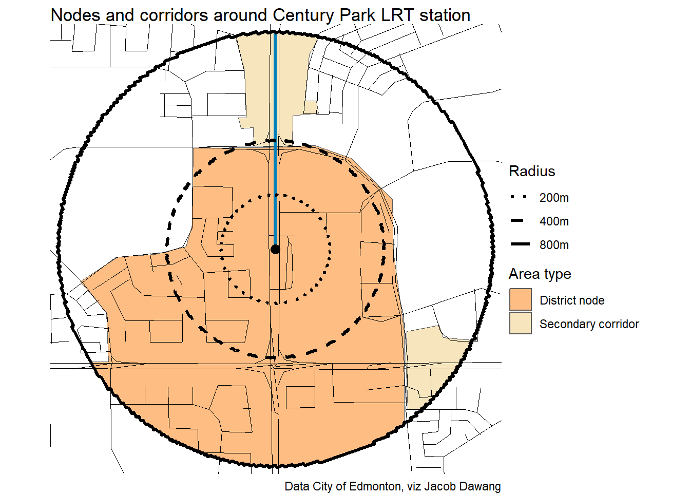
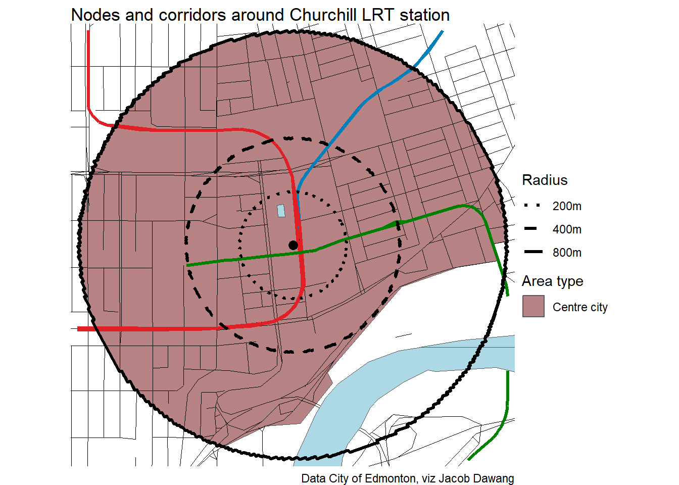
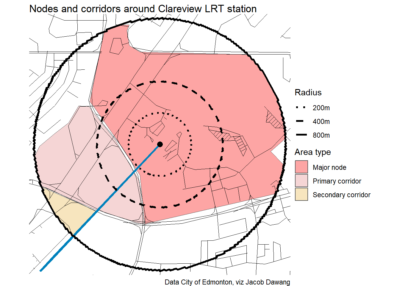
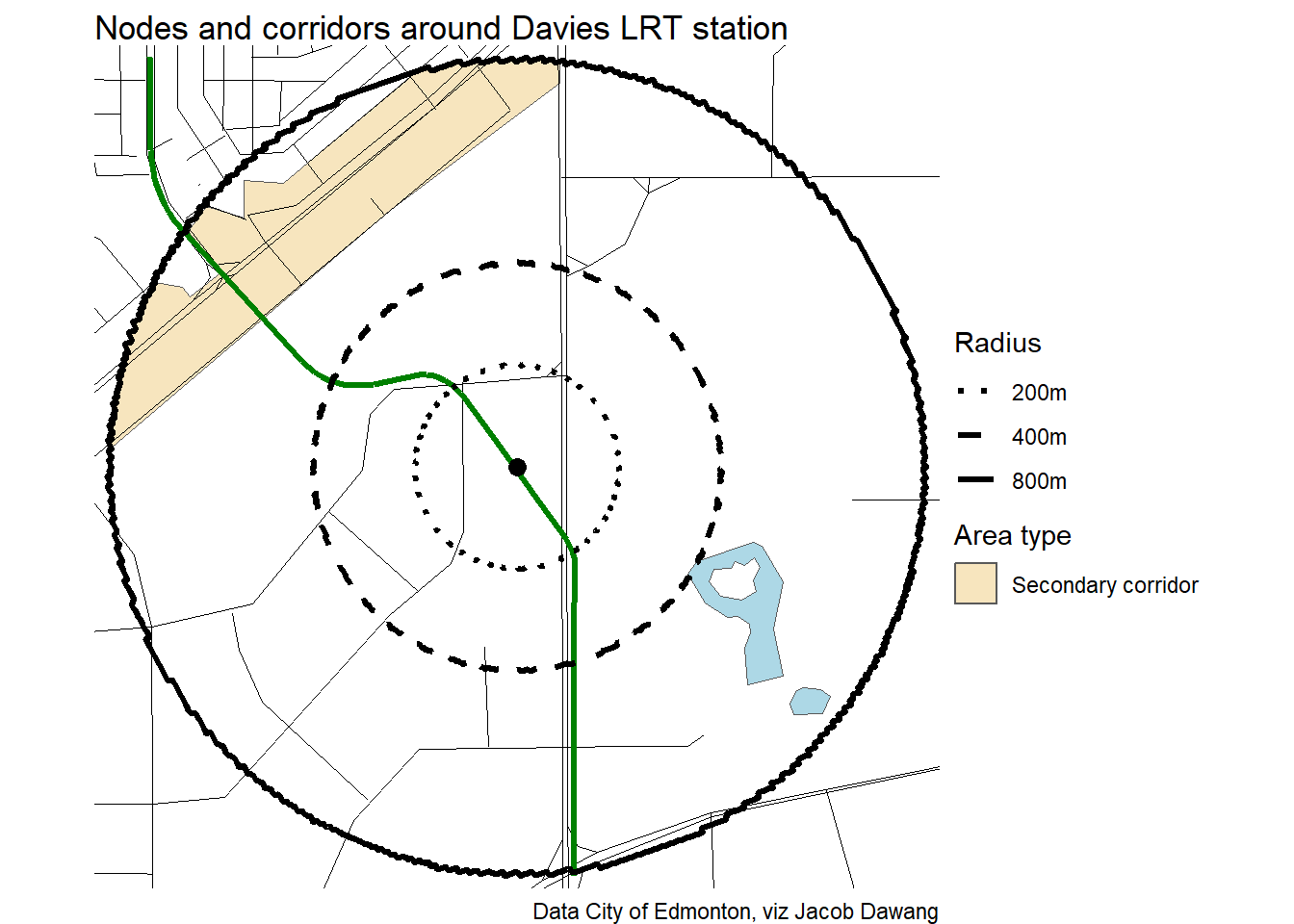
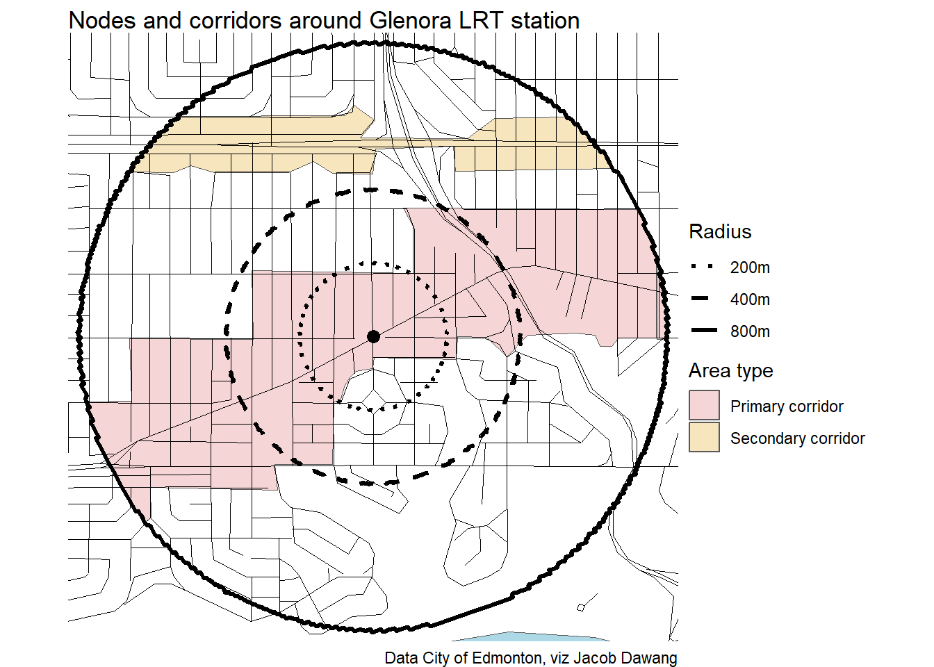
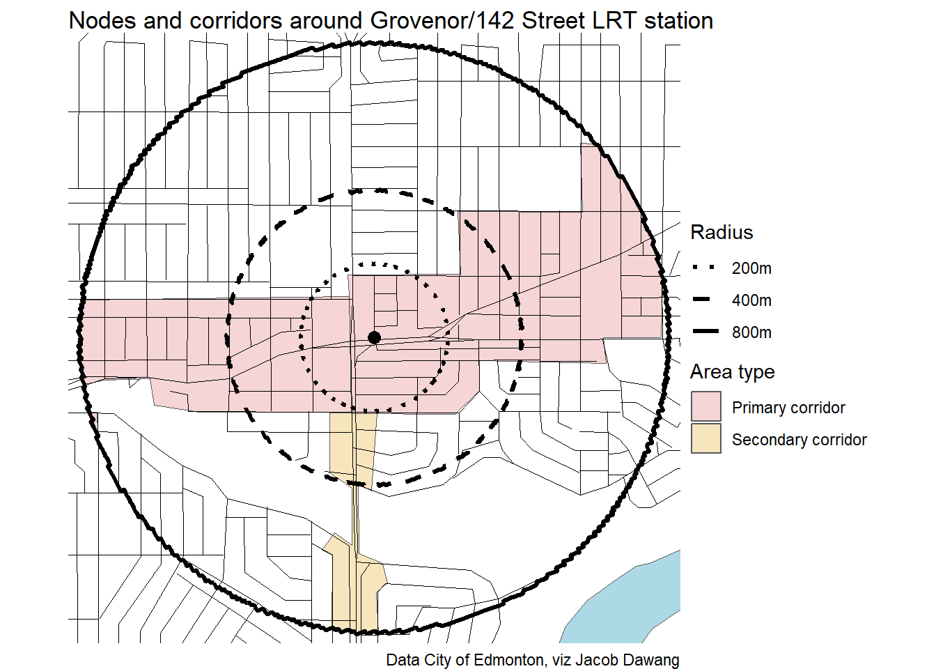
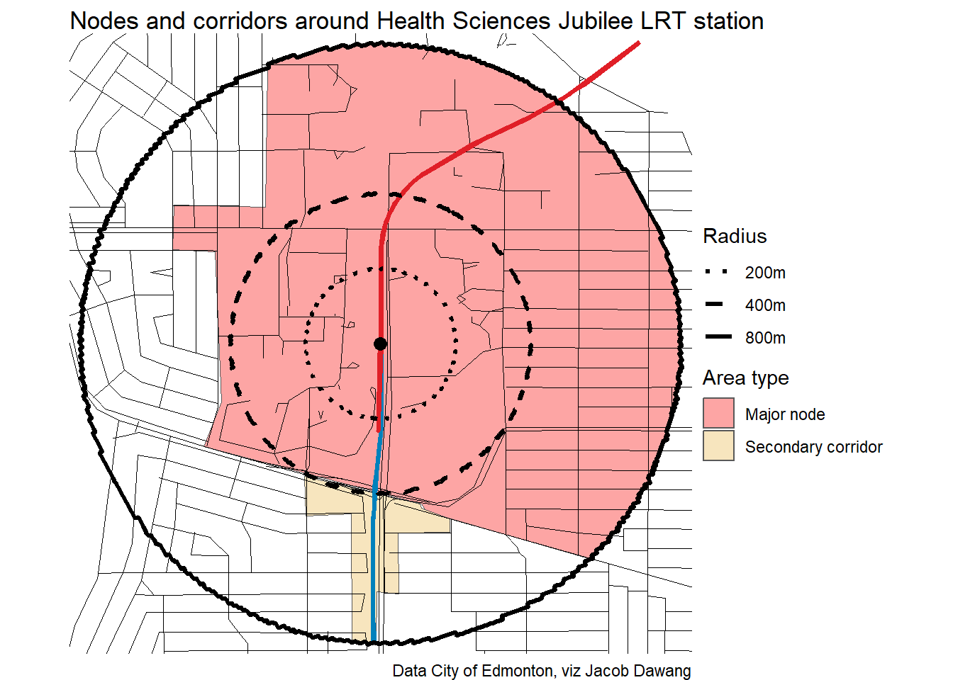
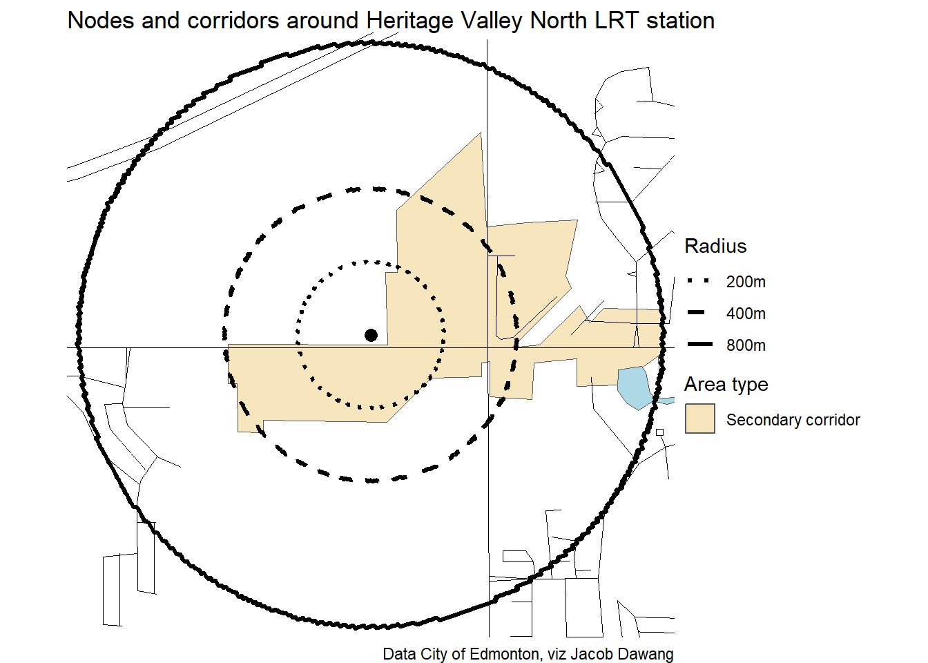
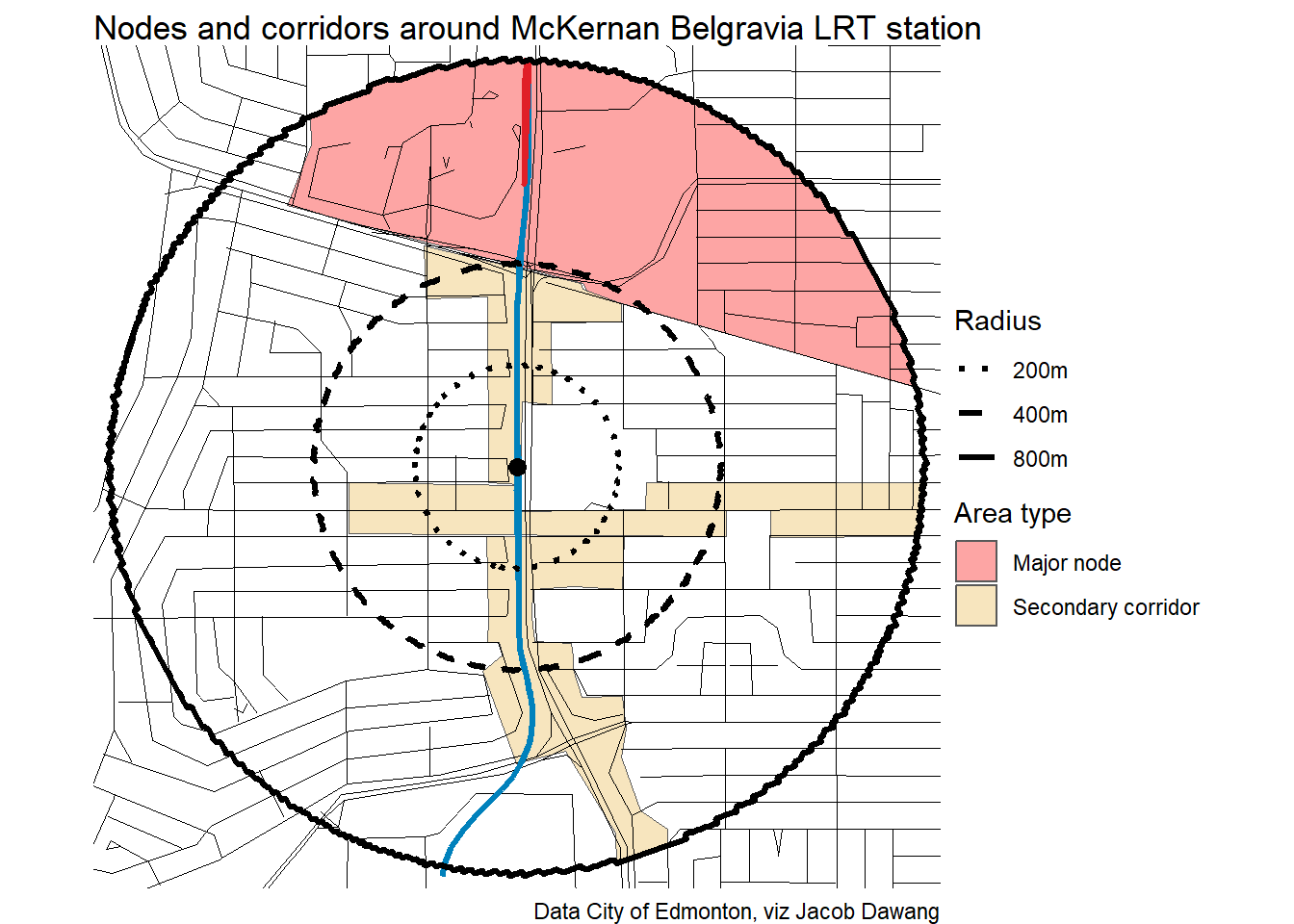
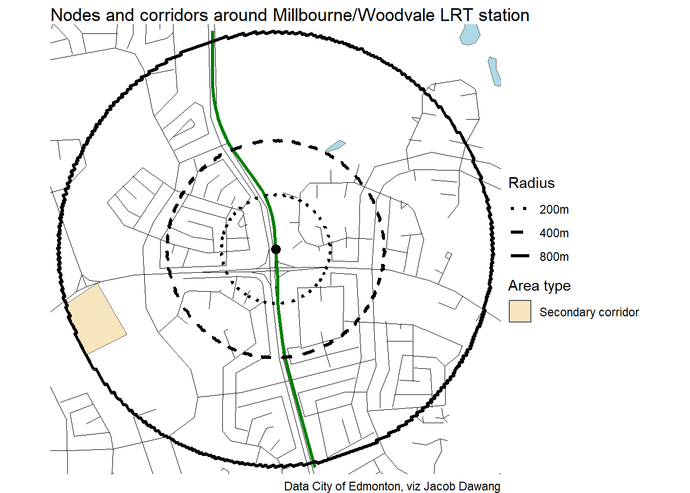
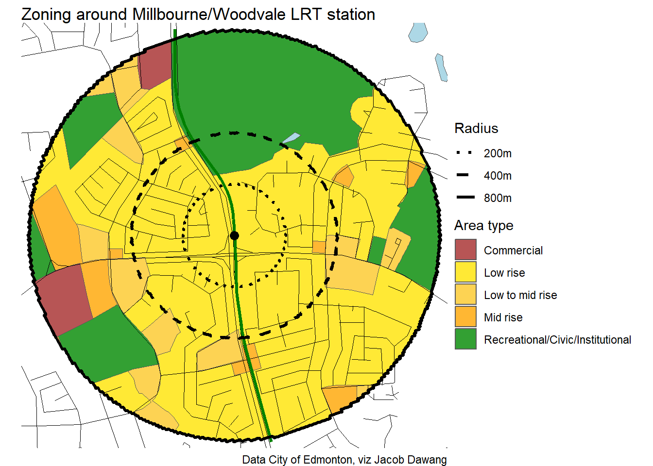
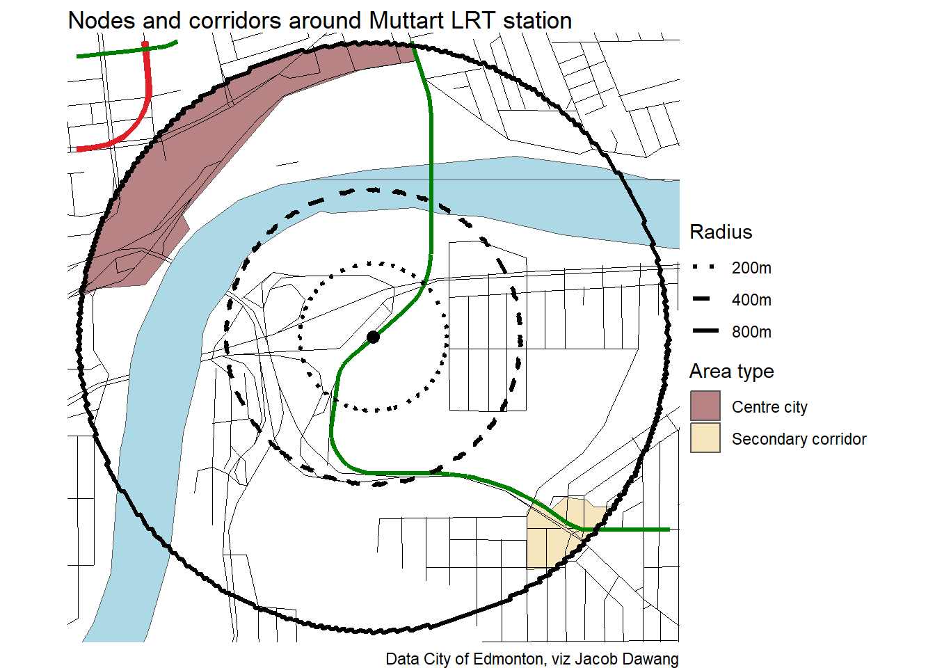
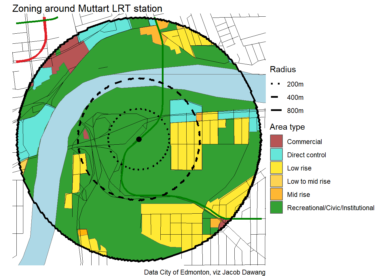
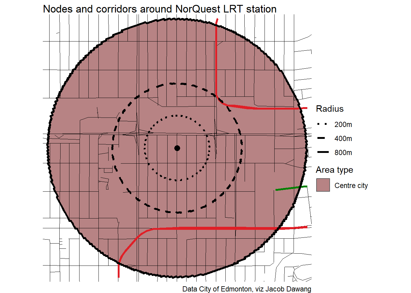
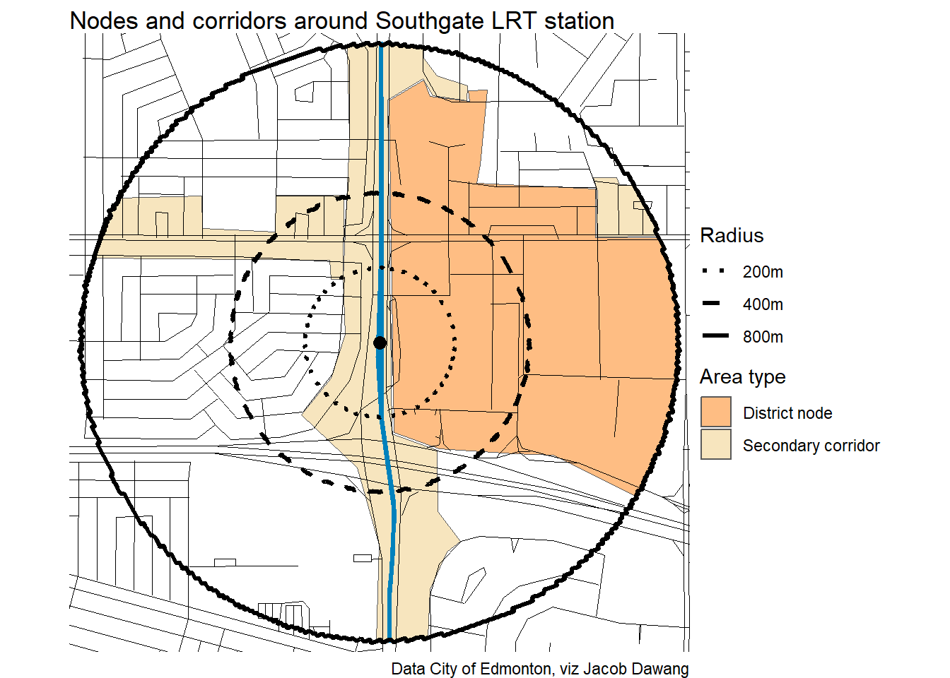
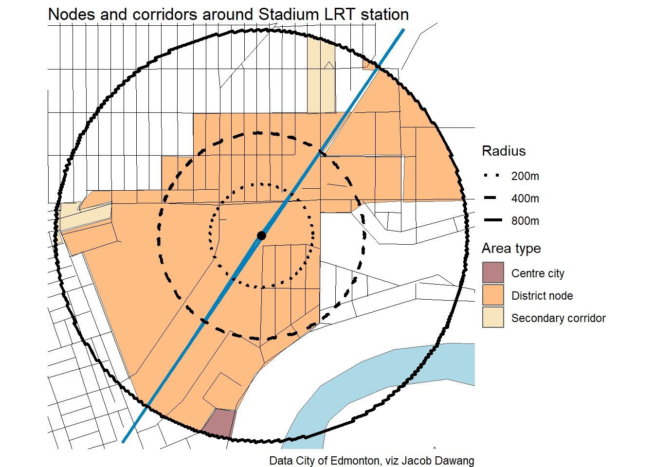
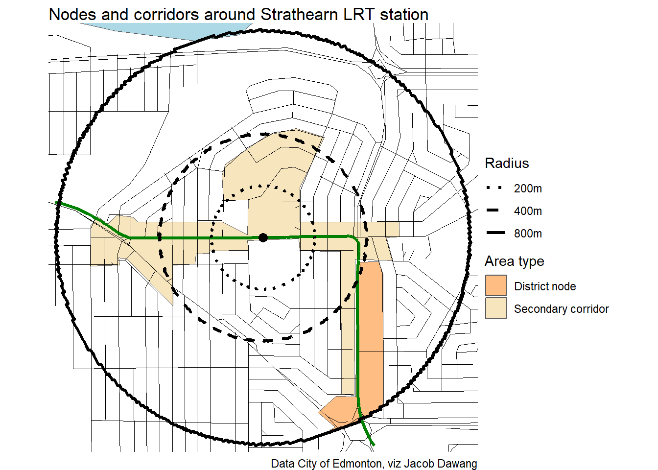
- District planning maps for nodes and corridors.
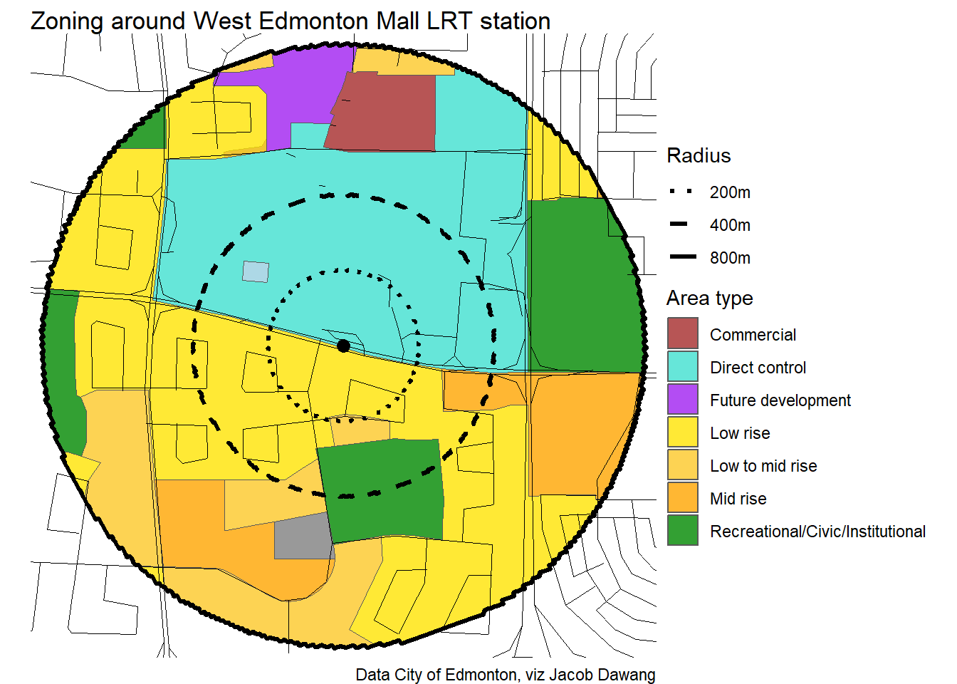
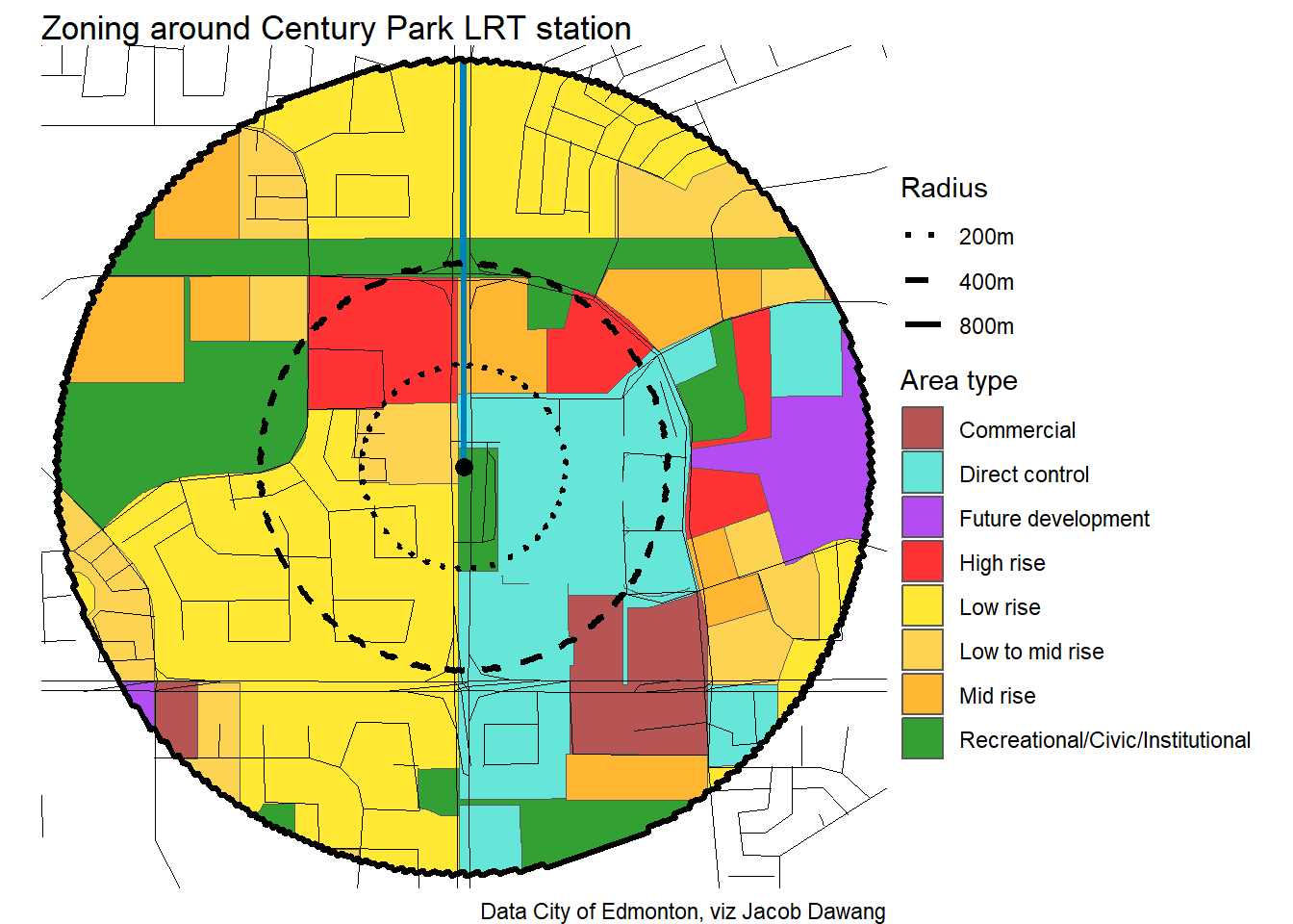
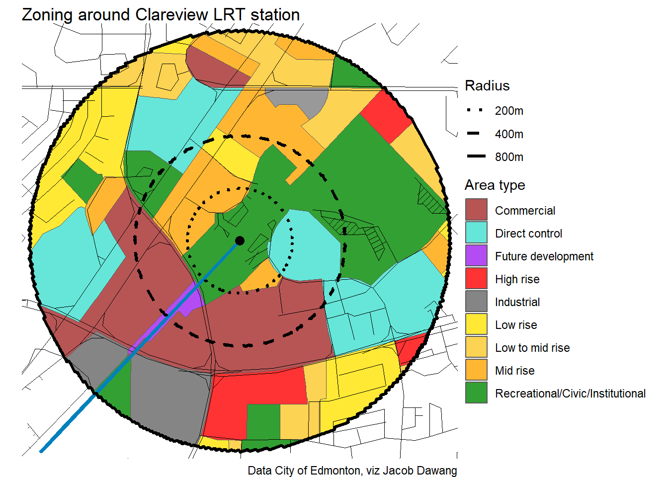
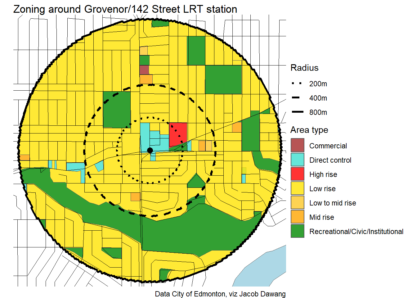
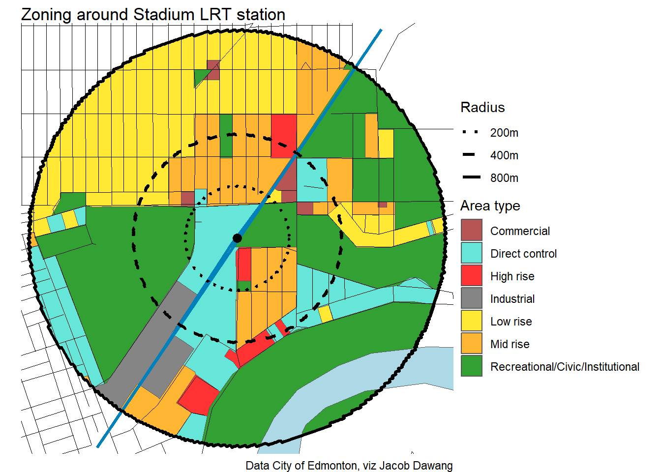
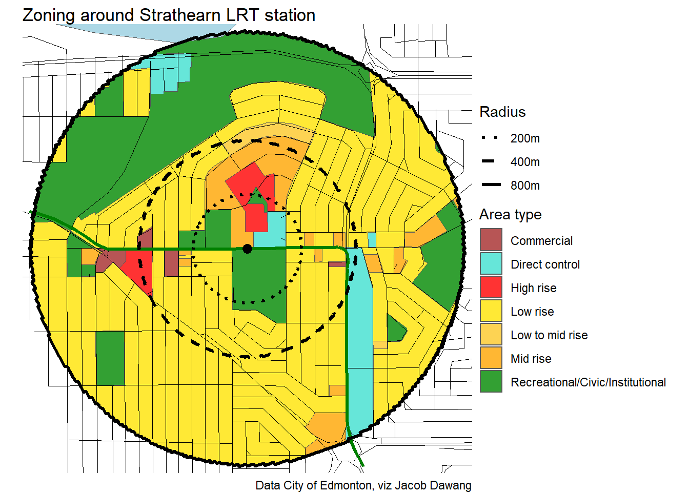
- Zoning Bylaw open data.
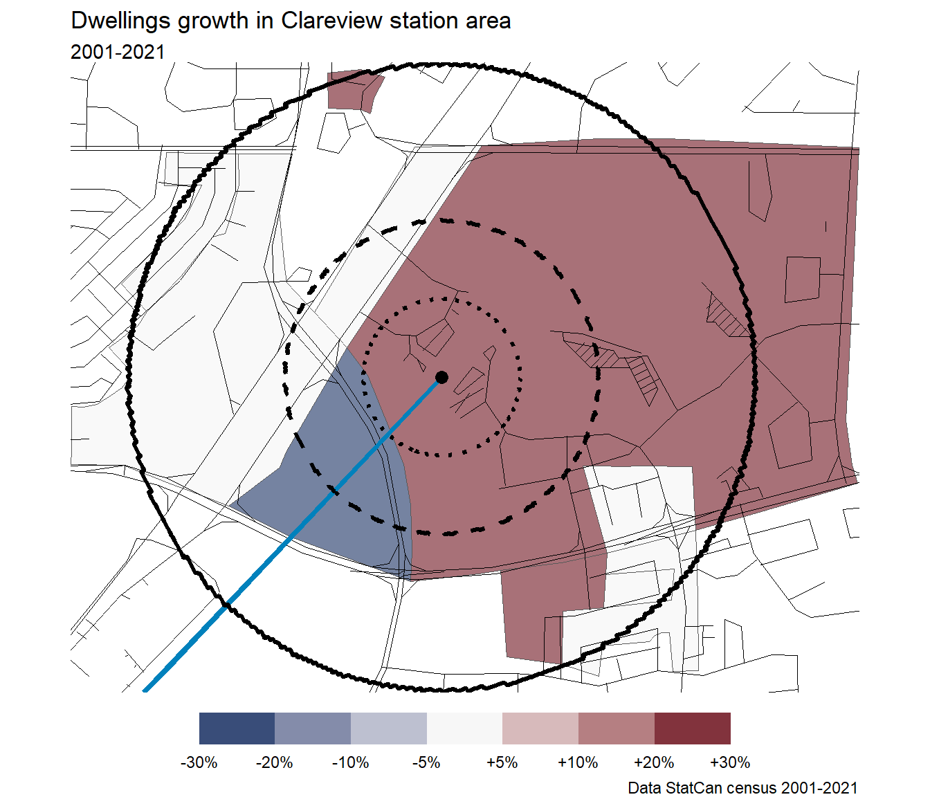
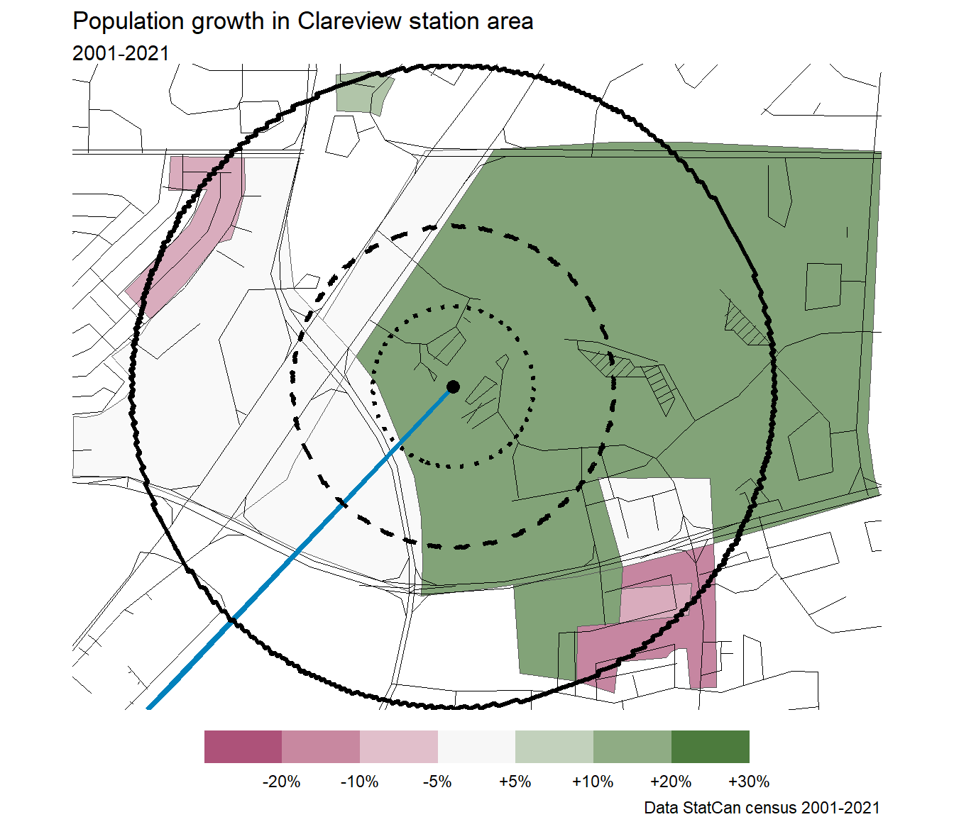
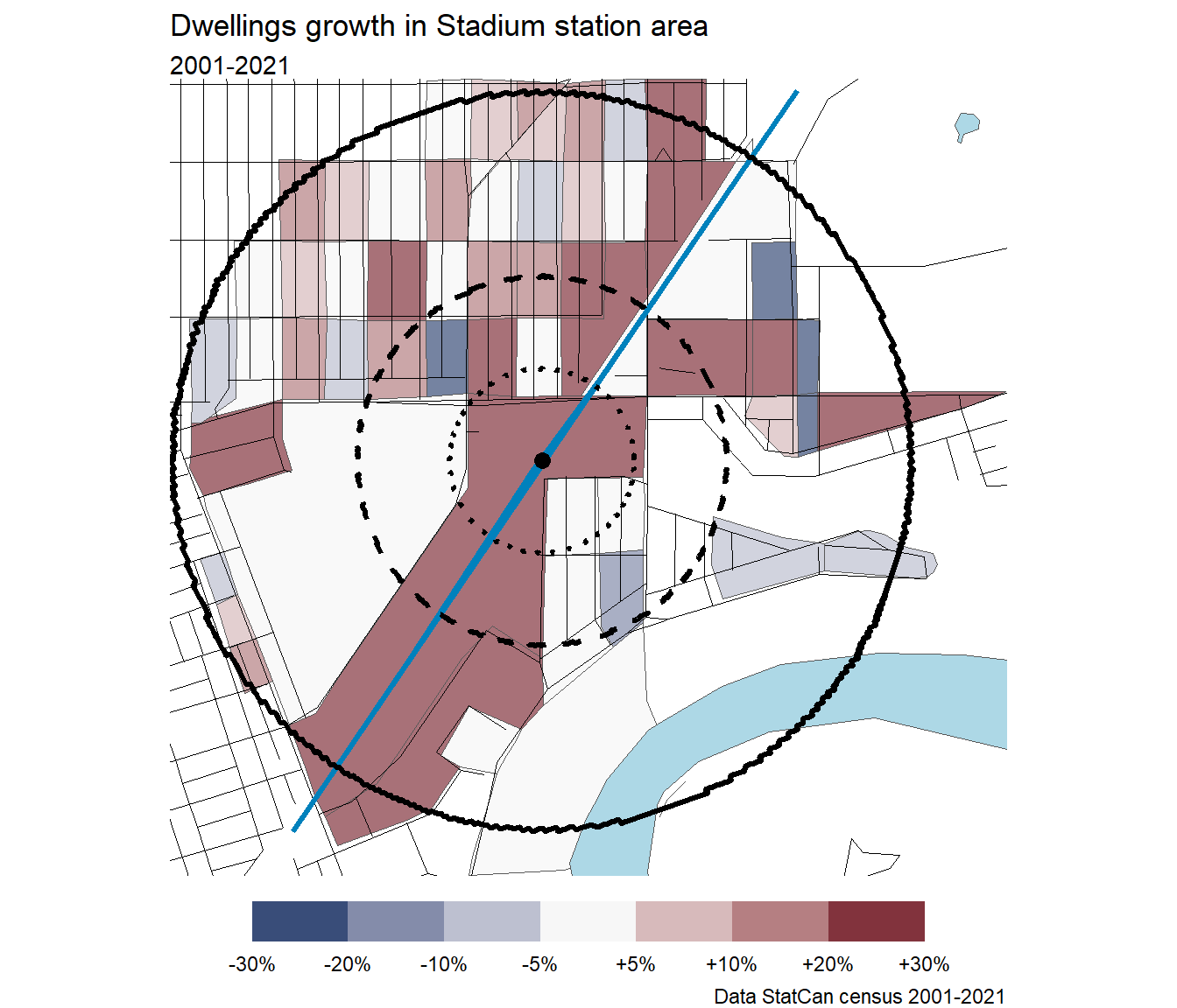
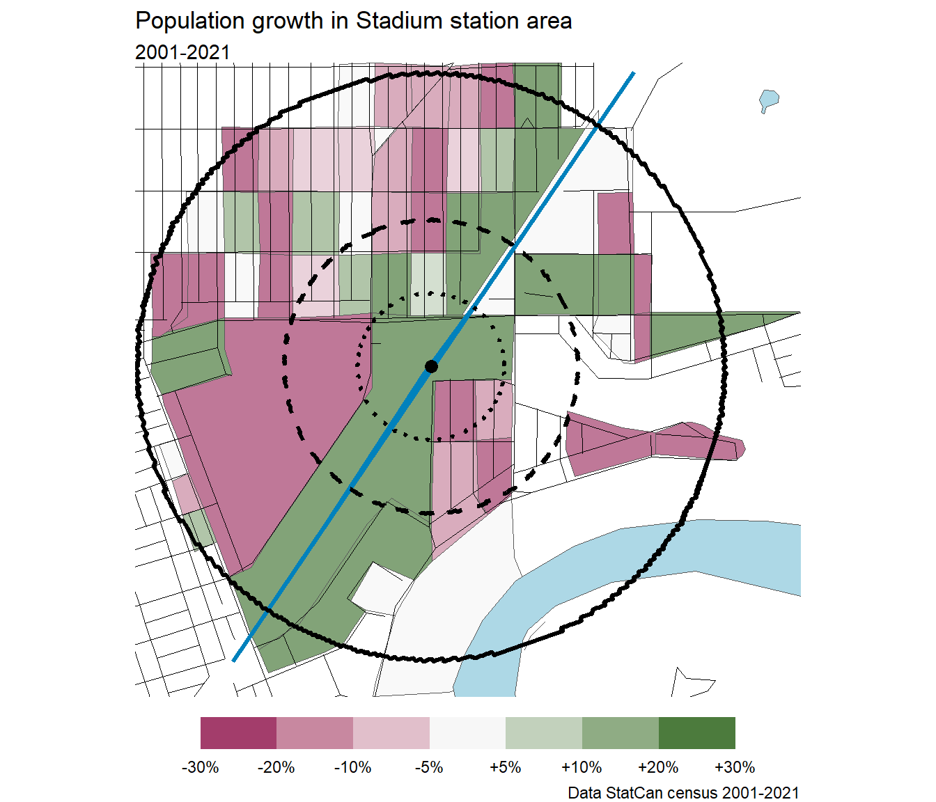
- StatCan census via censusmapper.
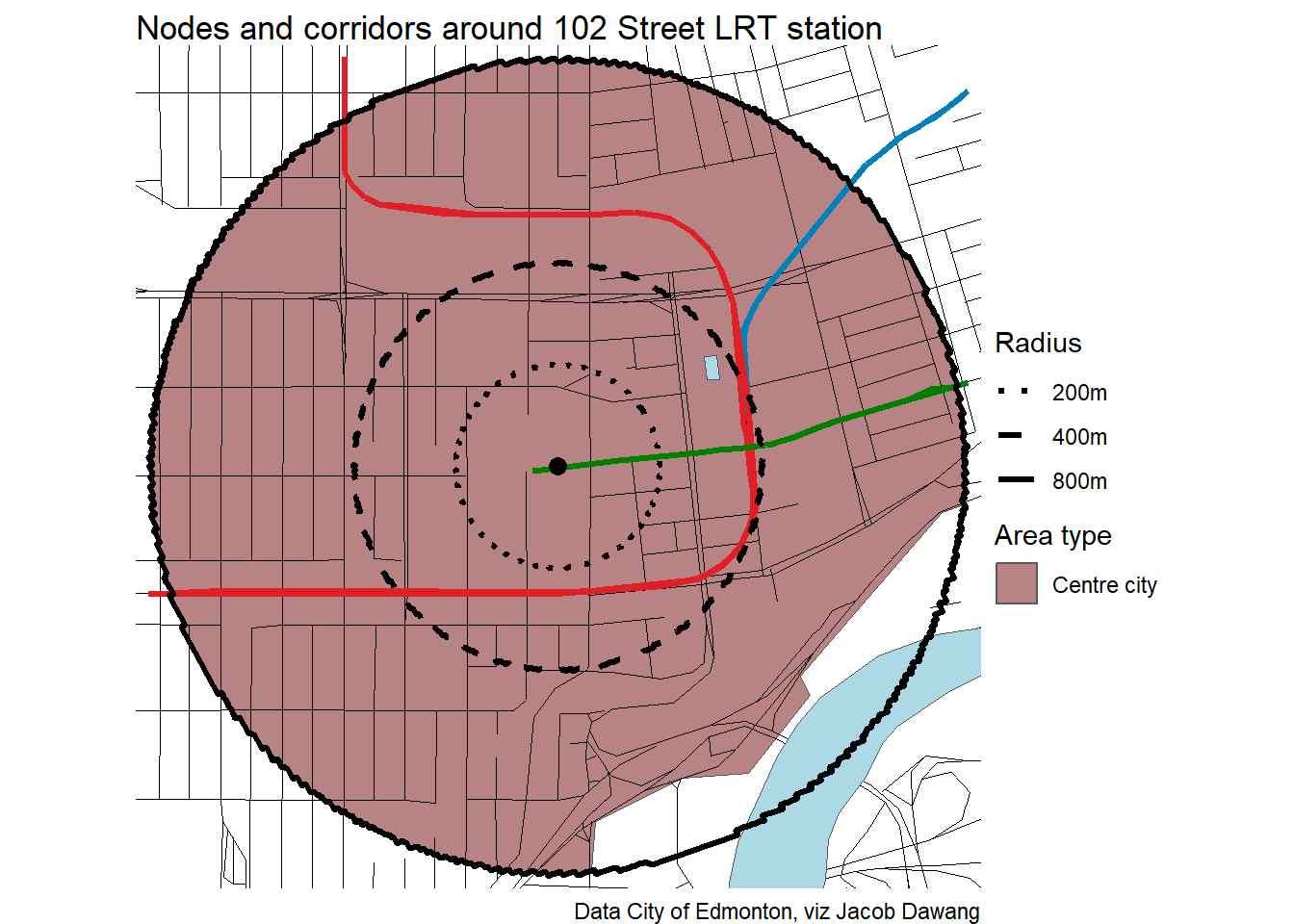
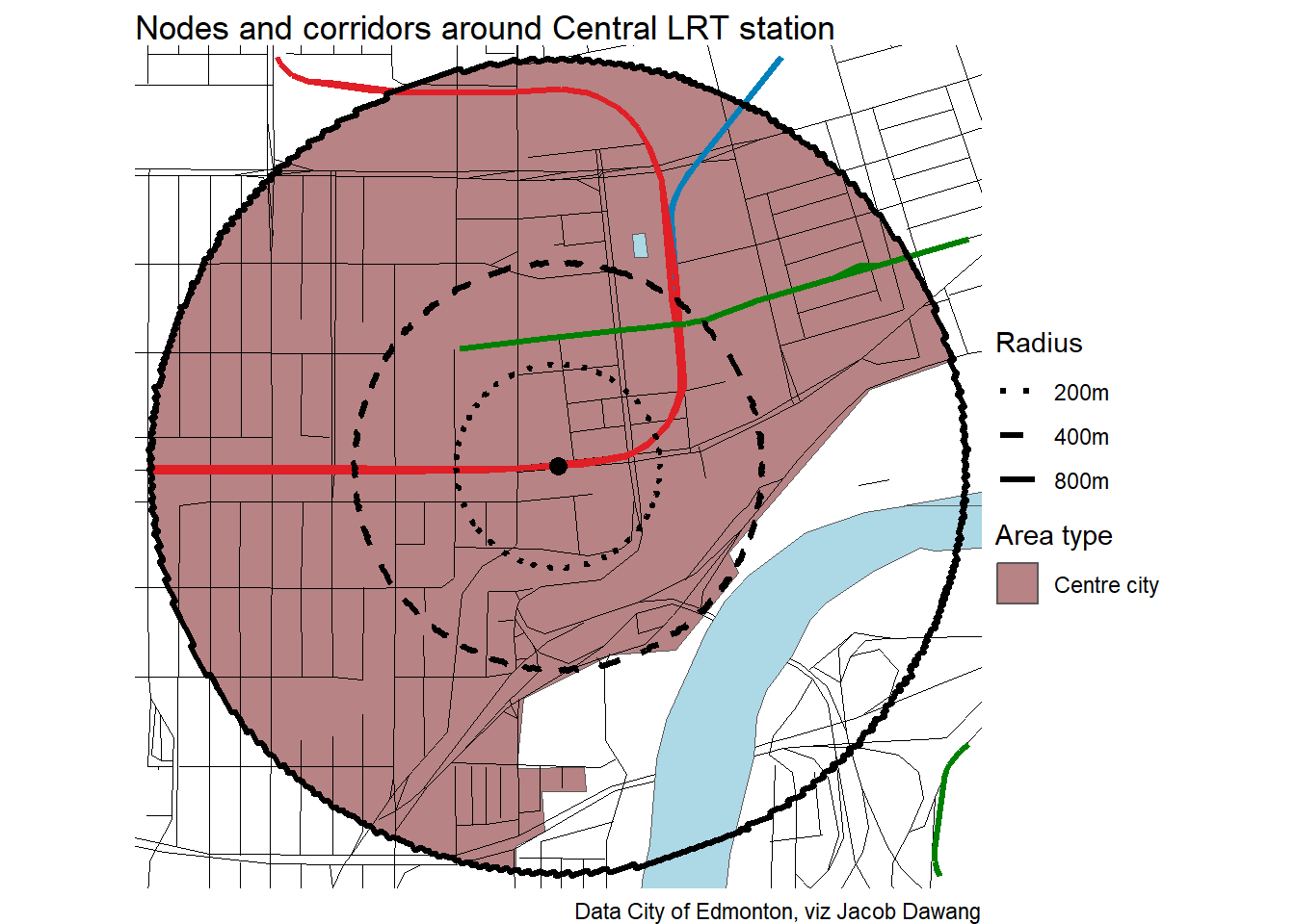
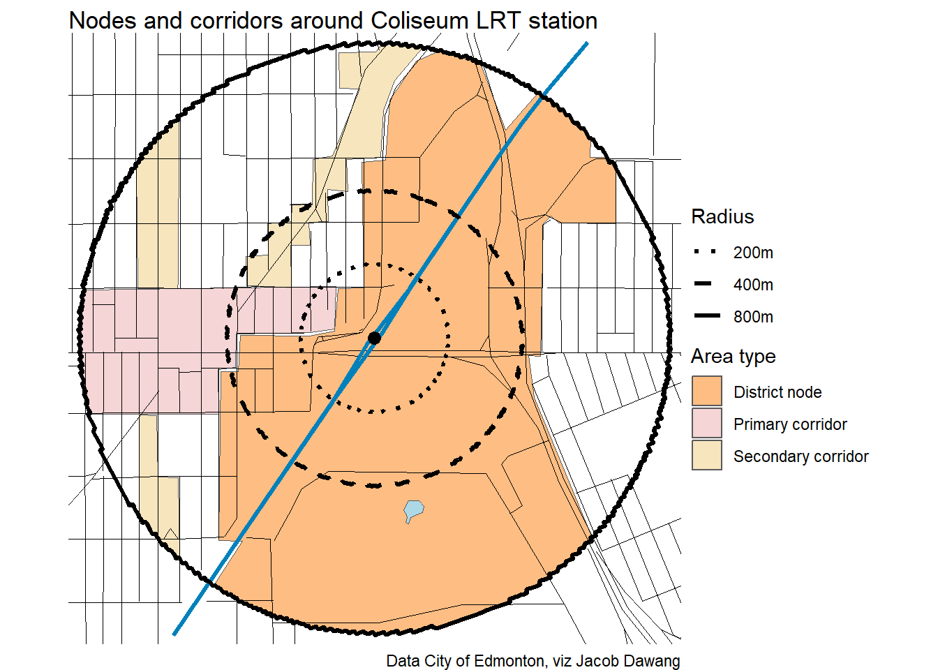
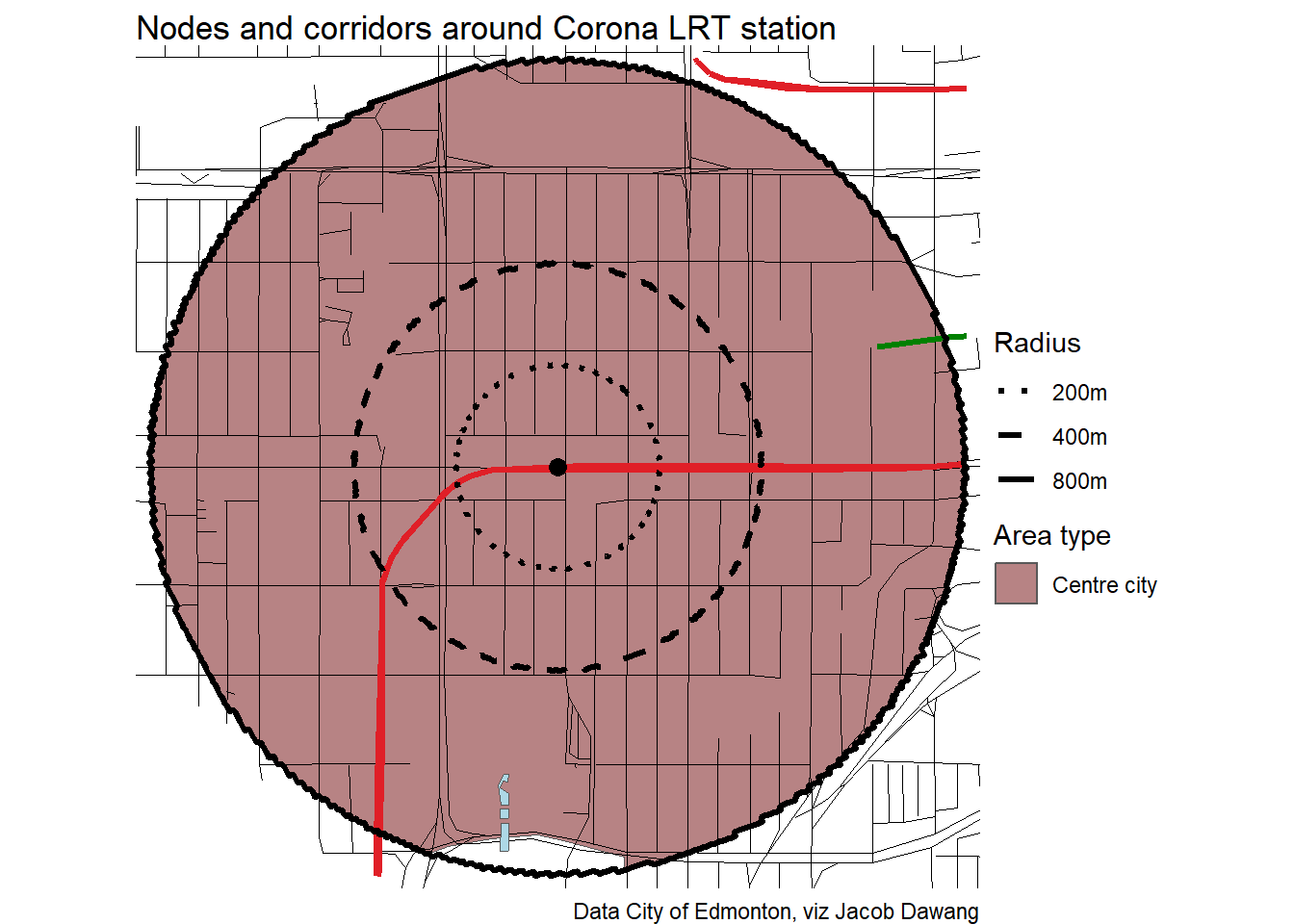
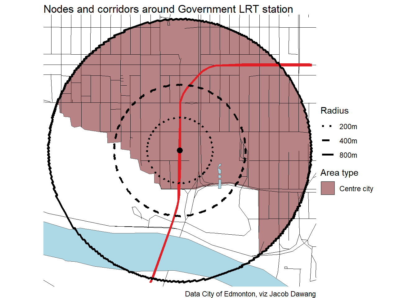
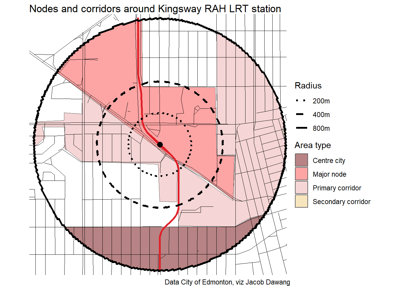
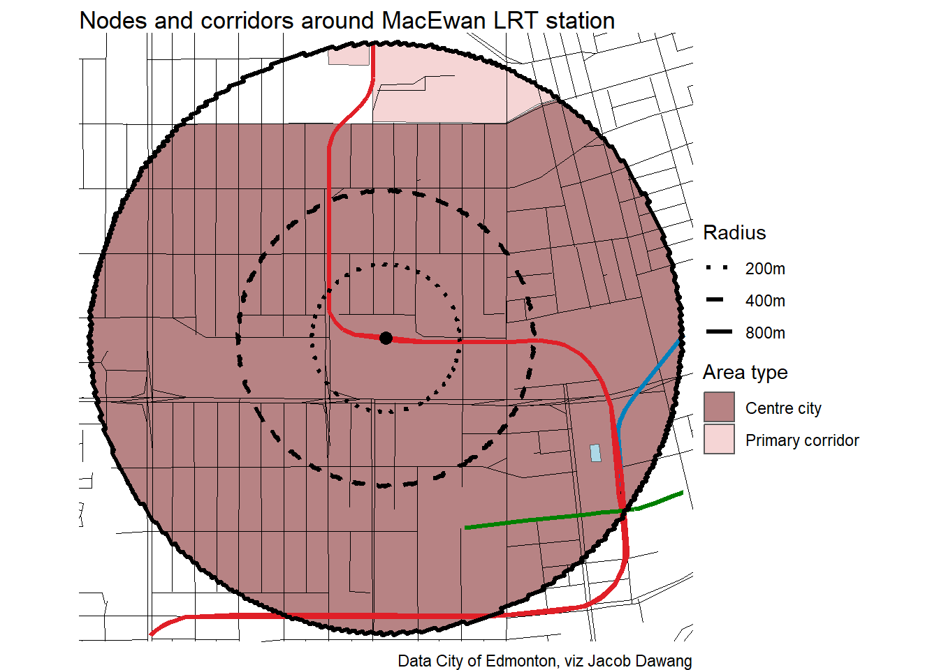
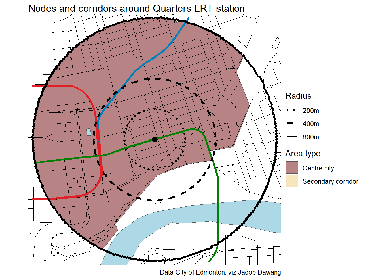
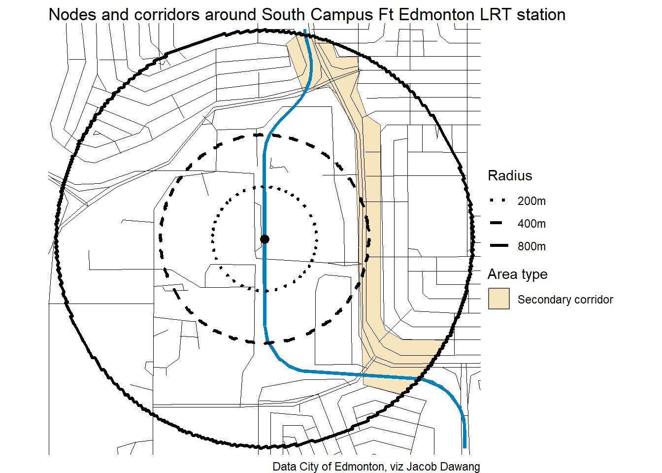
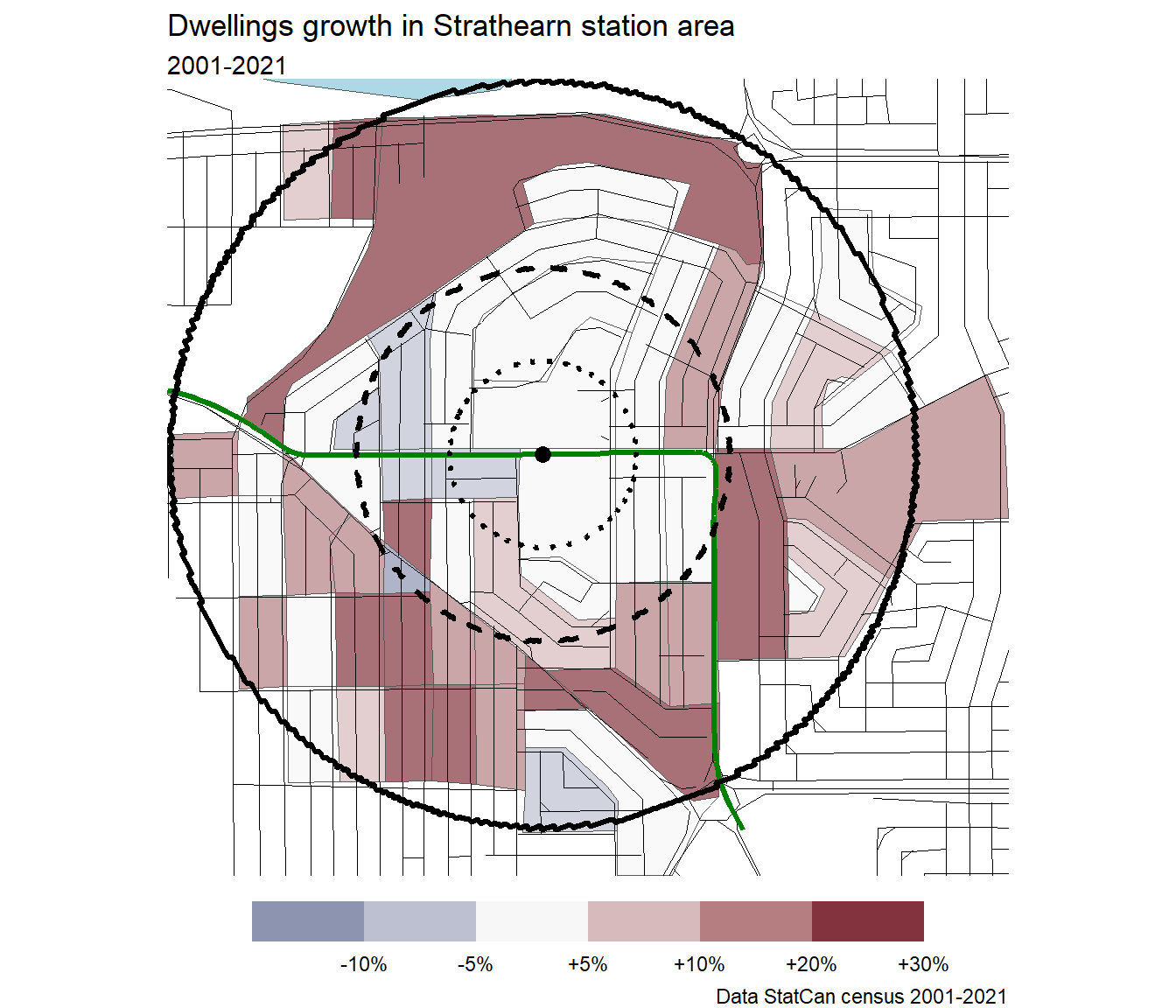
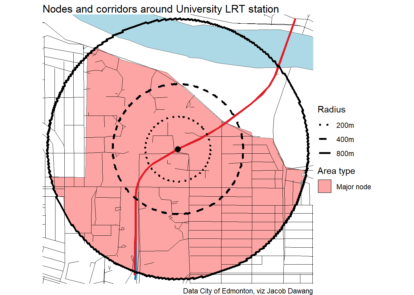
This took a much longer time than expected, as I had to draw the boundaries of the nodes and corridors manually. The Urban Planning Committee directed administration in the fall to show the boundaries of the nodes and corridors as blended, to show that it’s not a hard line. That was undoubtedly a good move, but the resulting maps are not available and I wouldn’t expect the approximate coverage of nodes and corridors to change that much. Here, I have used the old hard bounds from the draft district plans from the fall.
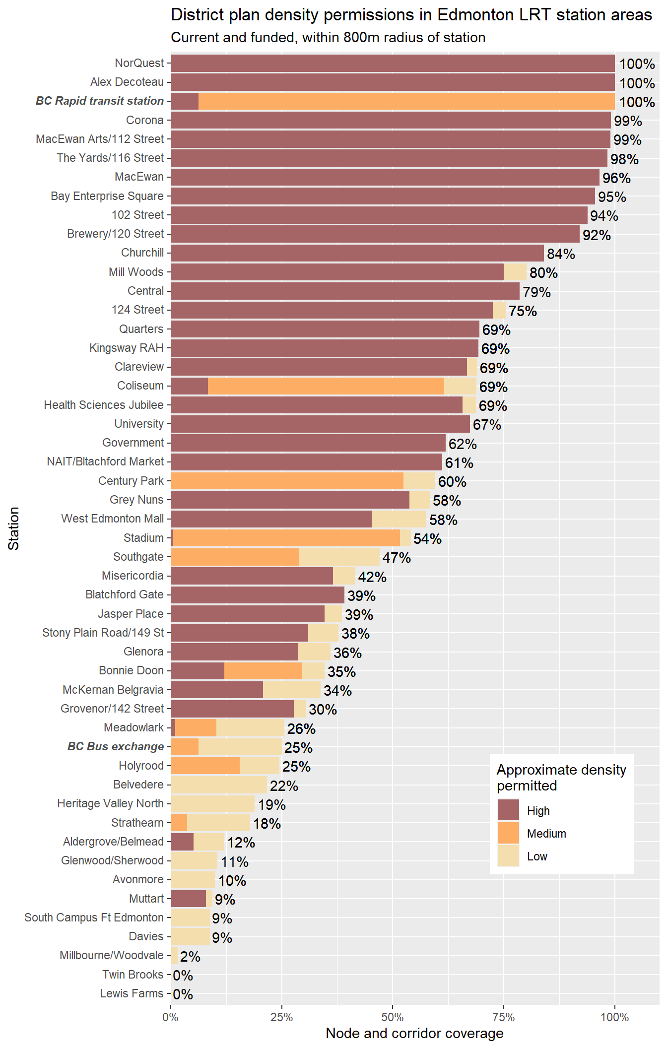
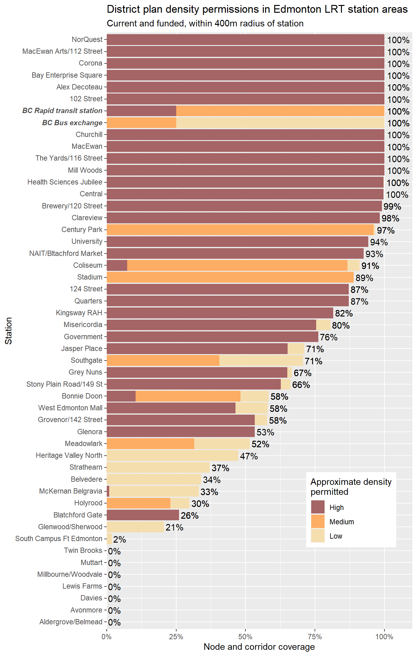
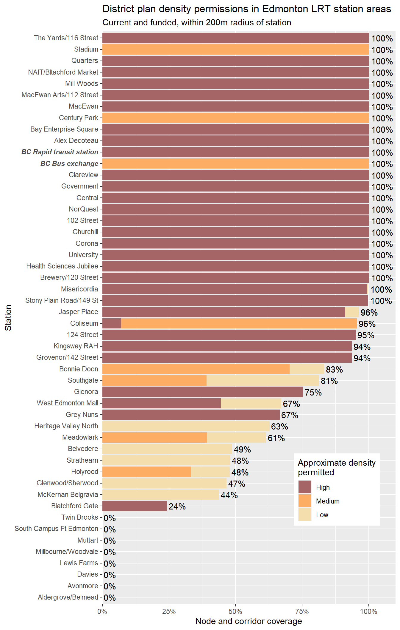
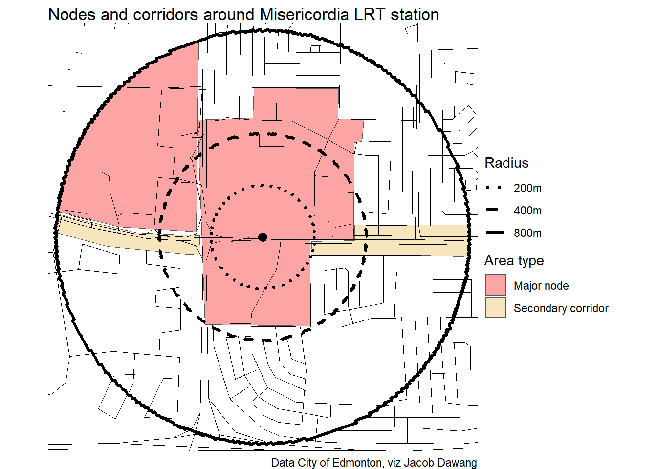
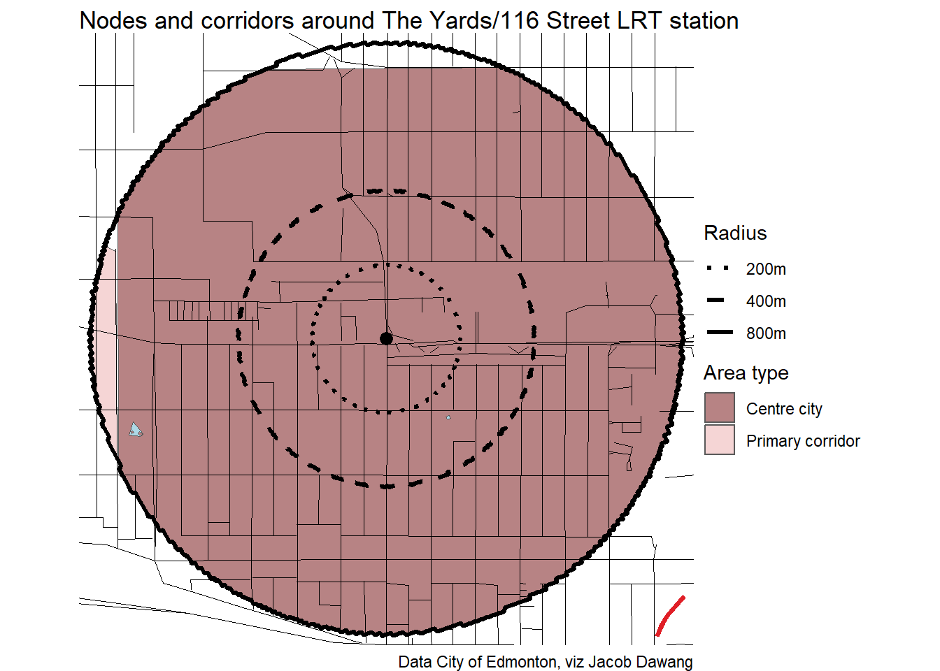
Node and corridor coverage
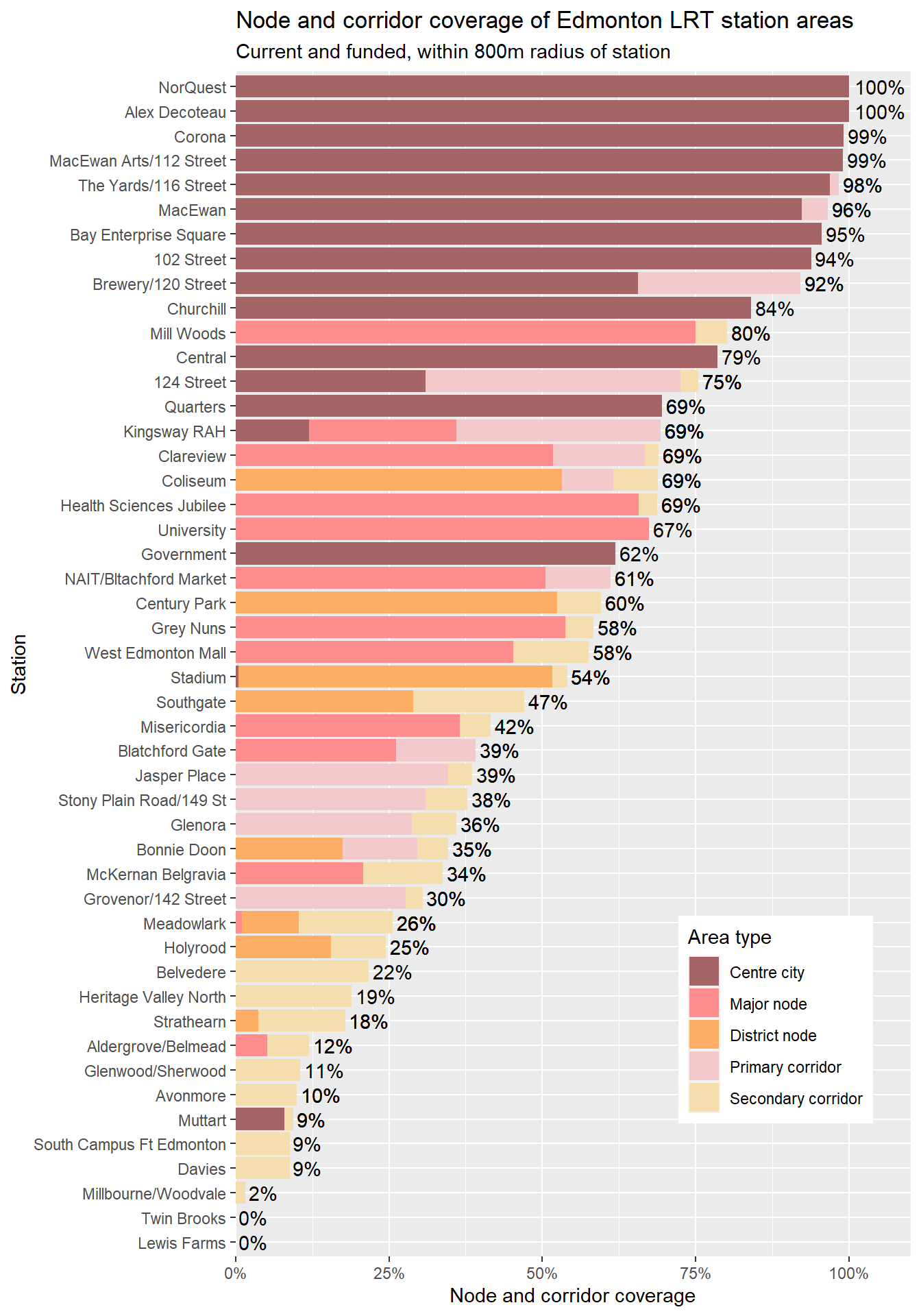
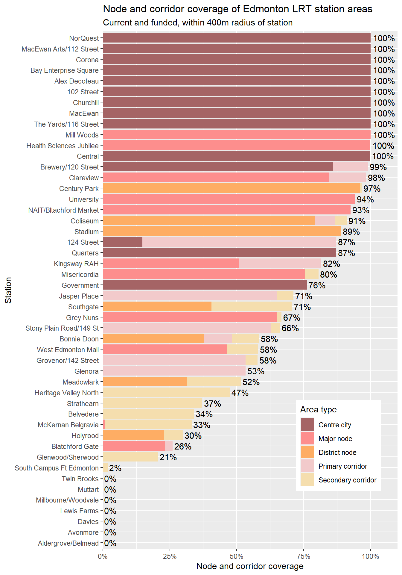
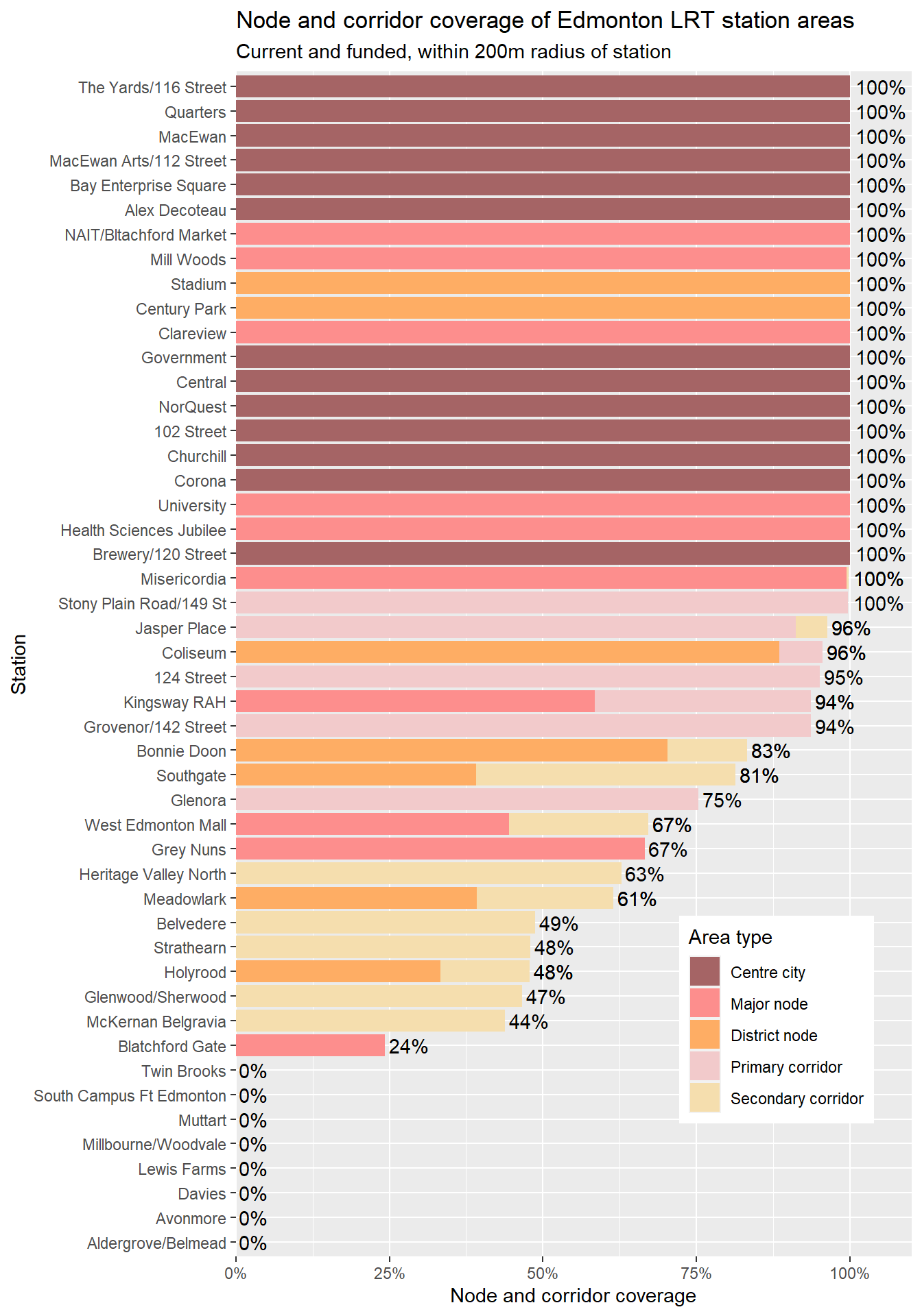
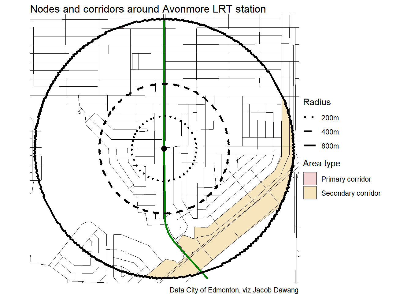
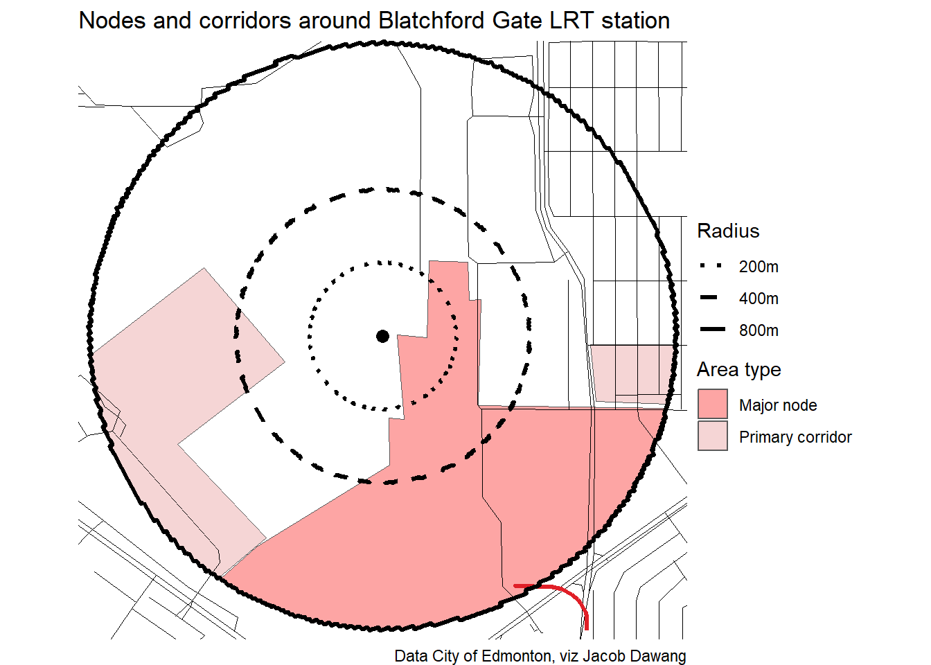
First, here is the raw node and corridor coverage according to the draft district plans for each of the LRT stations. Avonmore is one of the least covered, but is by no means alone. Centre city is the driving factor of the high coverage rates of many stations. Moving down the list, we can see that stations outside of downtown are generally not covered as much by nodes and corridors.
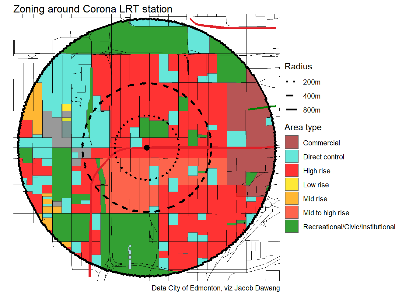
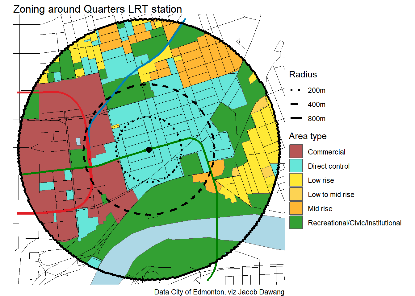
Compared to BC’s TOD policy
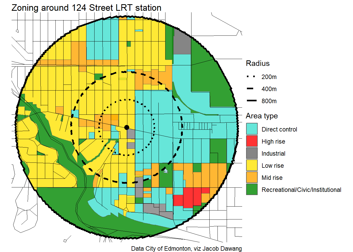
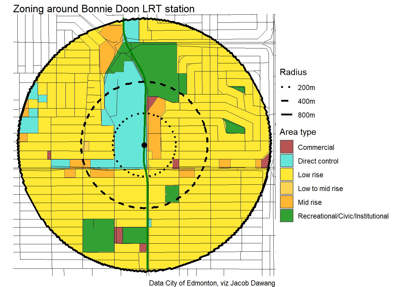
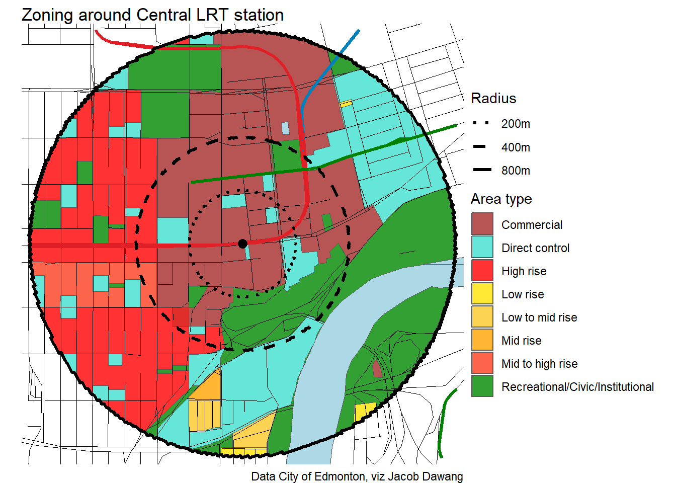
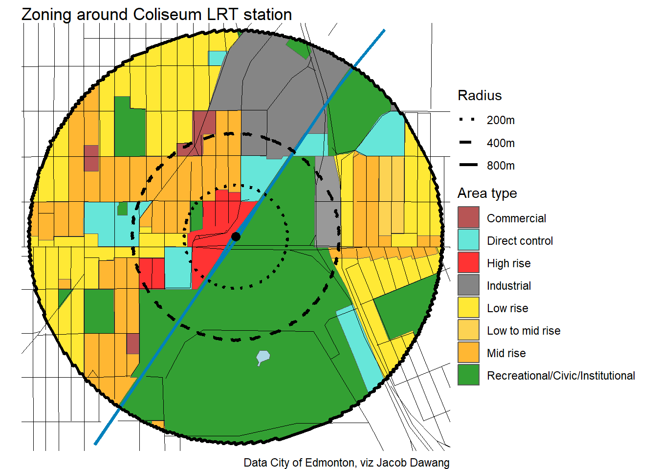
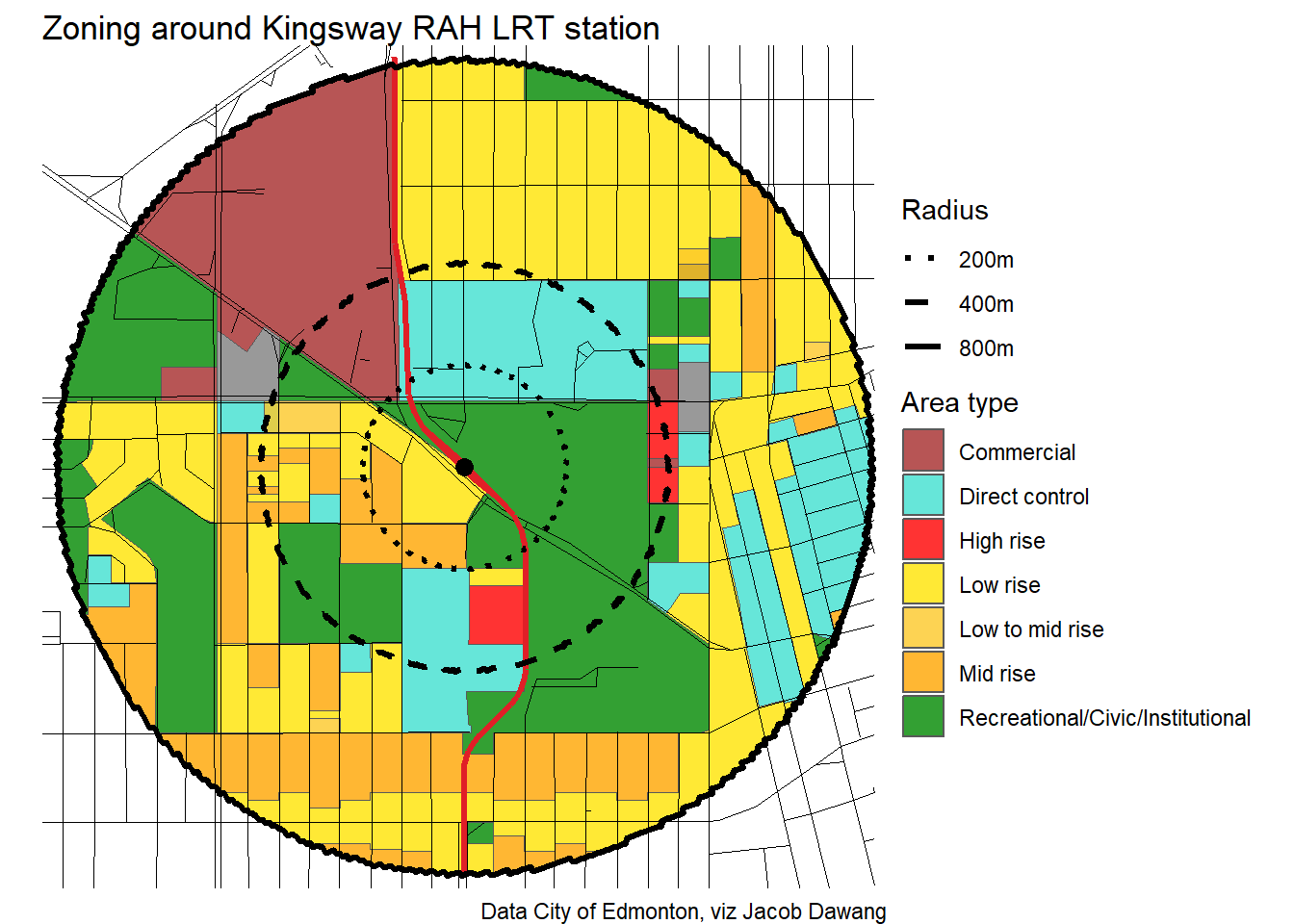
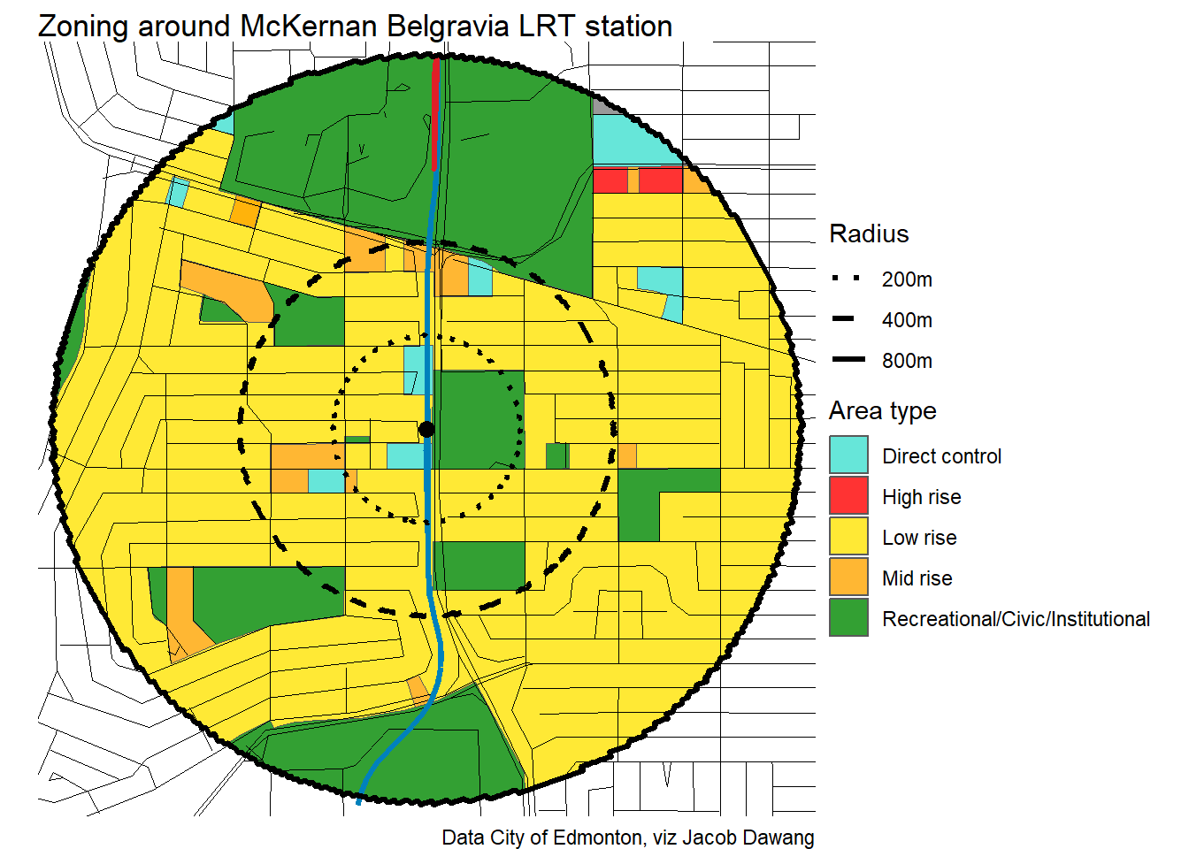
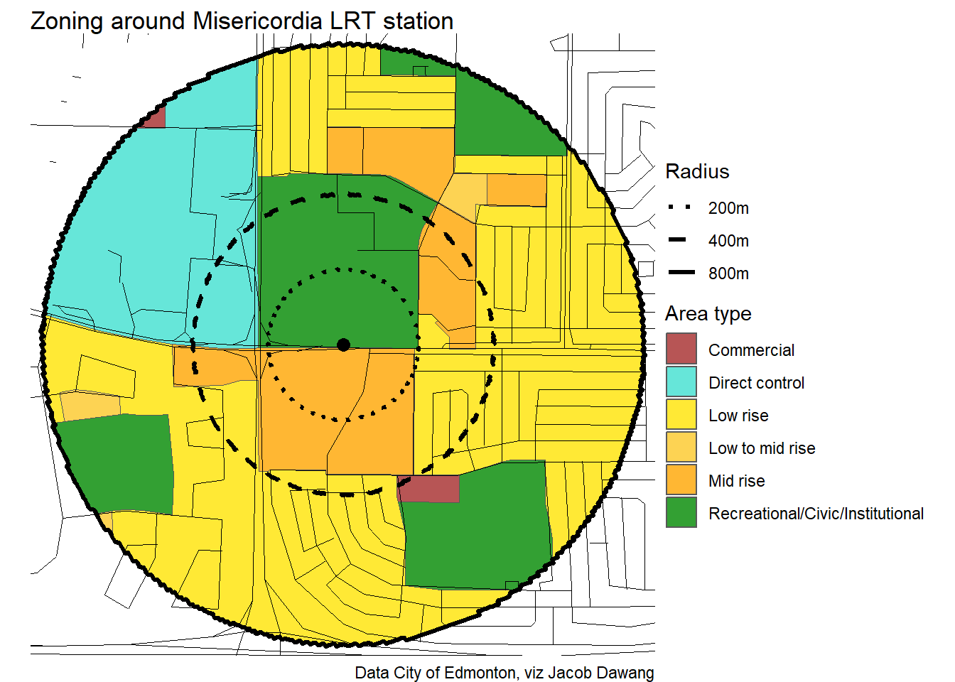
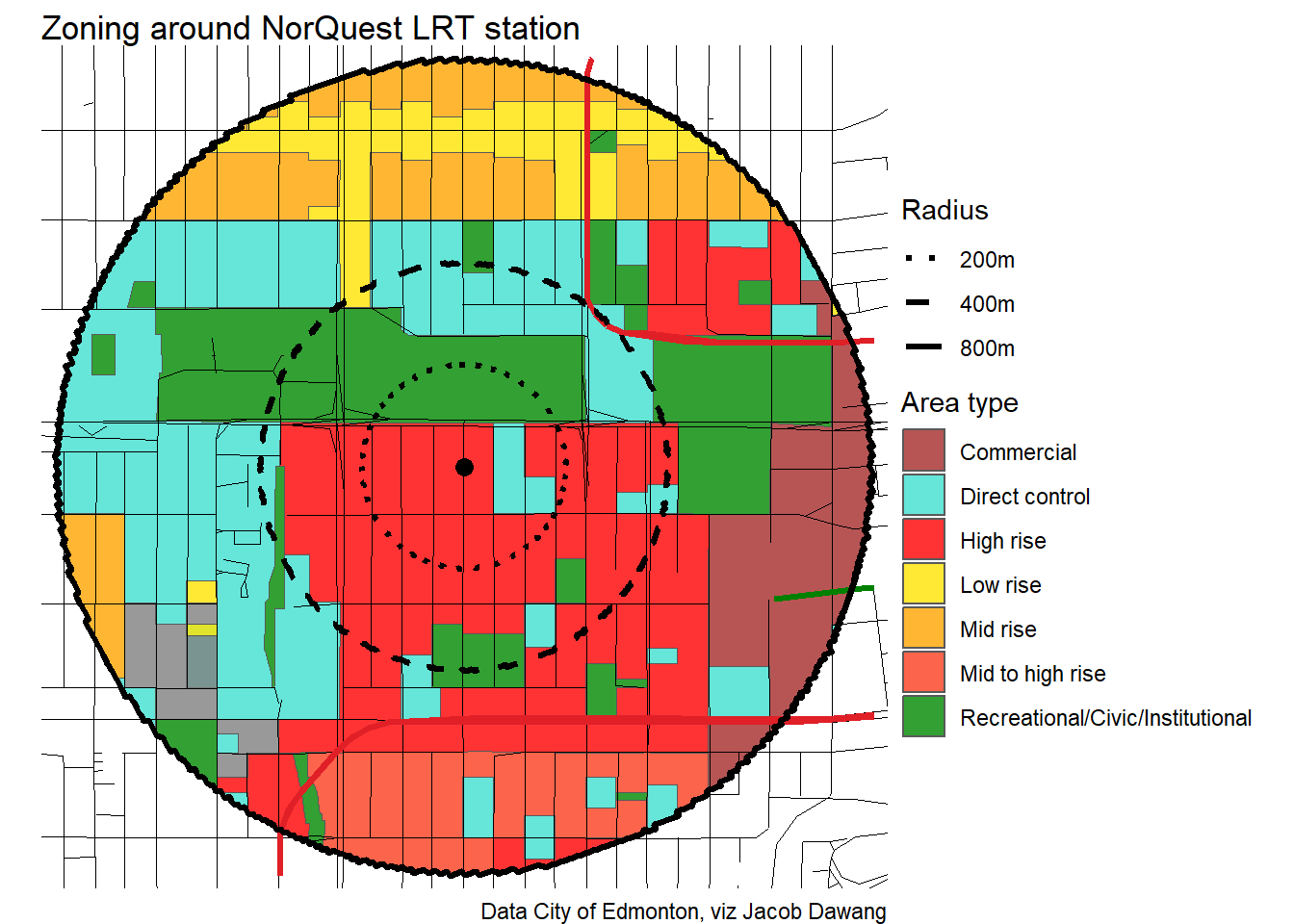
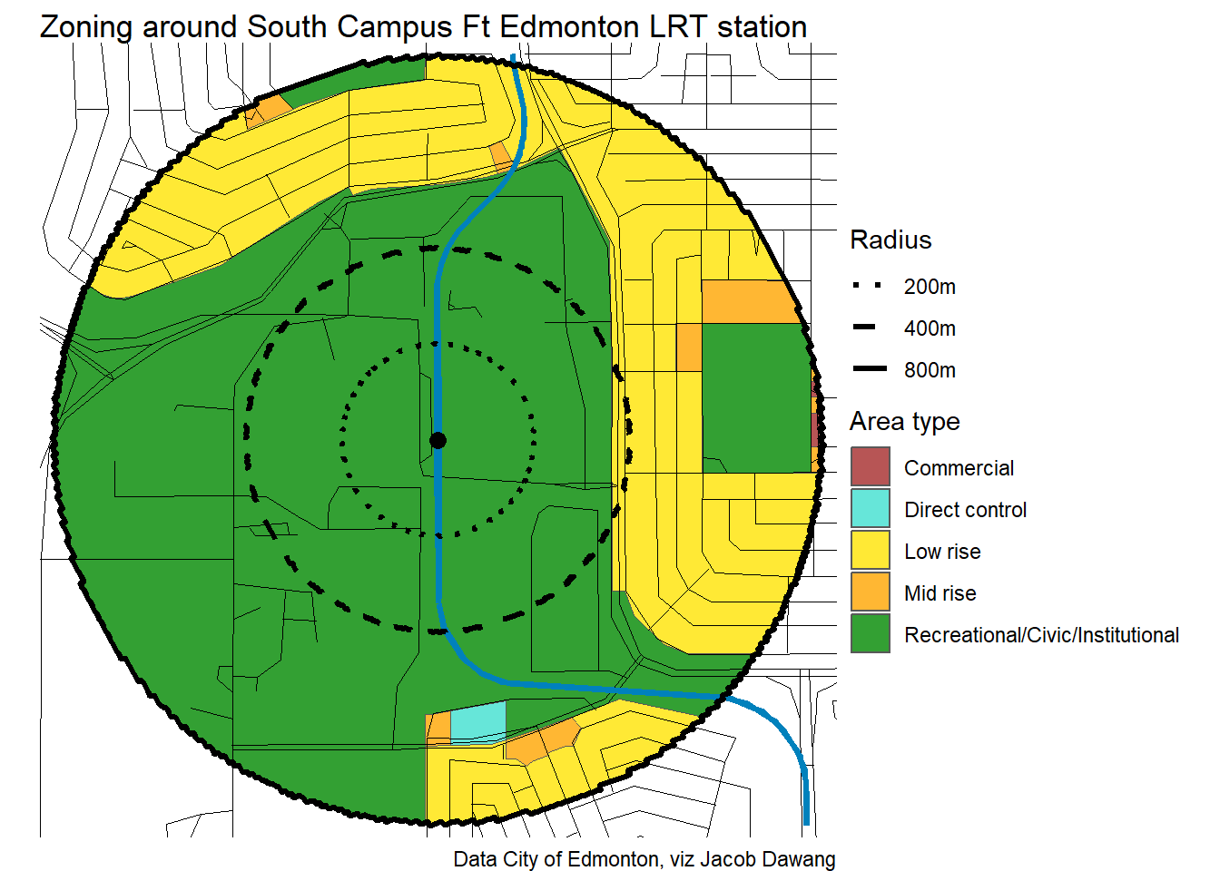
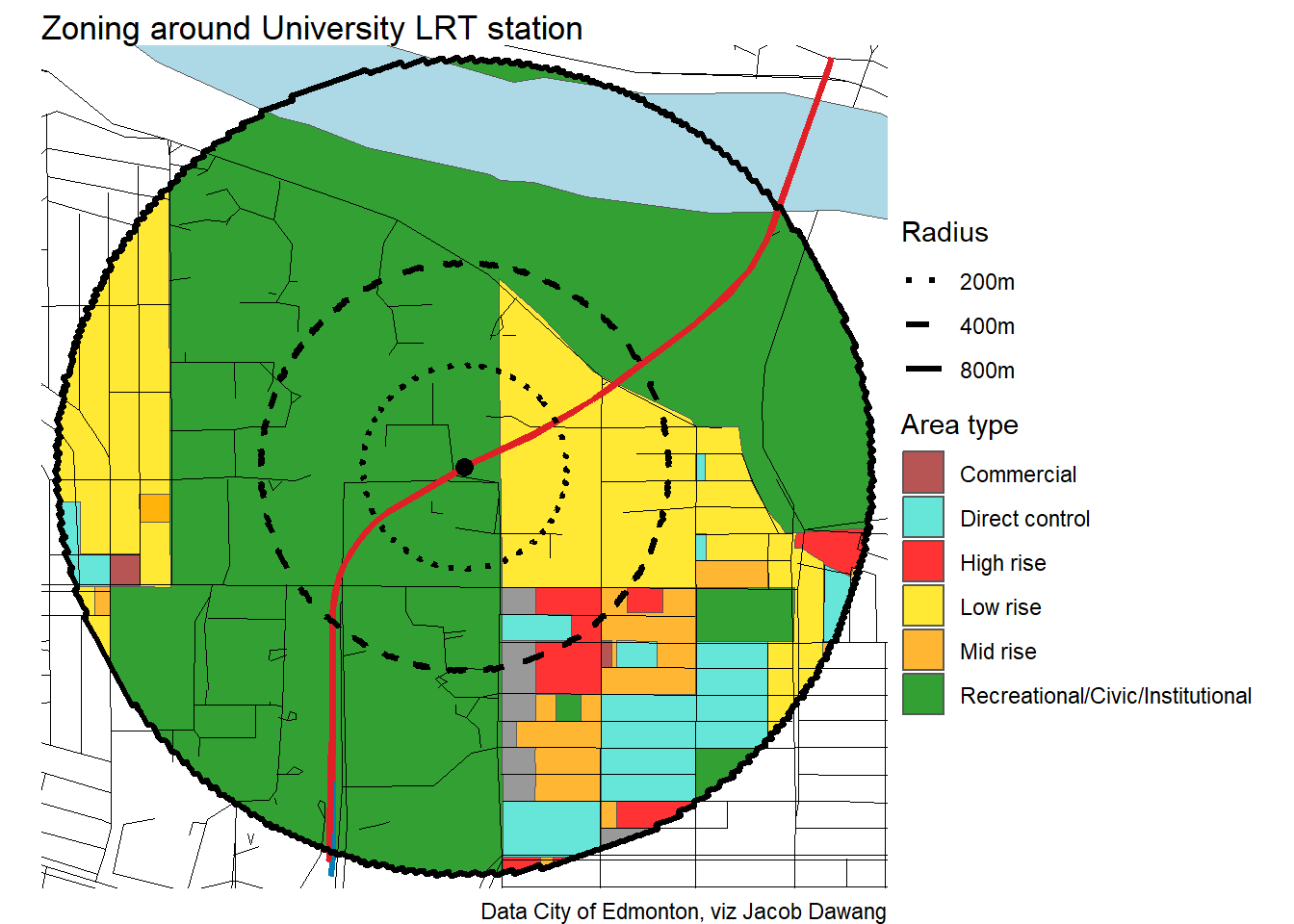
Here, I have combined the nodes and corridors, somewhat subjectively, into larger density buckets to compare them with British Columbia’s new TOD policy. We should be aiming to be permitting at least as much housing as BC is around their rapid transit stations. At the very least, we should be concerned when some of the LRT stations in residential areas are proposed to have less planning for higher density than BC bus exchanges. Some of the stations that would benefit from increased density permissions include McKernan Belgravia, Holyrood, and Glenwood/Sherwood. But, even stations like Bonnie Doon and Southgate would benefit from higher density permissions, as they designate the mall lands for higher density and not much else outside of it. In the end, LRT stations having better proposed land use than a generic bus exchange in our neighbouring province is not a cause for celebration, but a reminder that we need to strive for better.
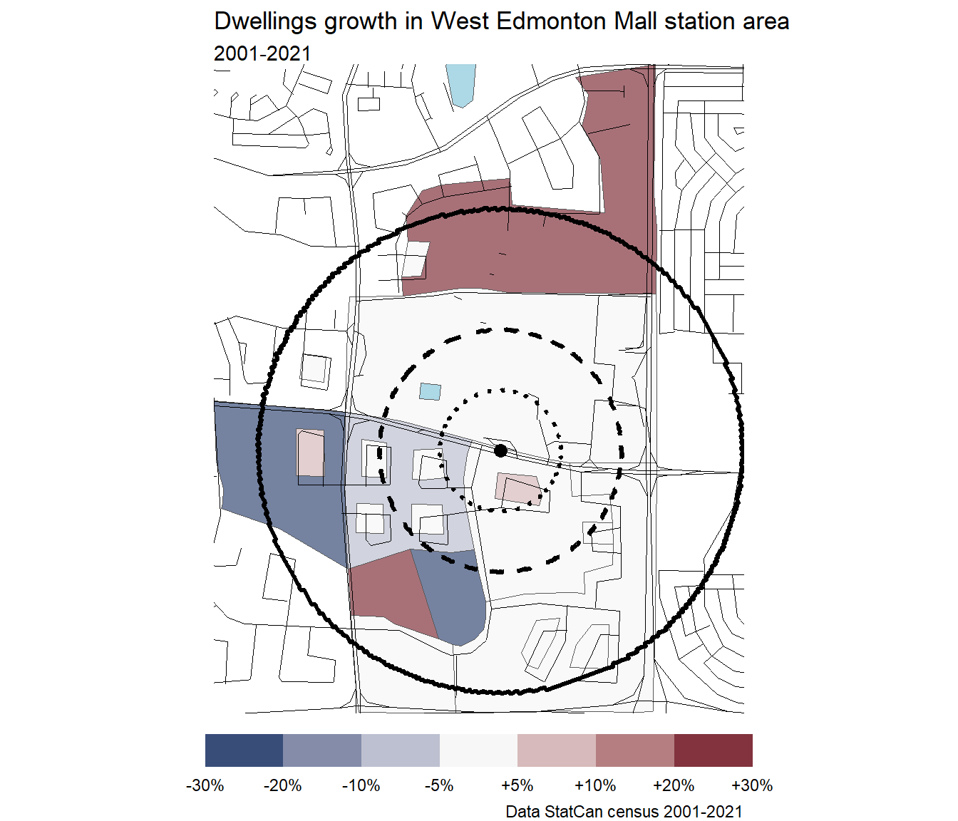
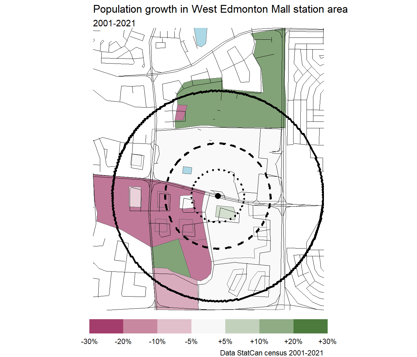
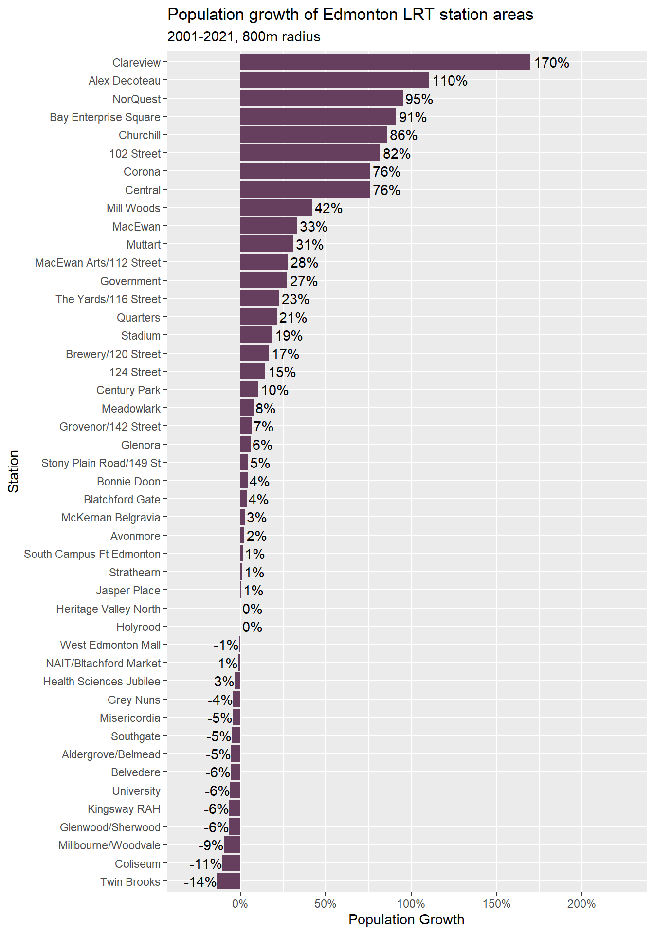
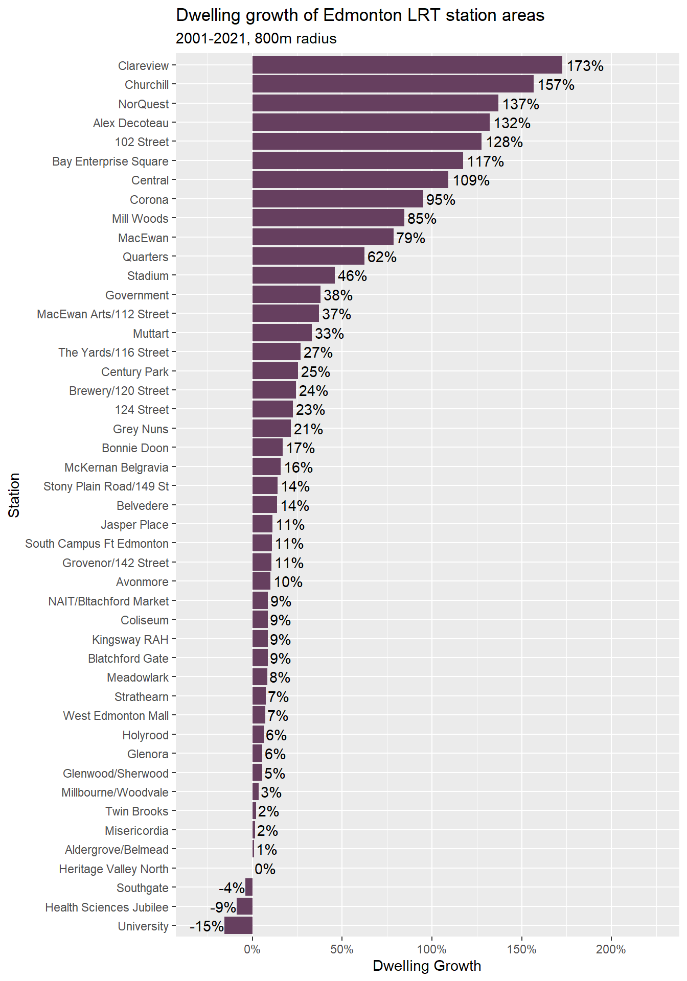
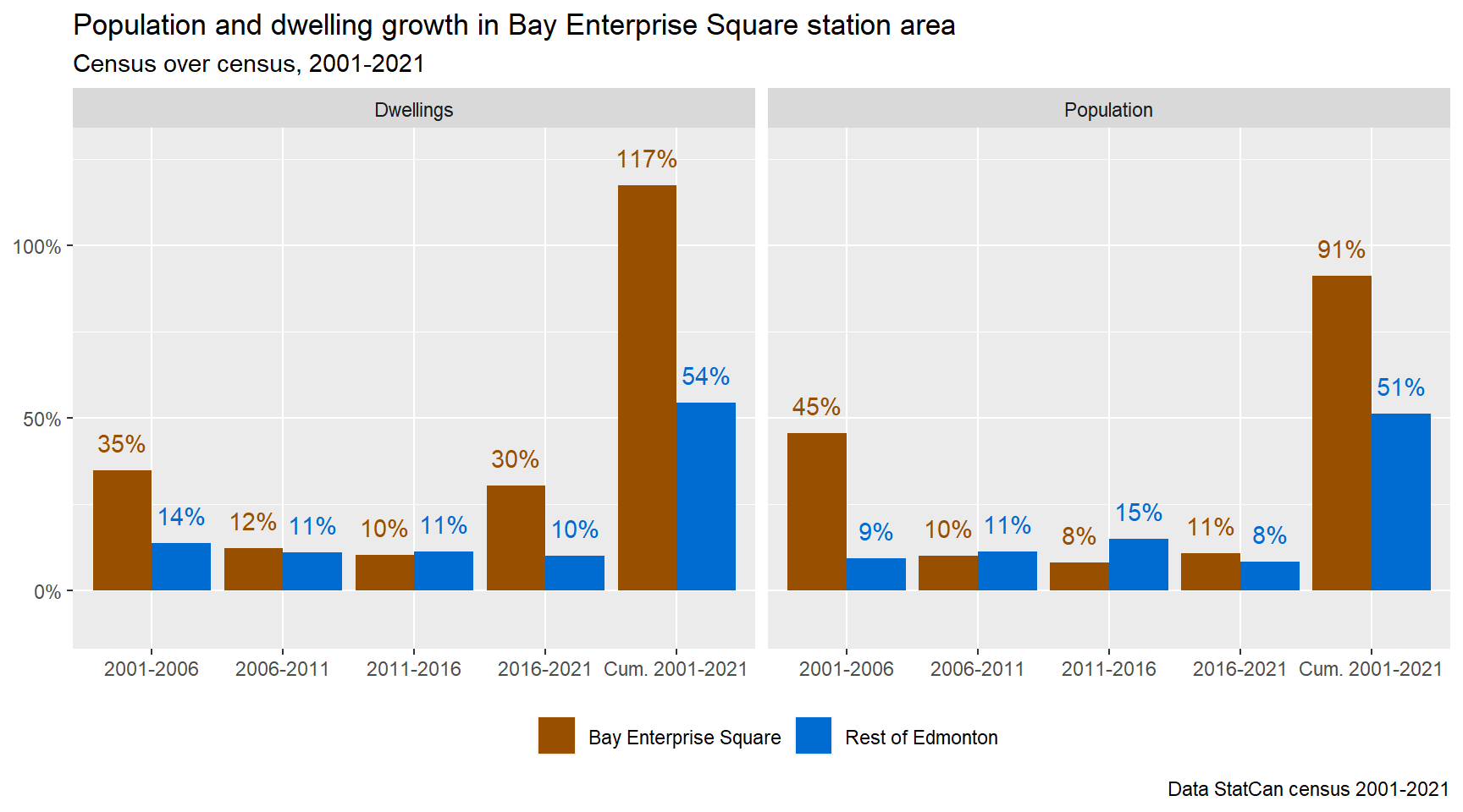
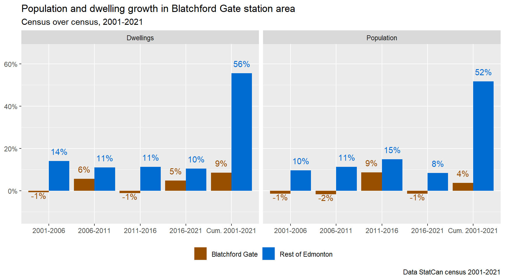
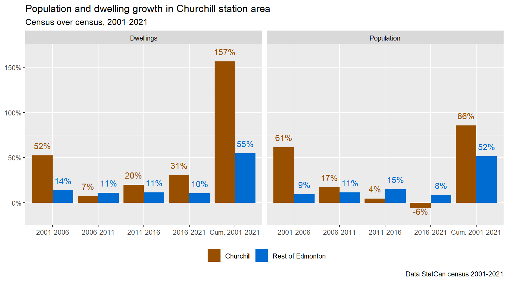
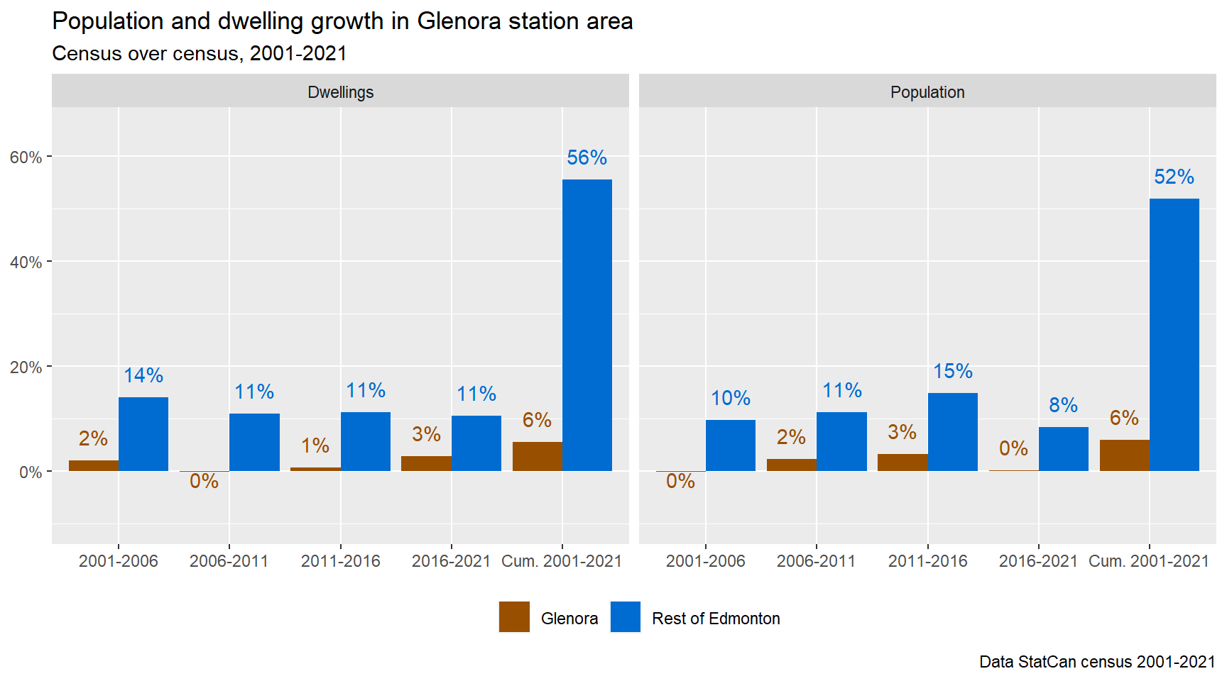
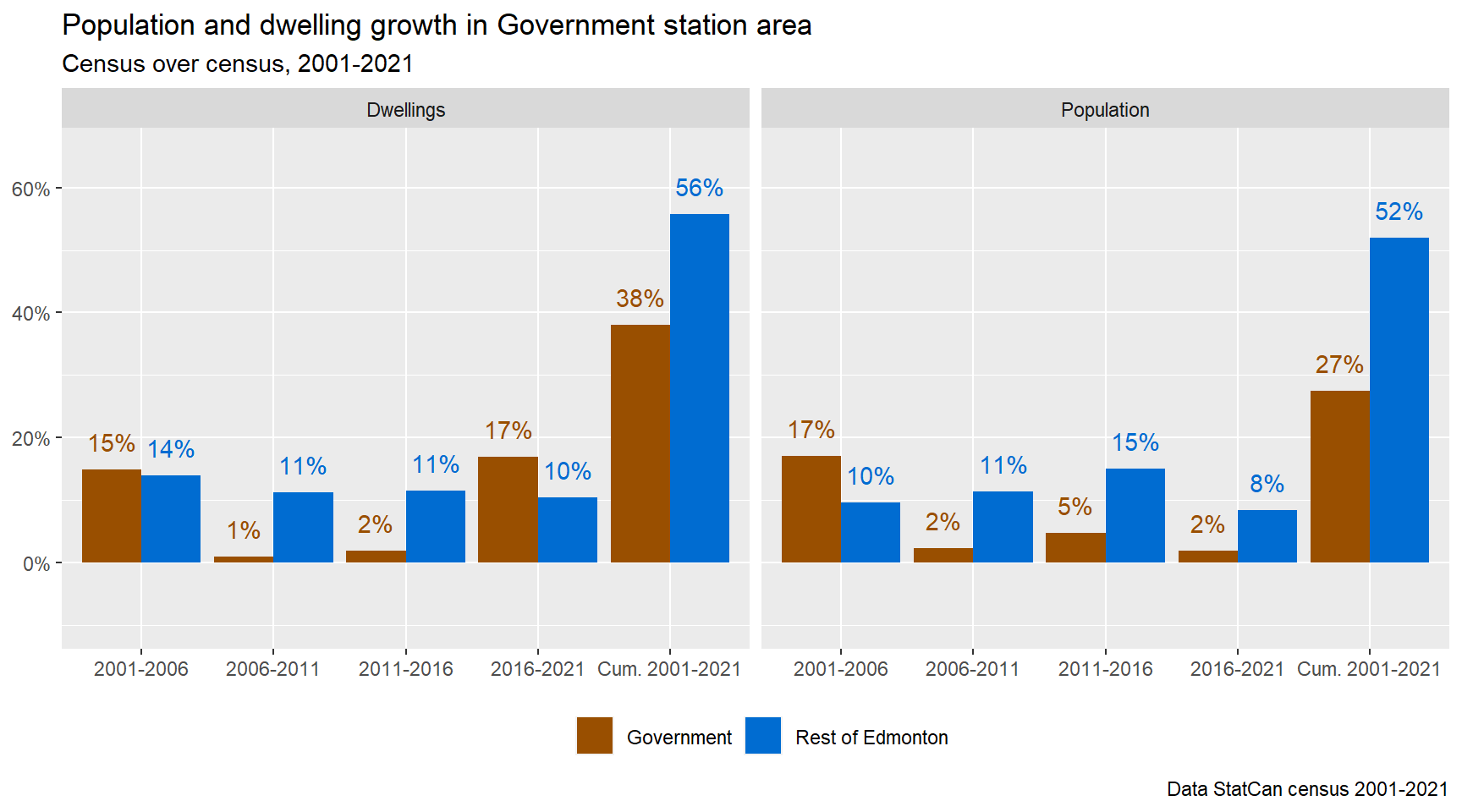
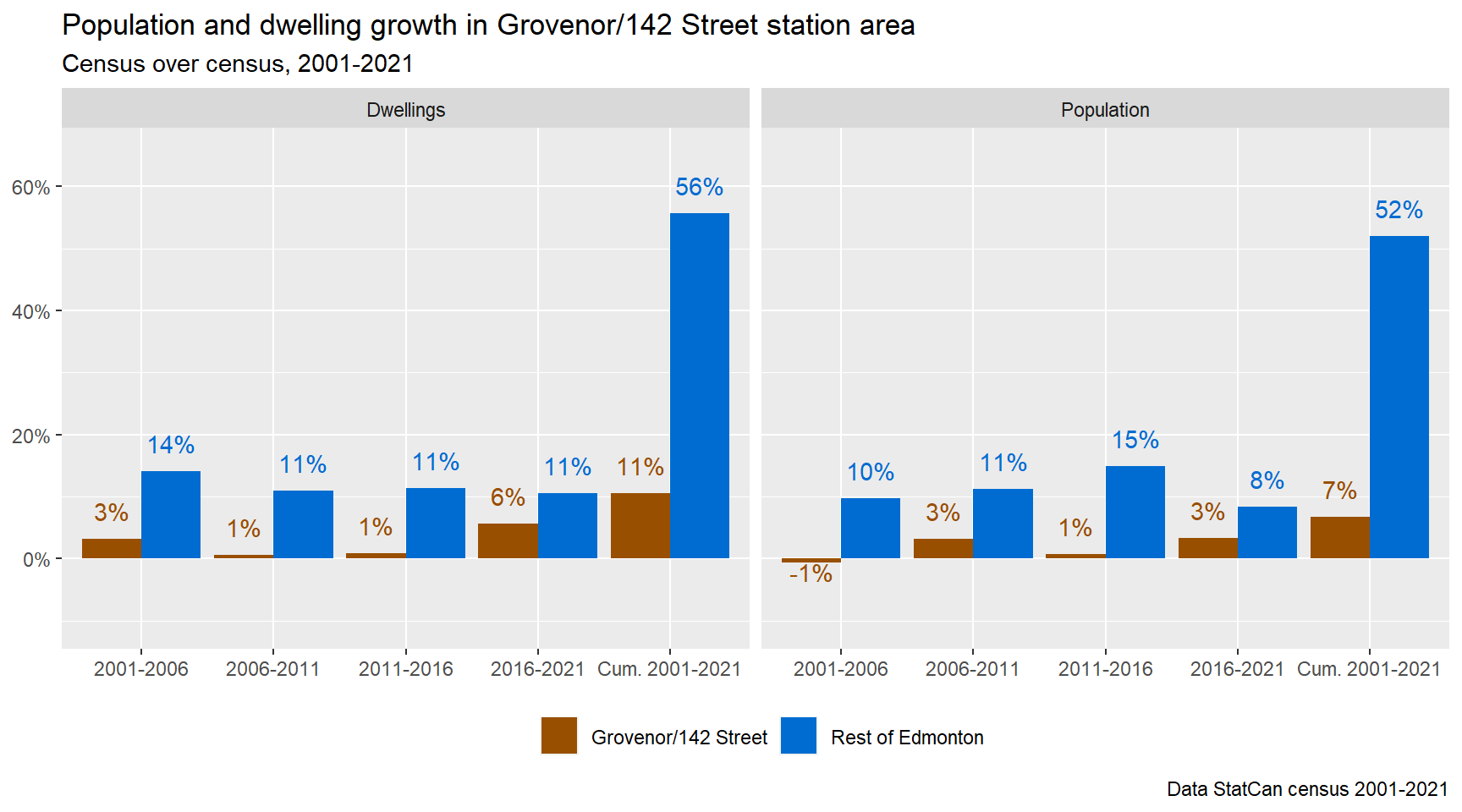
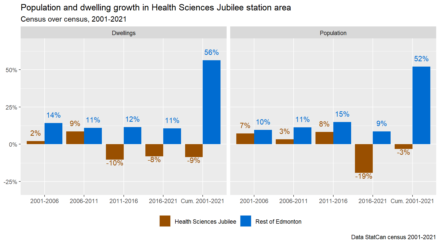
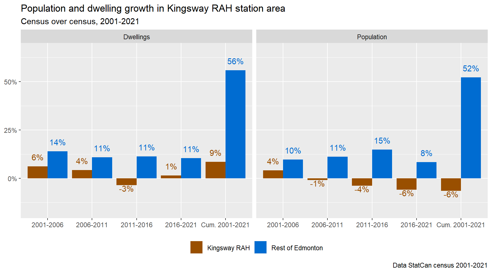
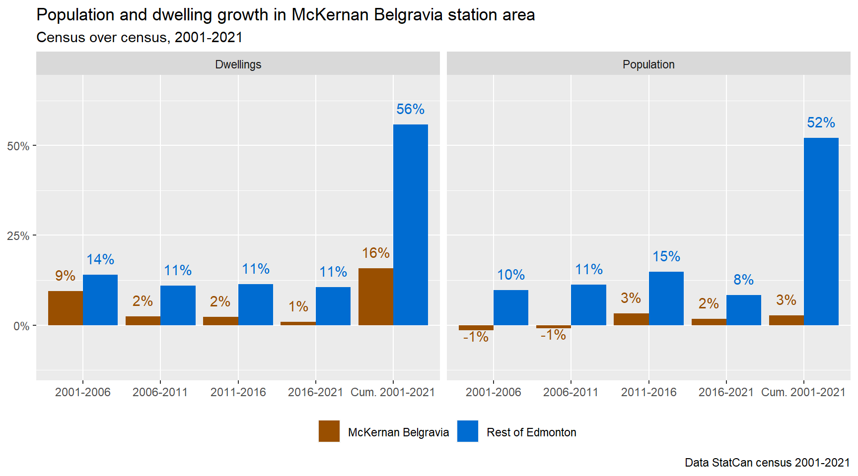
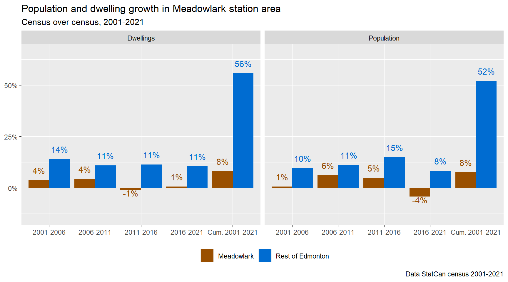
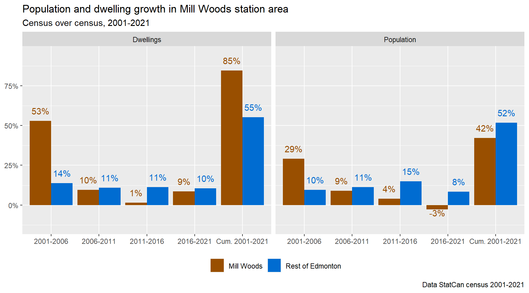
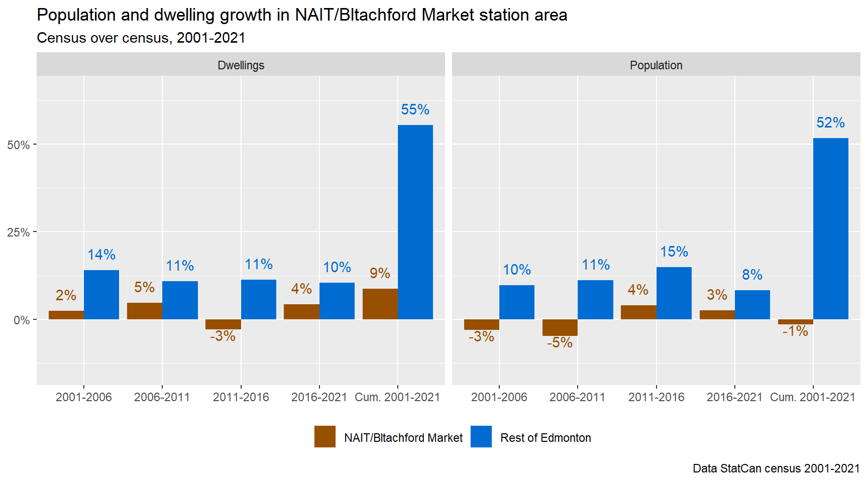
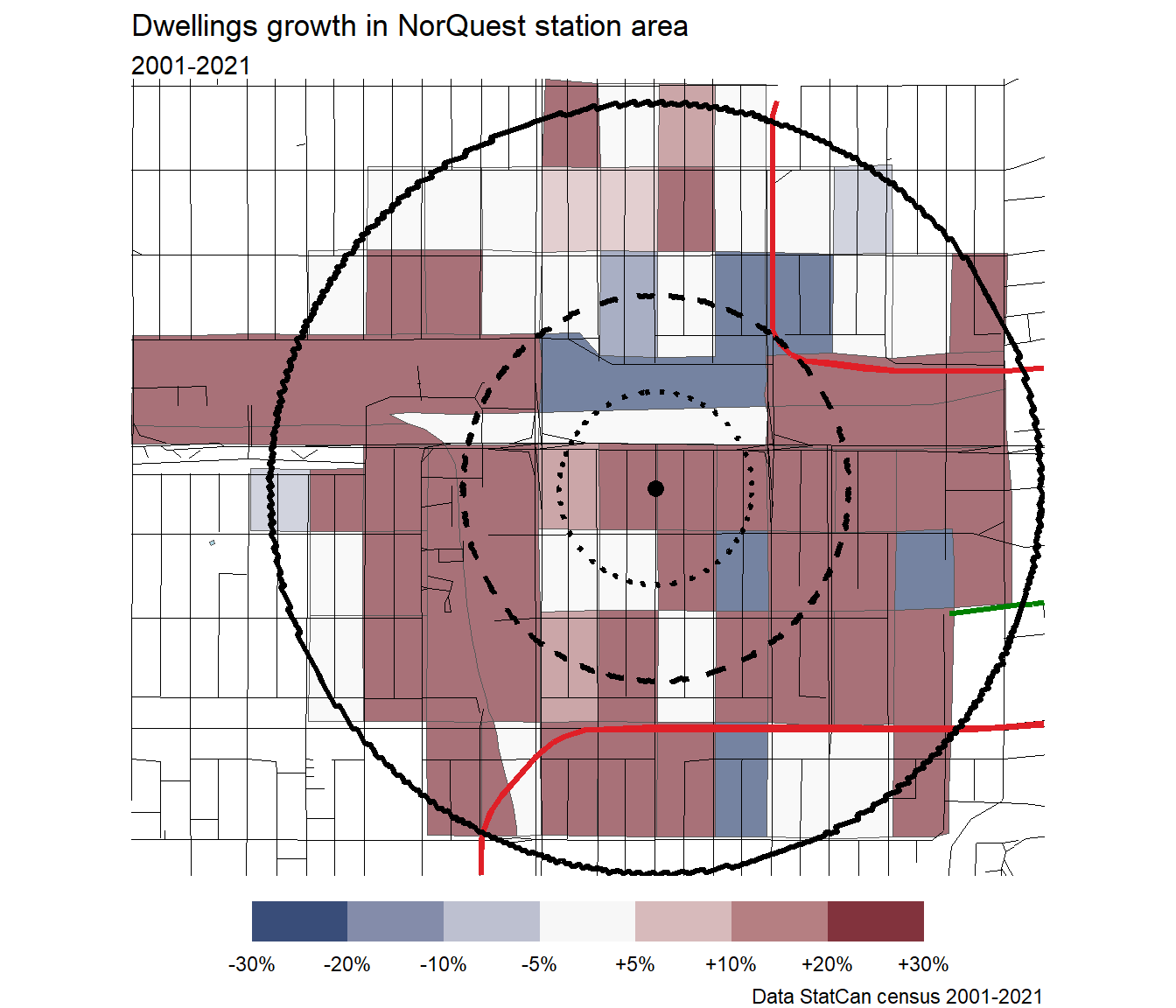
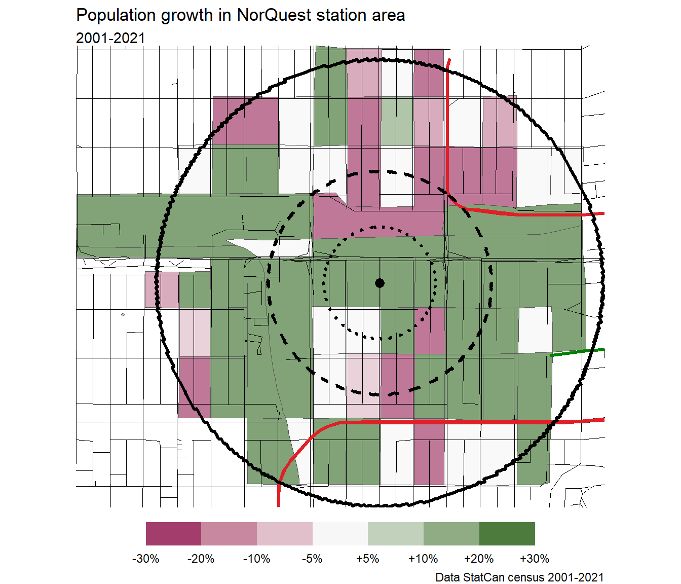
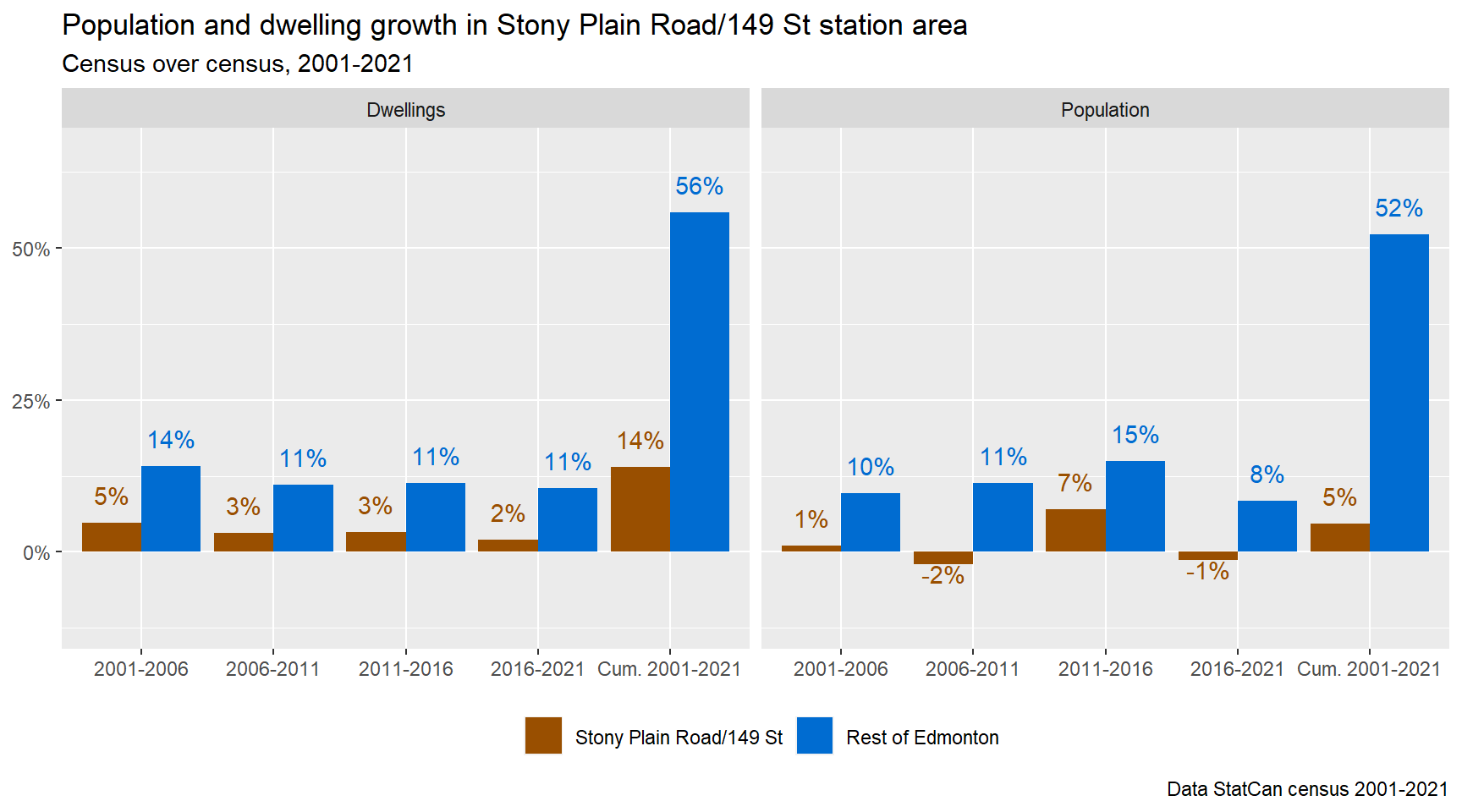
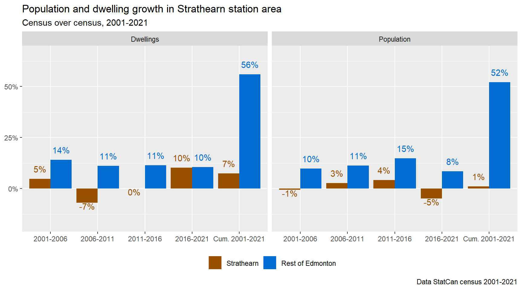
Growth power ranking
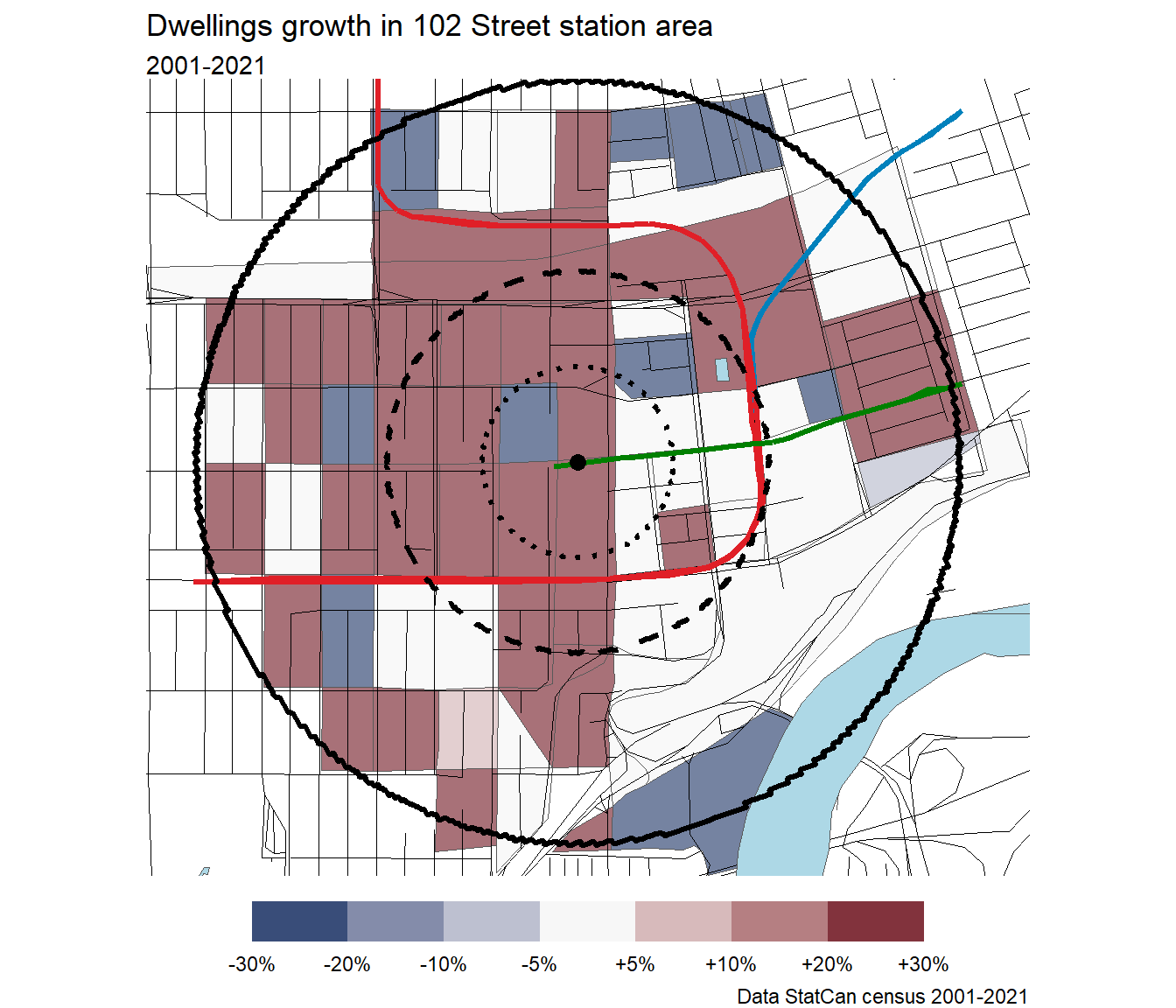
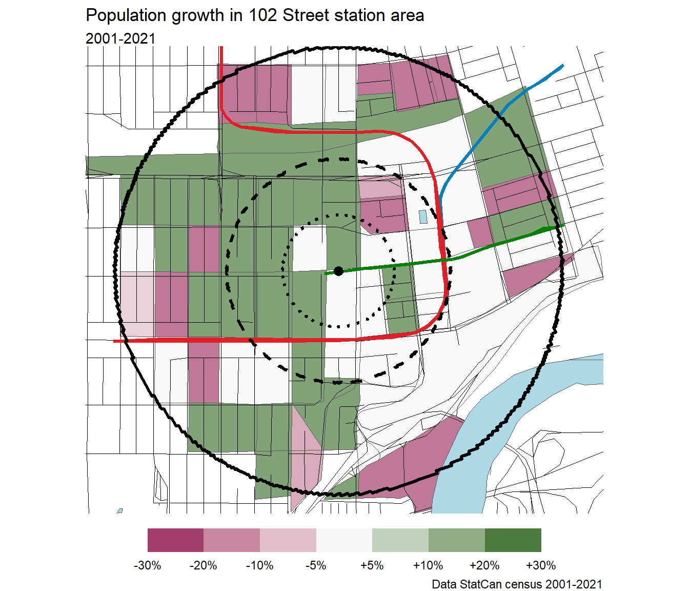
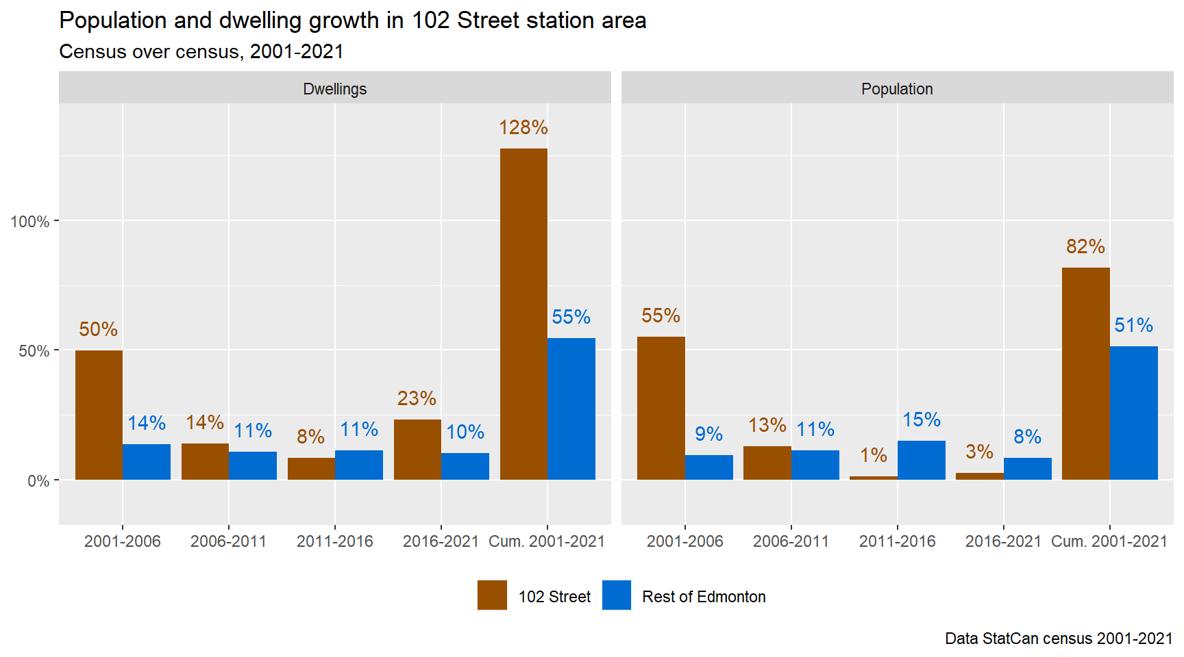
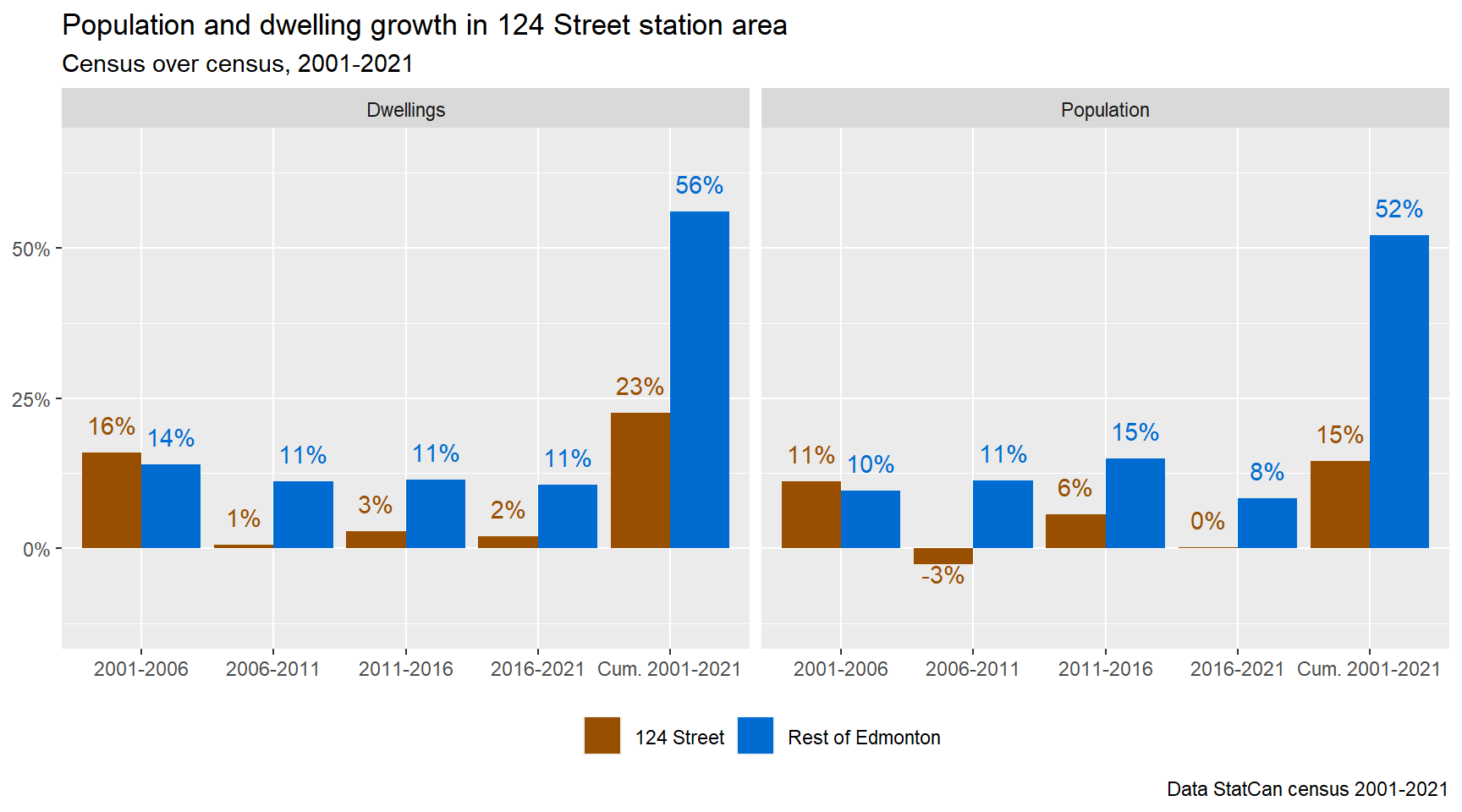
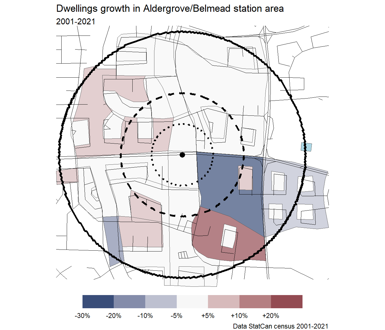
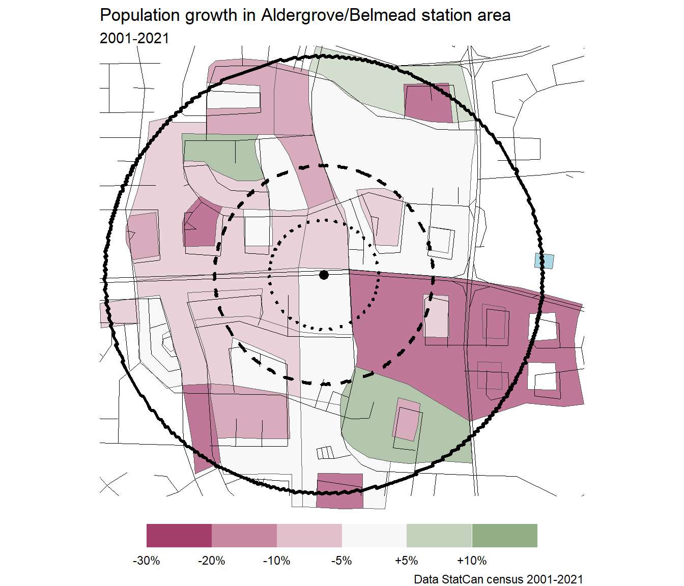
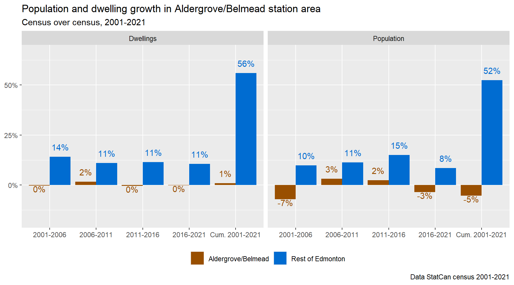
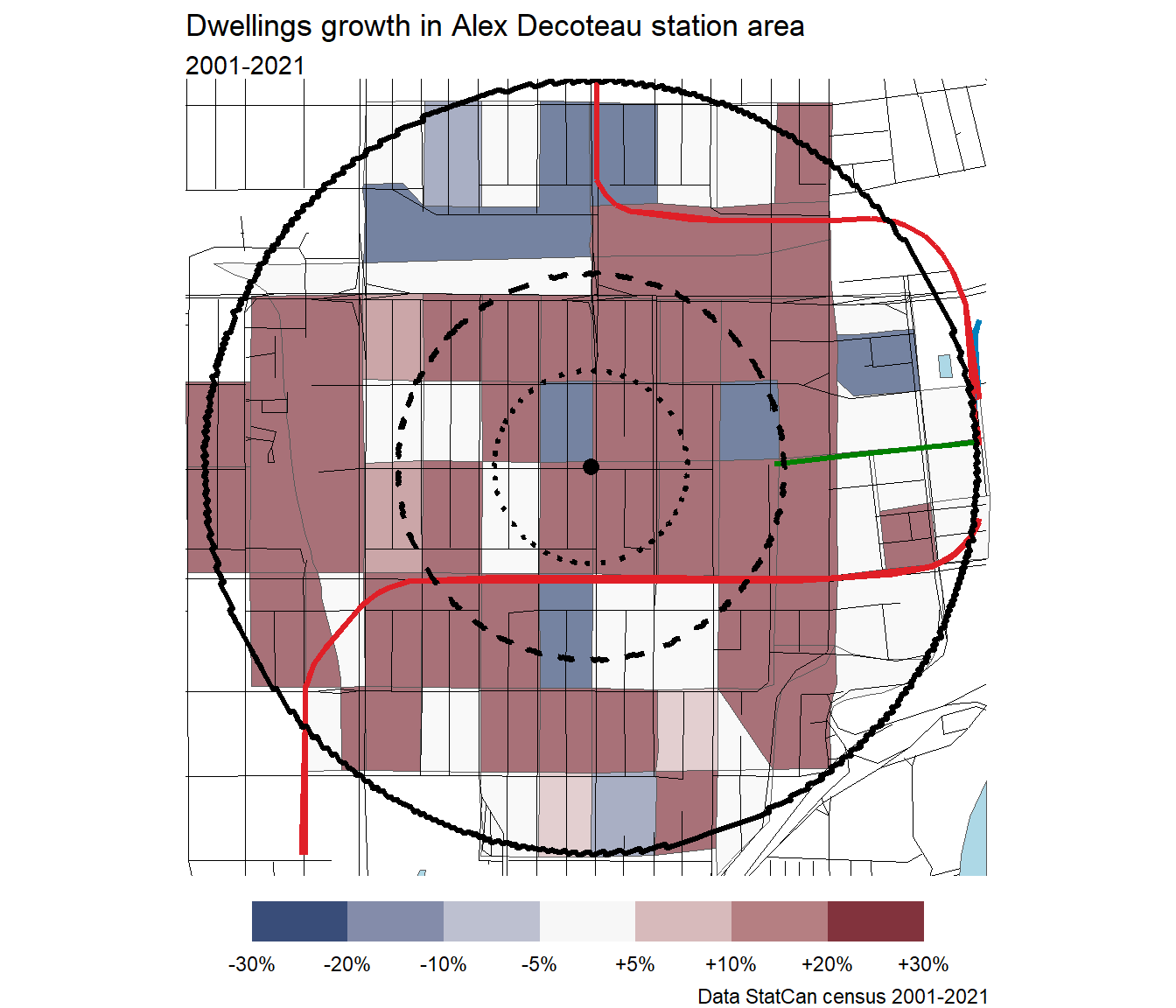
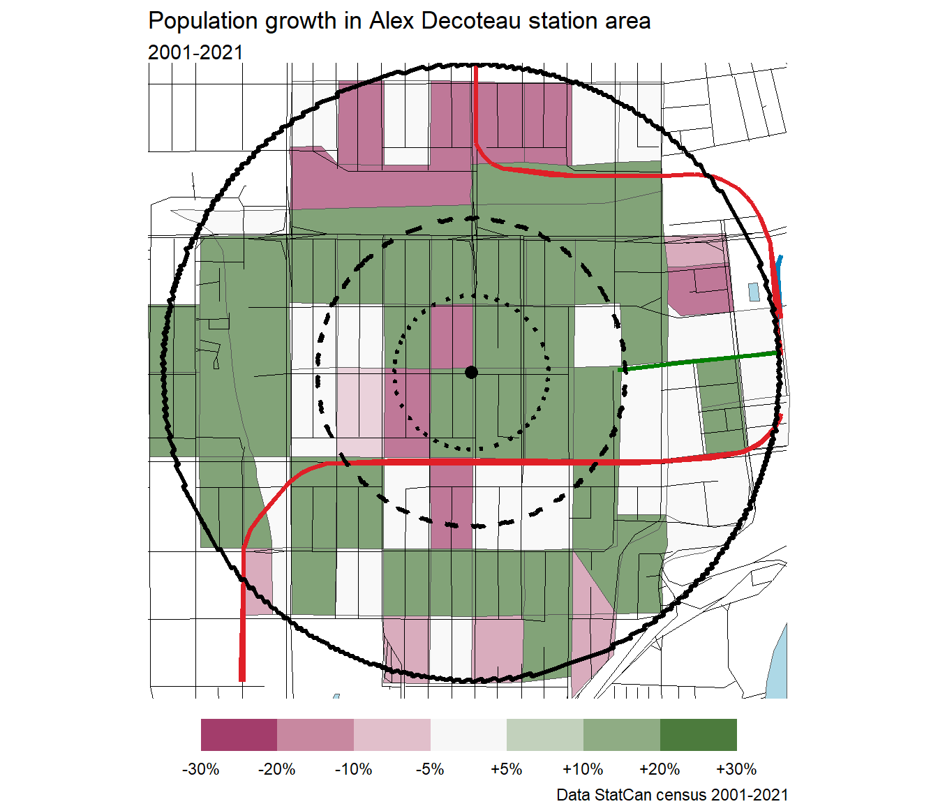
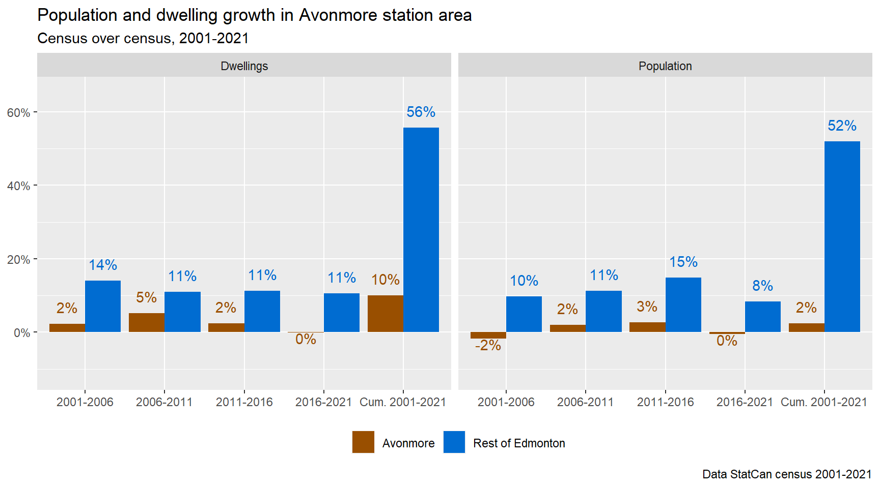
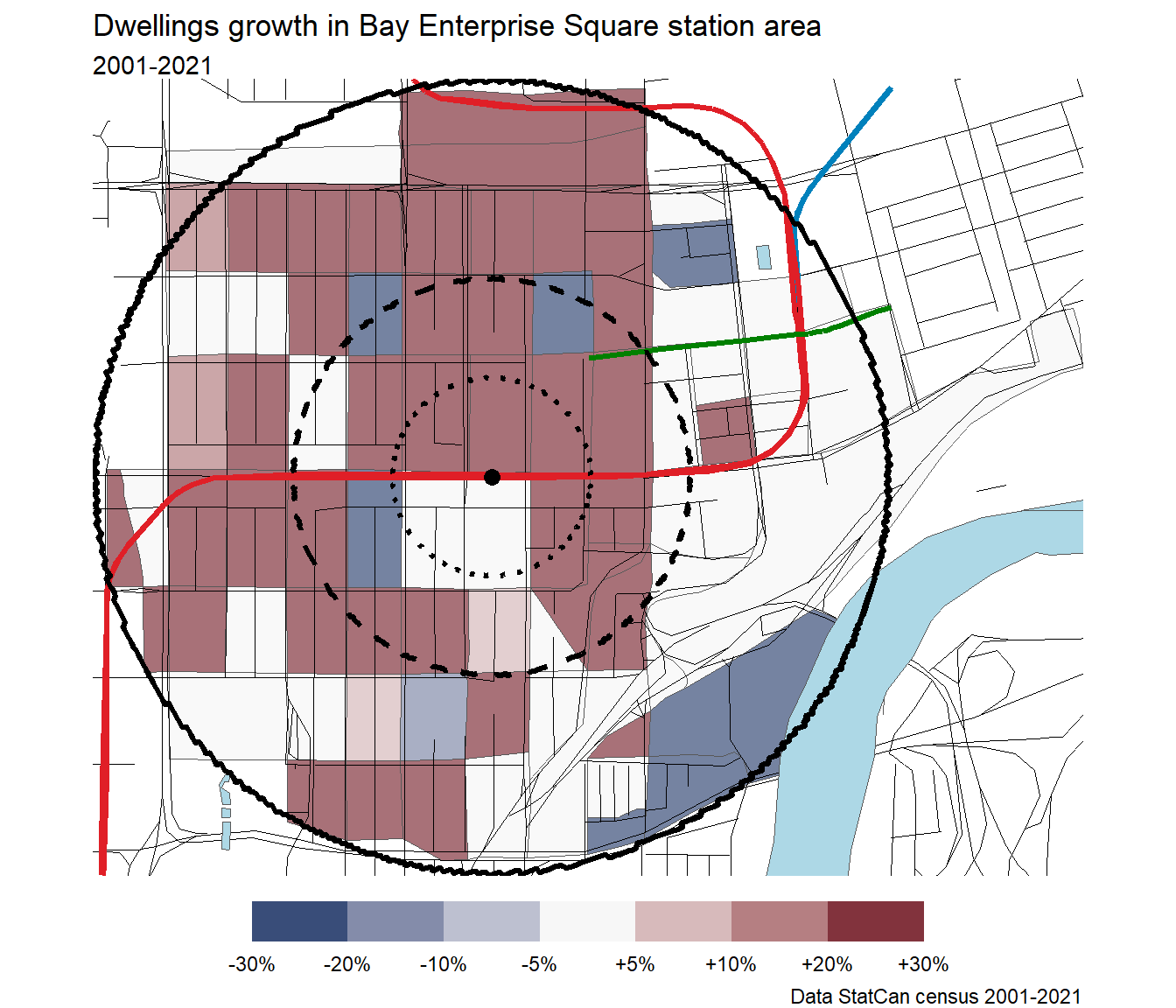
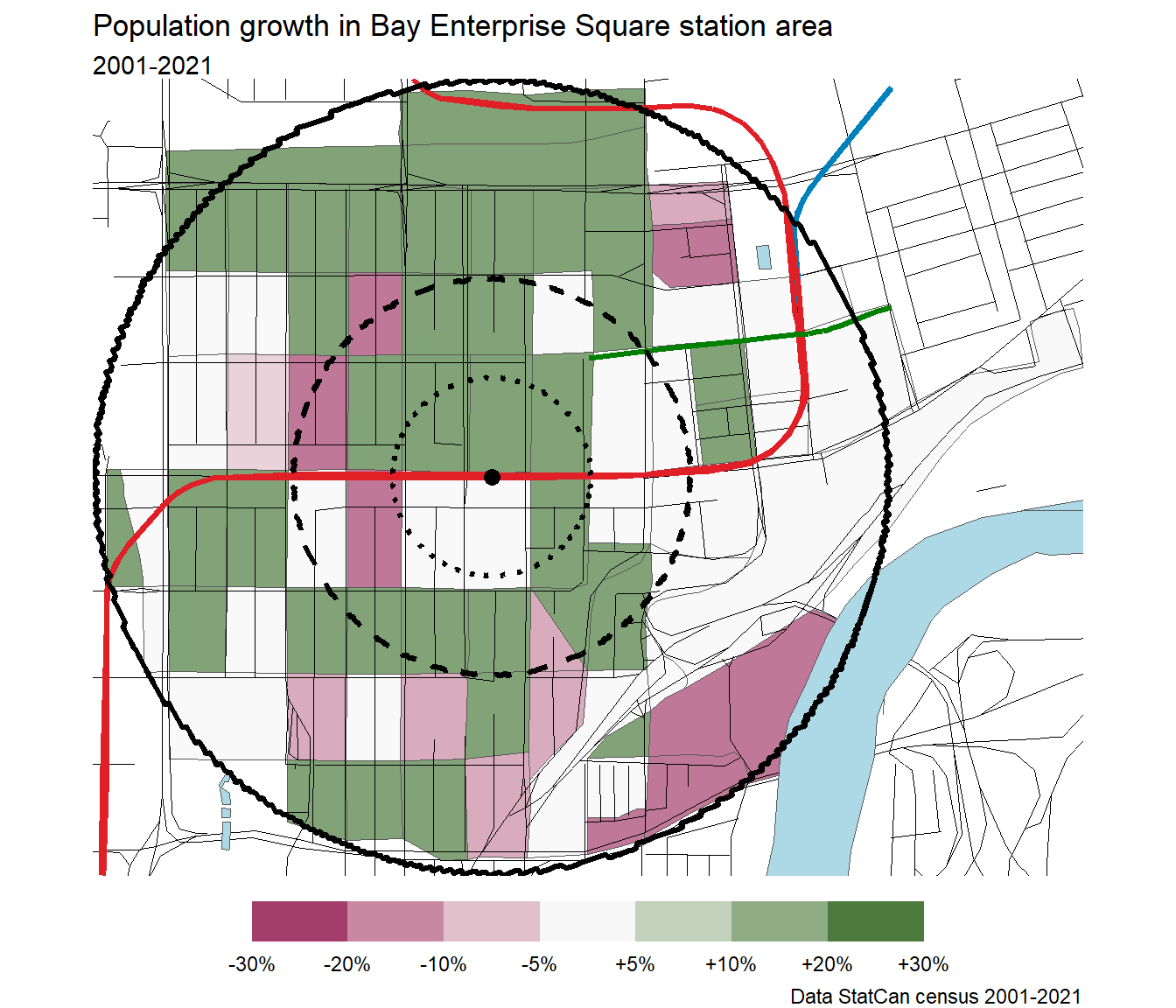
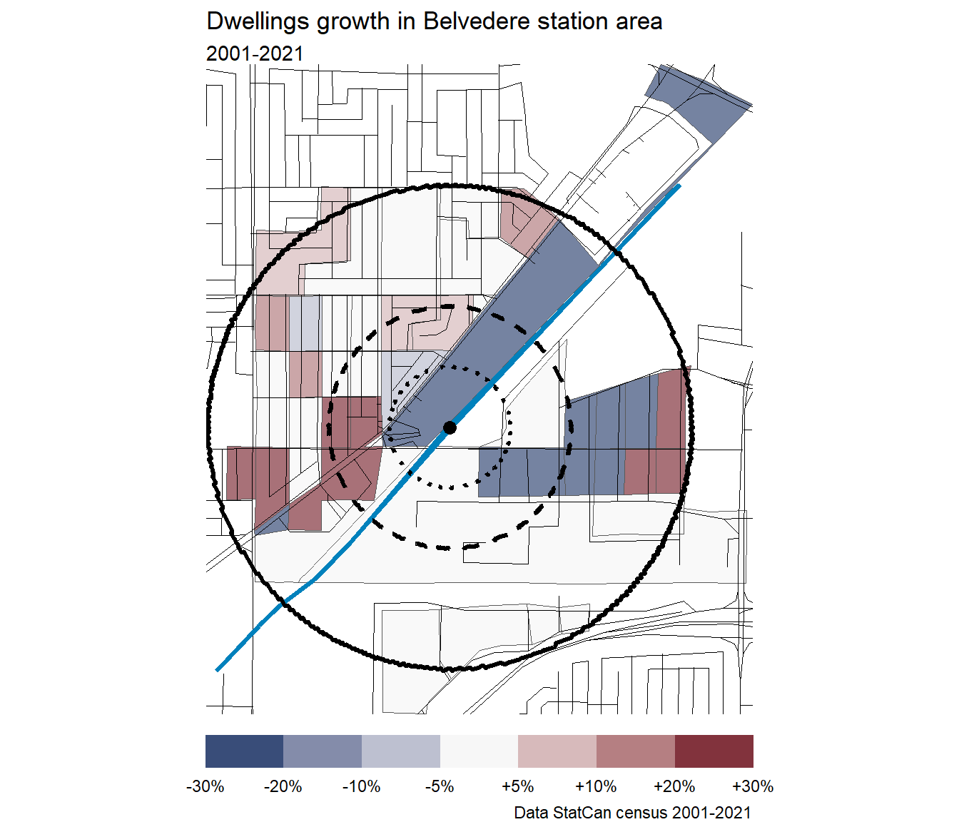
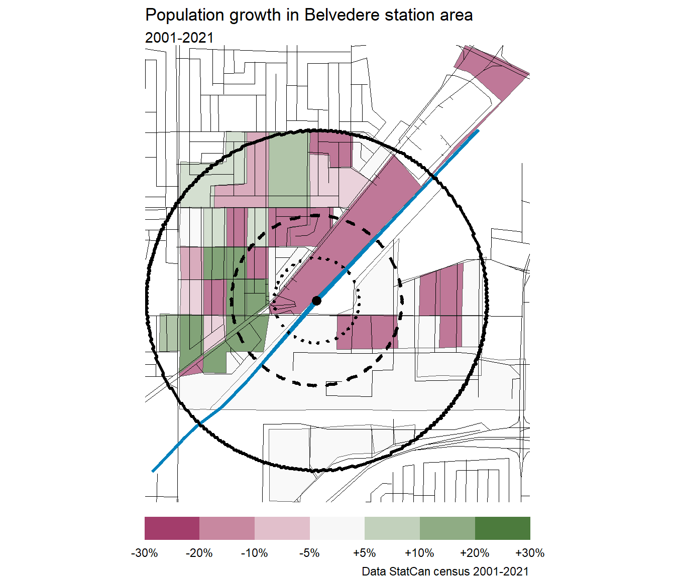
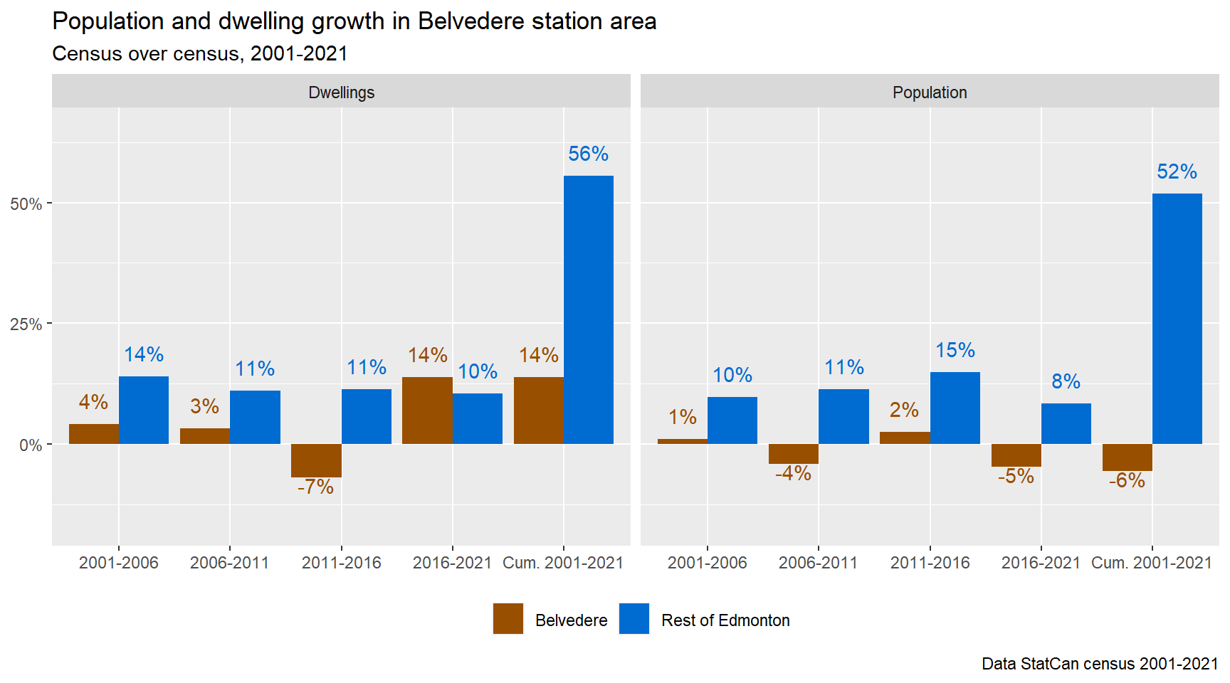
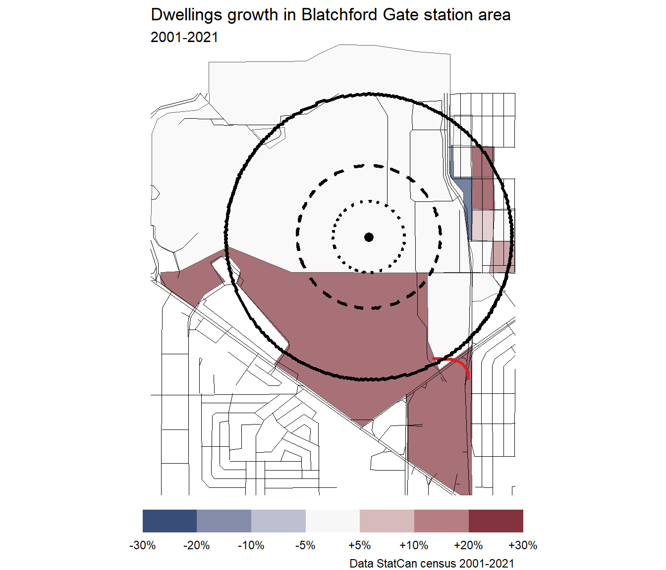
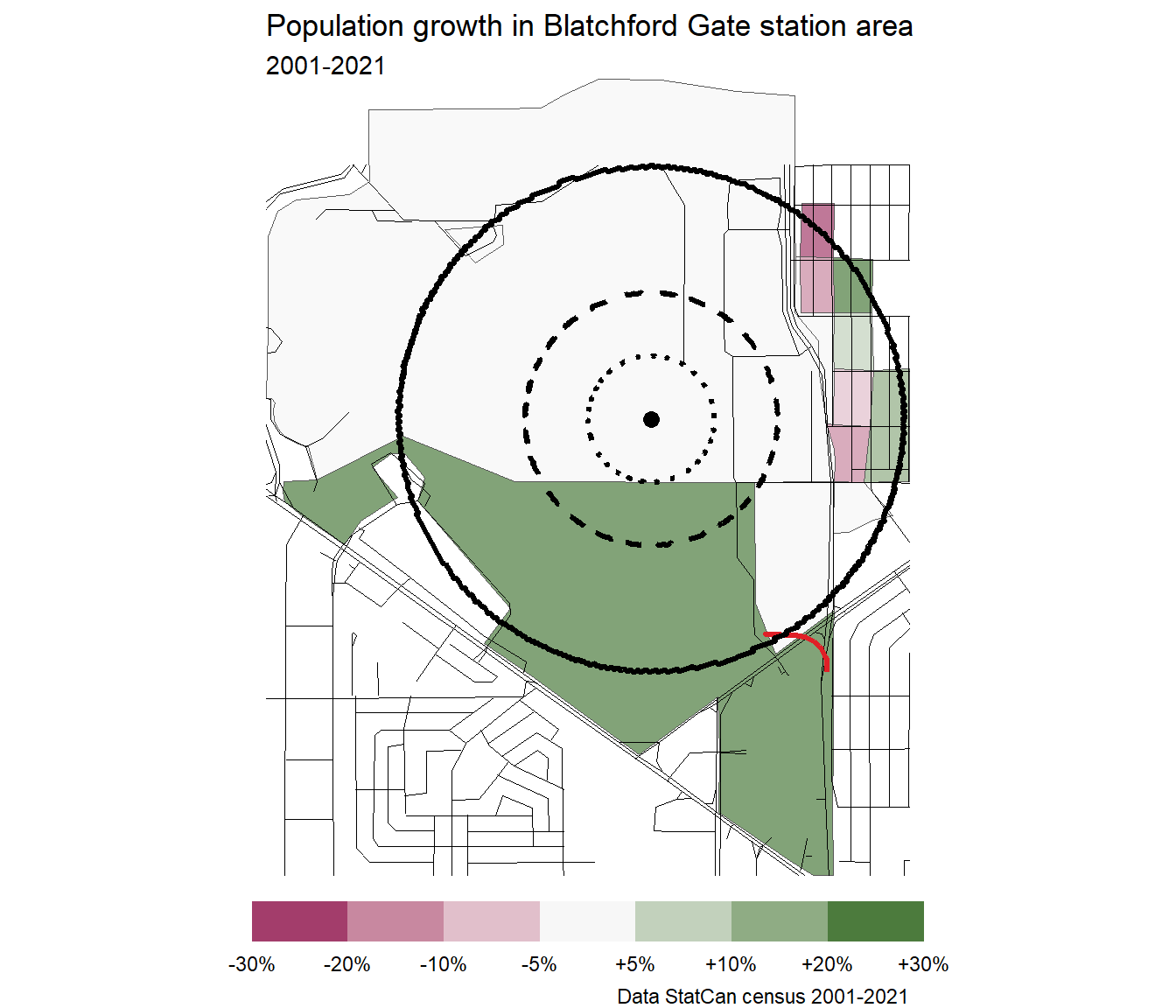
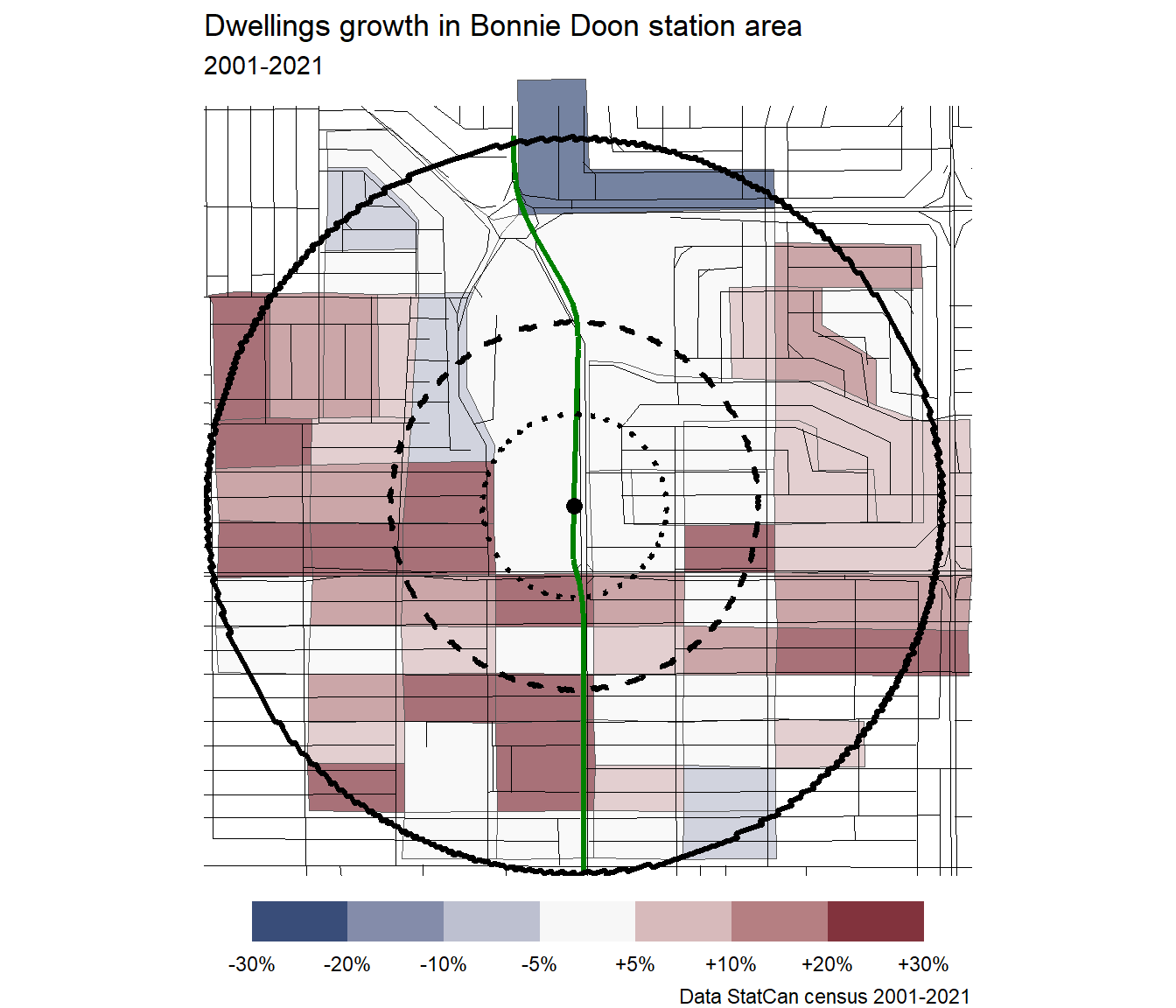
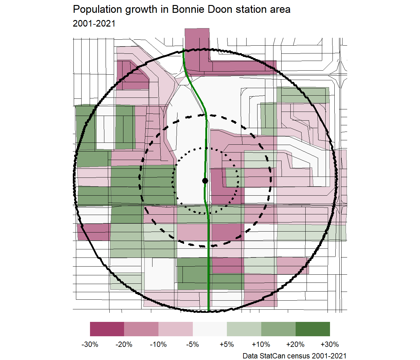
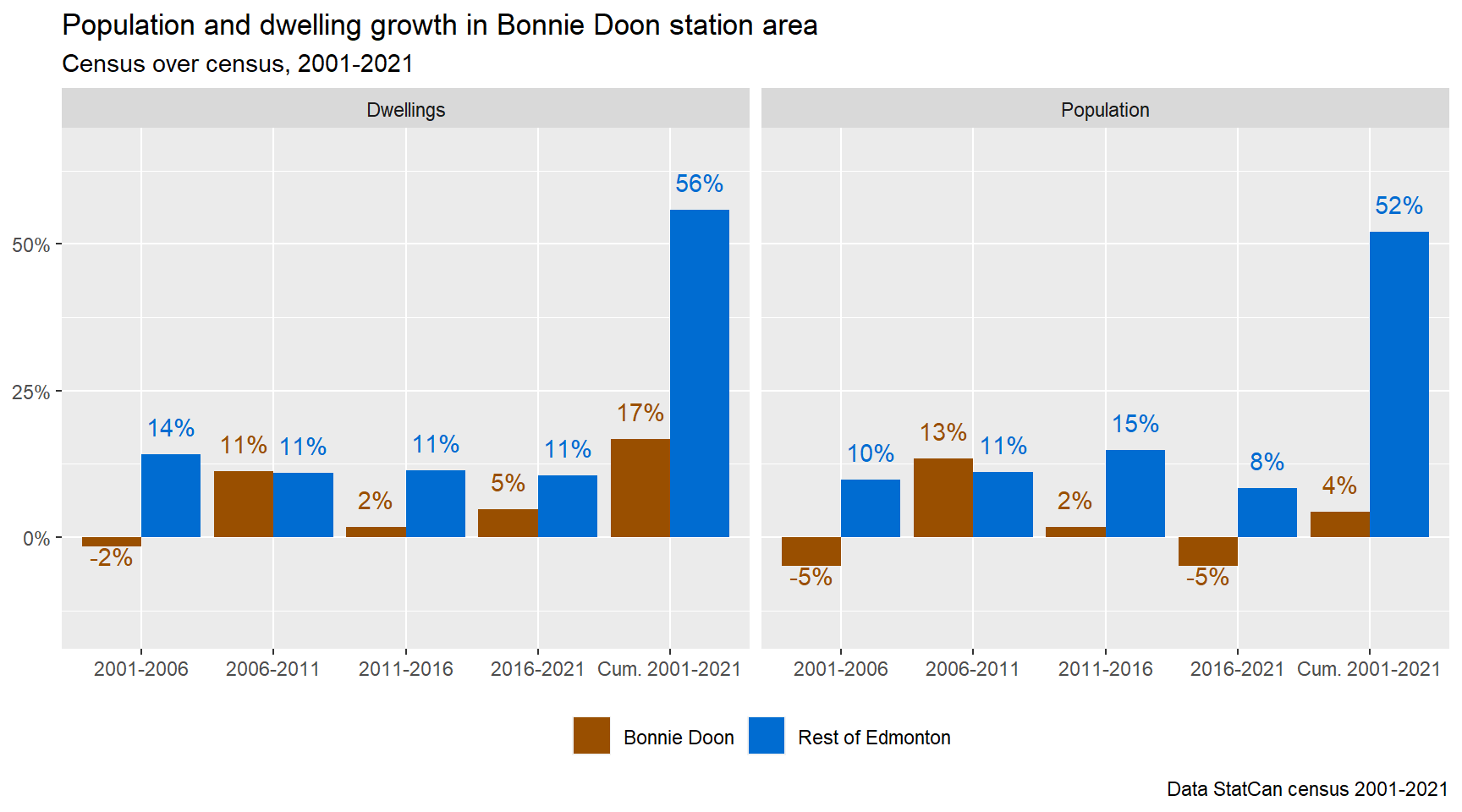
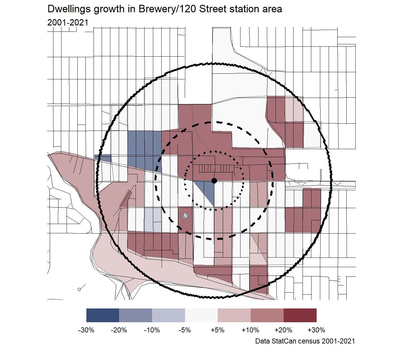
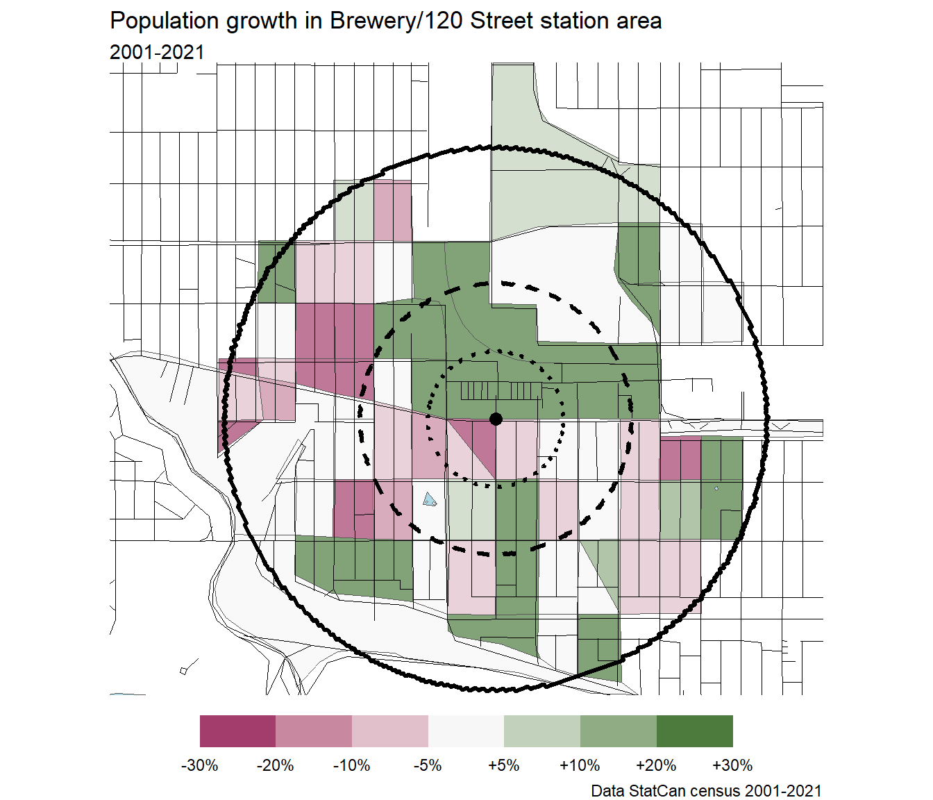
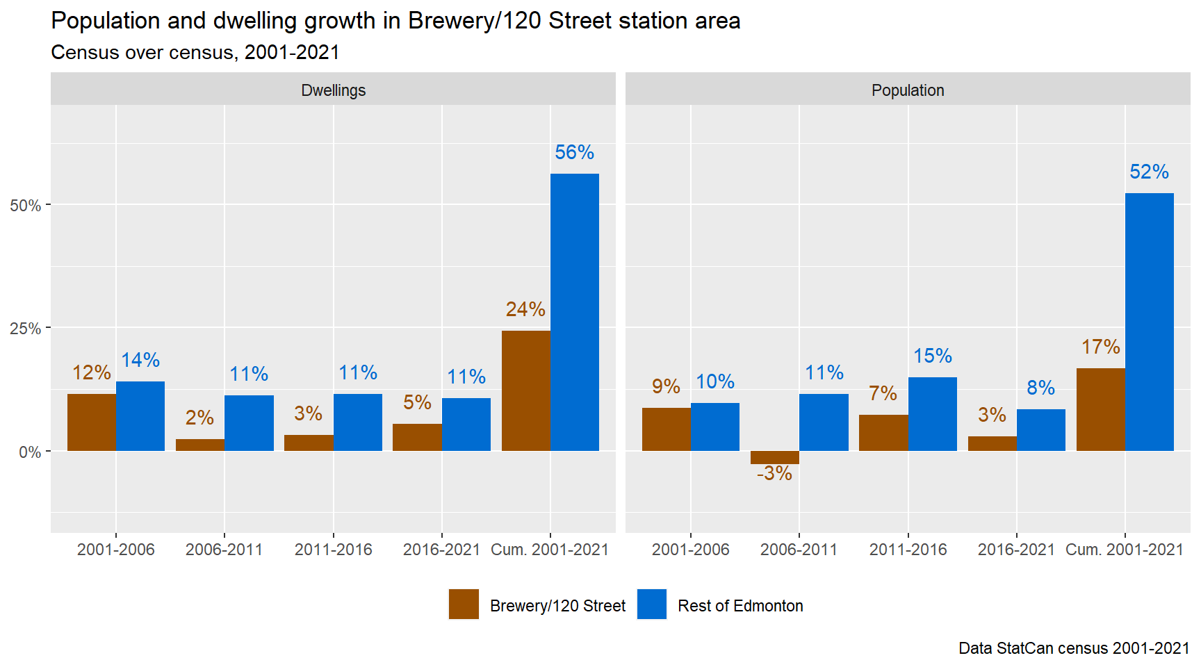
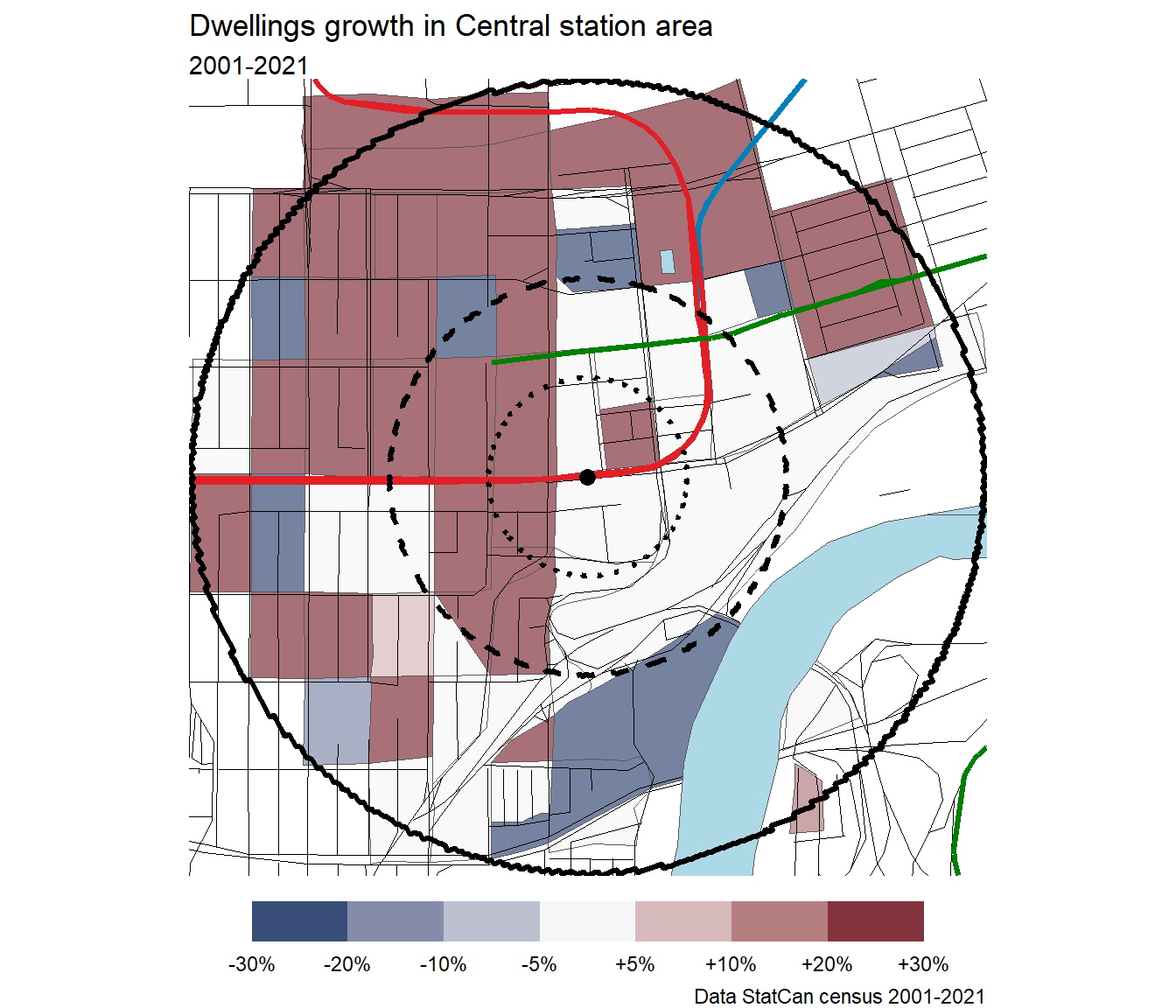
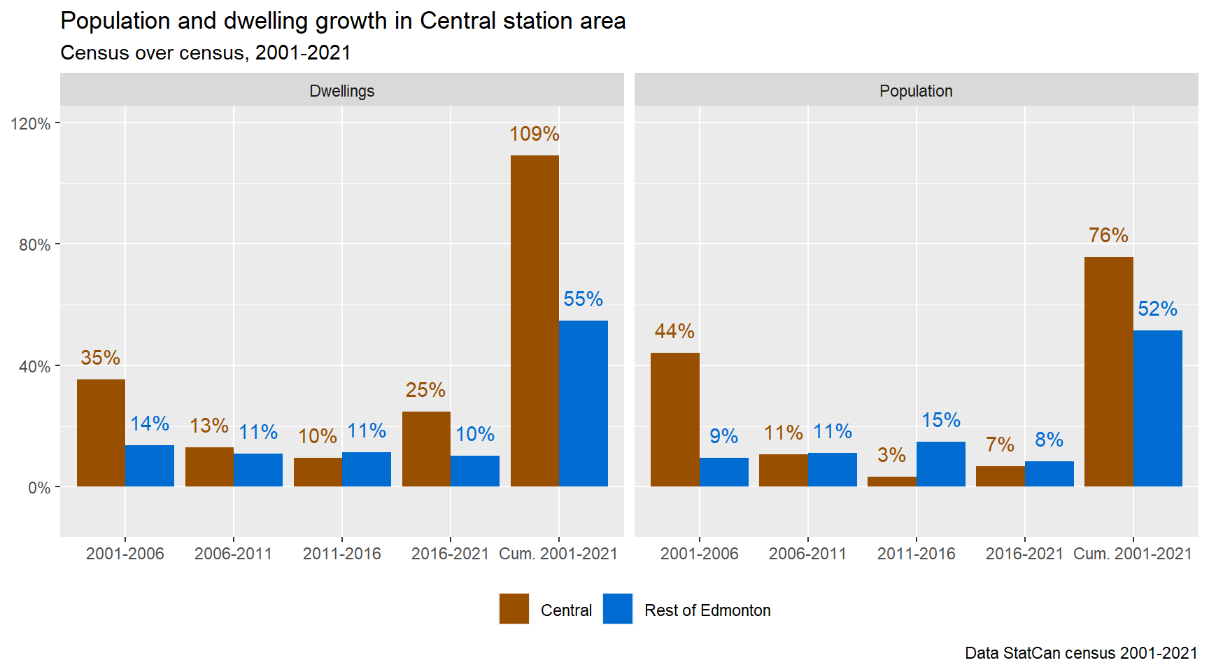
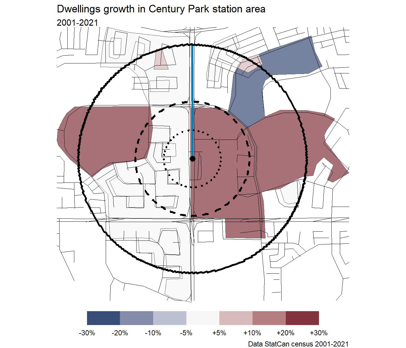
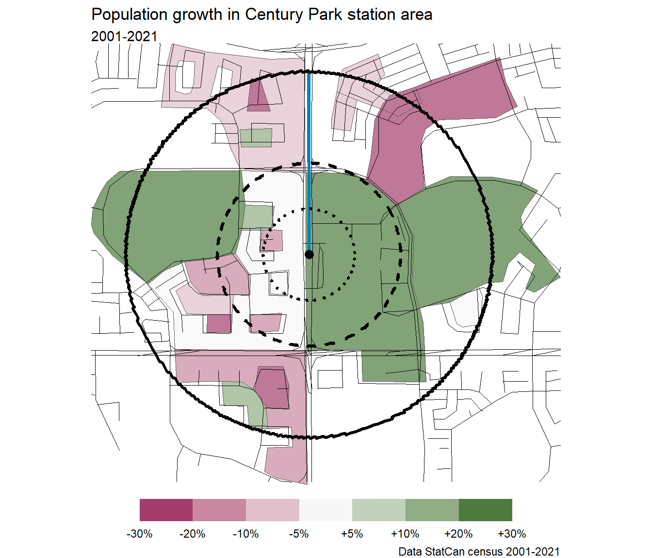
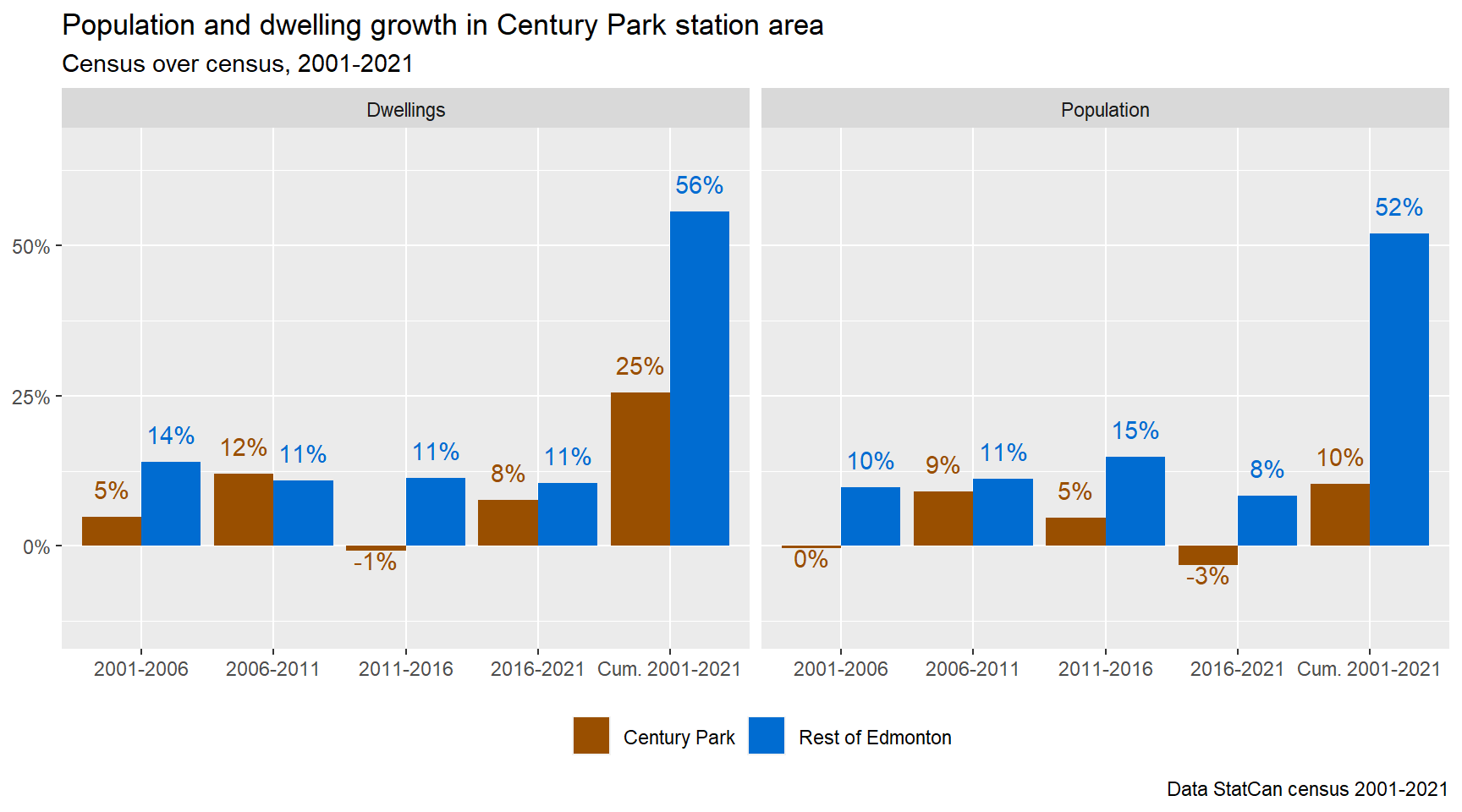
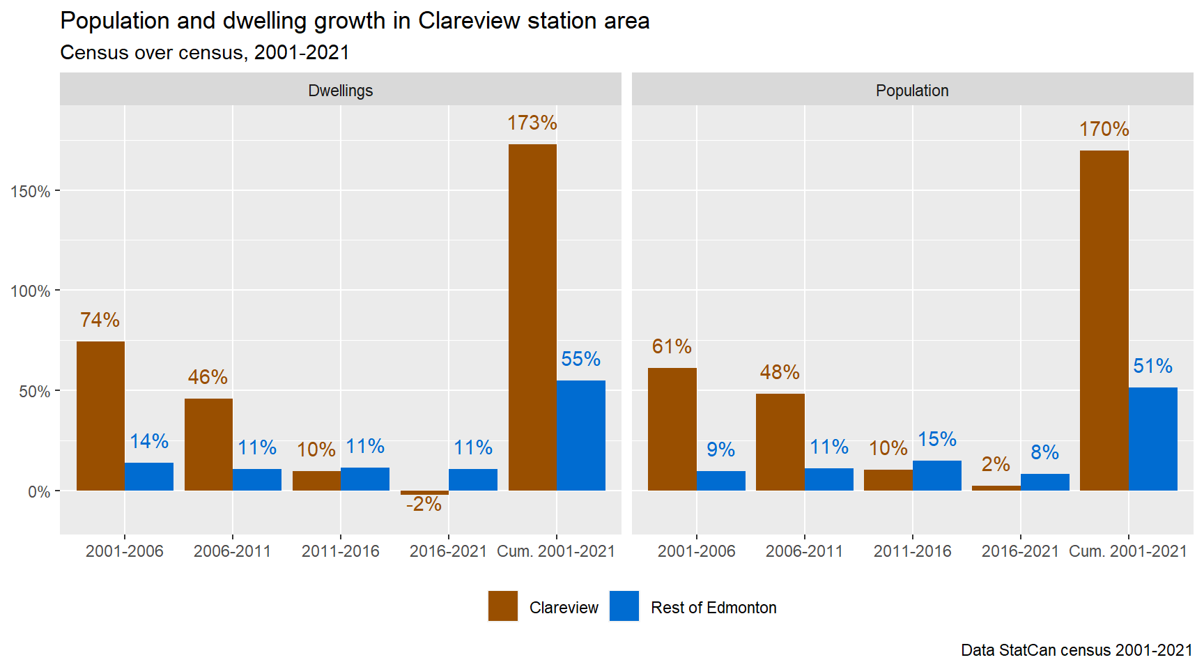
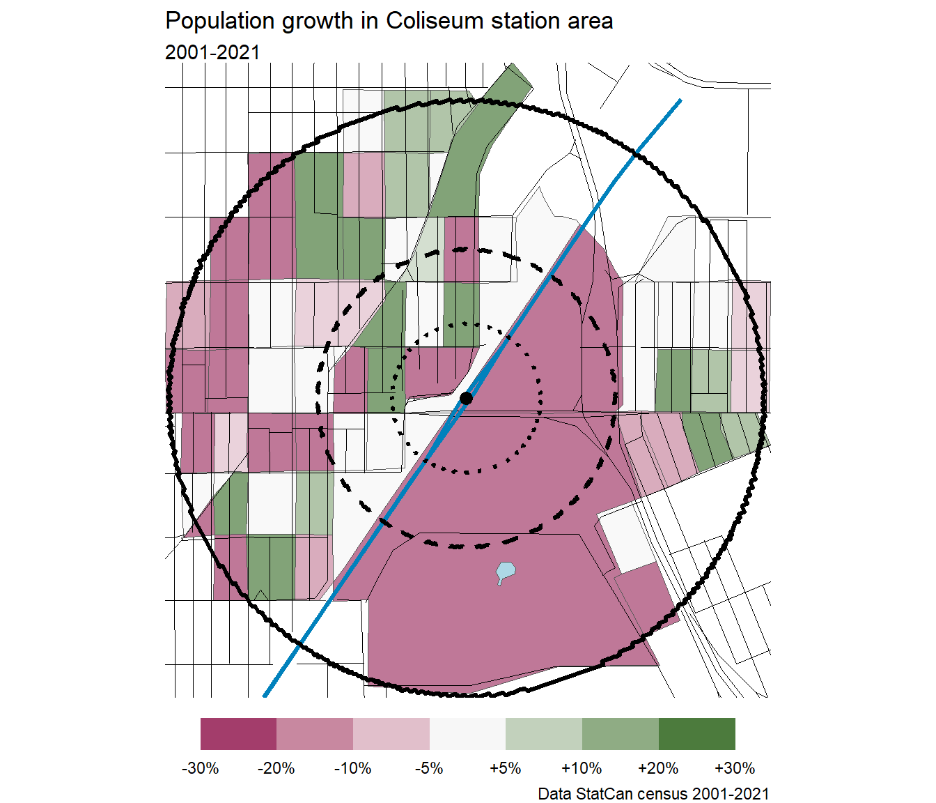
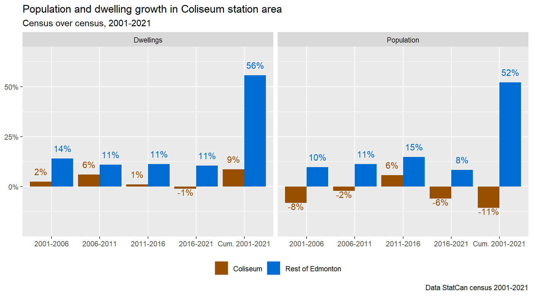
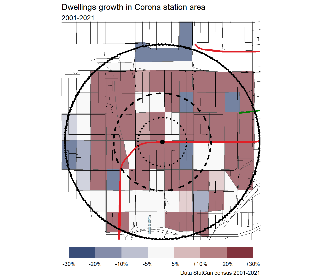
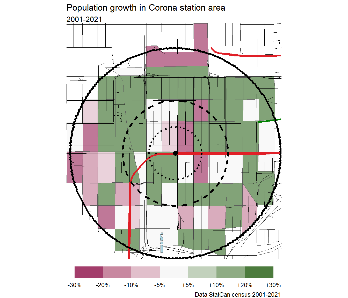
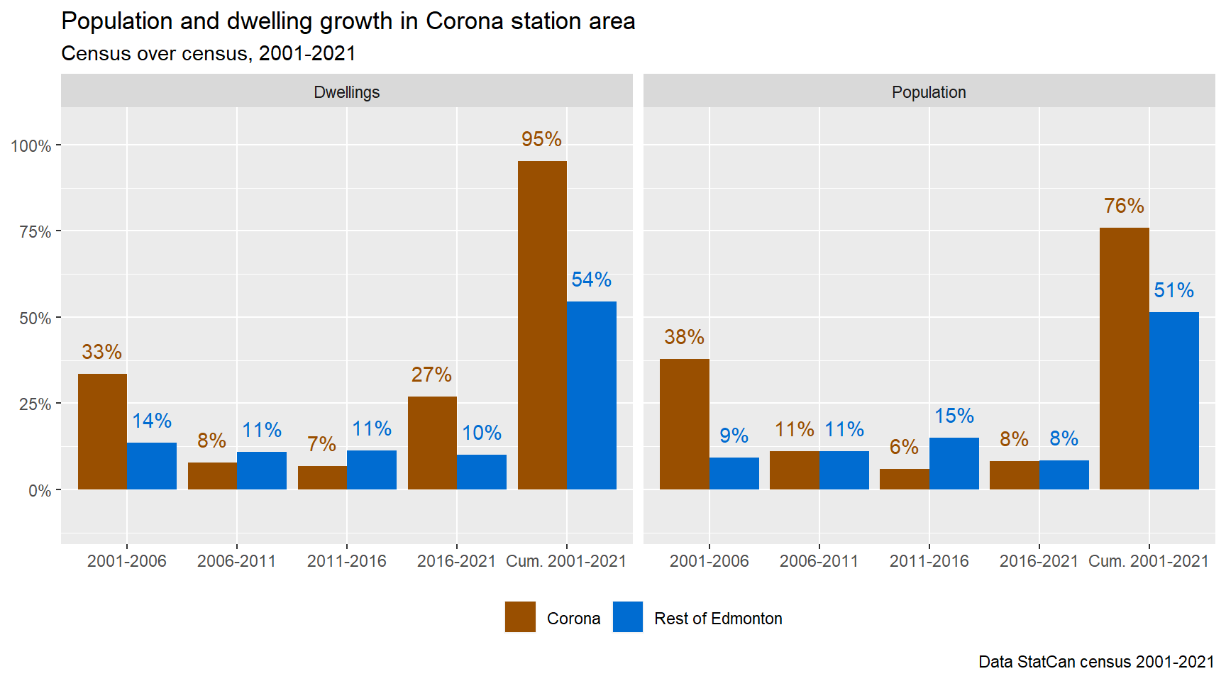
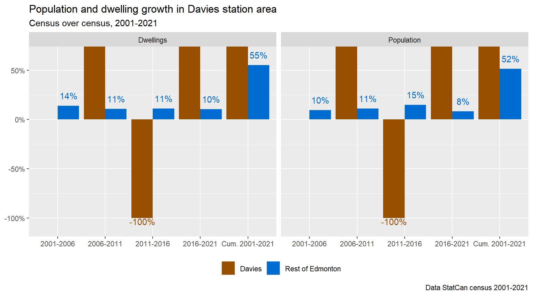
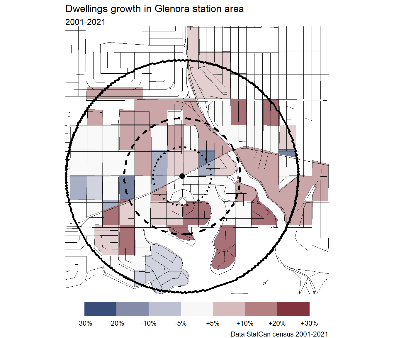
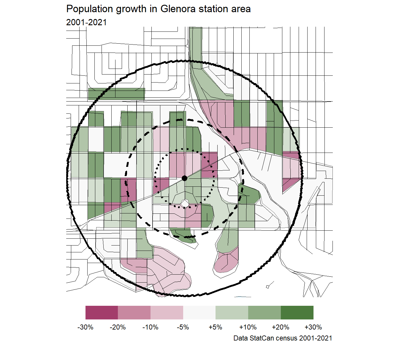
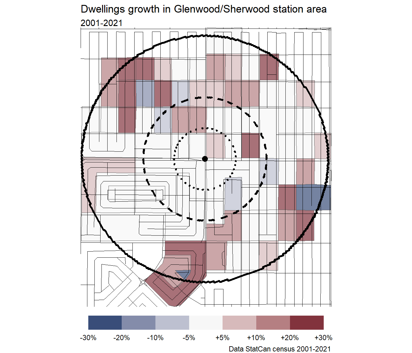
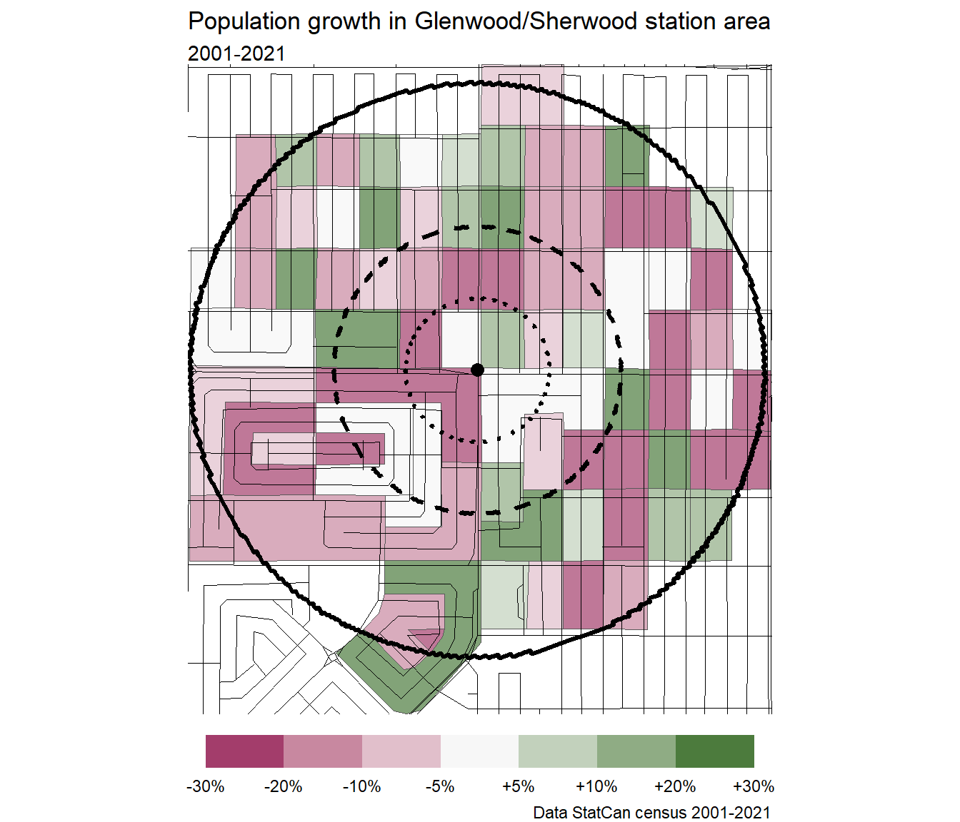
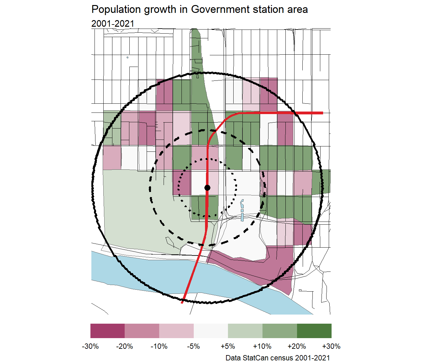
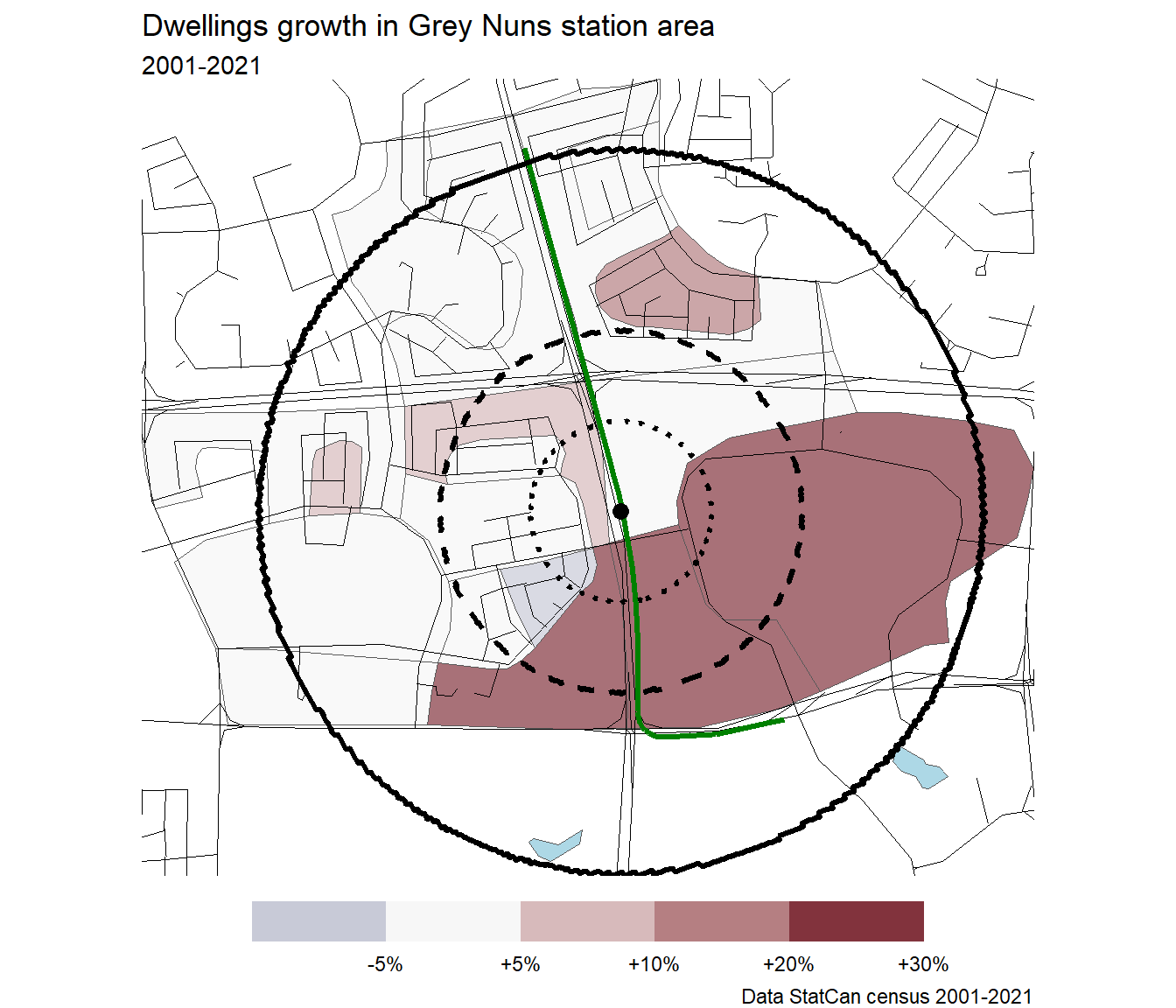
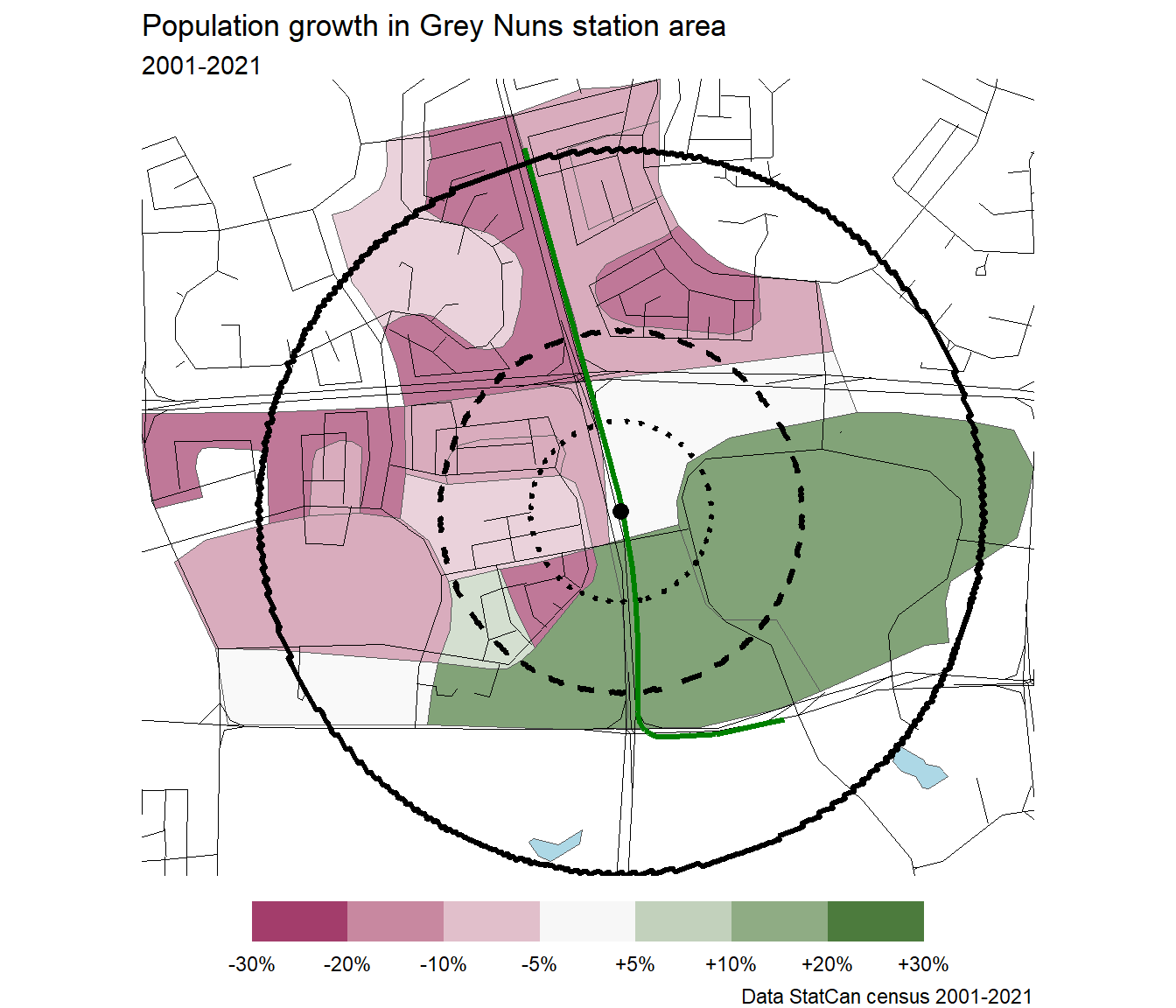
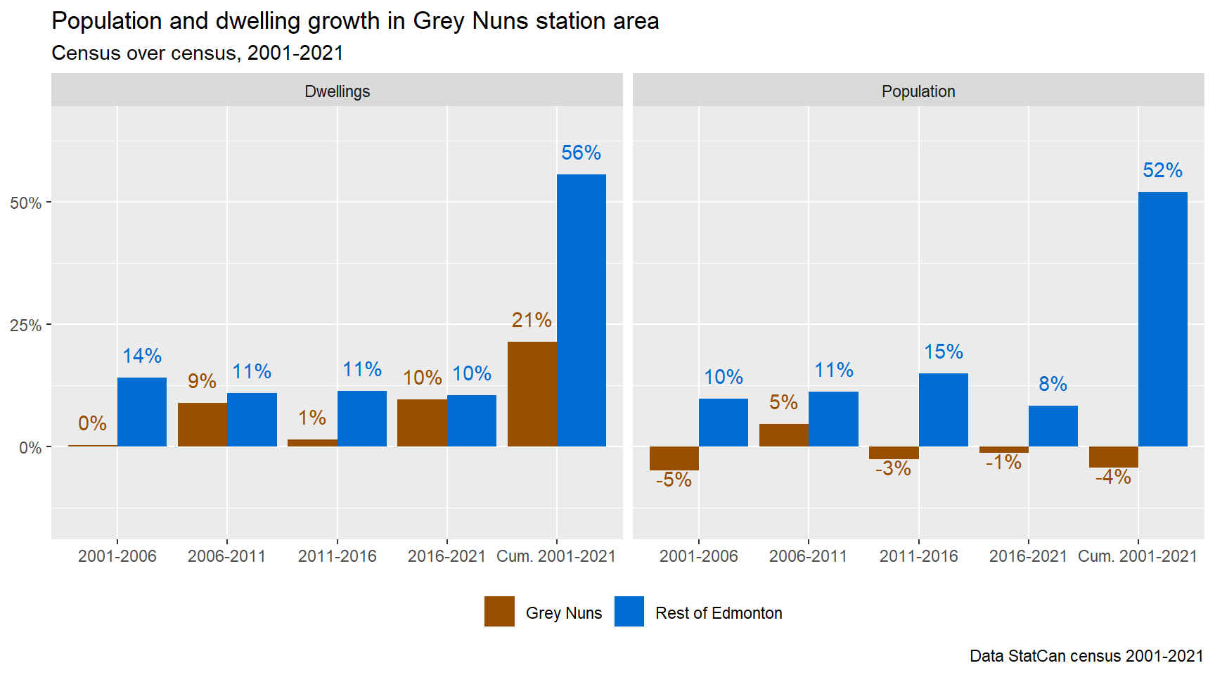
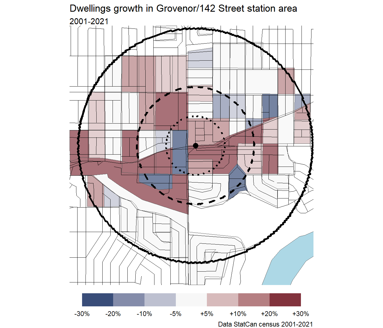
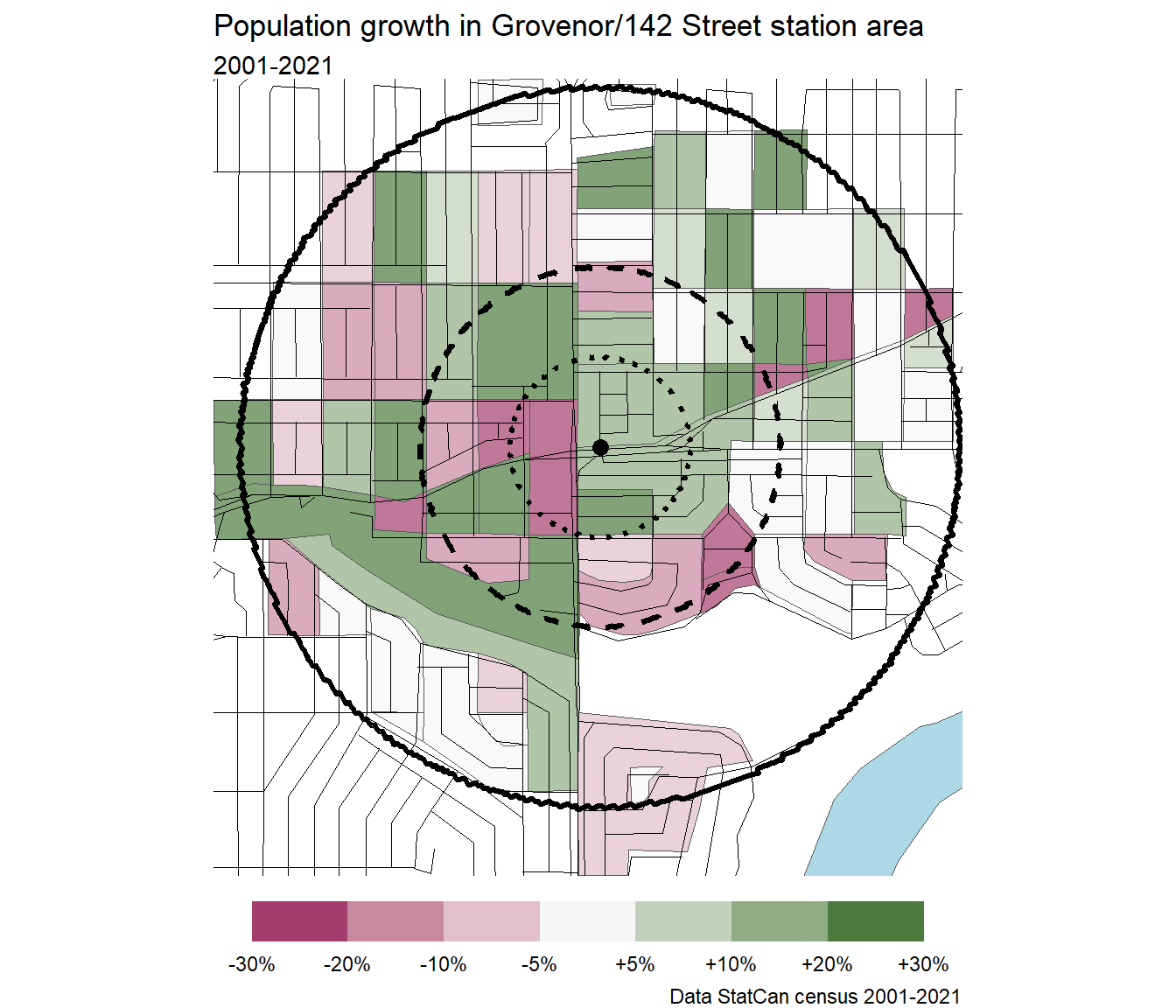
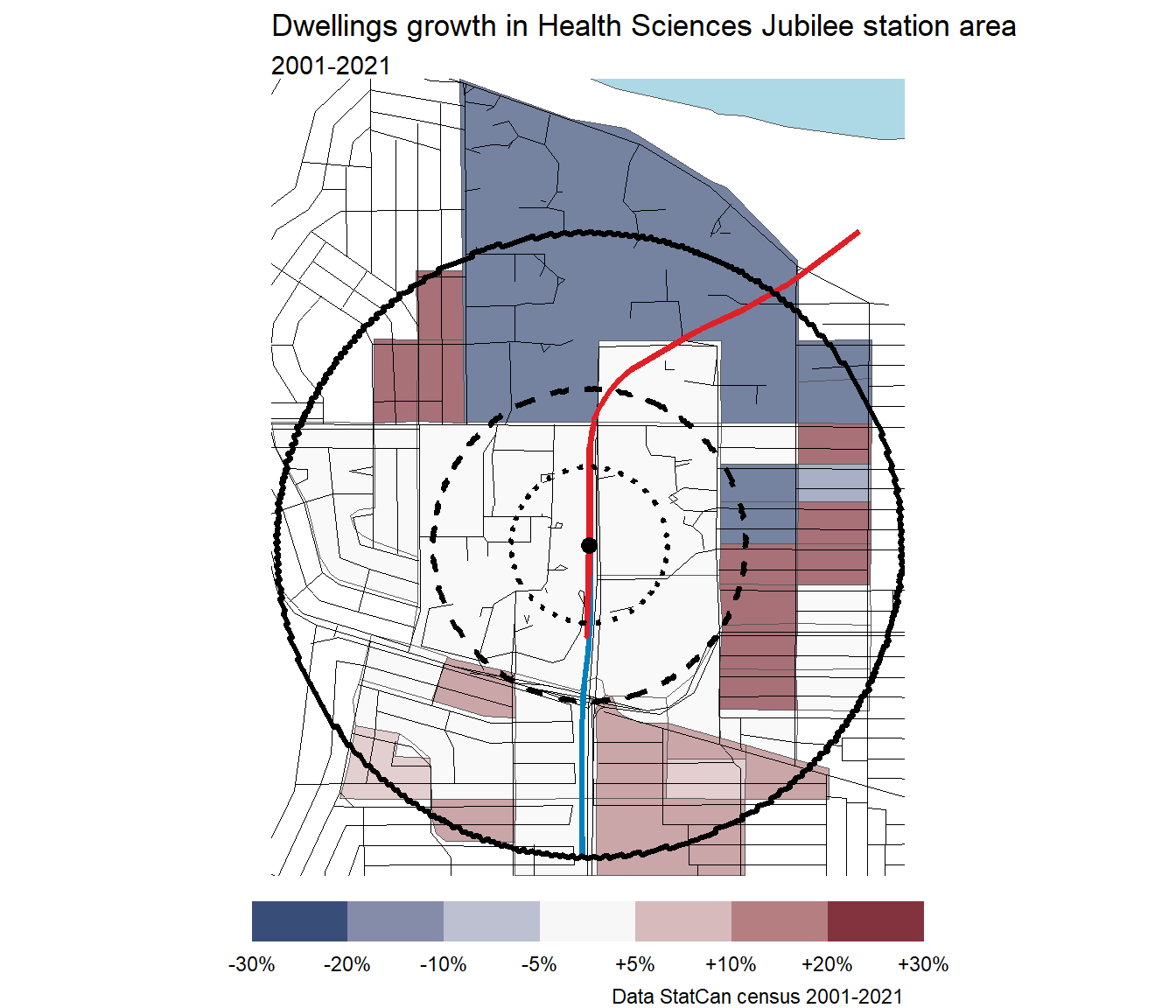
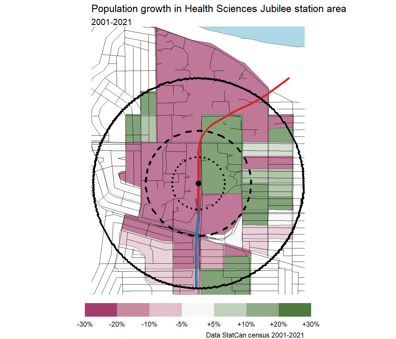
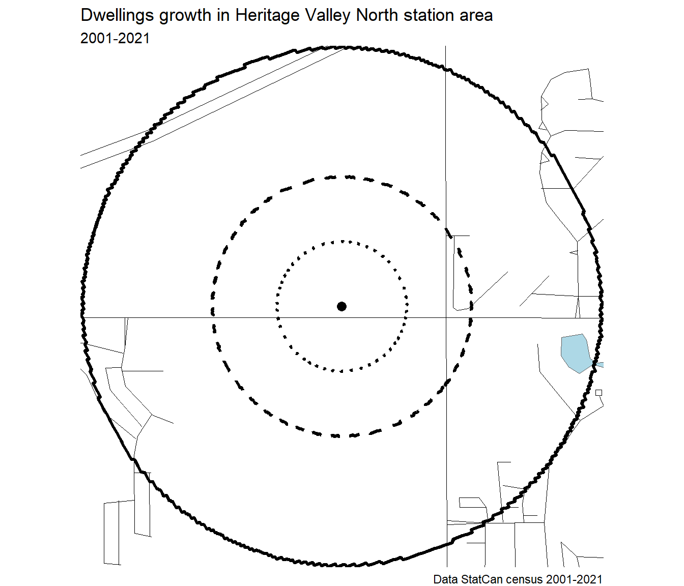
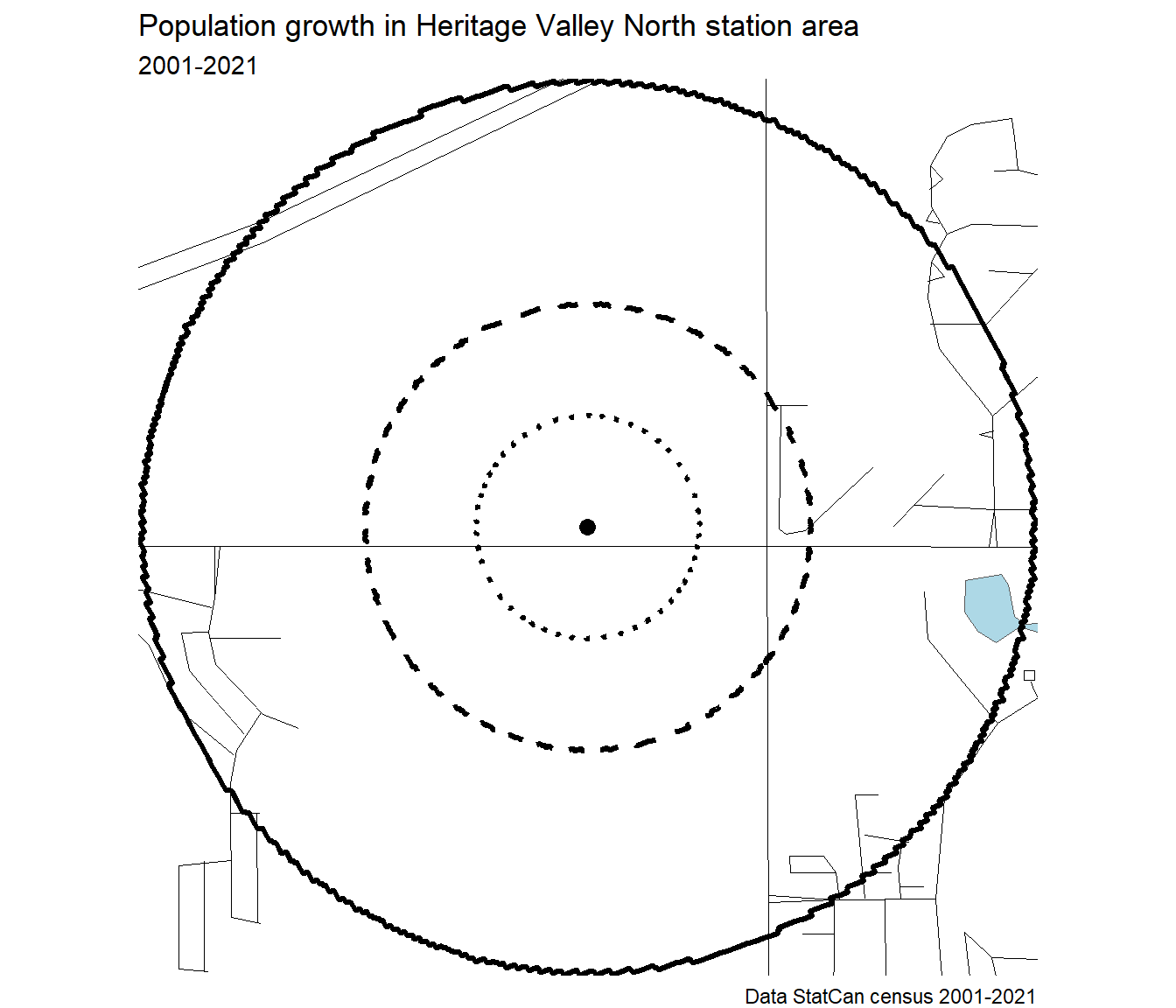
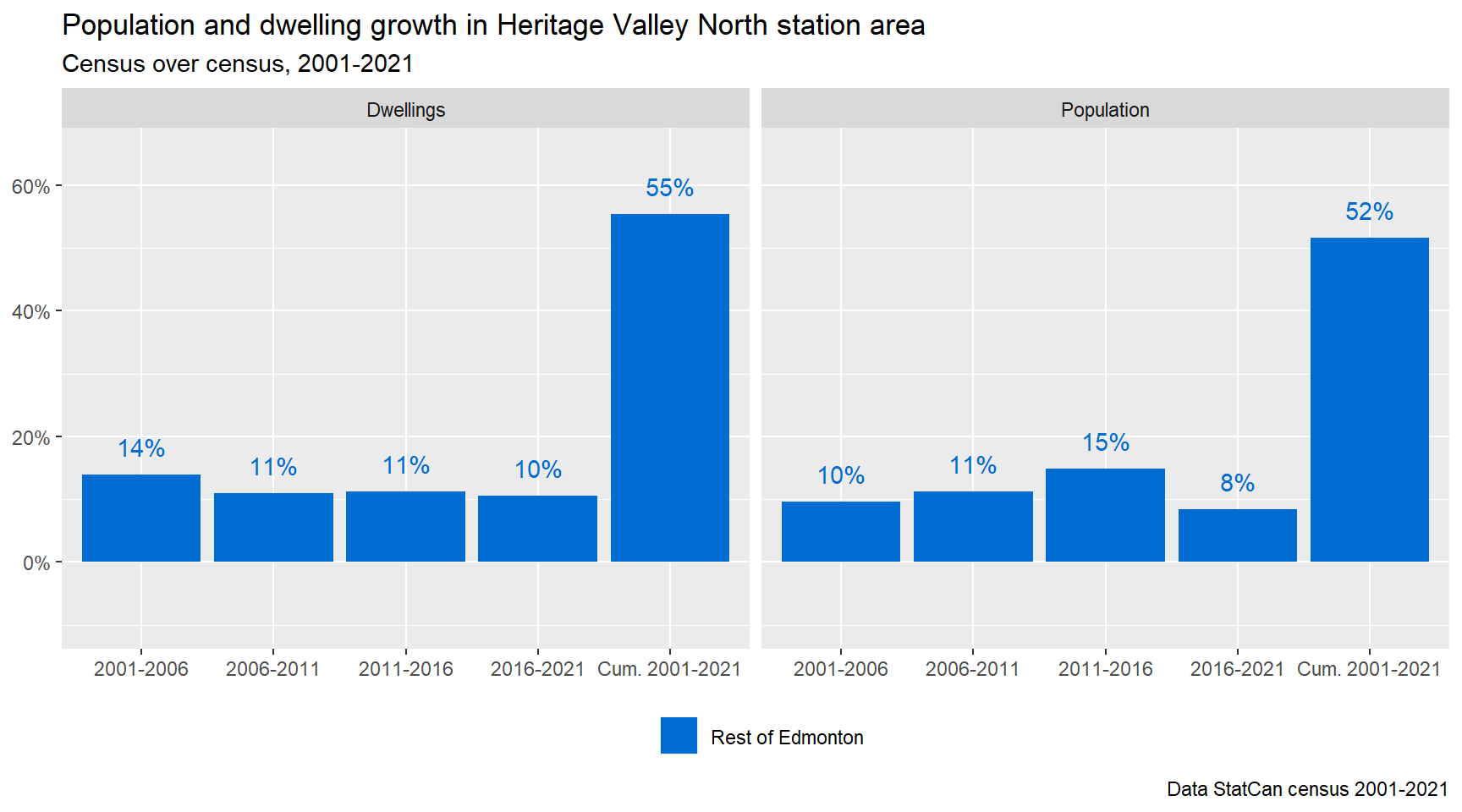
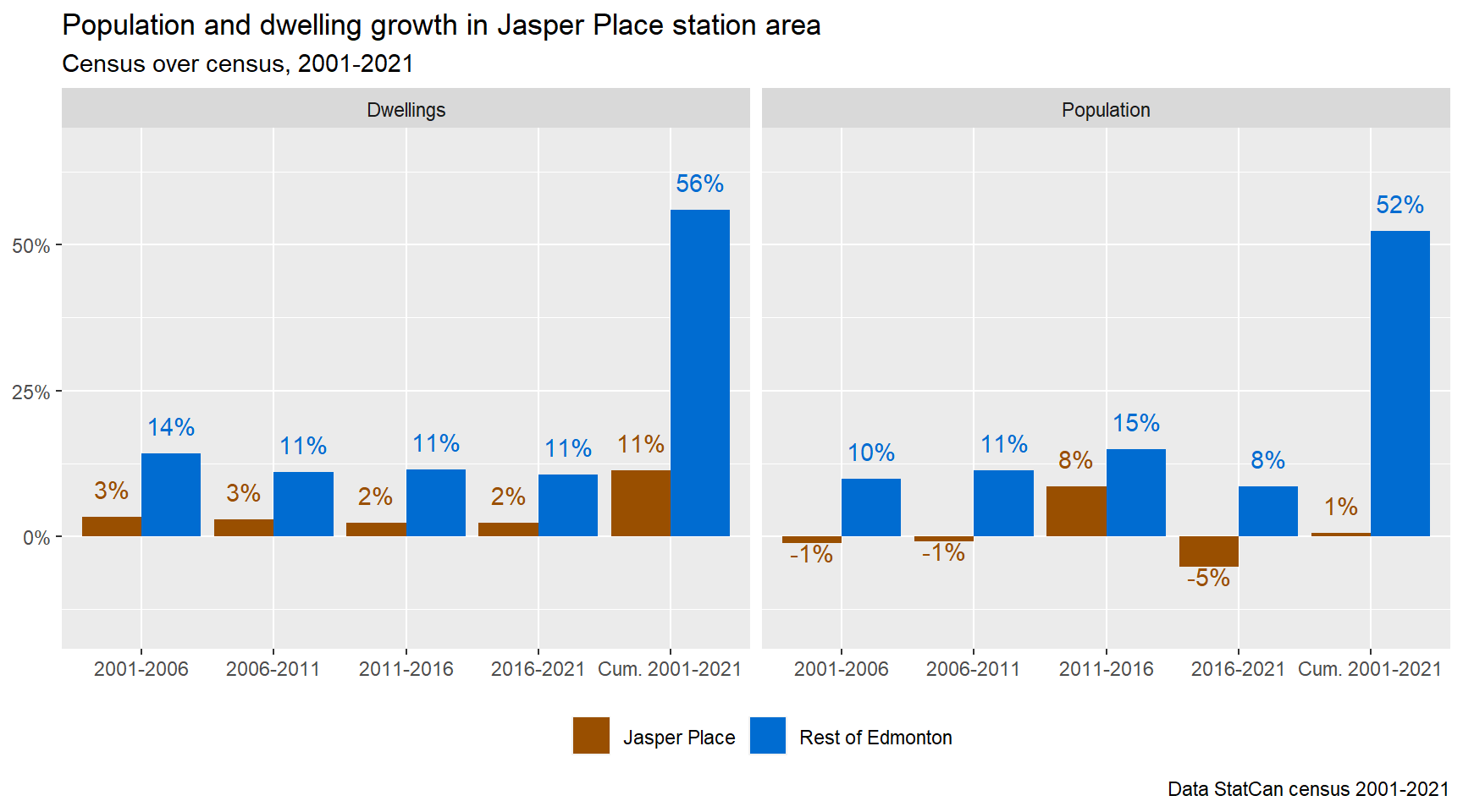
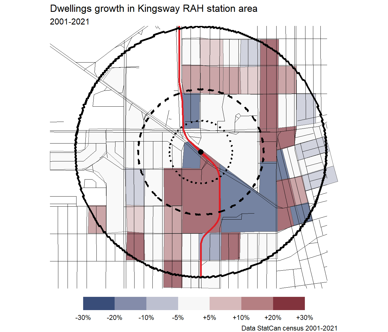
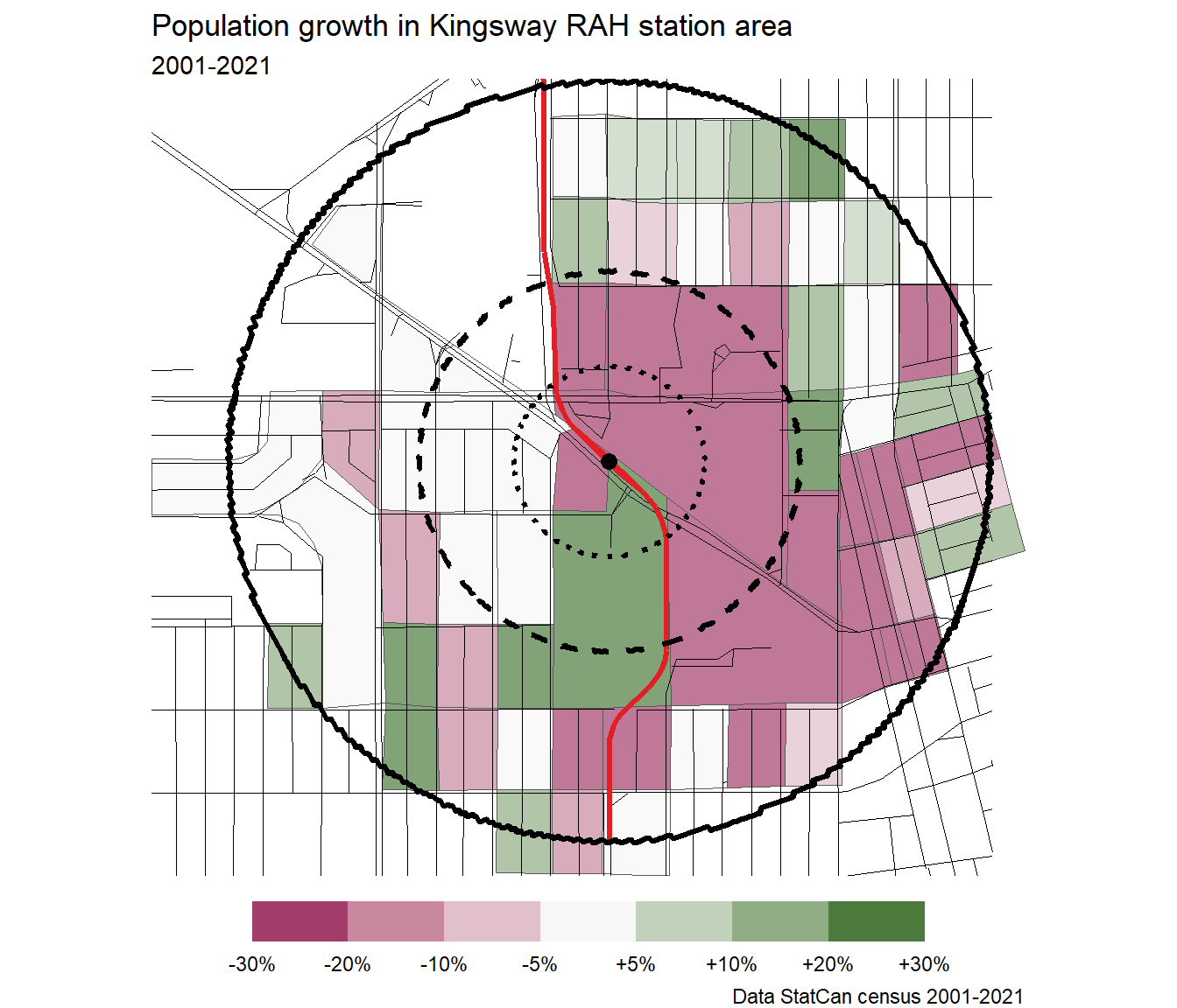
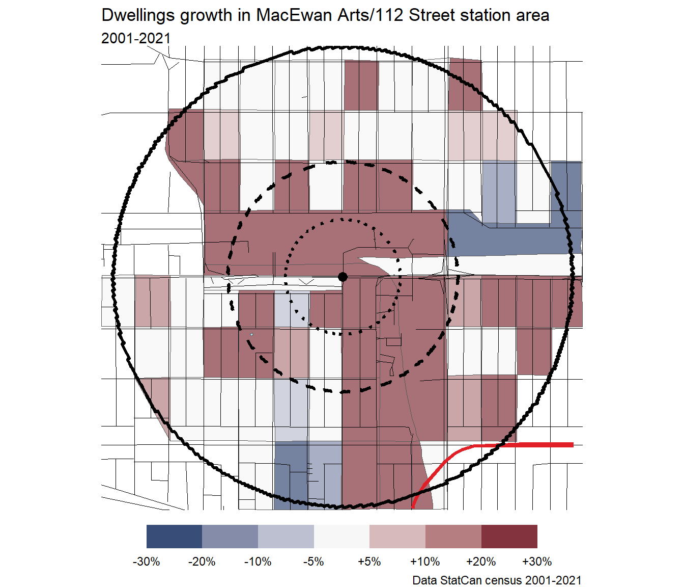
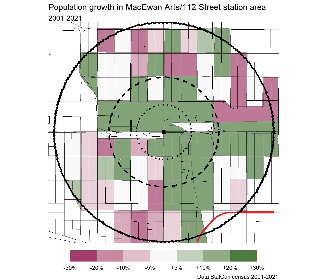
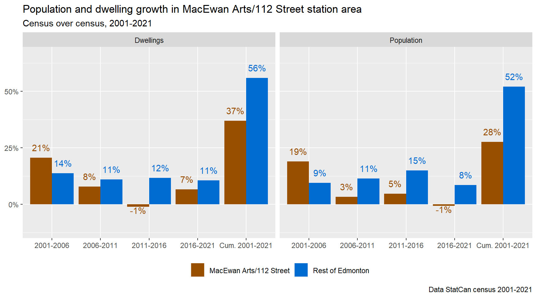
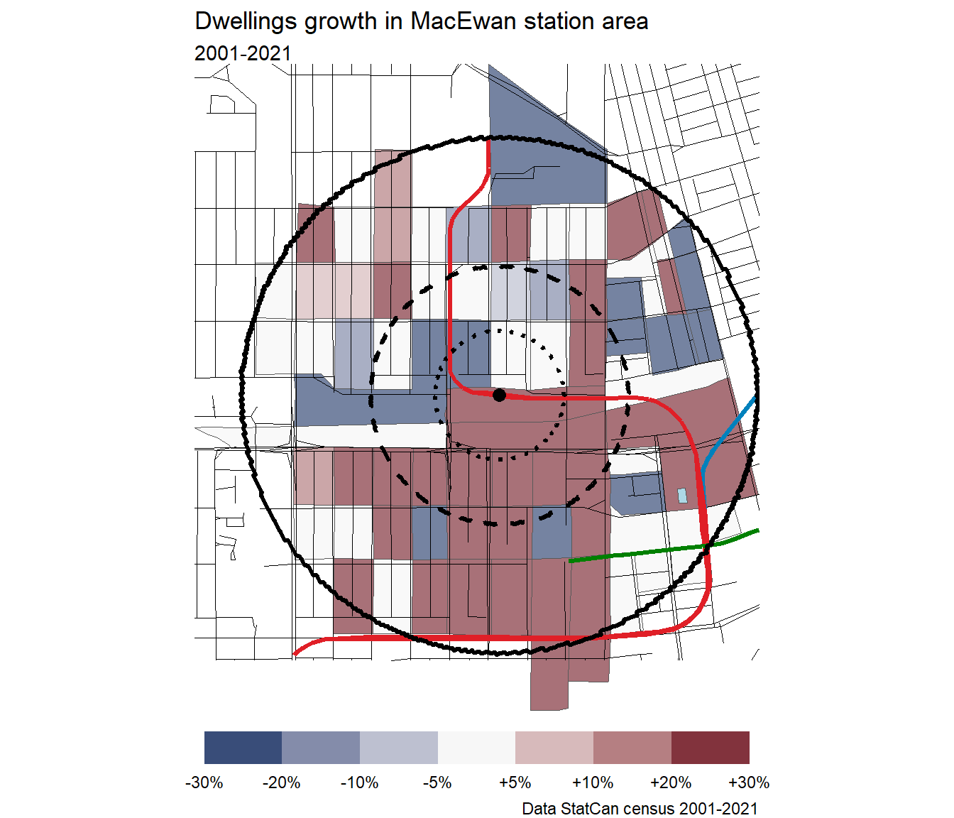
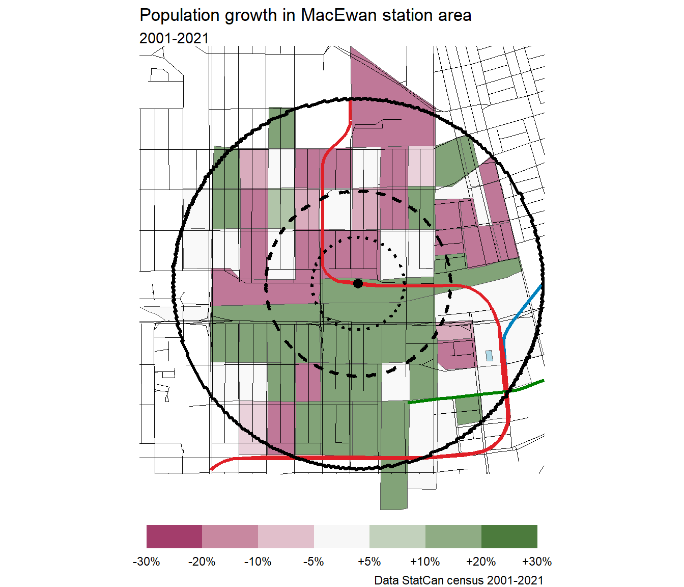
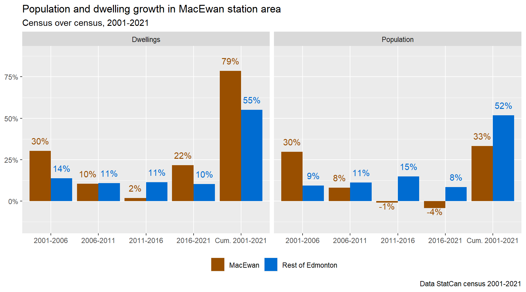
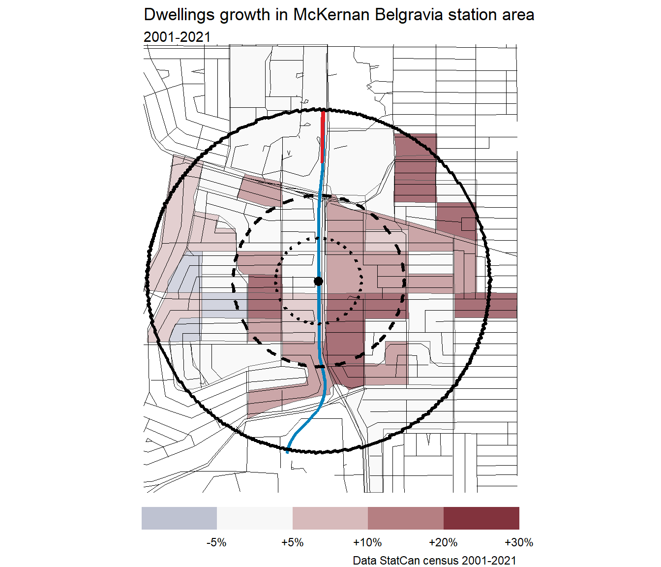
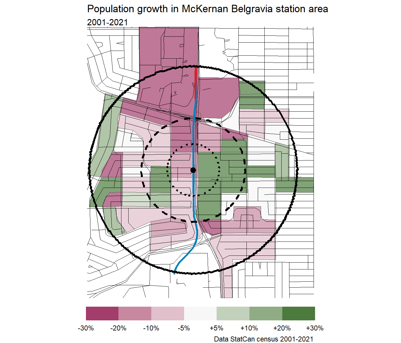
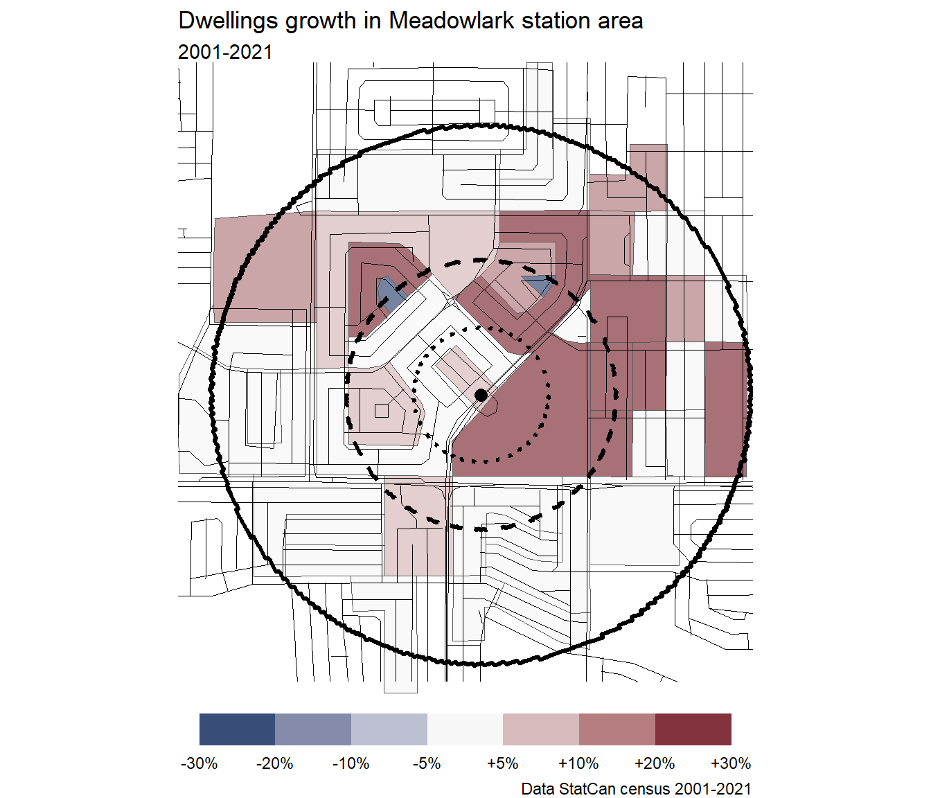
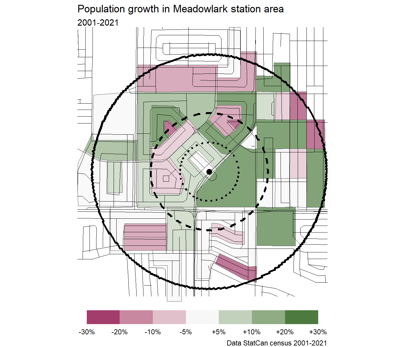
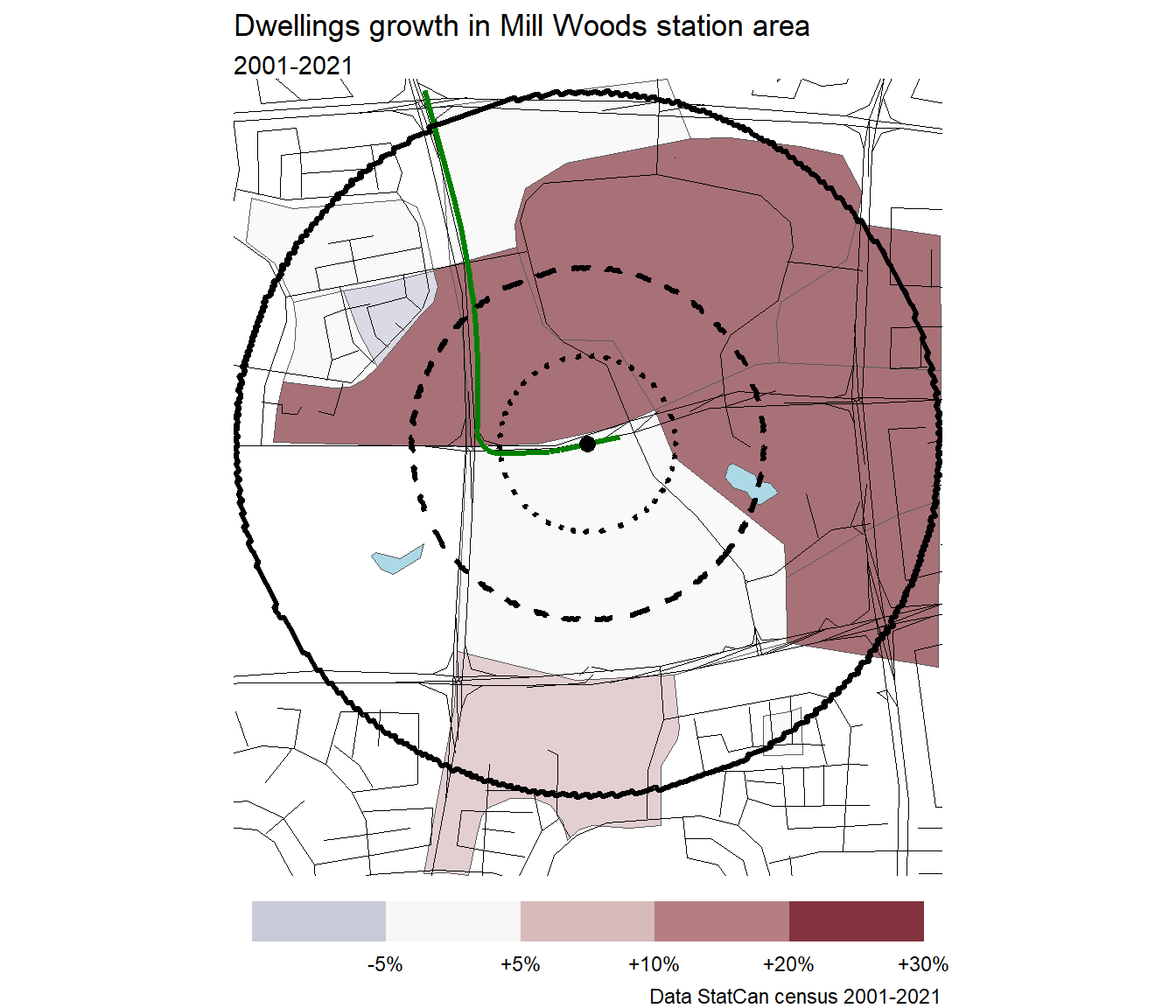
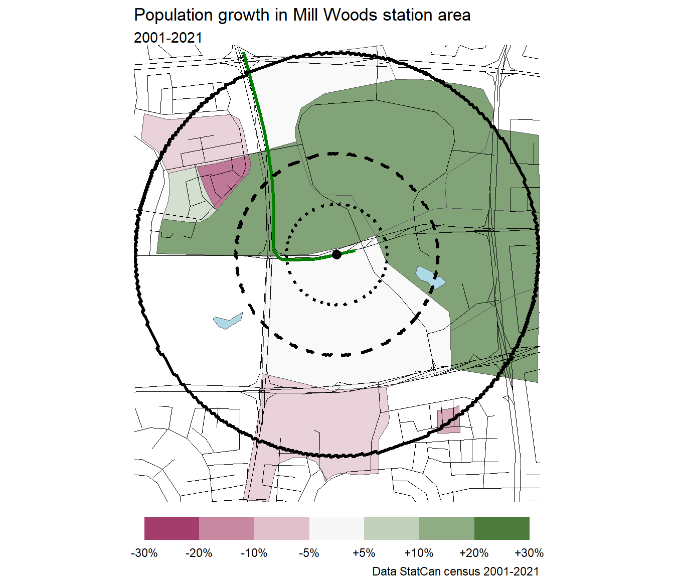
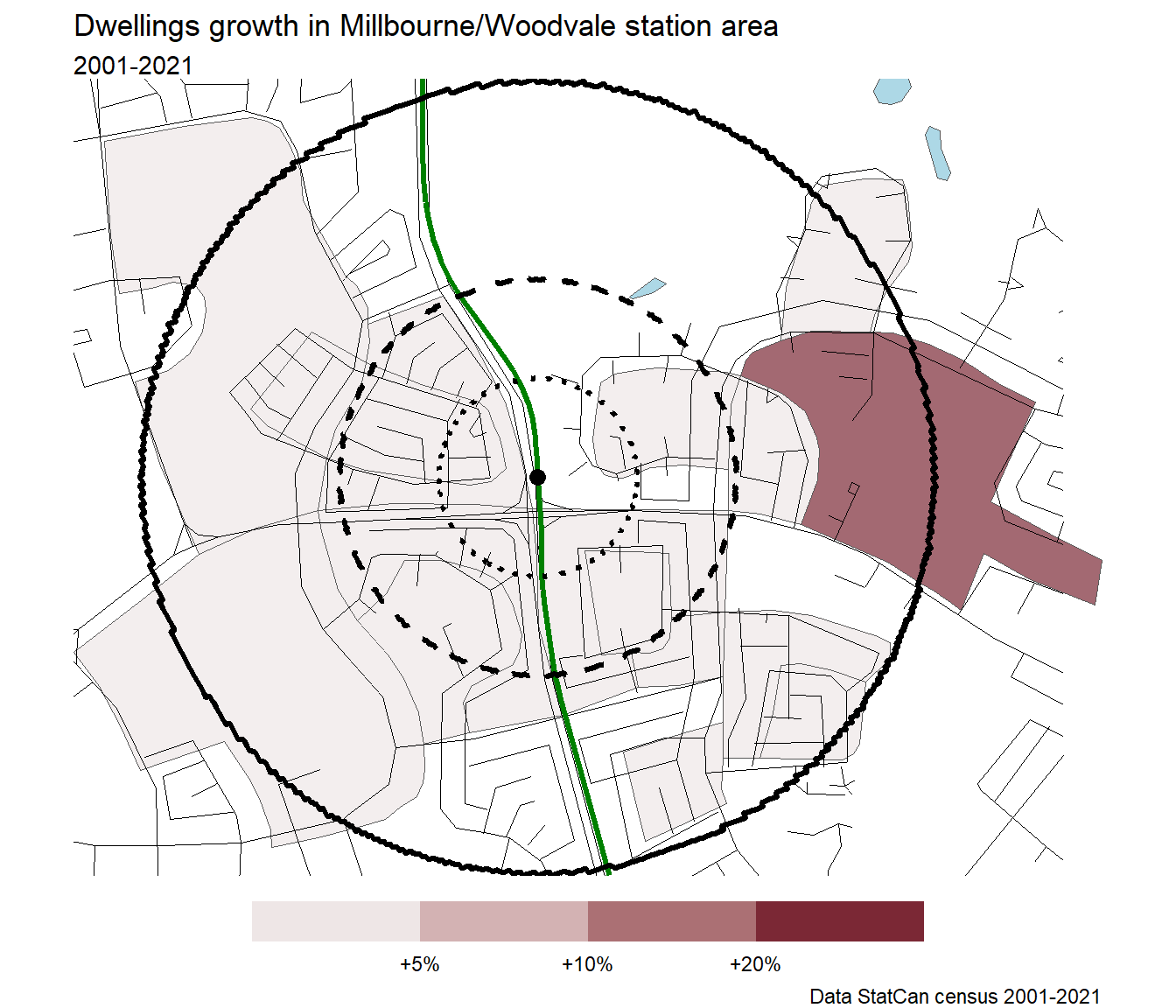
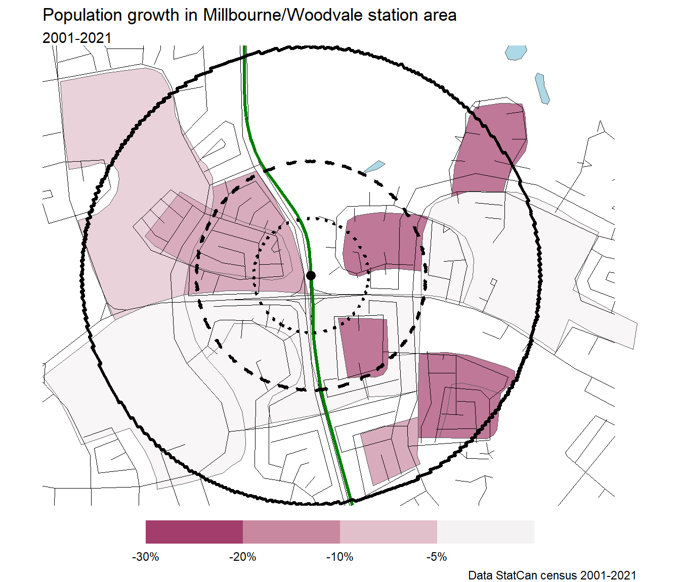
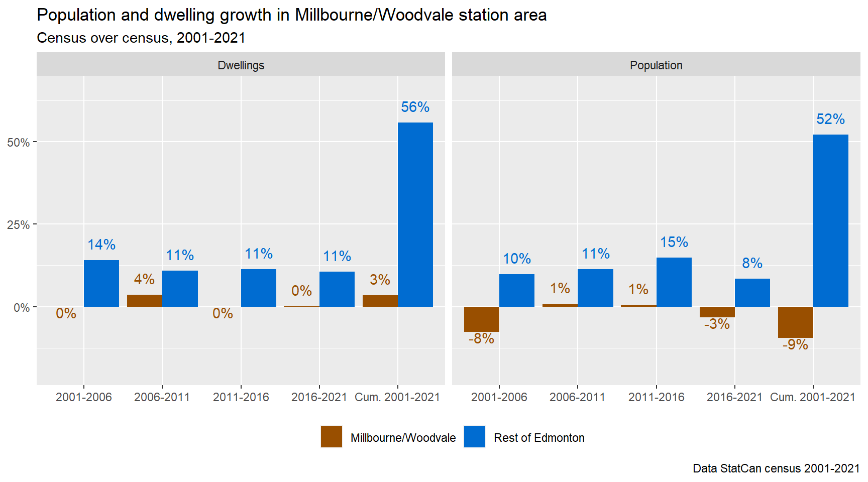
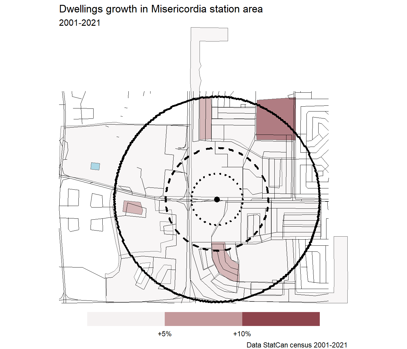
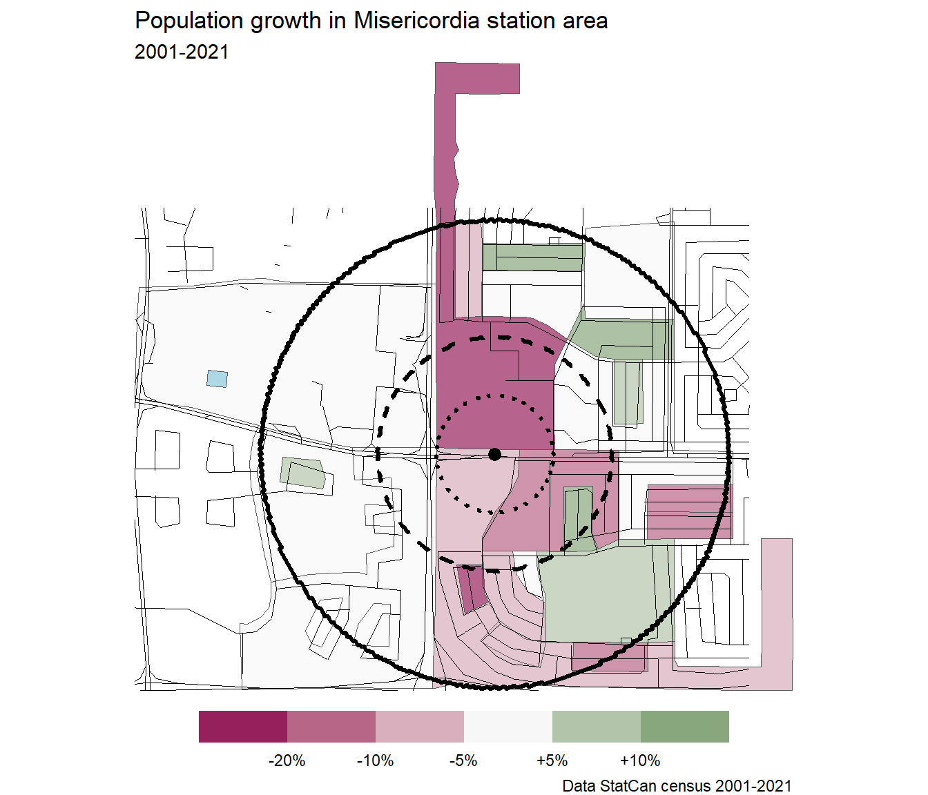
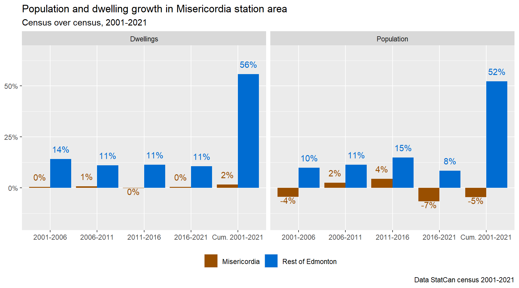
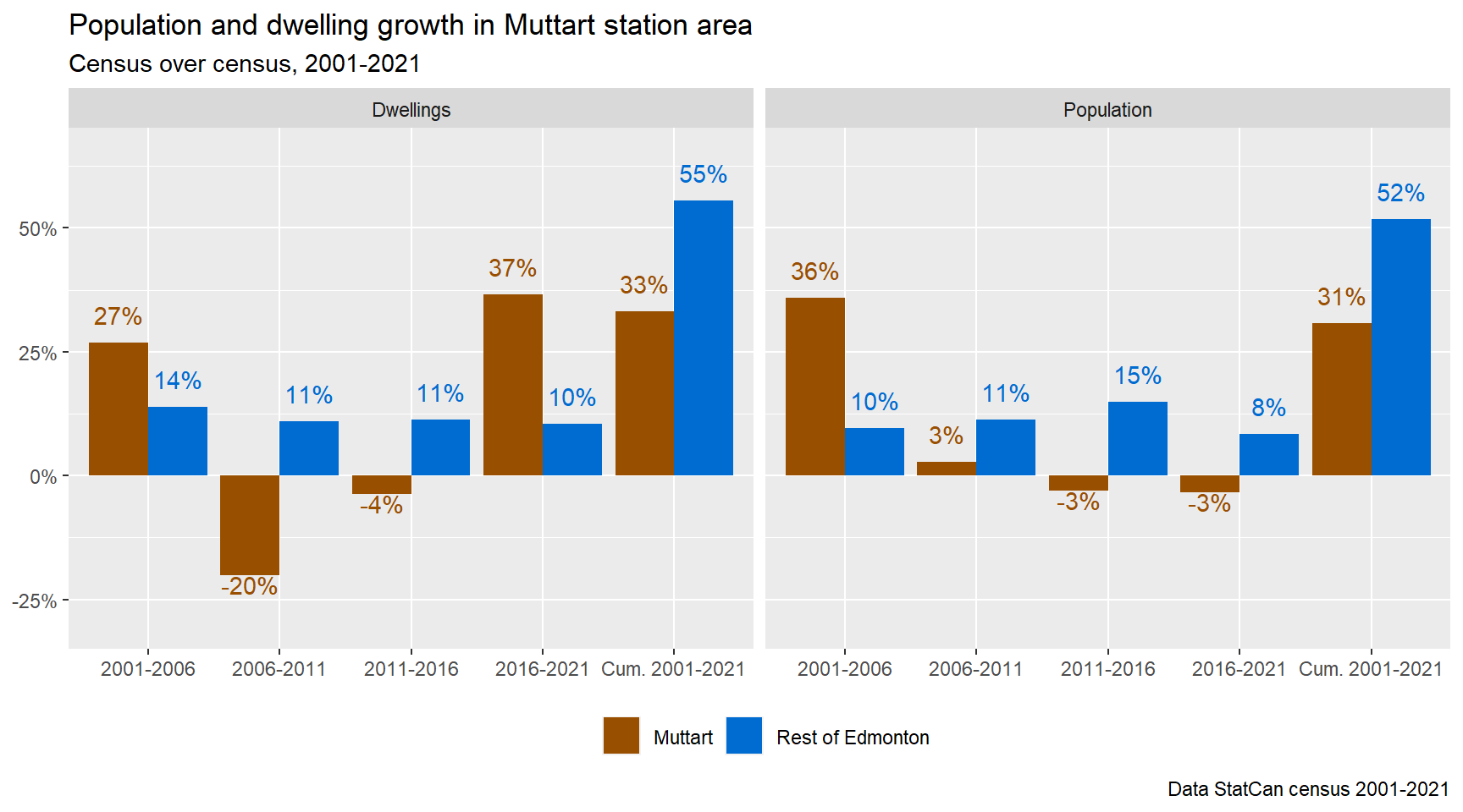
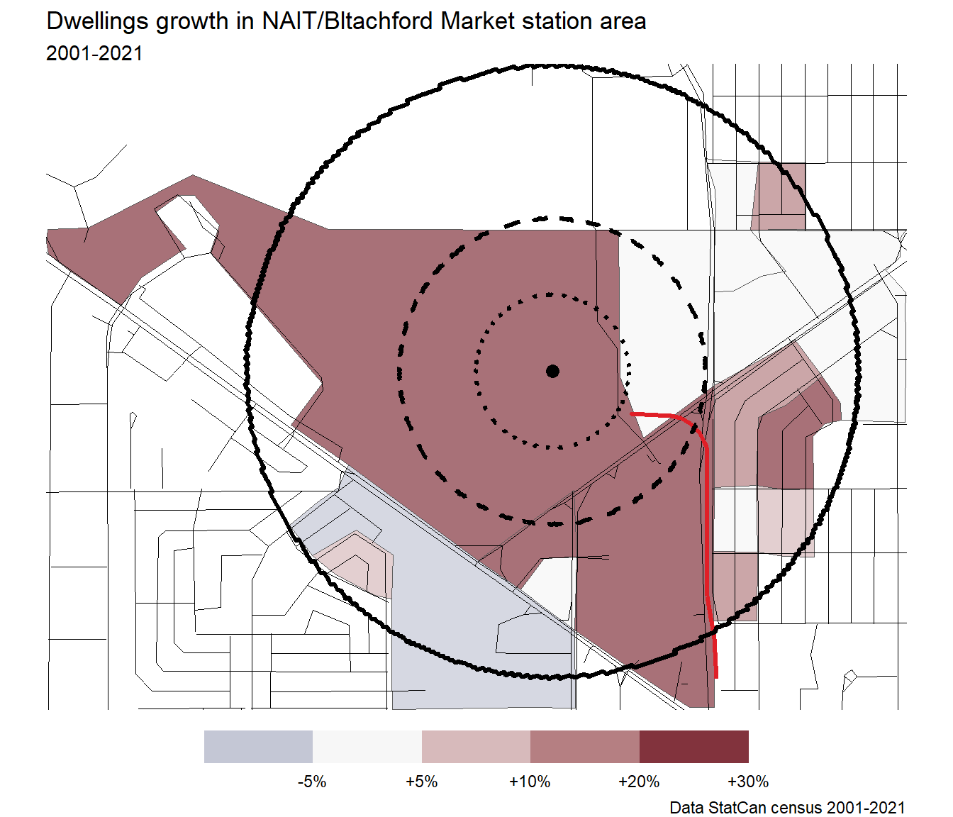
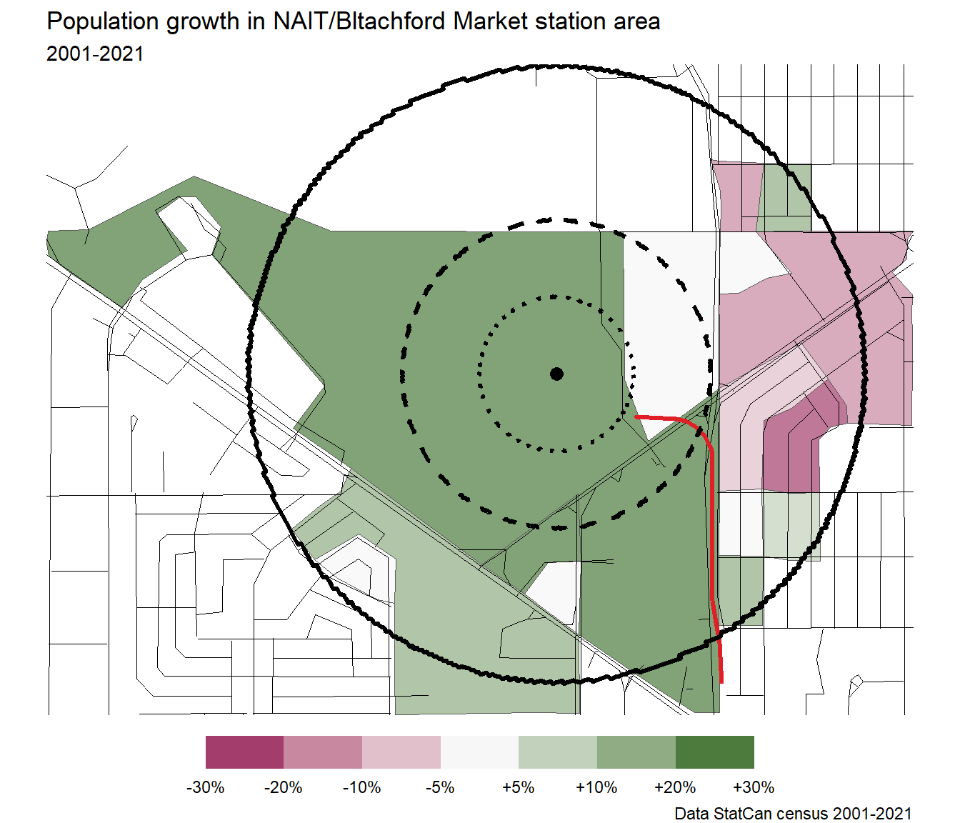
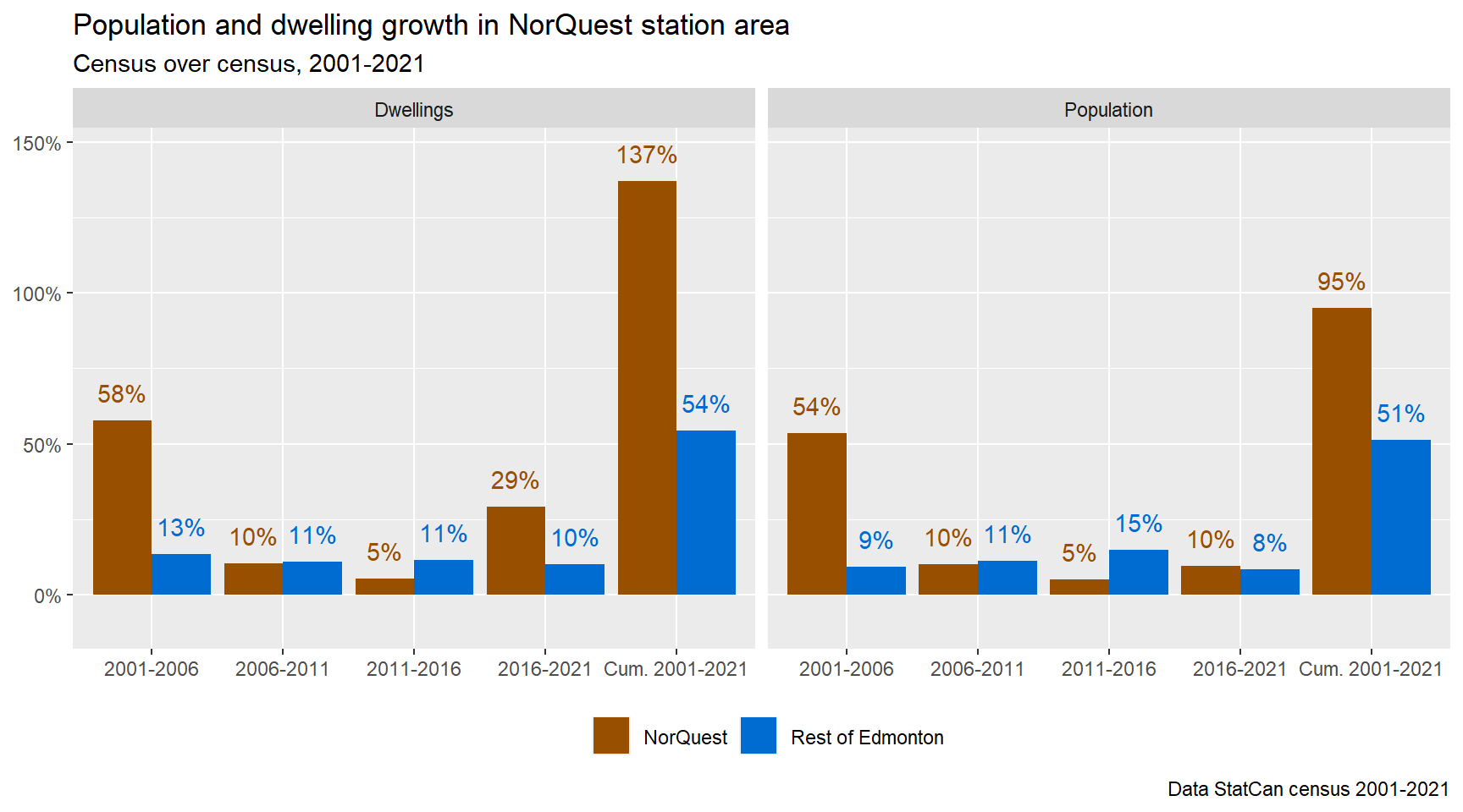
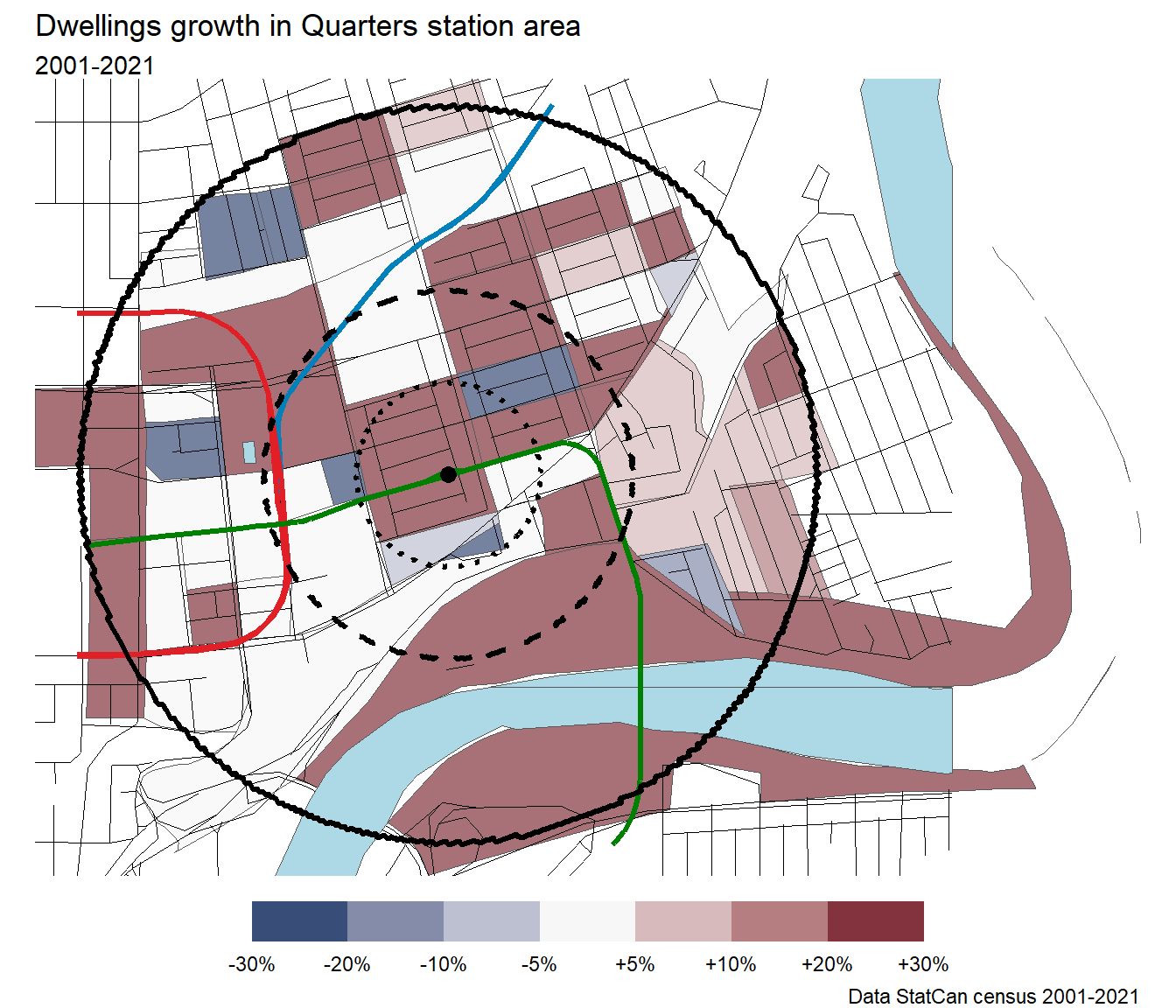
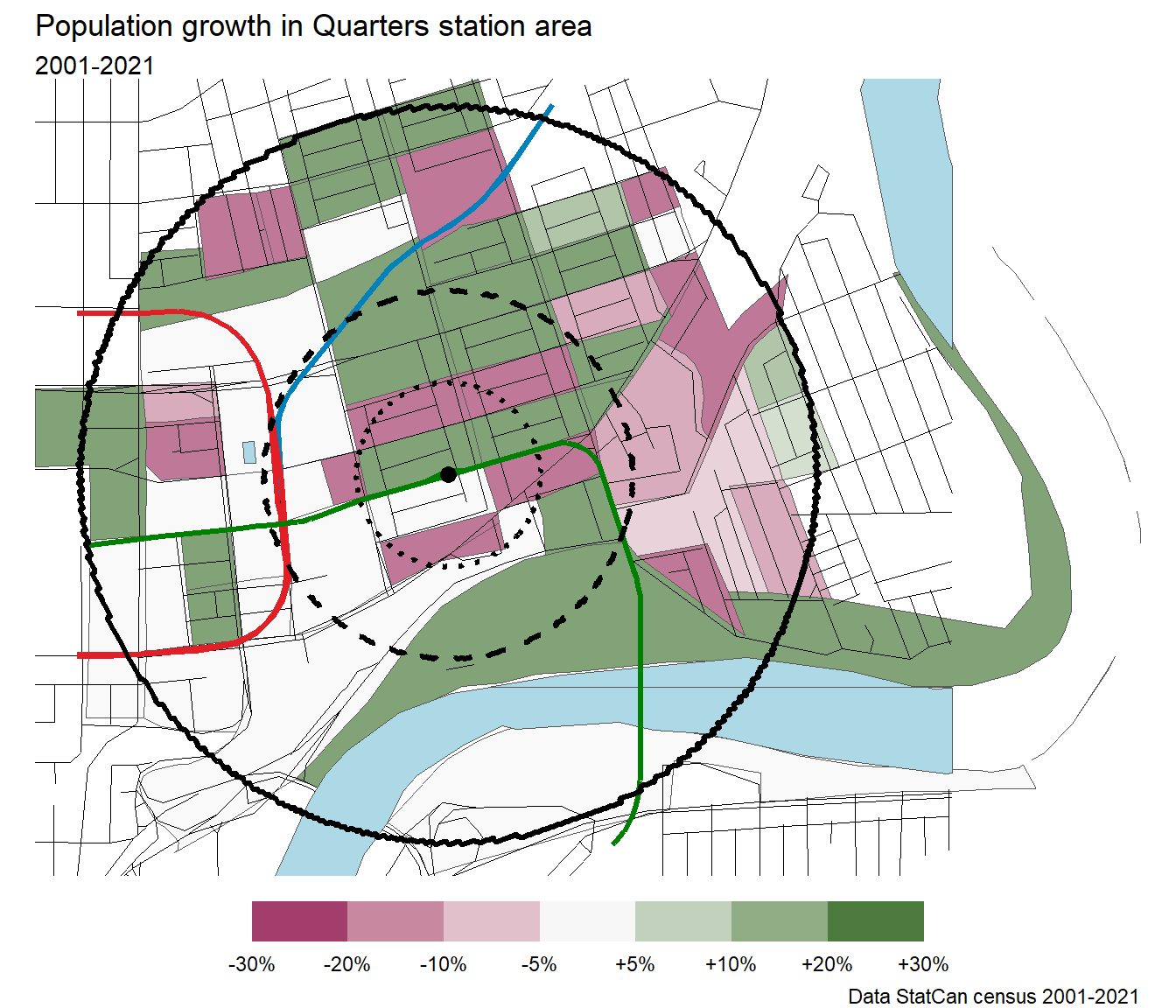
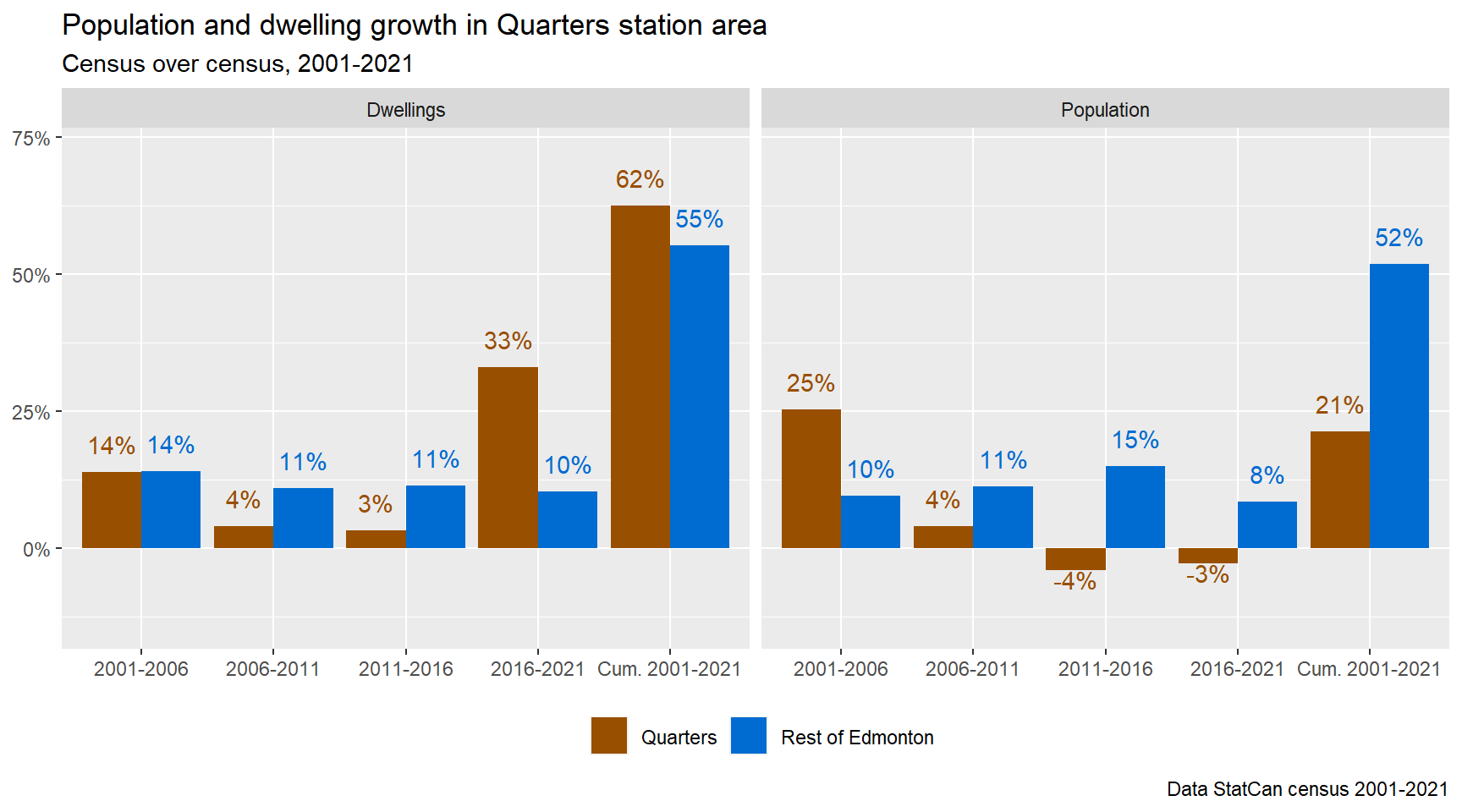
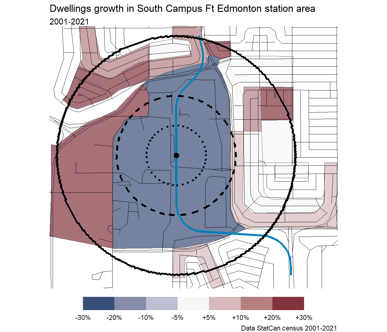
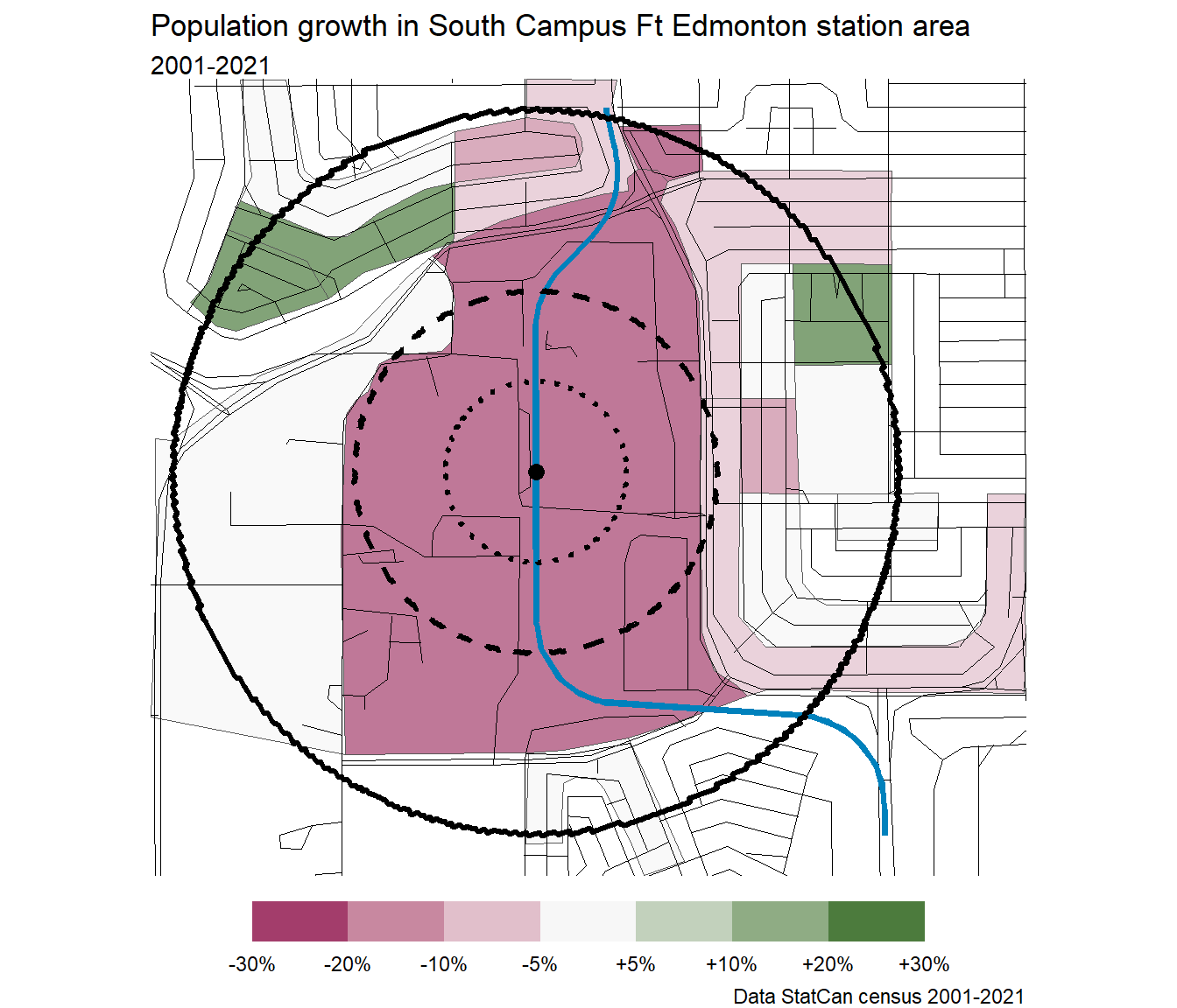
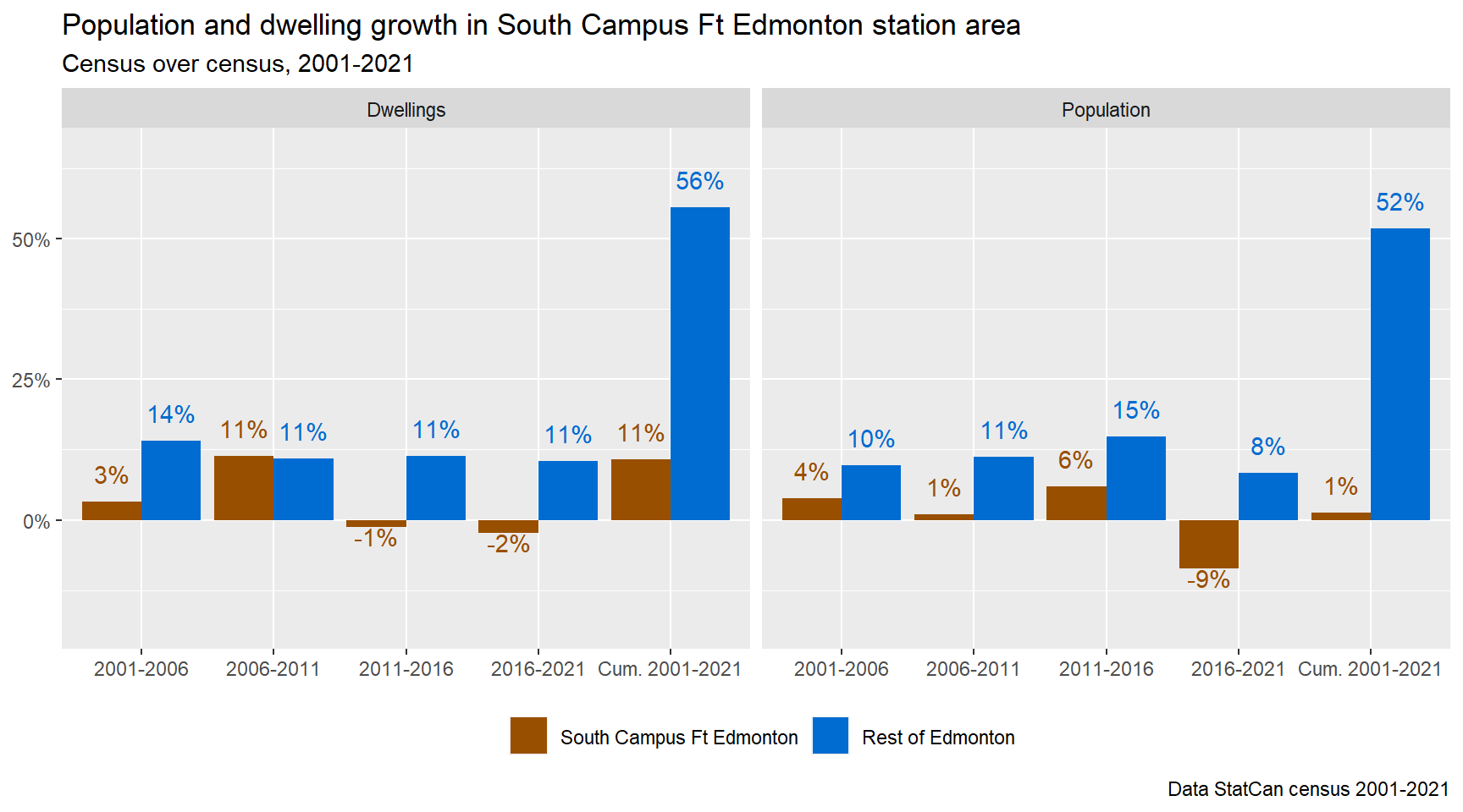
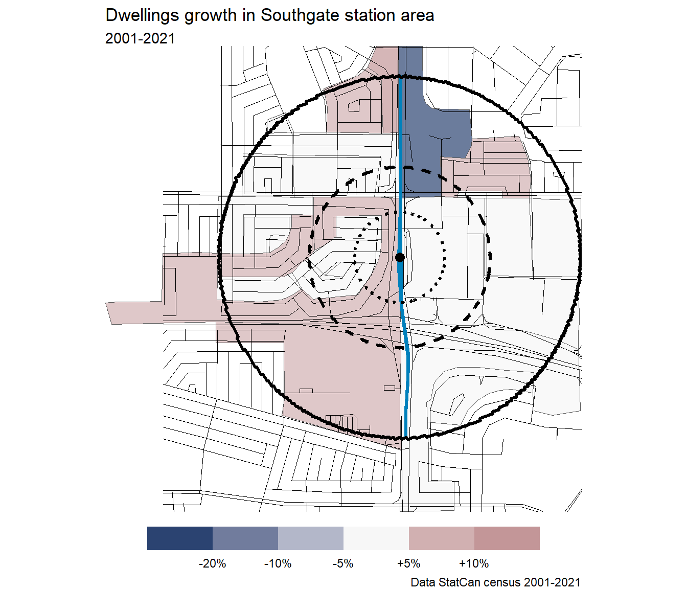
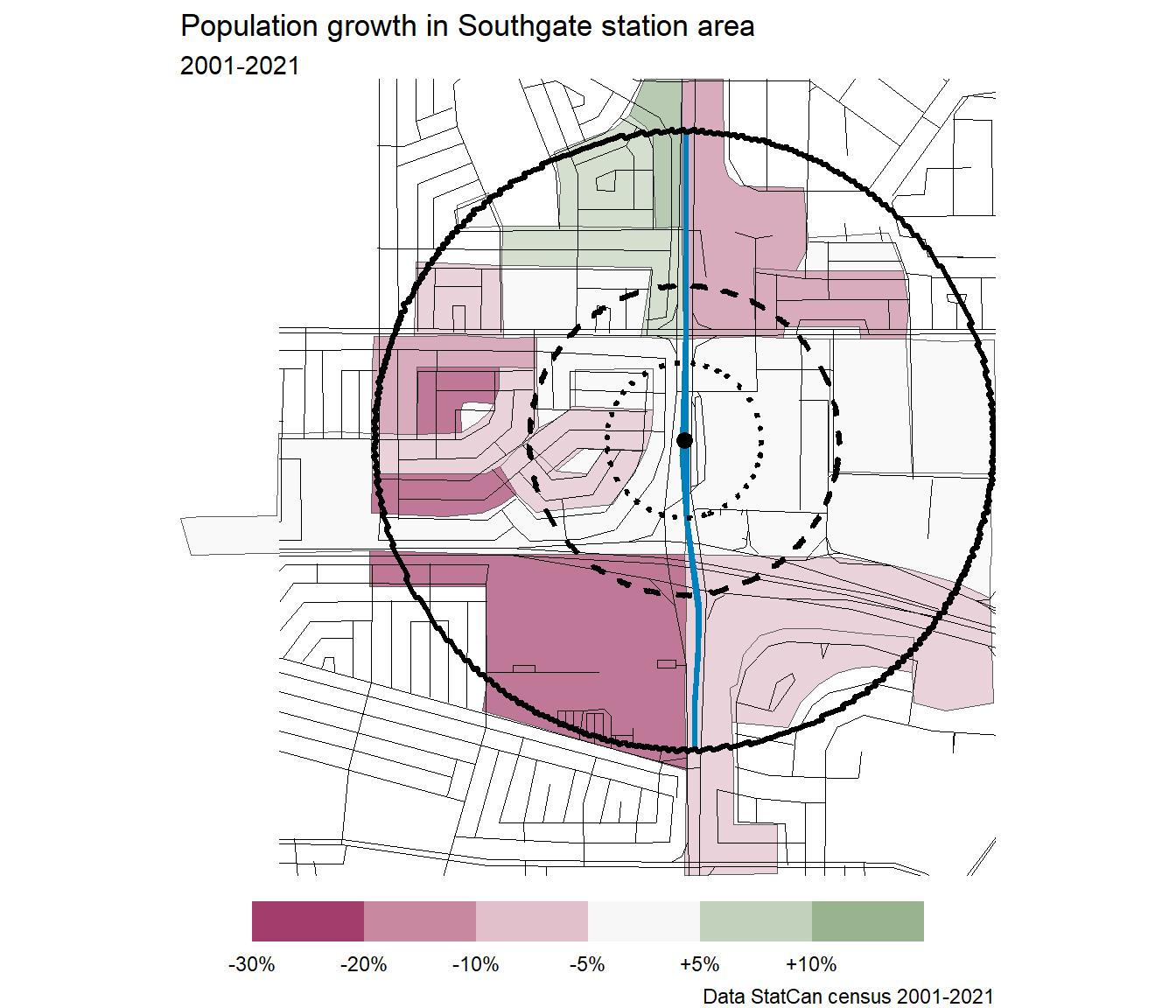
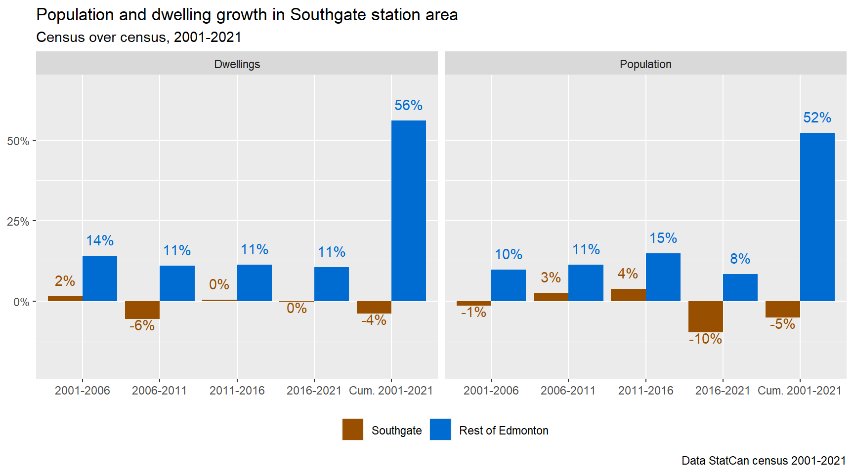
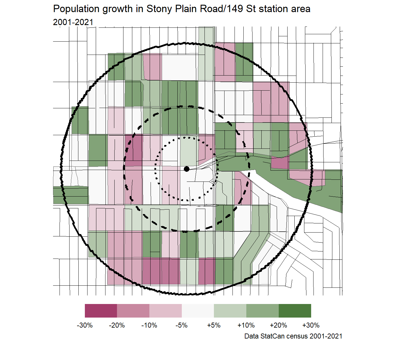
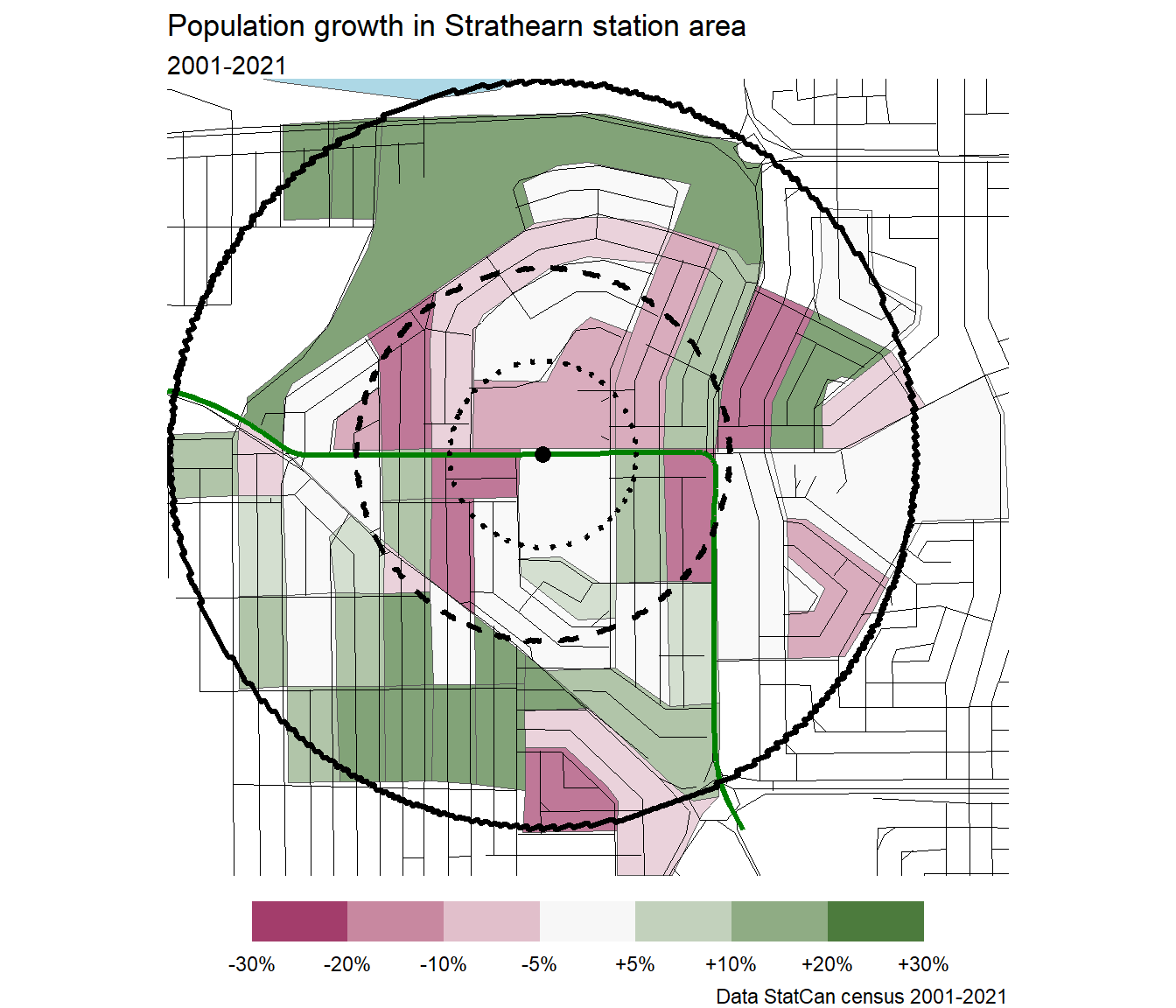
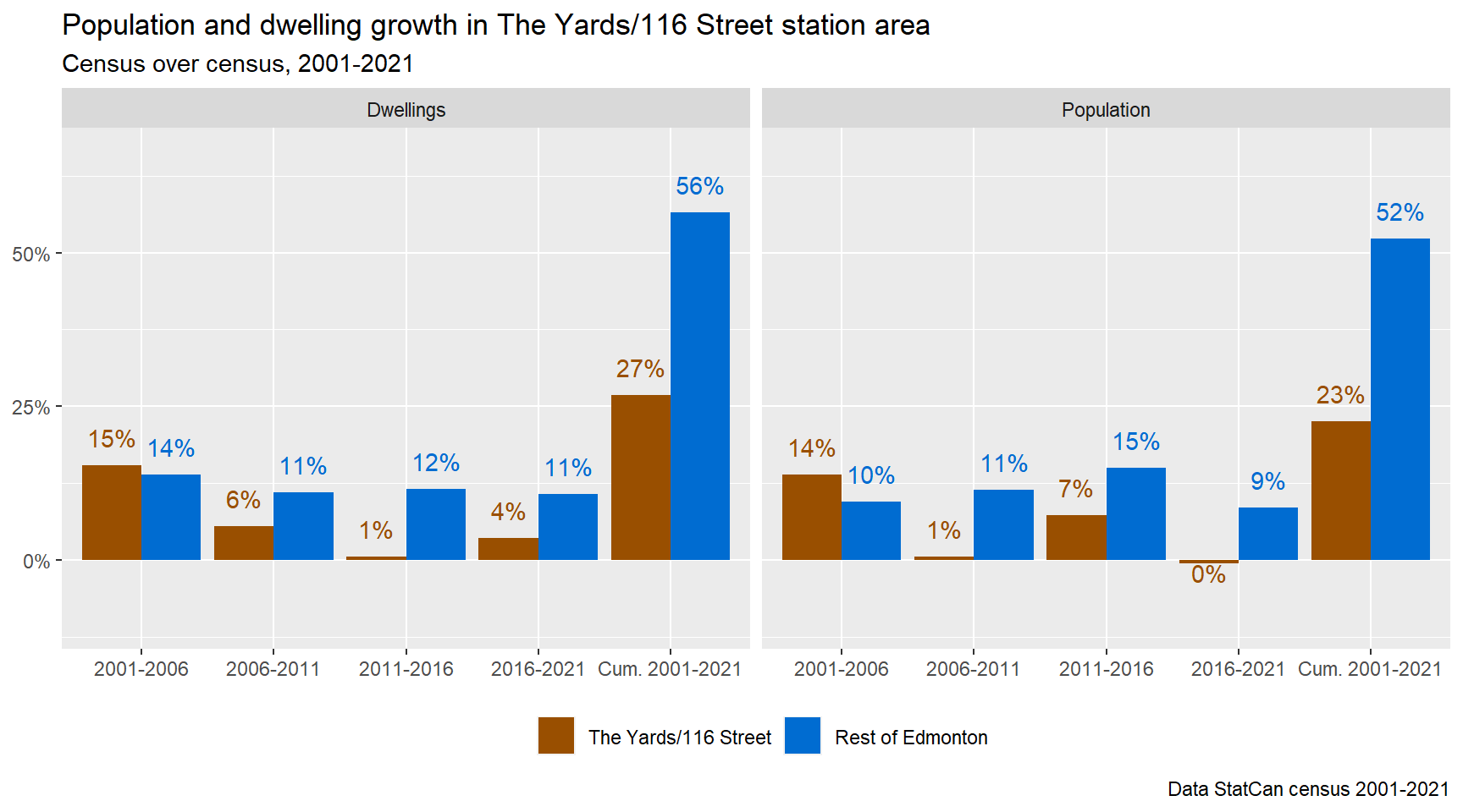
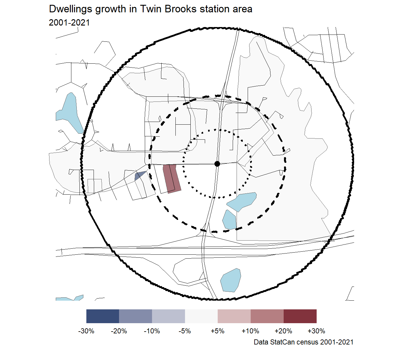
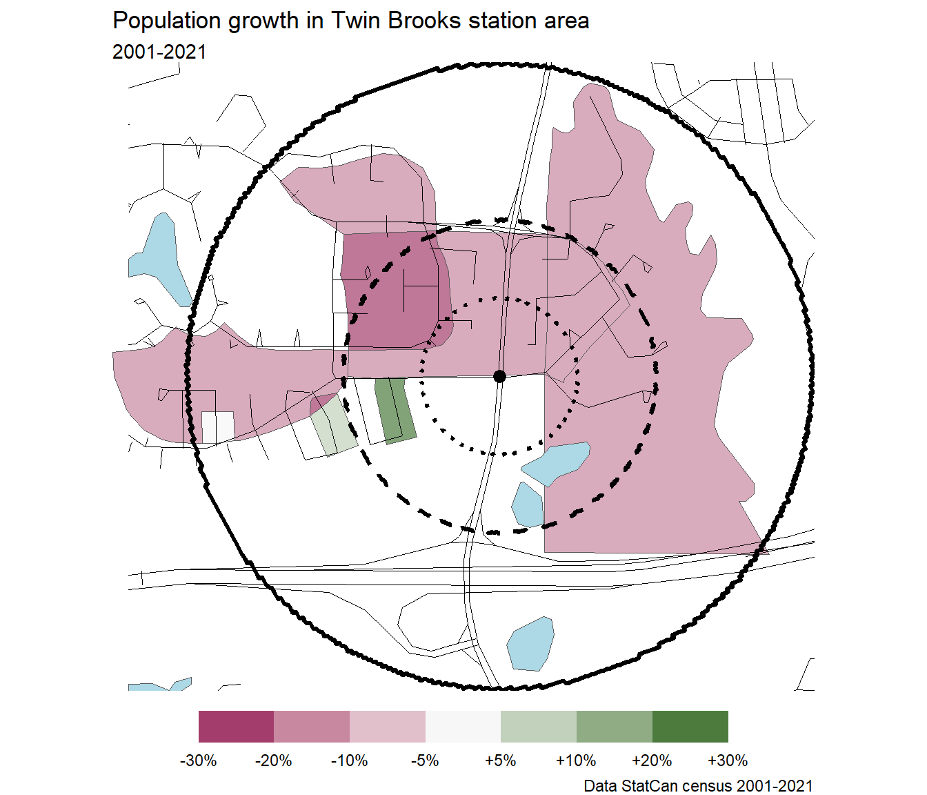
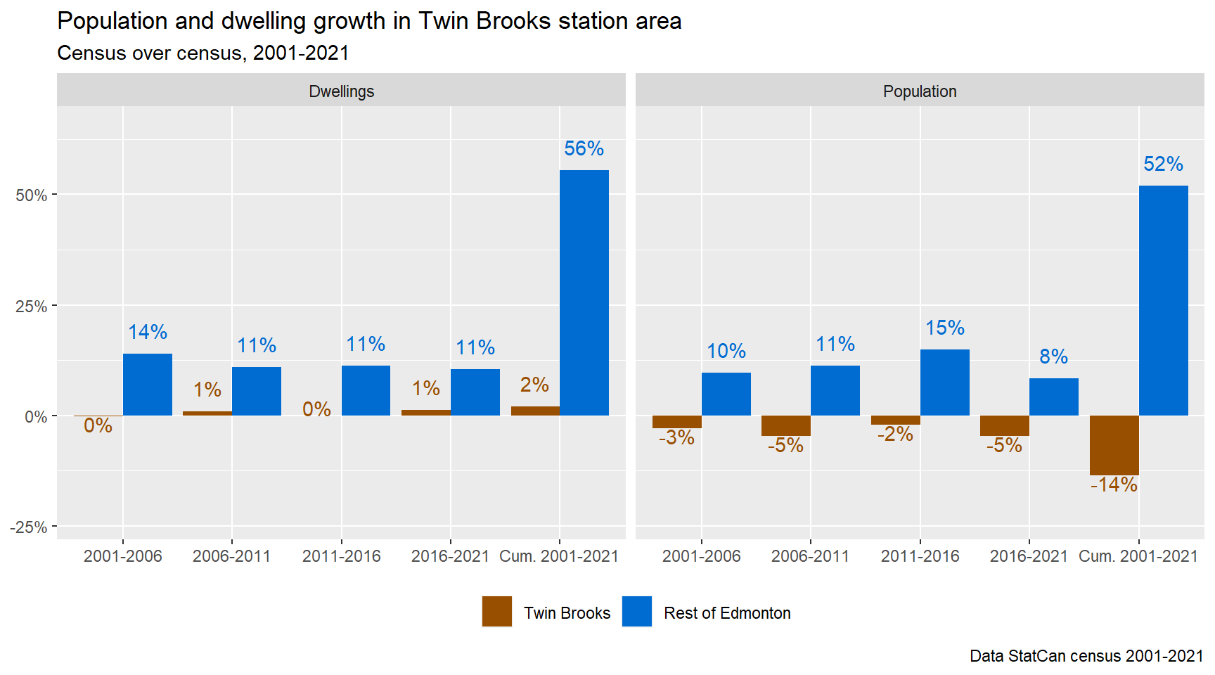
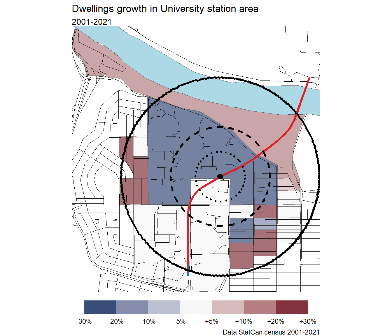
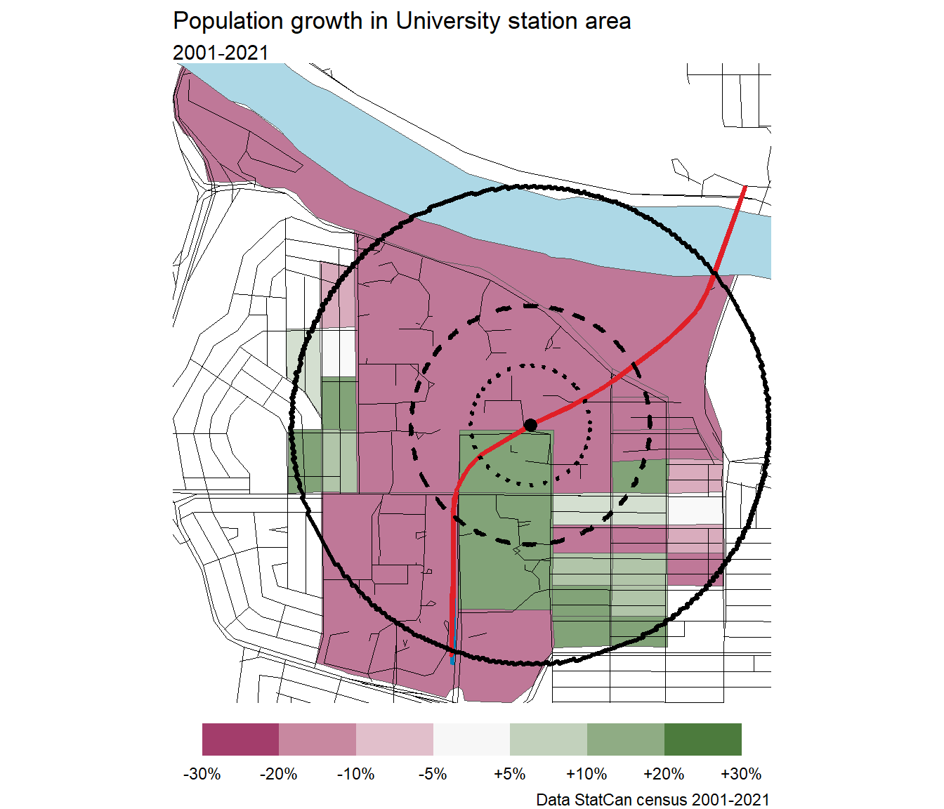
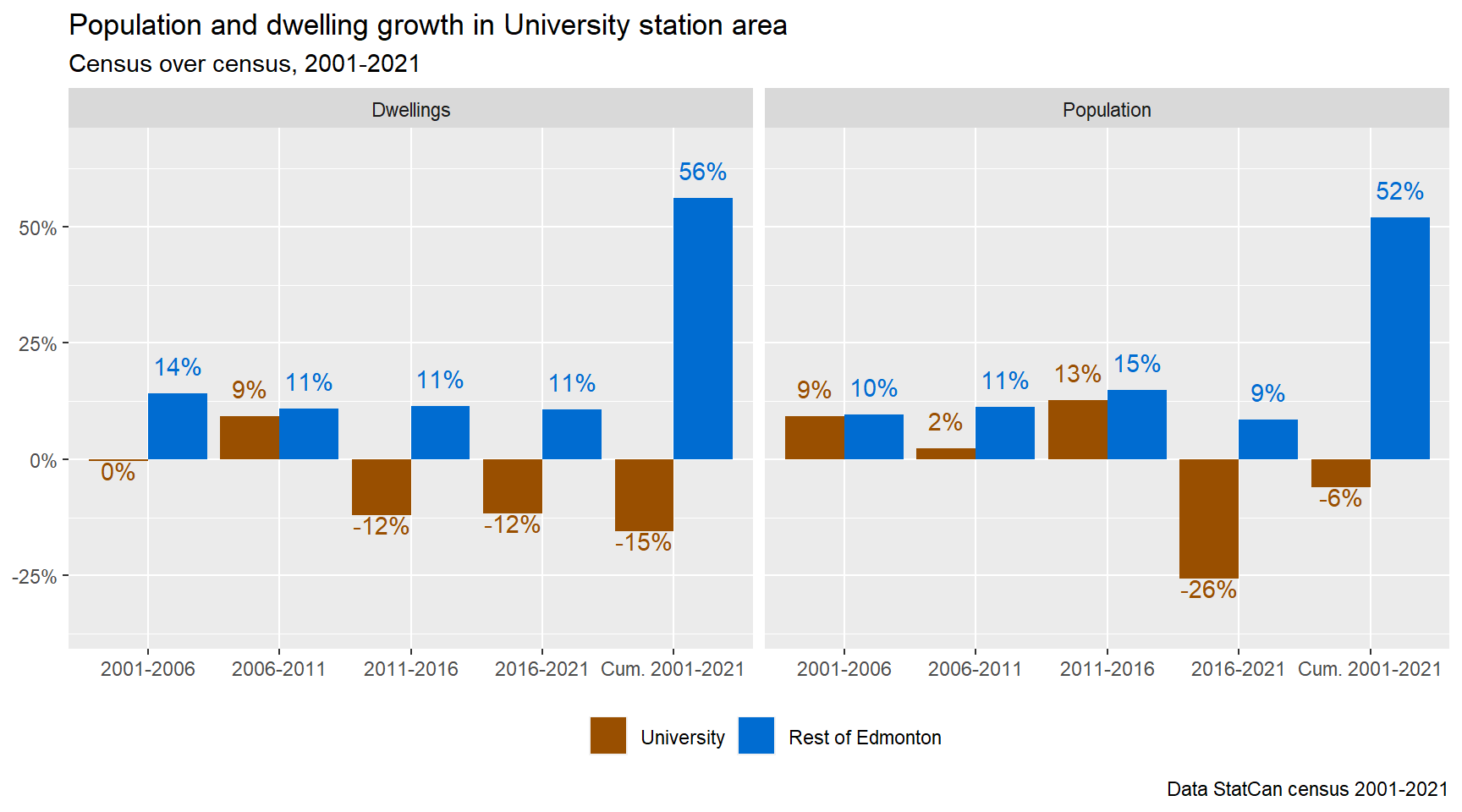
Using census data, I tabulated population and dwelling growth for each of the station areas between 2001-2021. I followed the same methodology for aligning the station area with the census dissemination blocks as in my posts for McKernan Belgravia Station. Dissemination blocks are considered part of the station area if over 50% of their area is within a 800m radius of the station.
Note
I excluded Davies and Lewis Farms from these charts as they are majority industrial and agricultural in 2001. Having almost no population or dwellings in the base year messes up the chart.
Stations
Lots of plots here, but this is where you’ll find a profile of each station’s land use and growth.
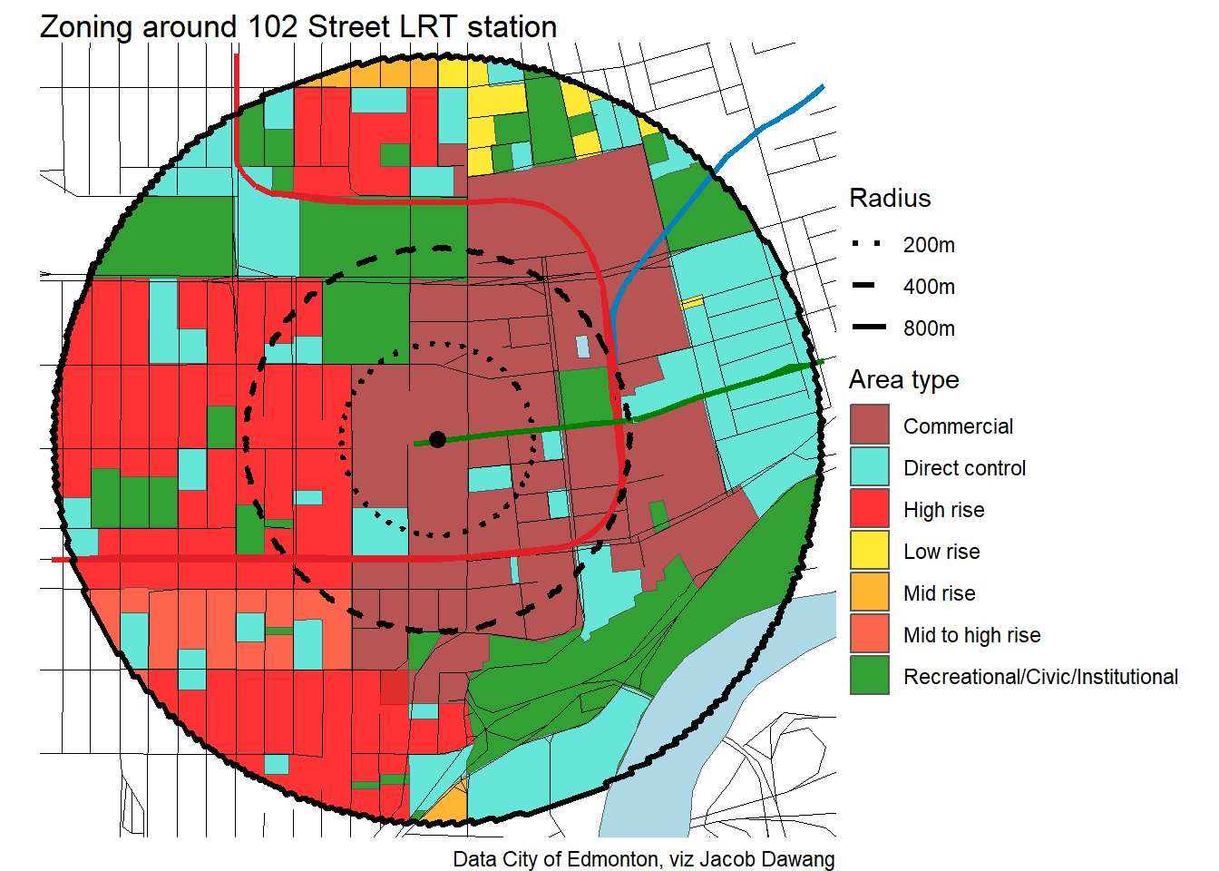
102 Street
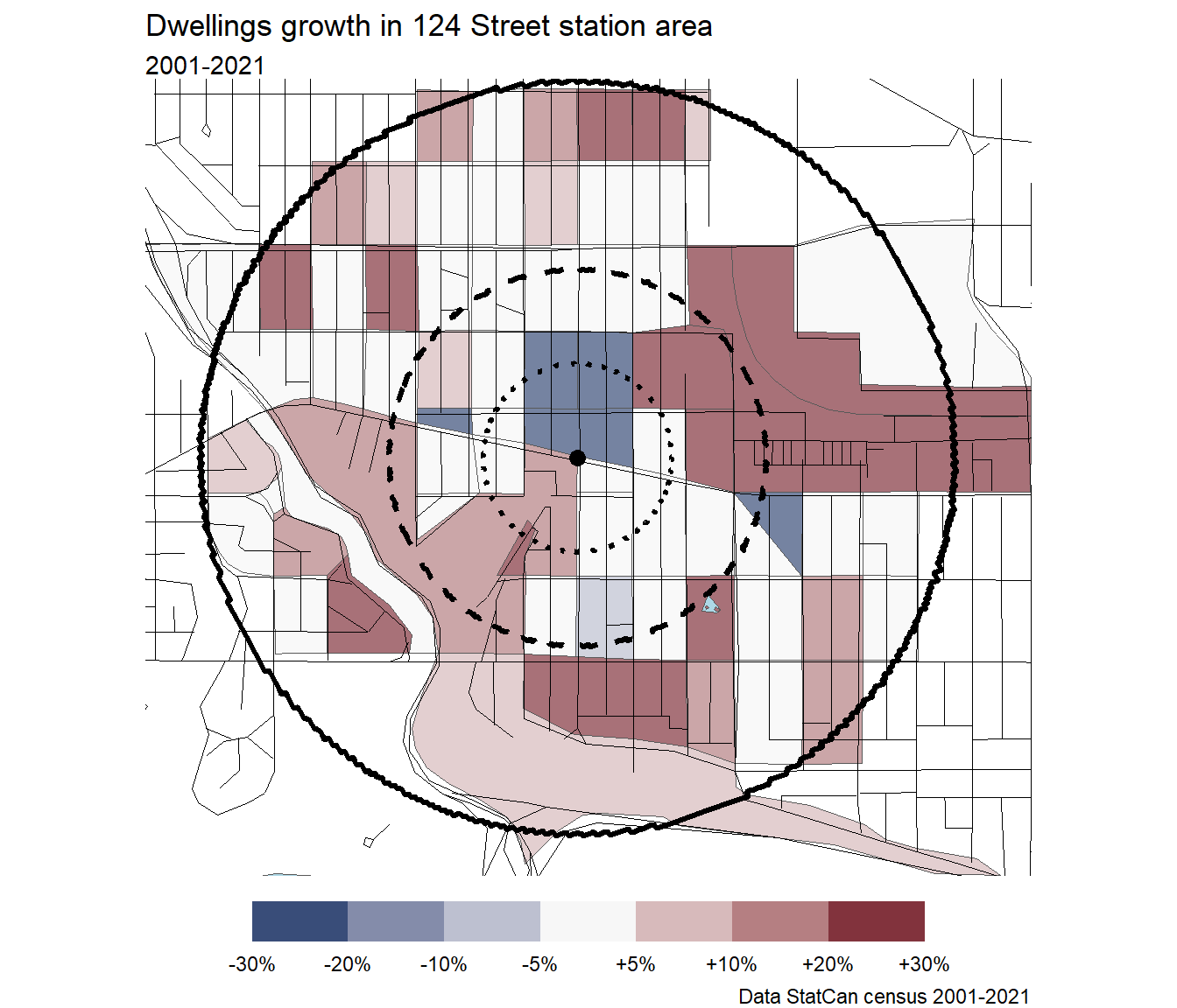
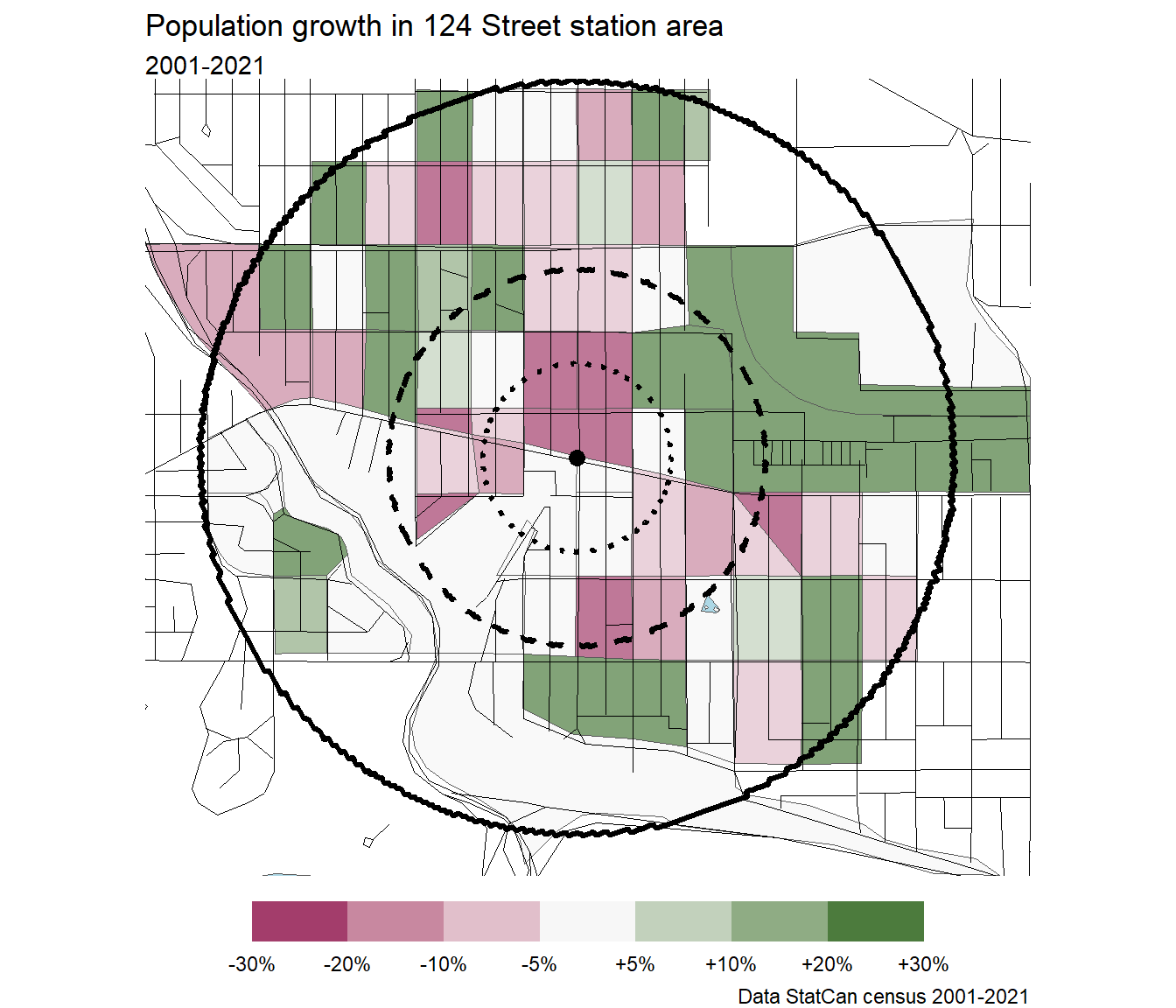
124 Street
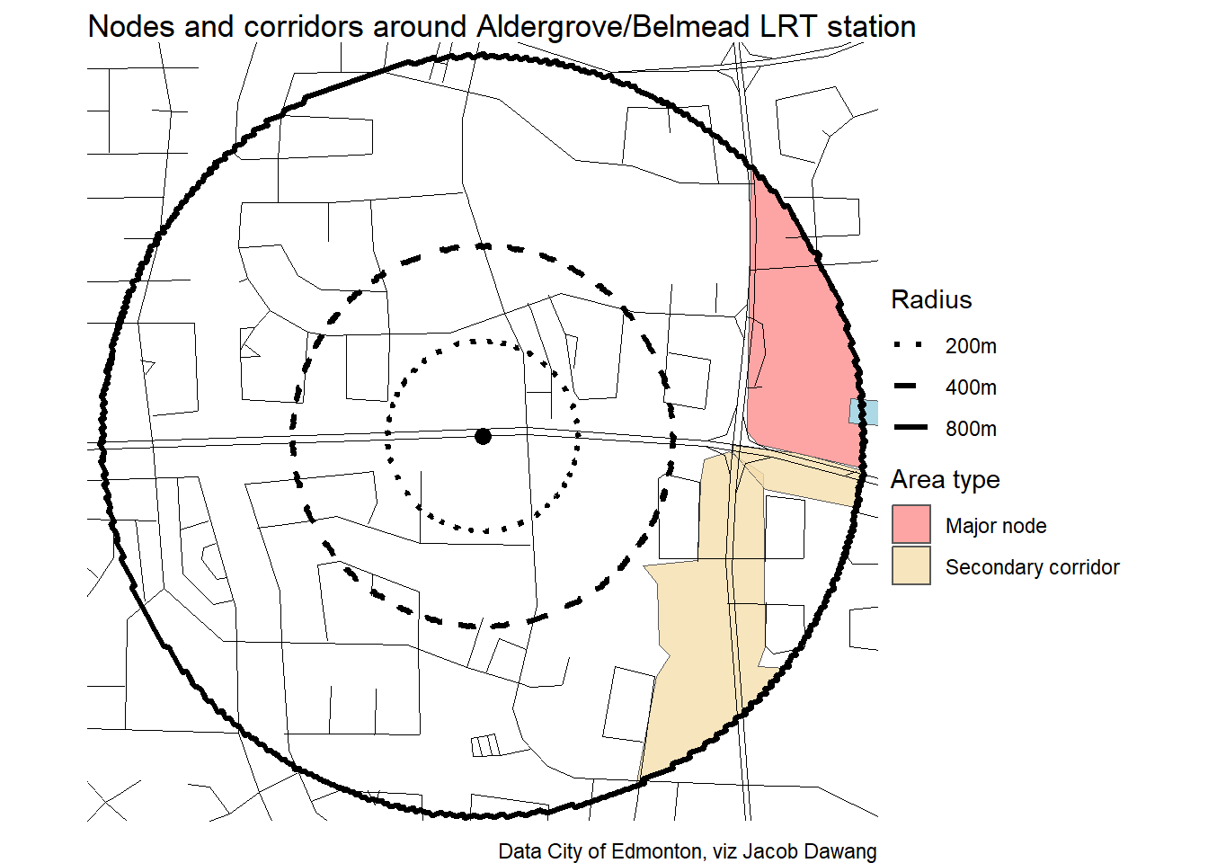
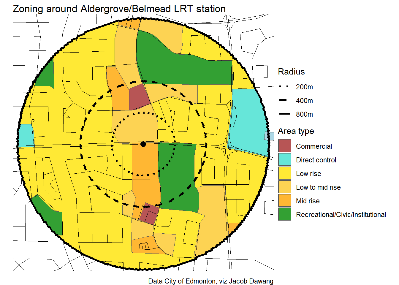
Aldergrove/Belmead
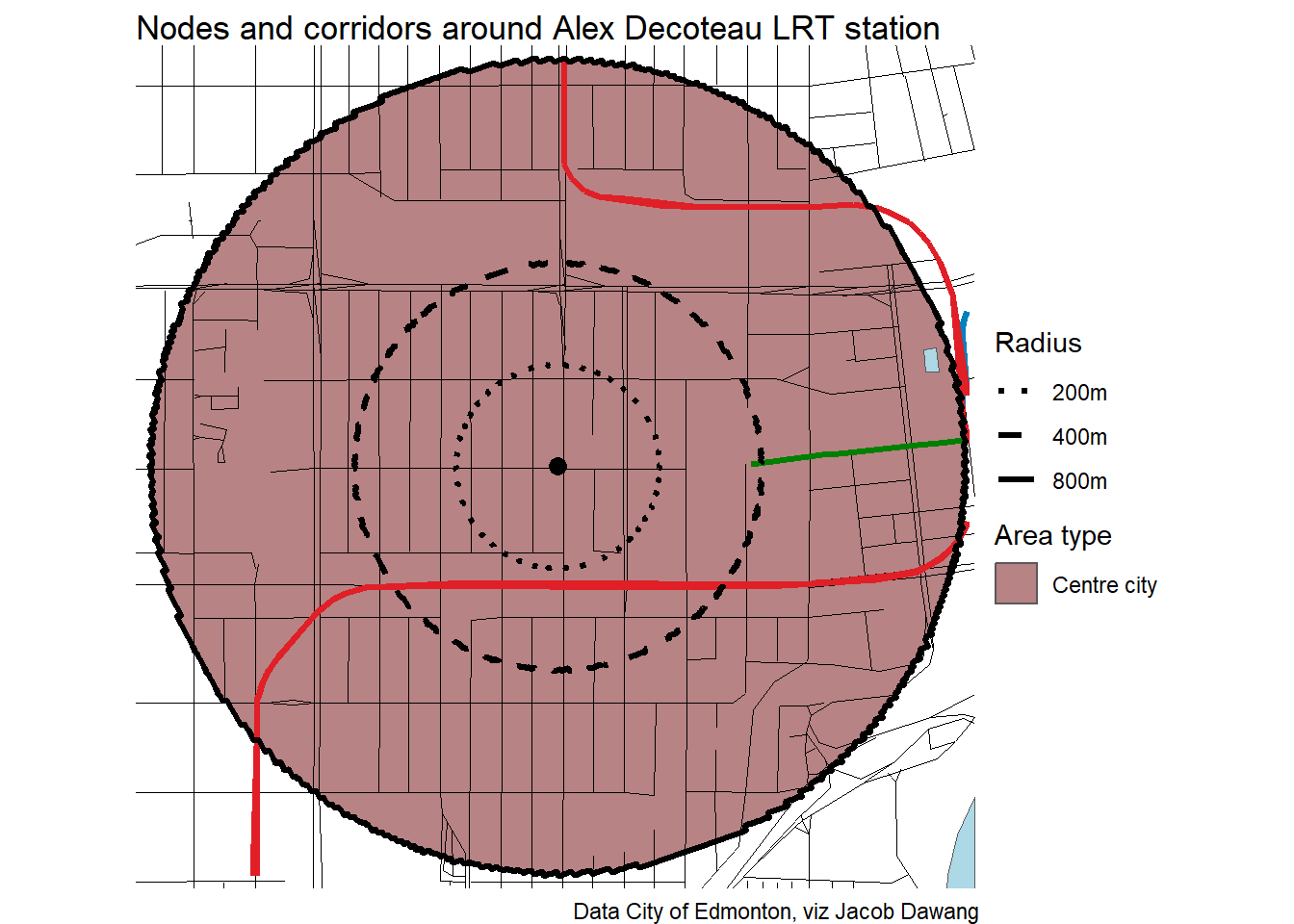
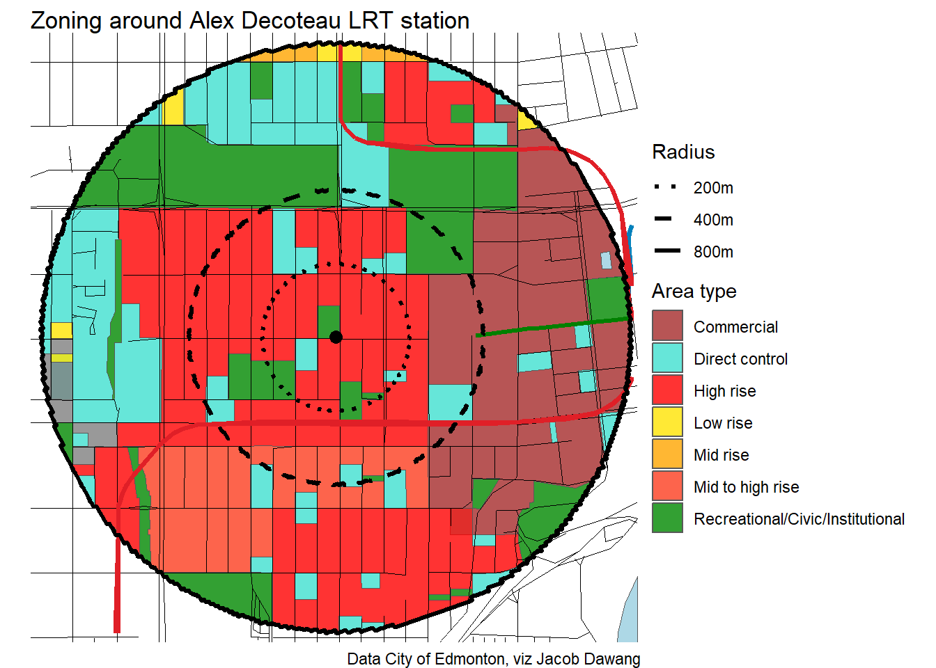
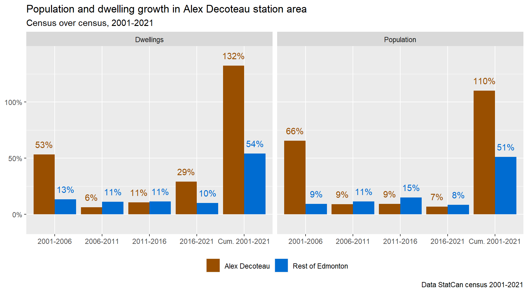
Alex Decoteau
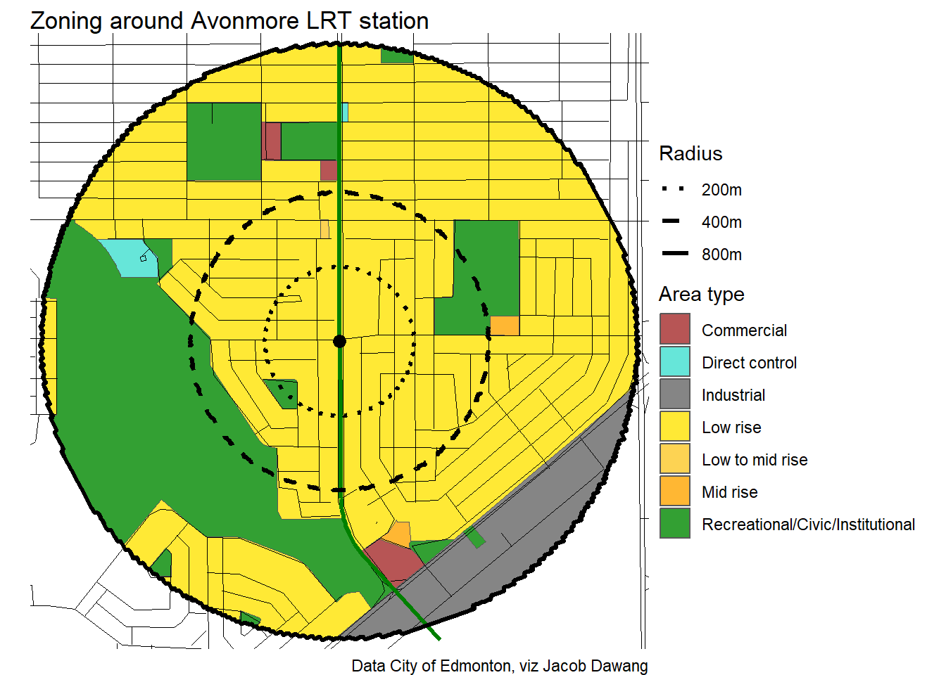
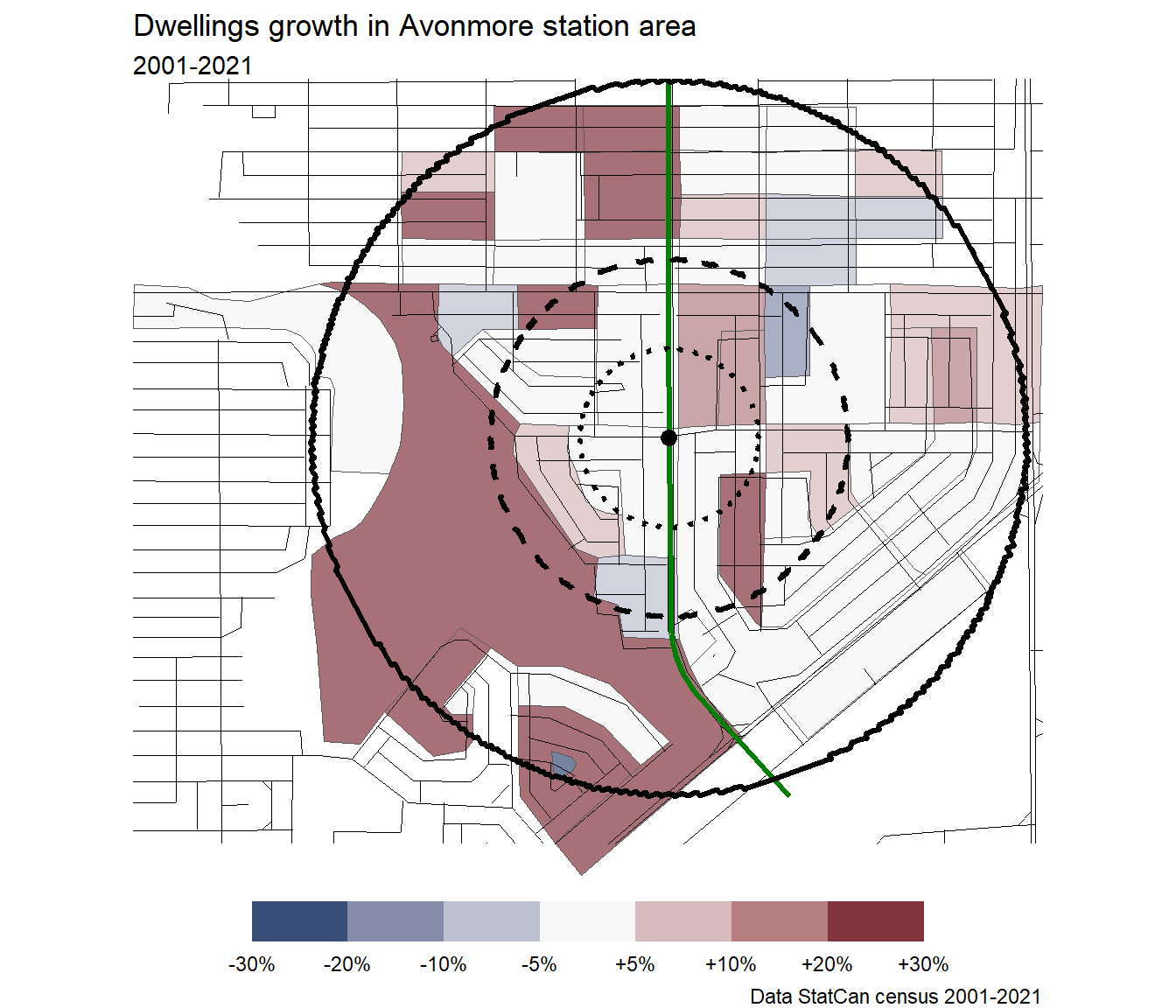
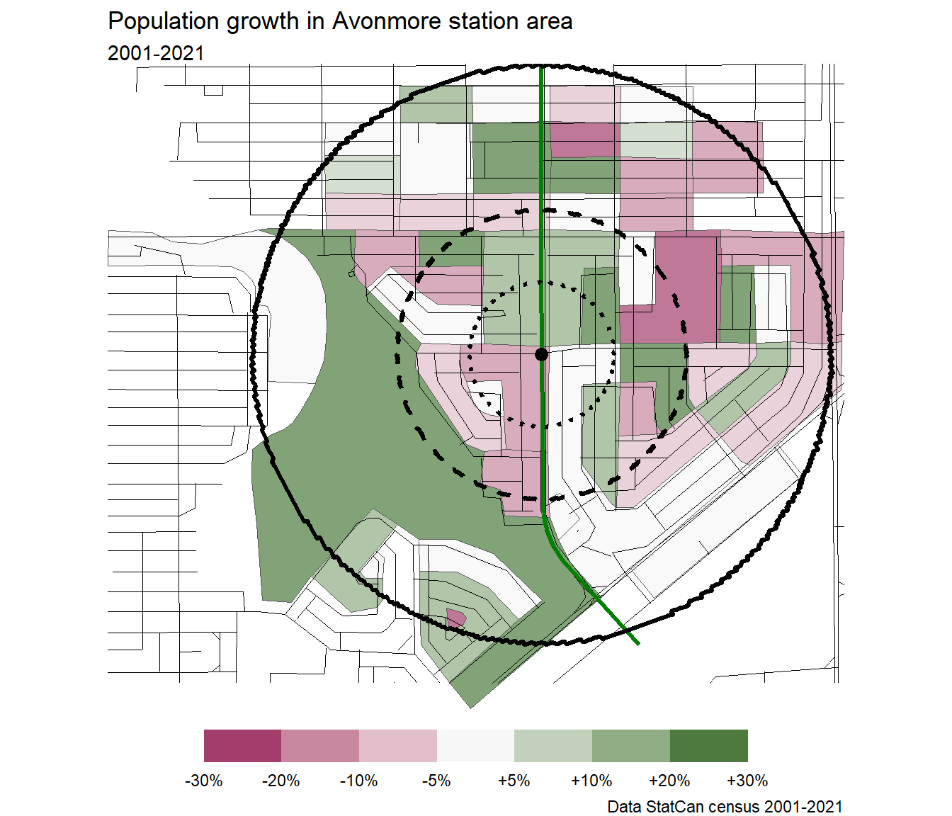
Avonmore
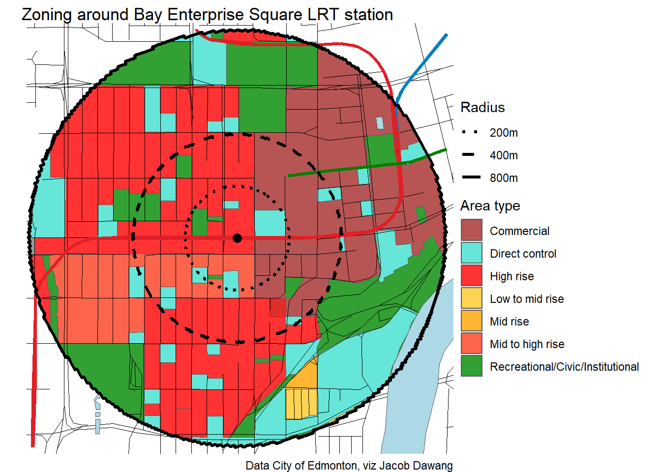
Bay Enterprise Square
Belvedere

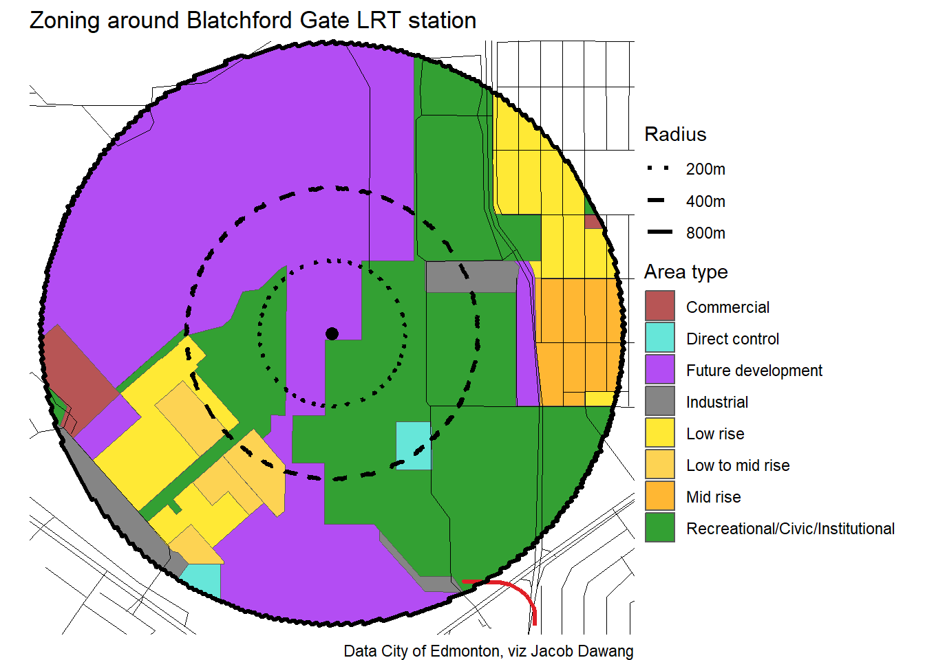
Blatchford Gate
Bonnie Doon

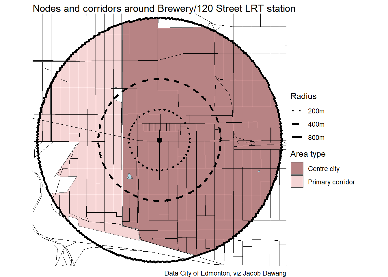
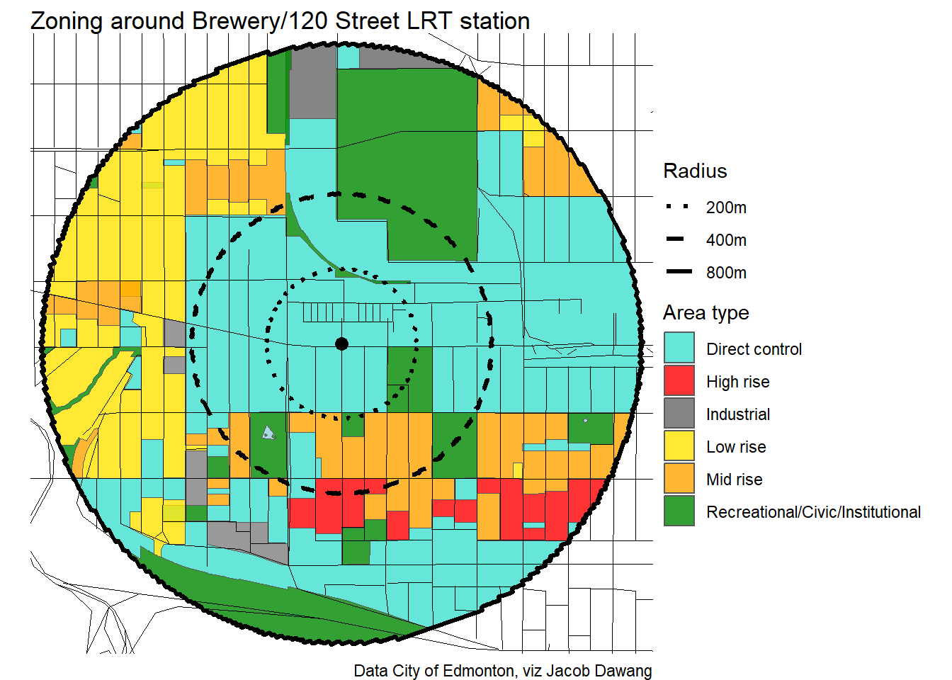
Brewery/120 Street
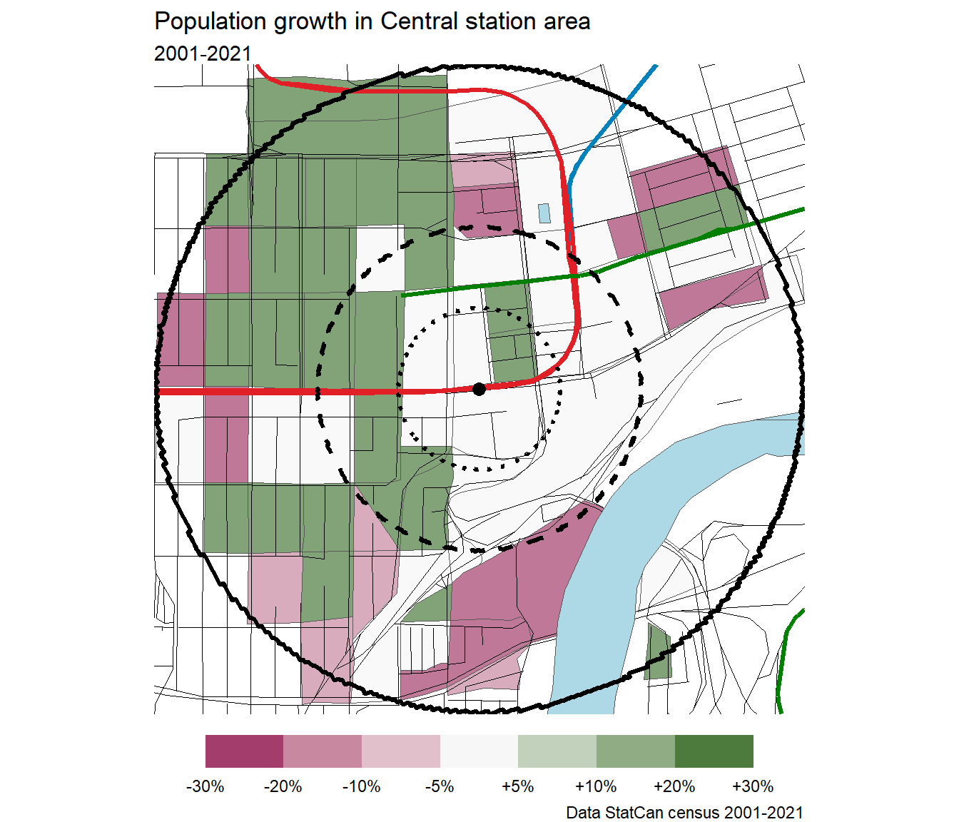
Central
Century Park
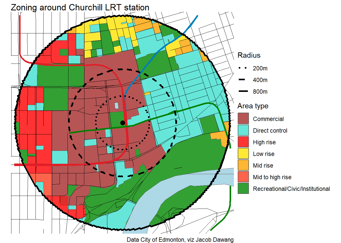
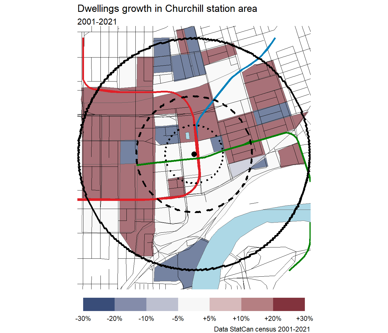
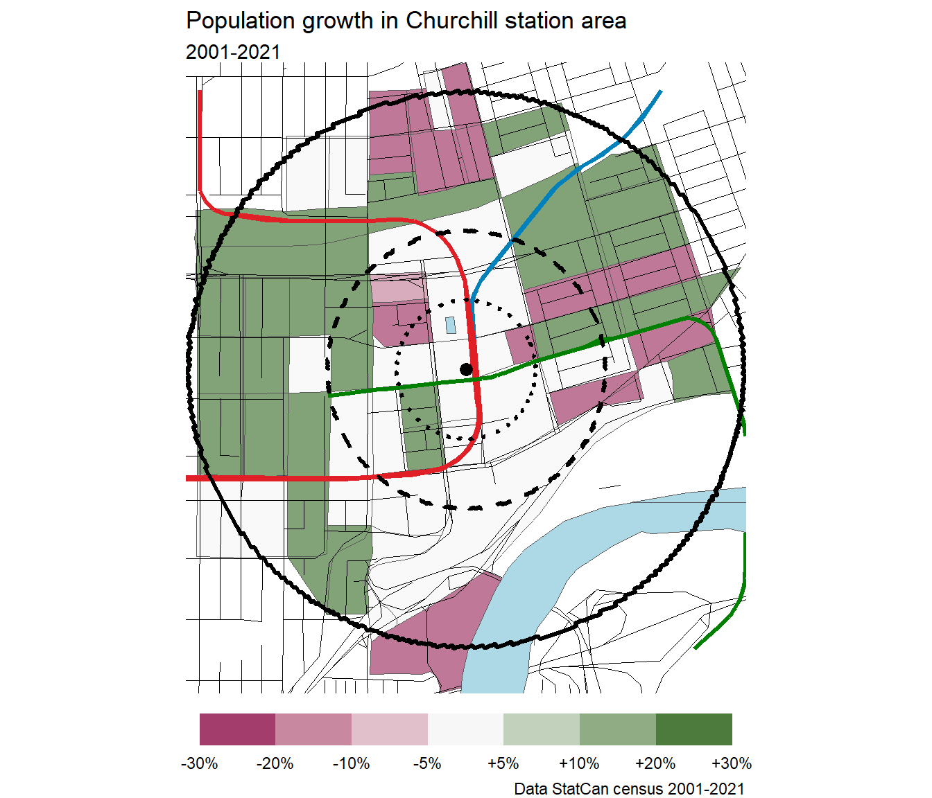
Churchill
Clareview
Coliseum

Corona
Davies
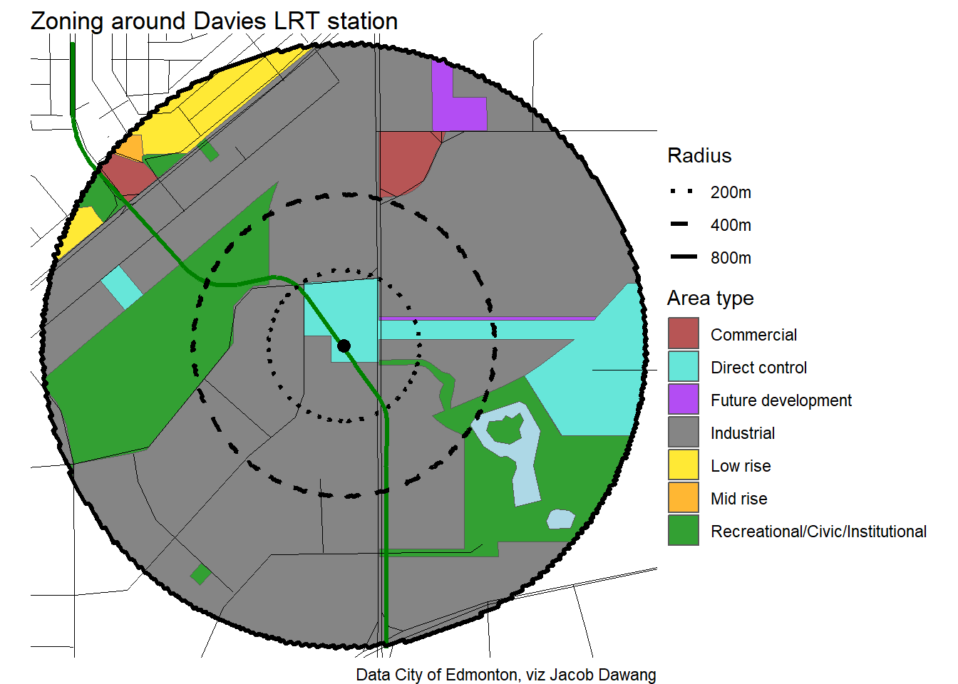
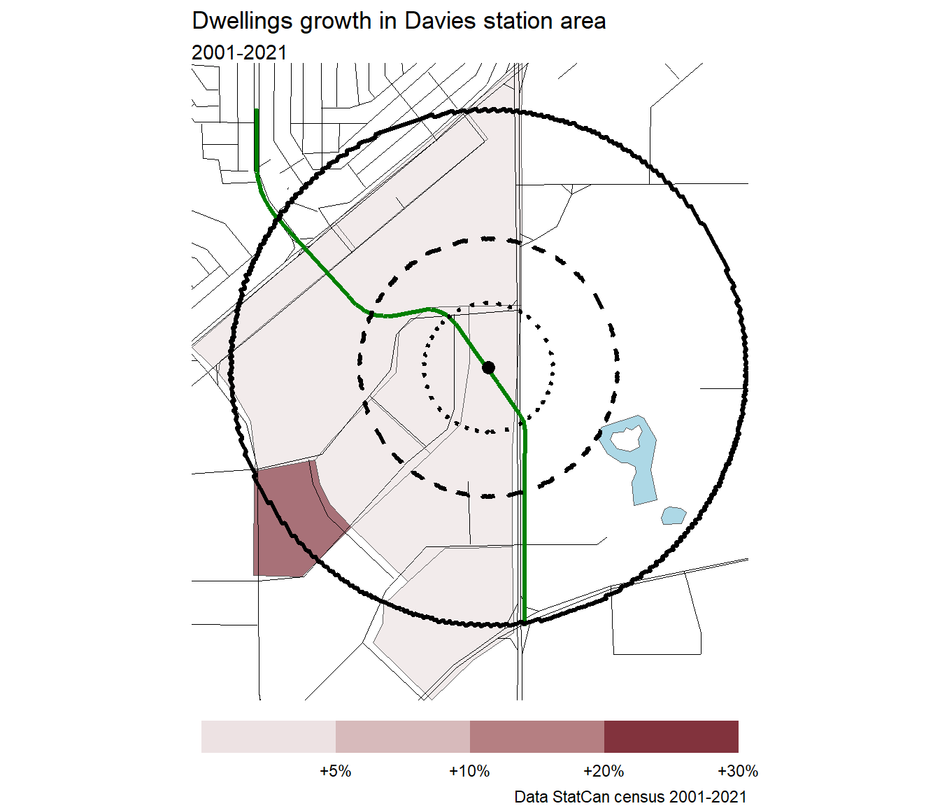
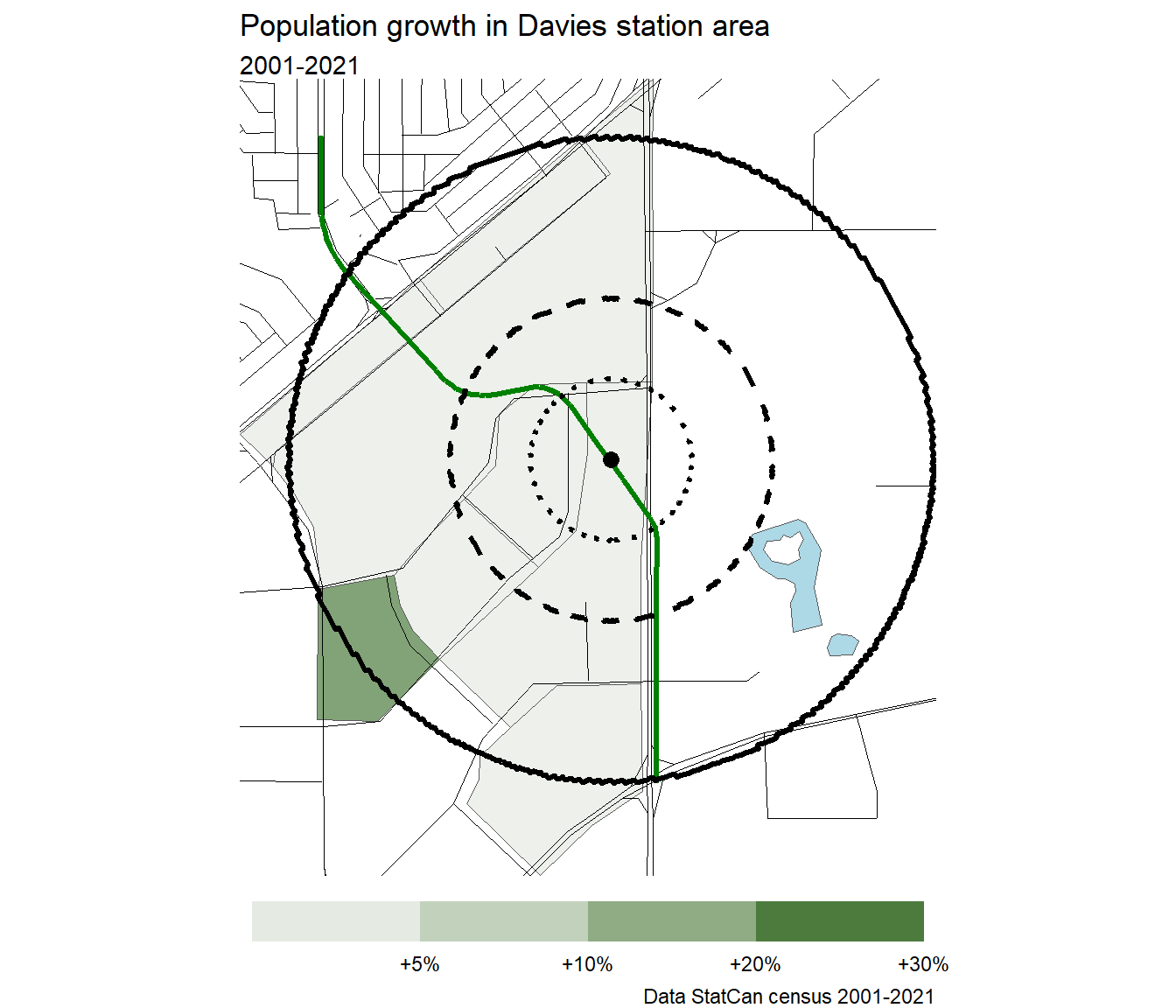
Note
Because Davies is such an industrial area, the census data shows wild swings percentage-wise.
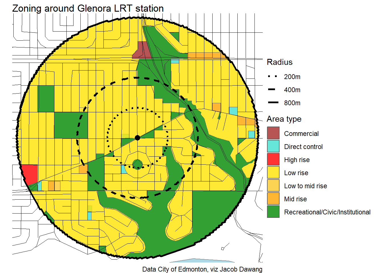
Glenora
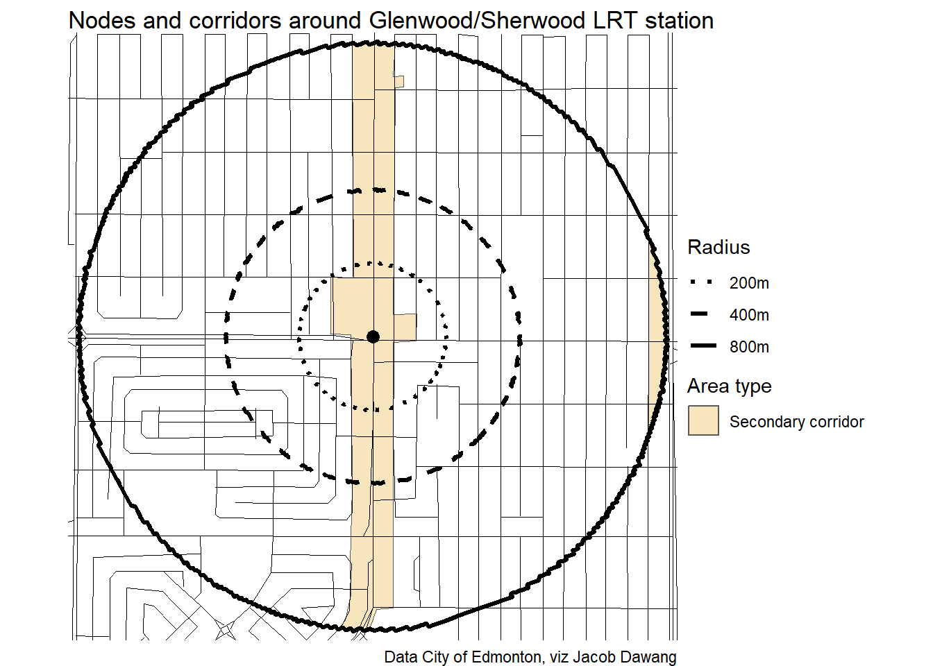
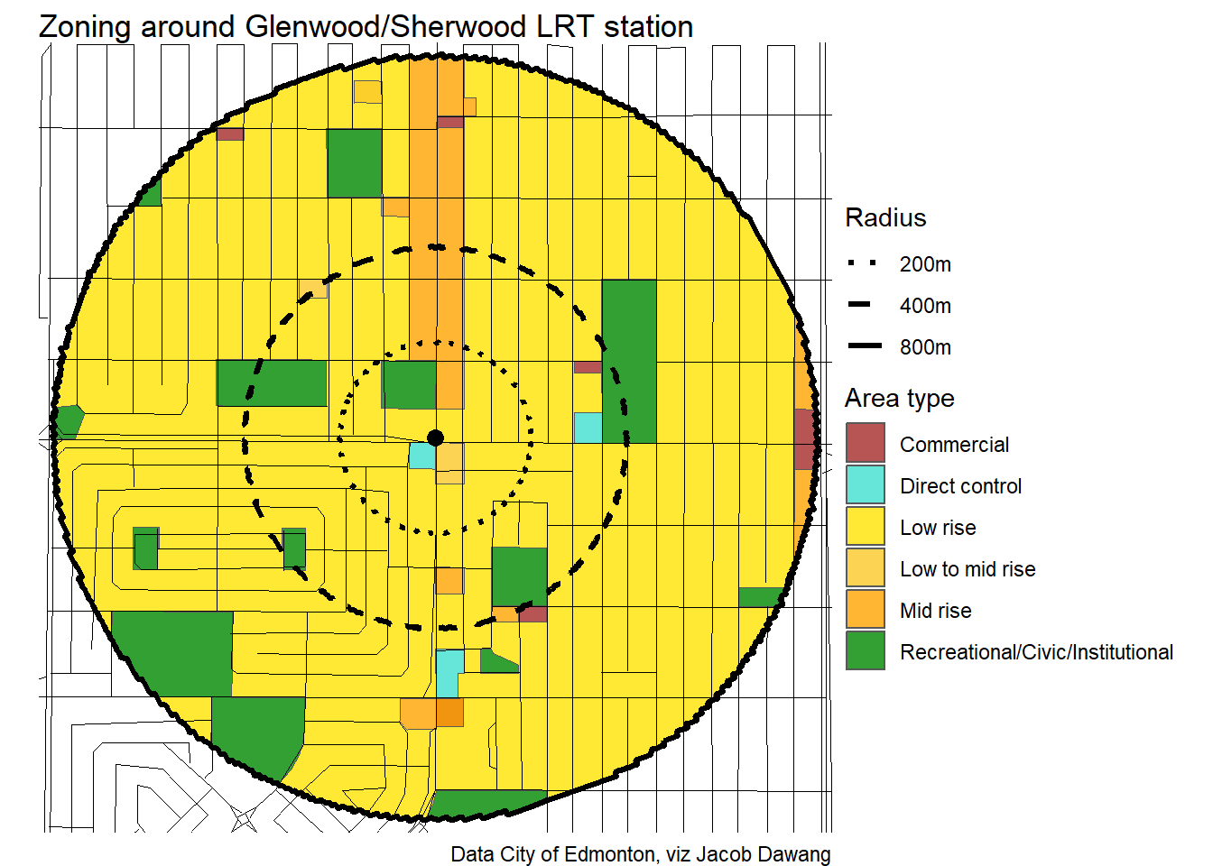
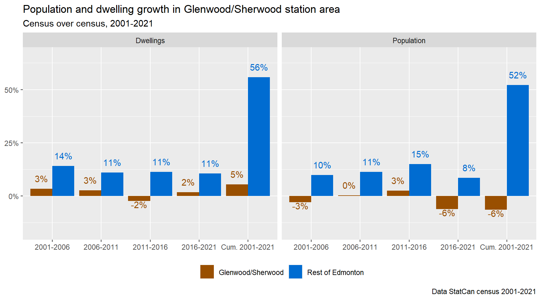
Glenwood/Sherwood
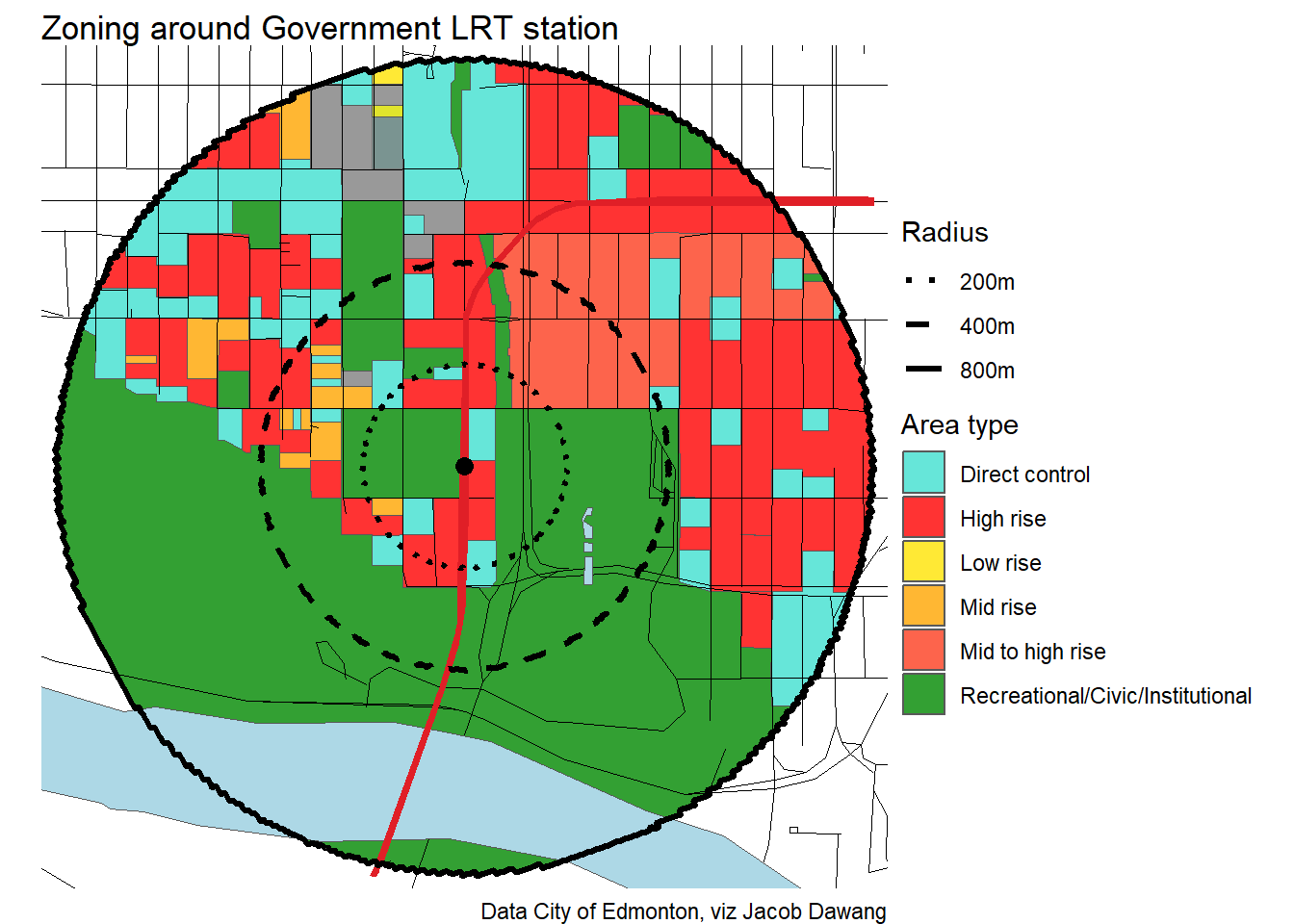
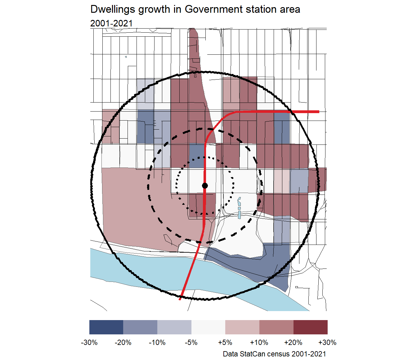
Government
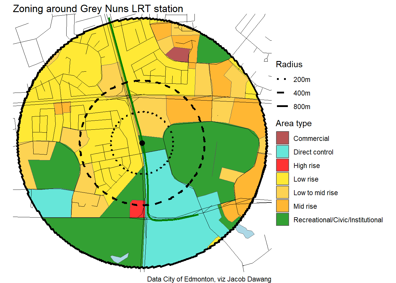
Grey Nuns

Grovenor/142 Street
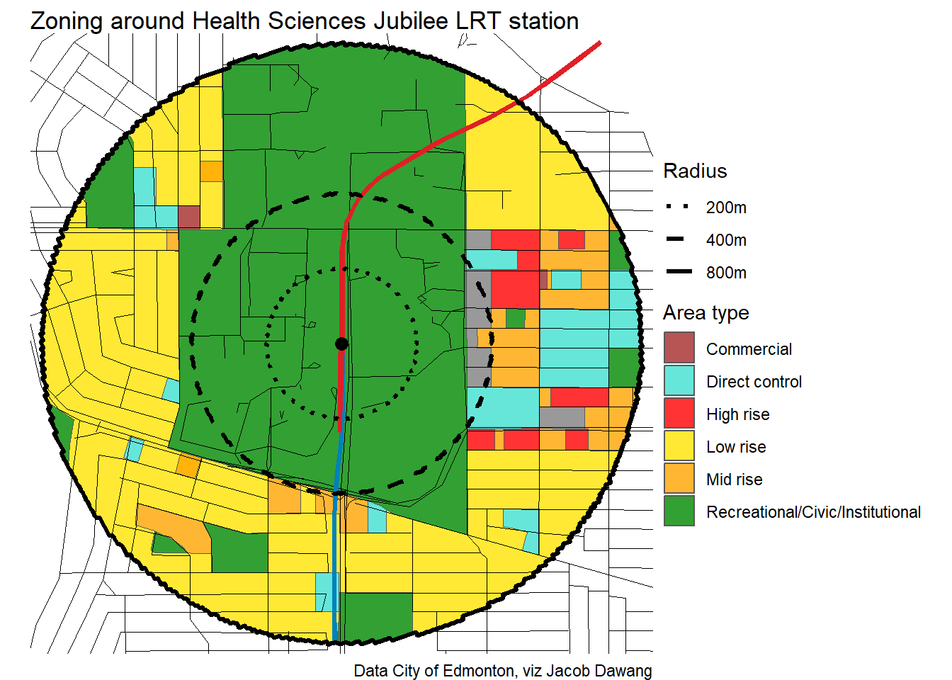
Health Sciences Jubilee
Heritage Valley North

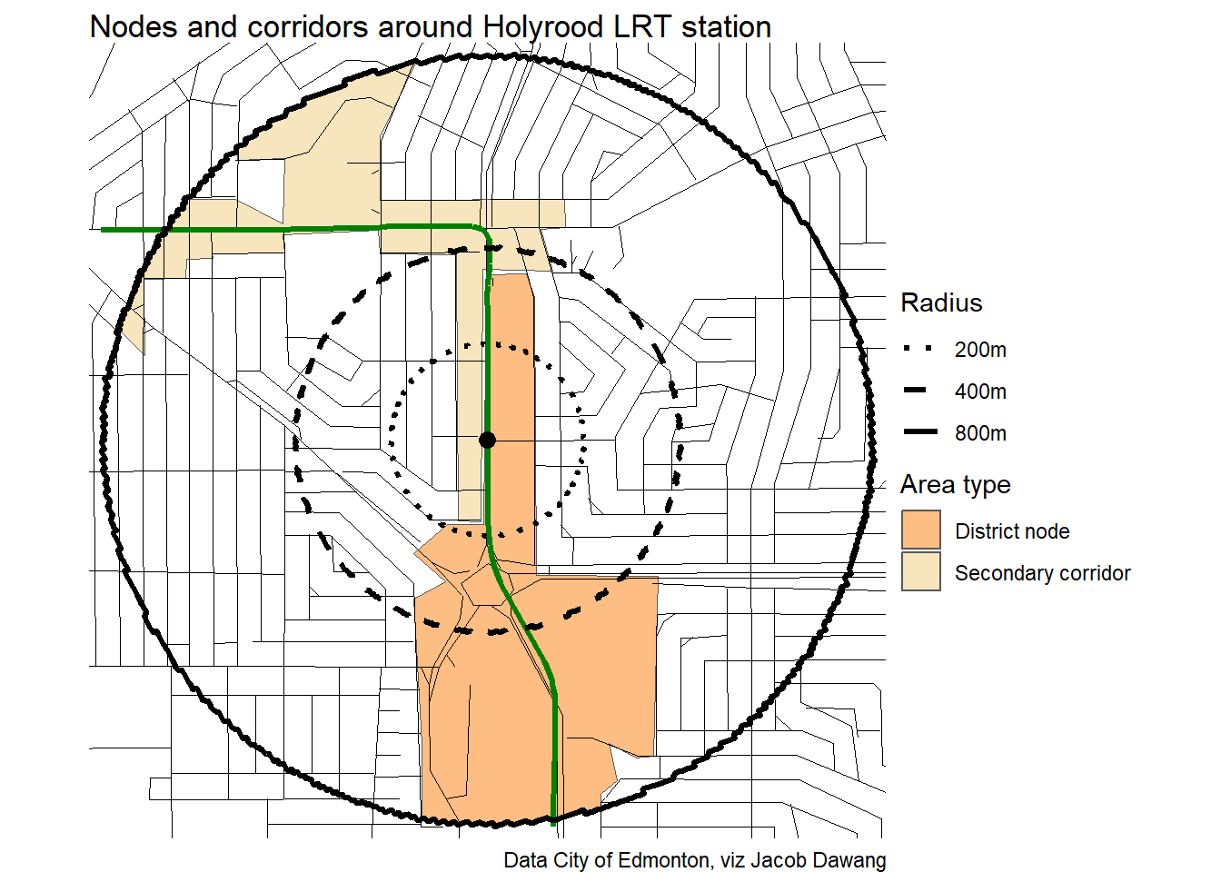
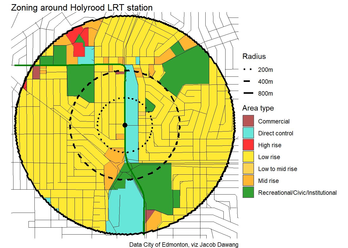
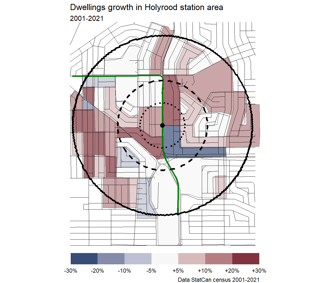
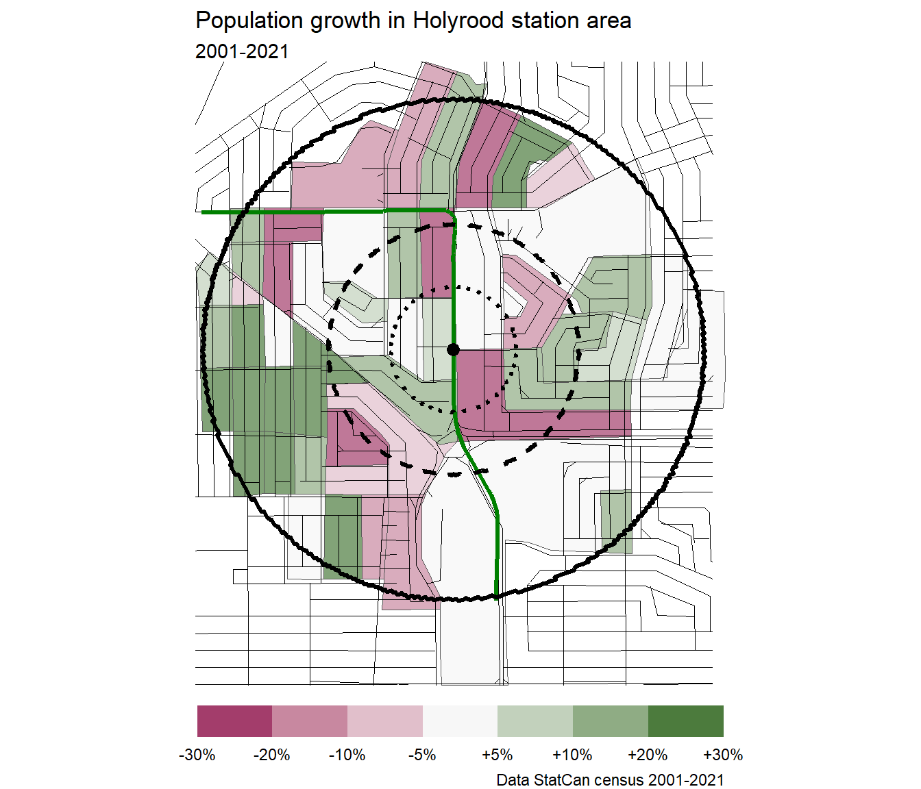
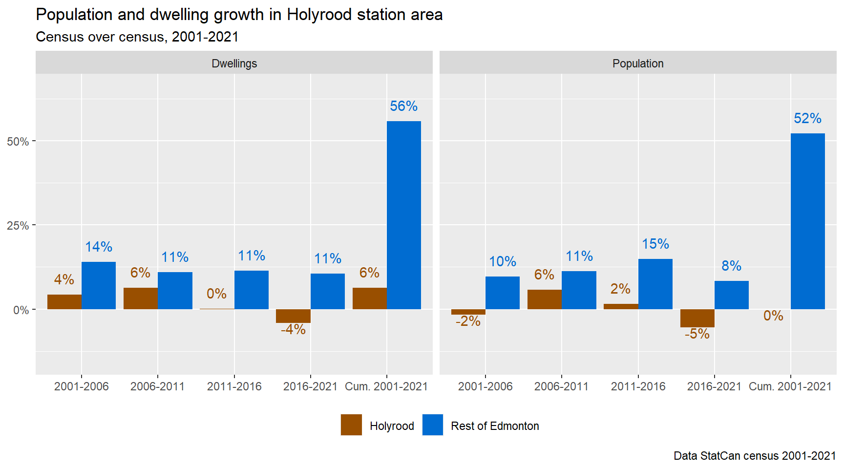
Holyrood
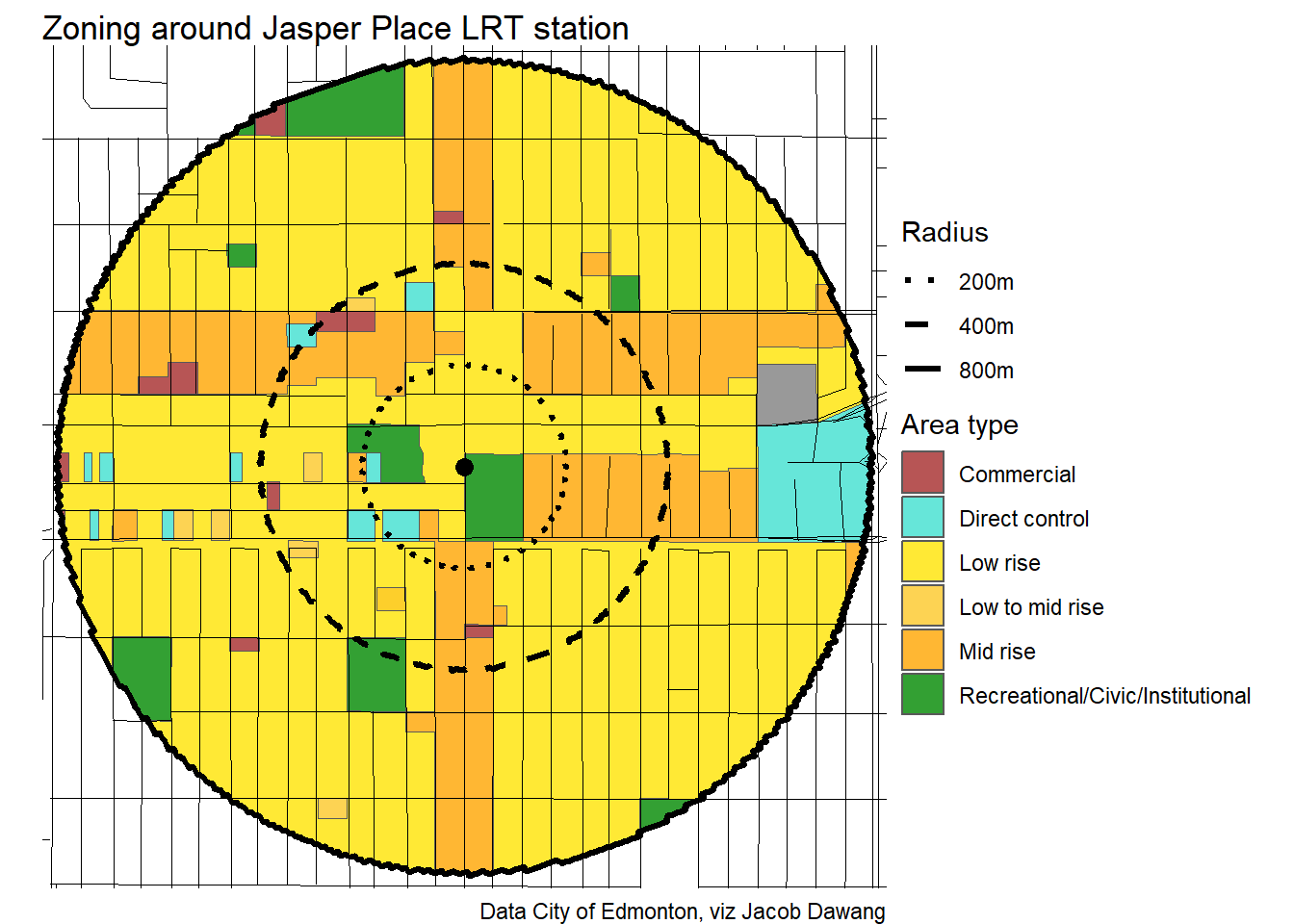
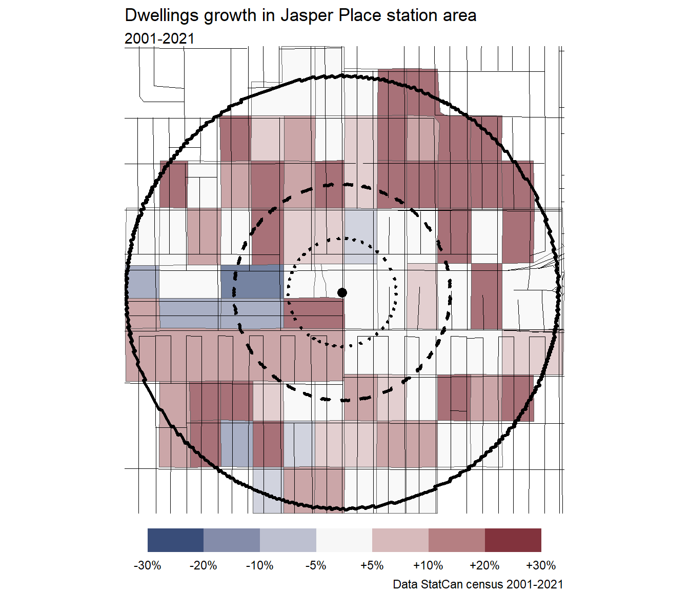
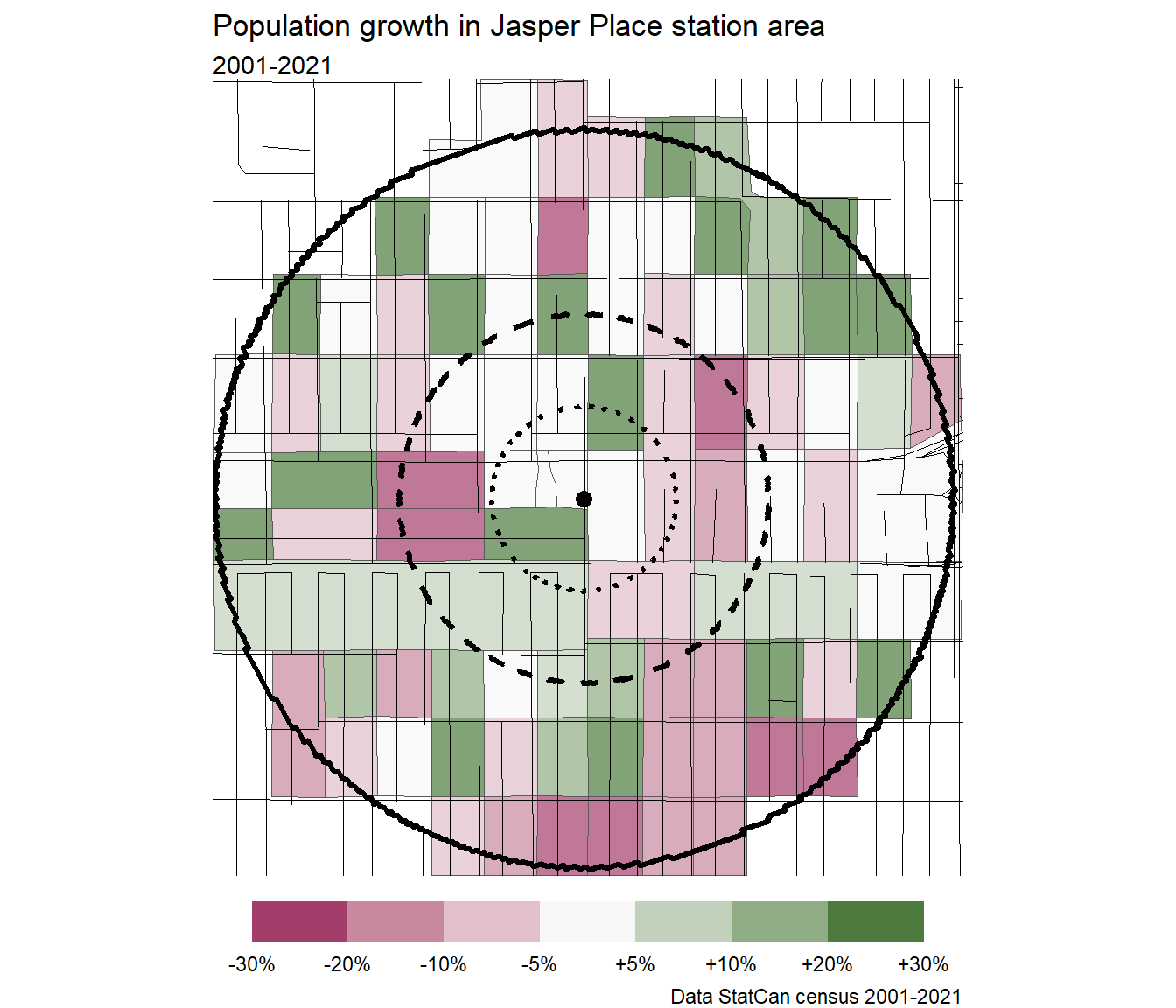
Jasper Place

Kingsway RAH
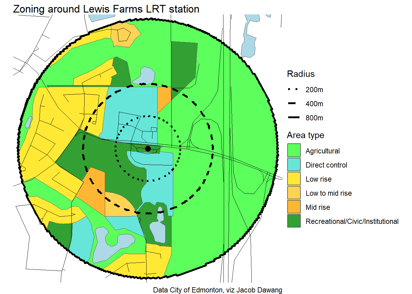
Lewis Farms
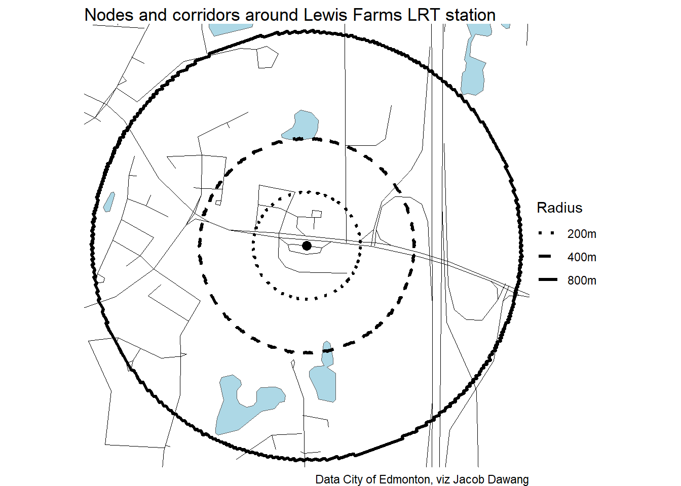
Note
Because Lewis Farms has so little residential, there are no dissemination blocks included in the station area. The census plots cannot be generated.
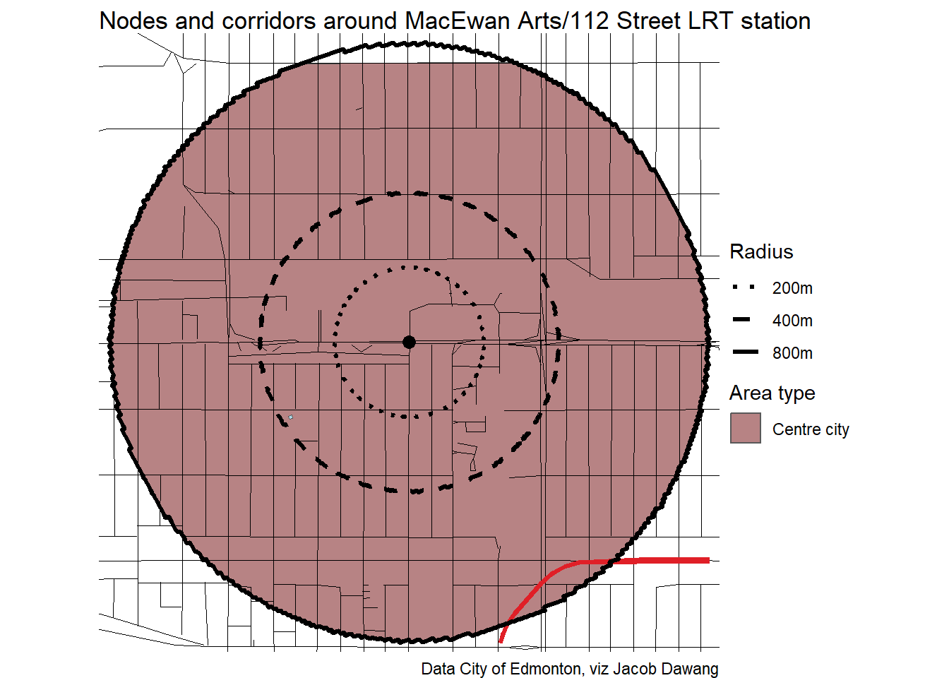
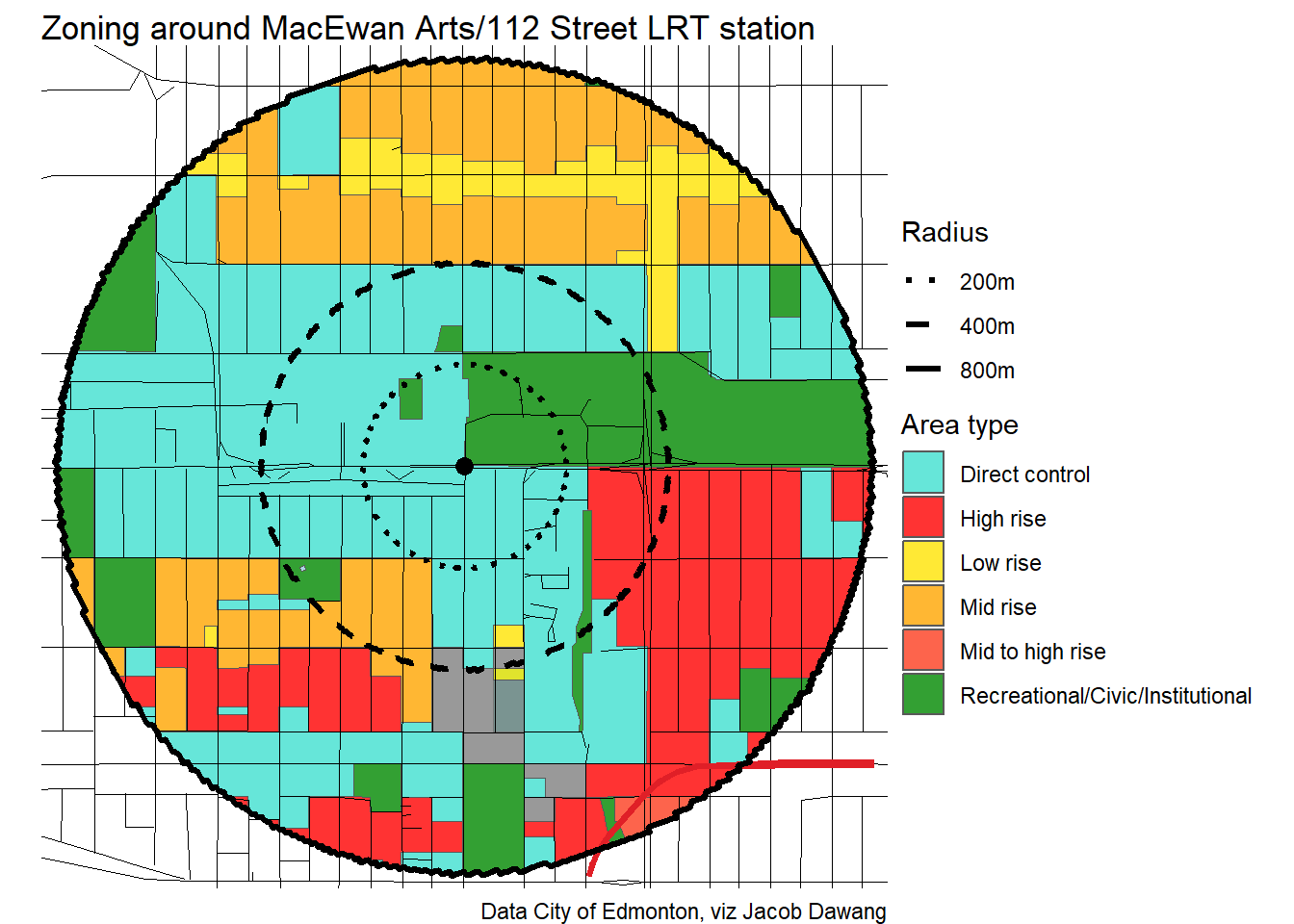
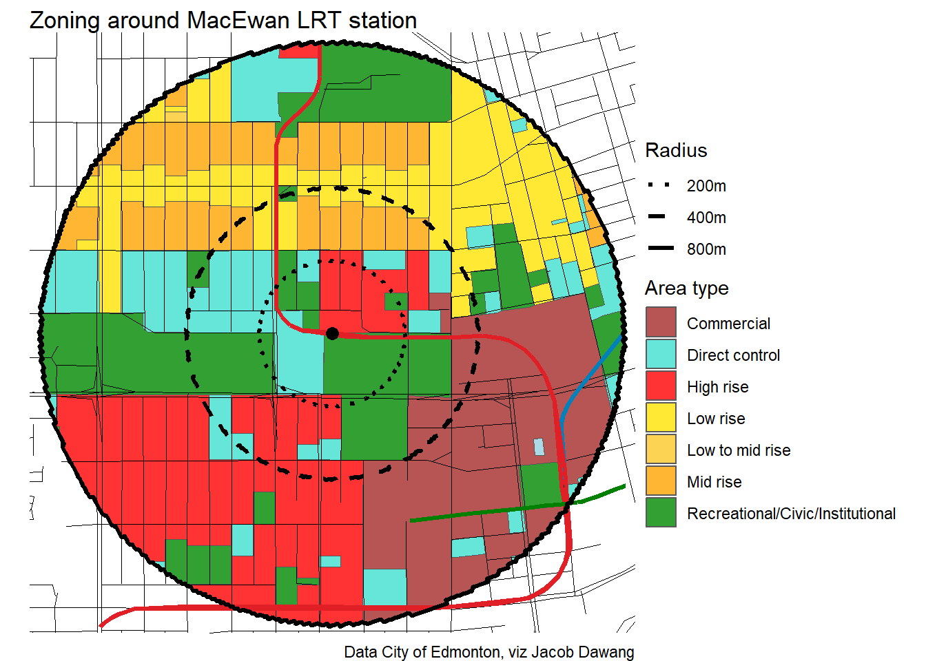
MacEwan Arts/112 Street
MacEwan
McKernan Belgravia
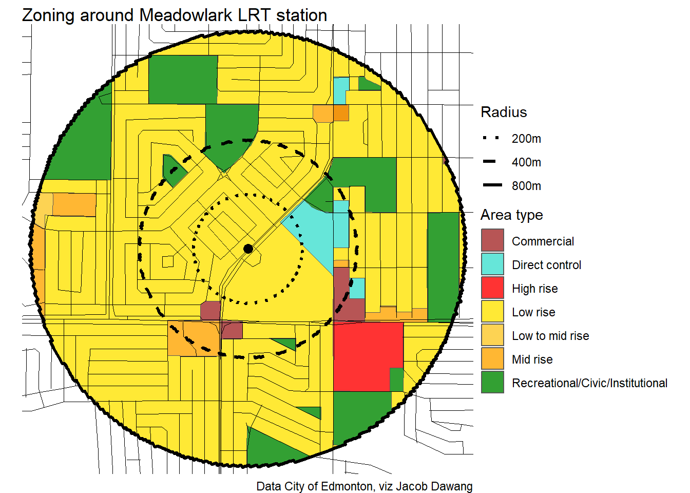
Meadowlark

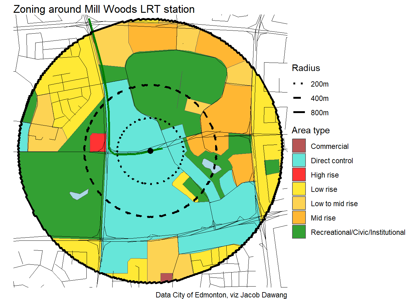
Mill Woods
Millbourne/Woodvale
Misericordia
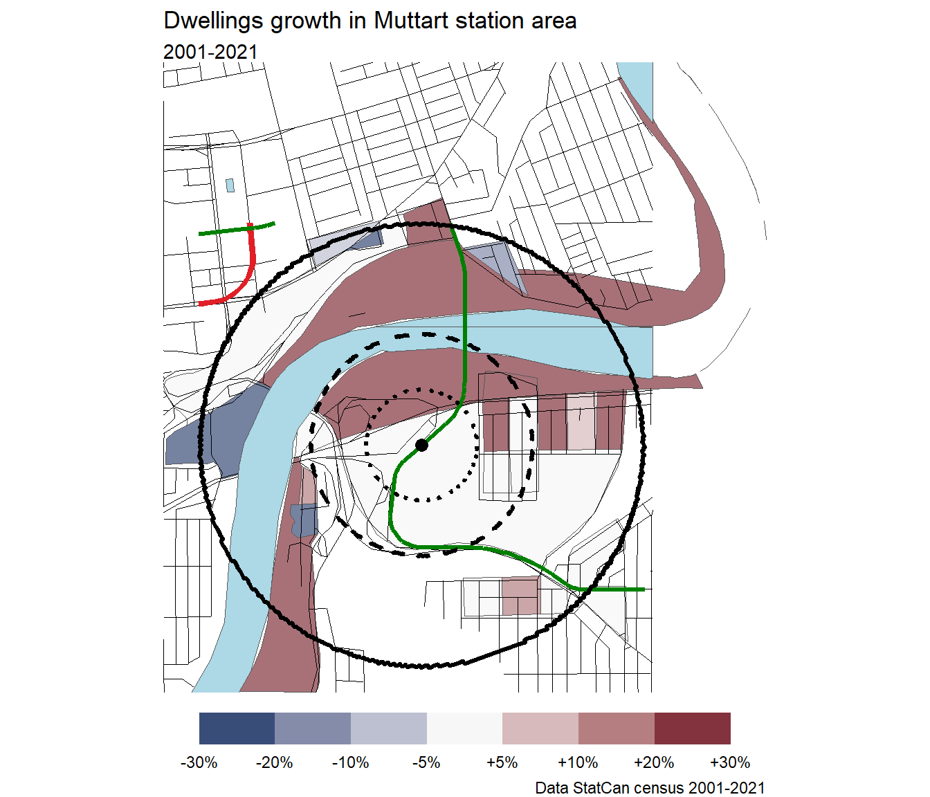
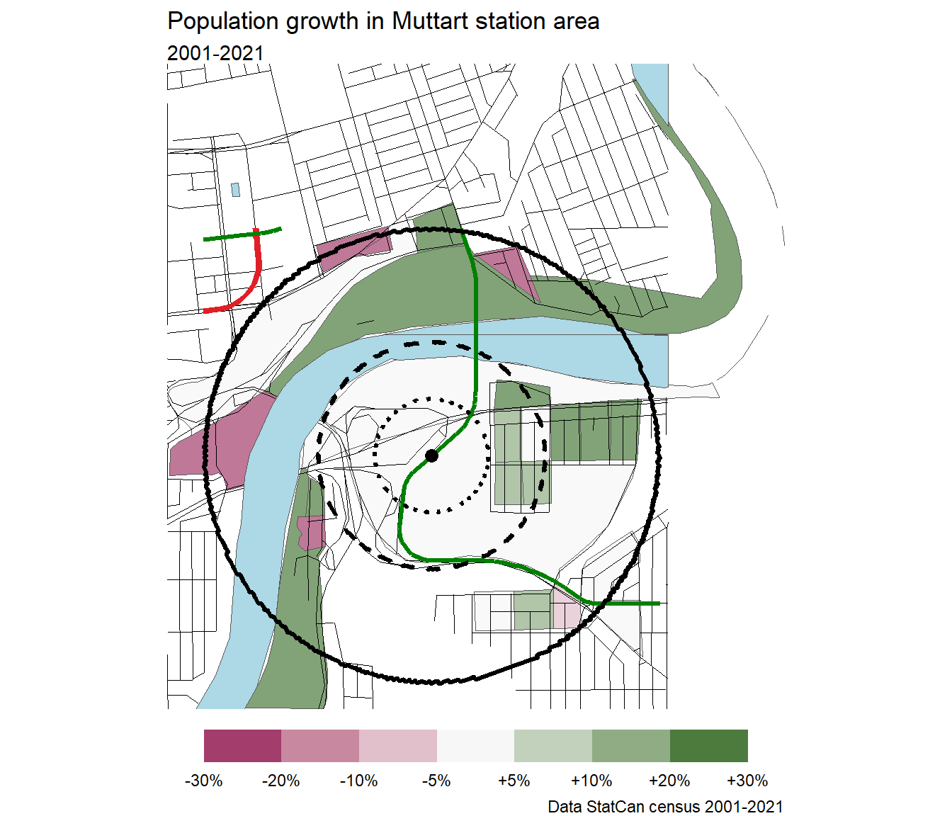
Muttart
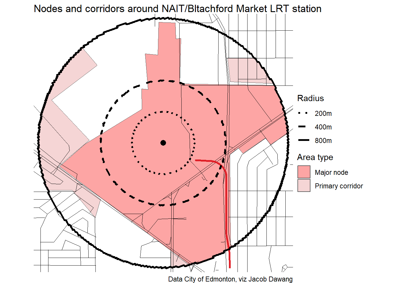
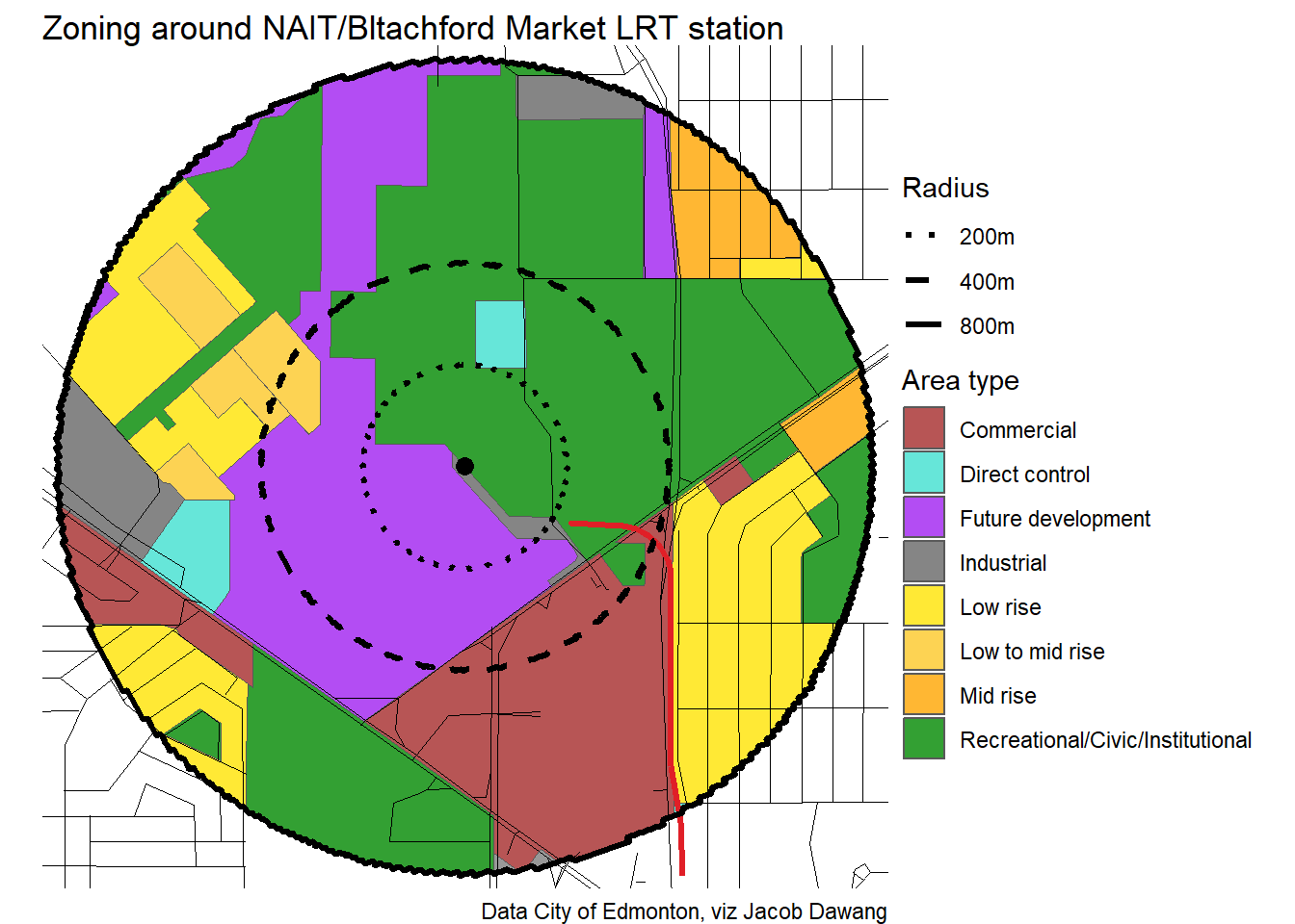
NAIT/Bltachford Market
NorQuest
Quarters
South Campus Ft Edmonton
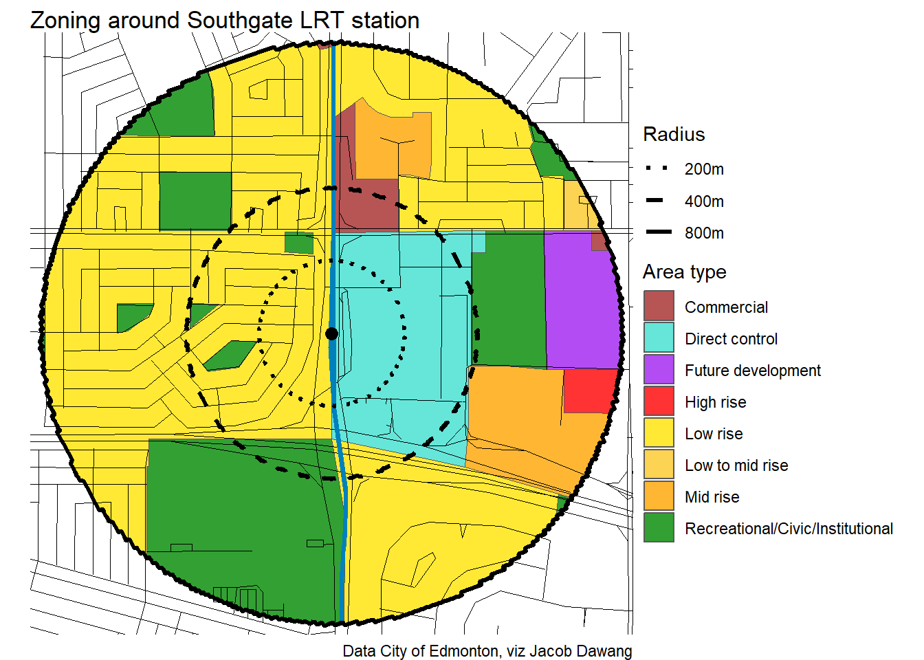
Southgate
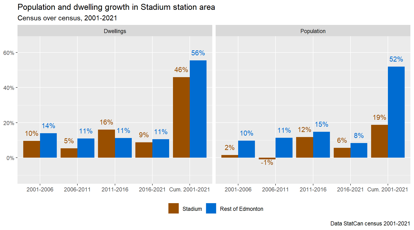
Stadium
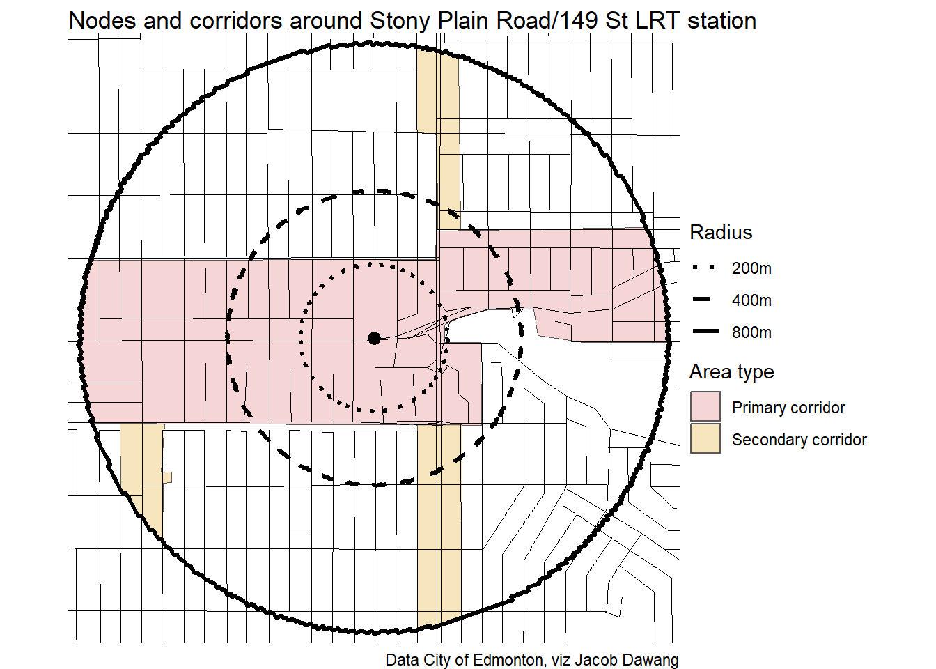
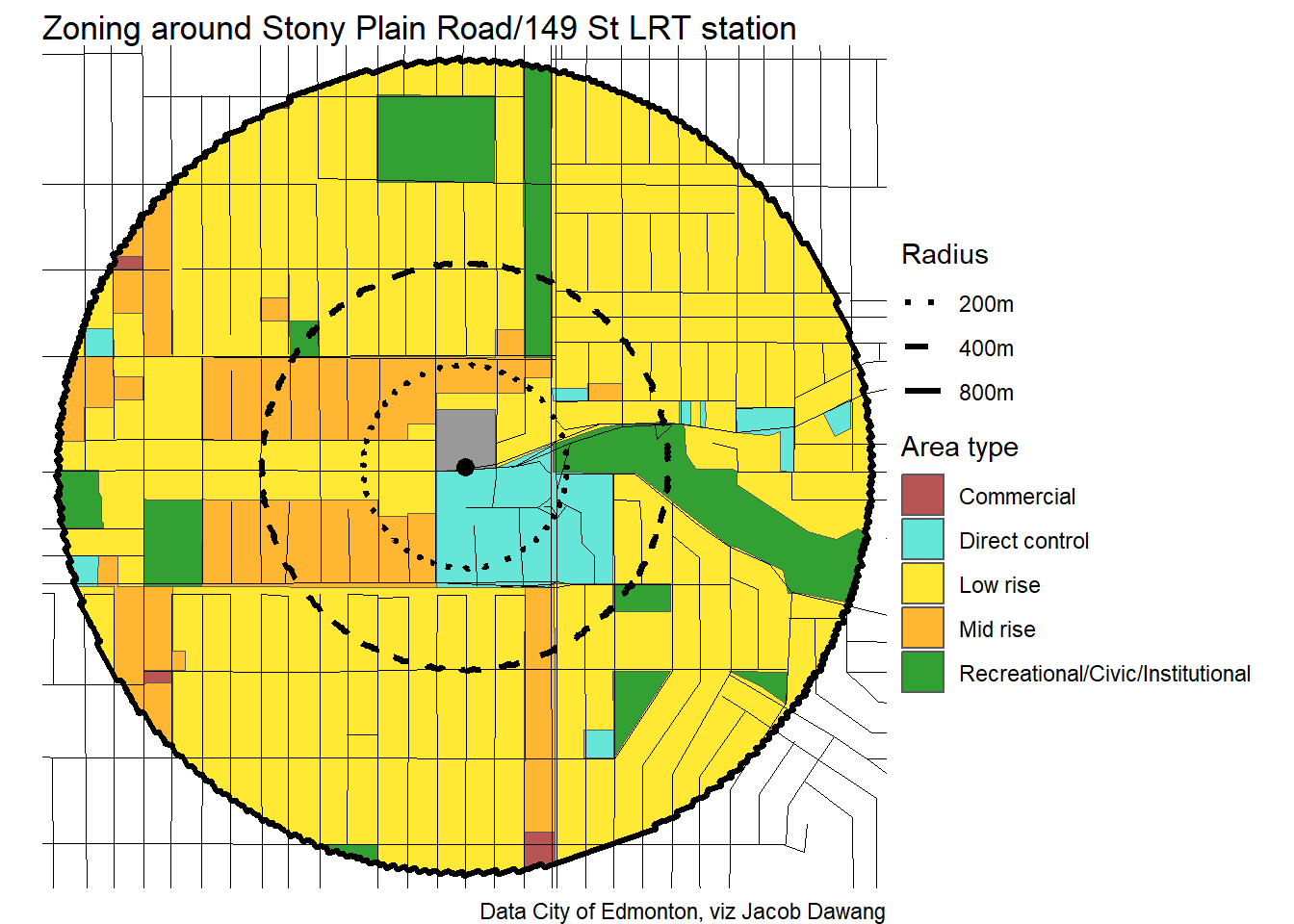
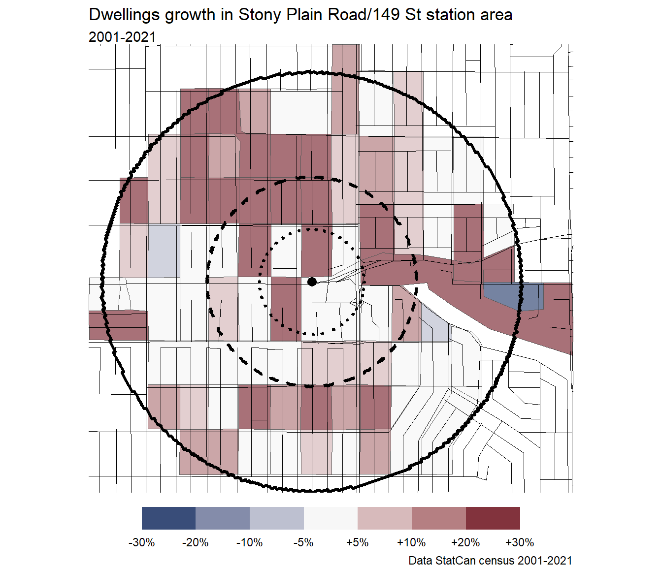
Stony Plain Road/149 St
Strathearn
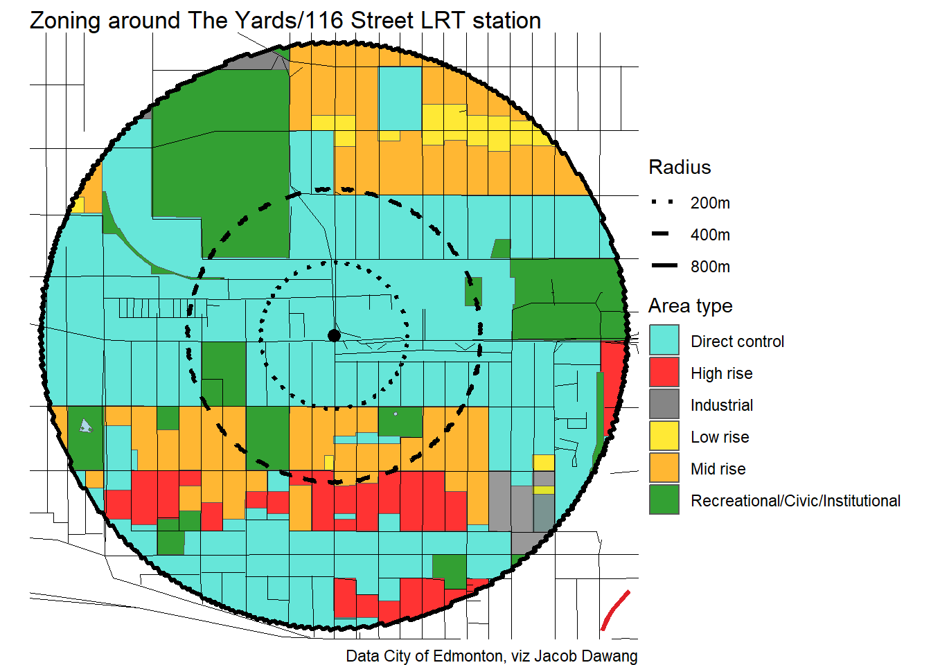
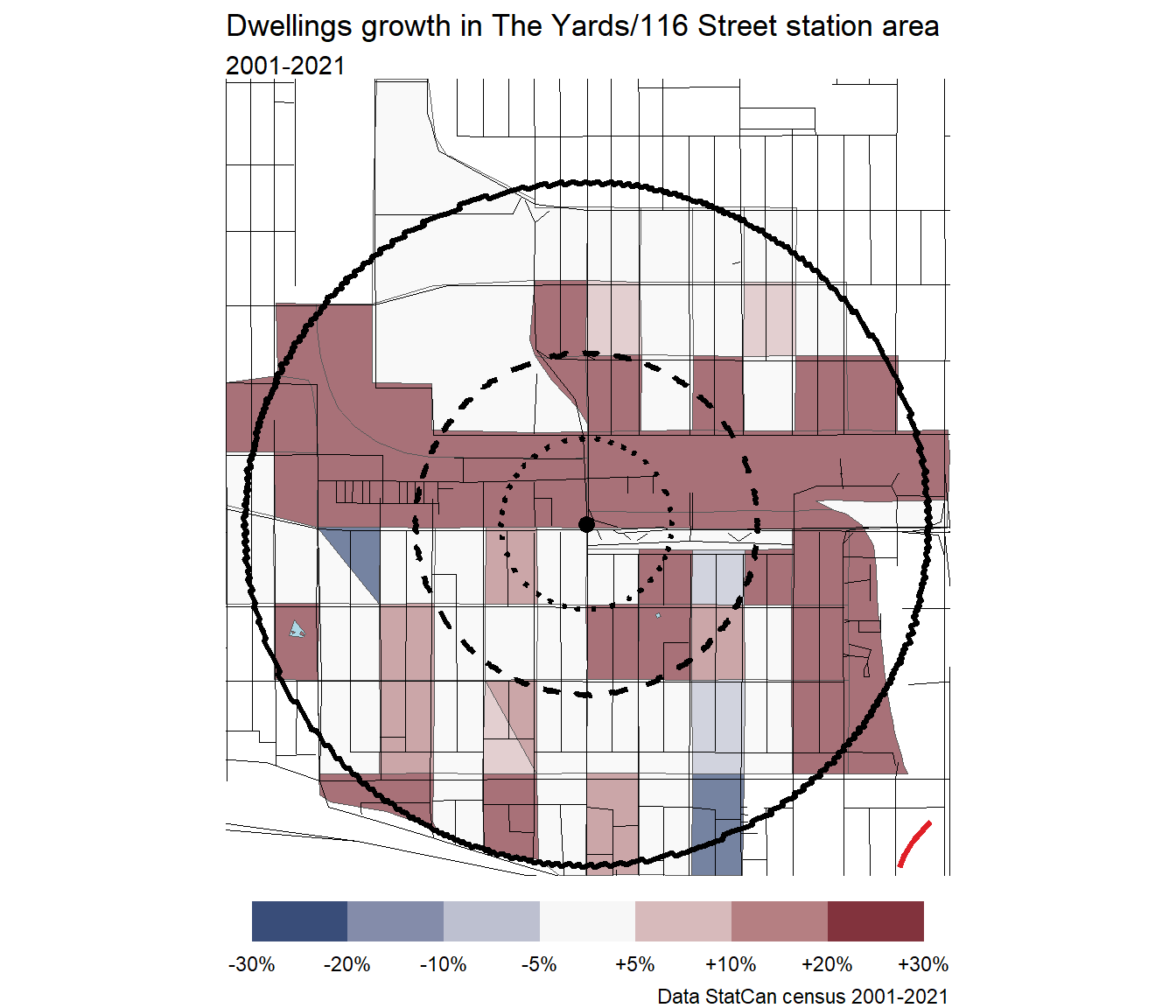
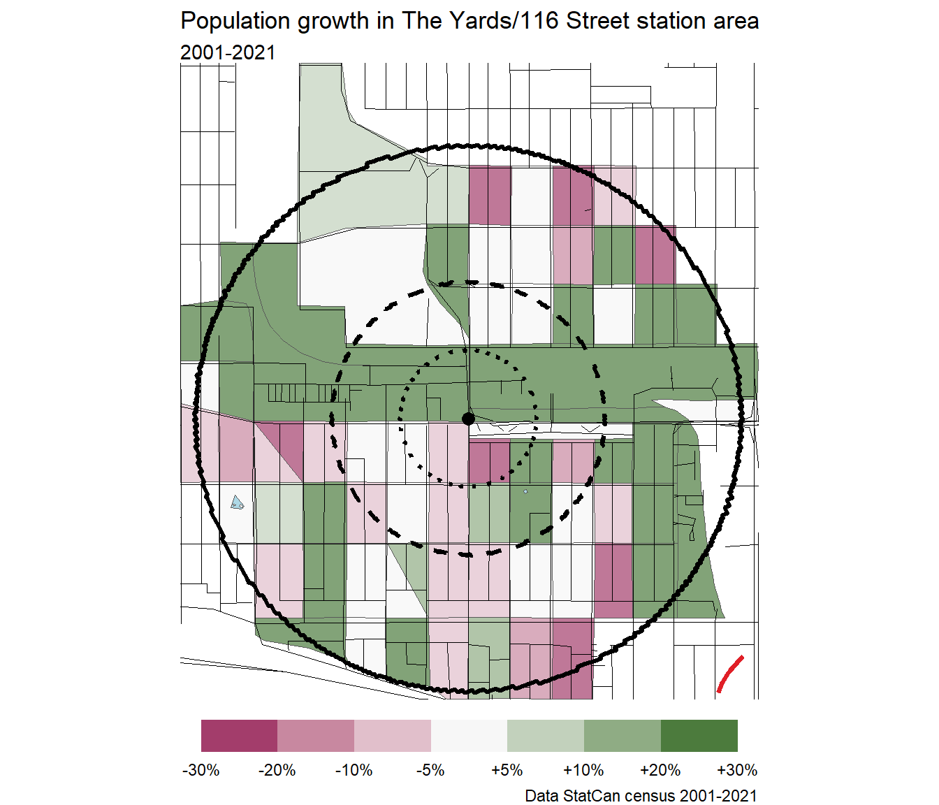
The Yards/116 Street
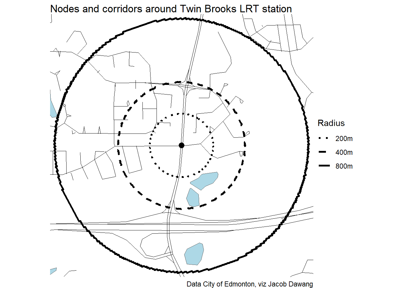
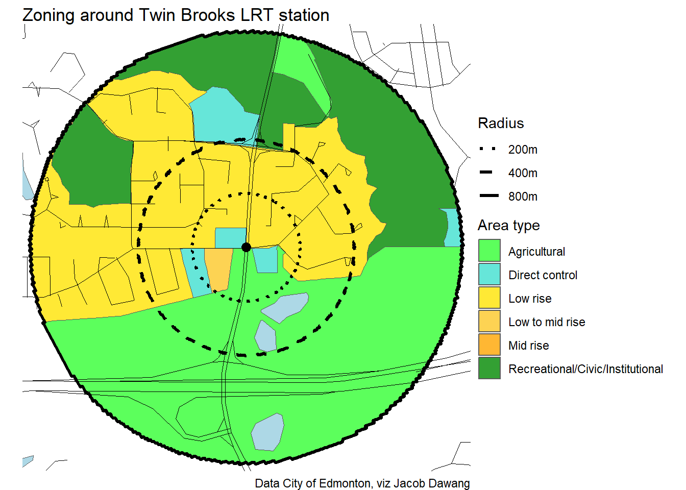
Twin Brooks
University
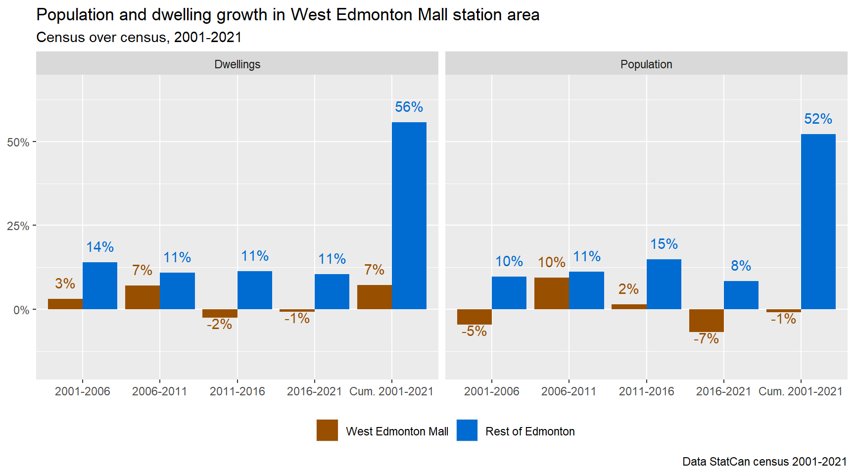
West Edmonton Mall